France Map with Regions
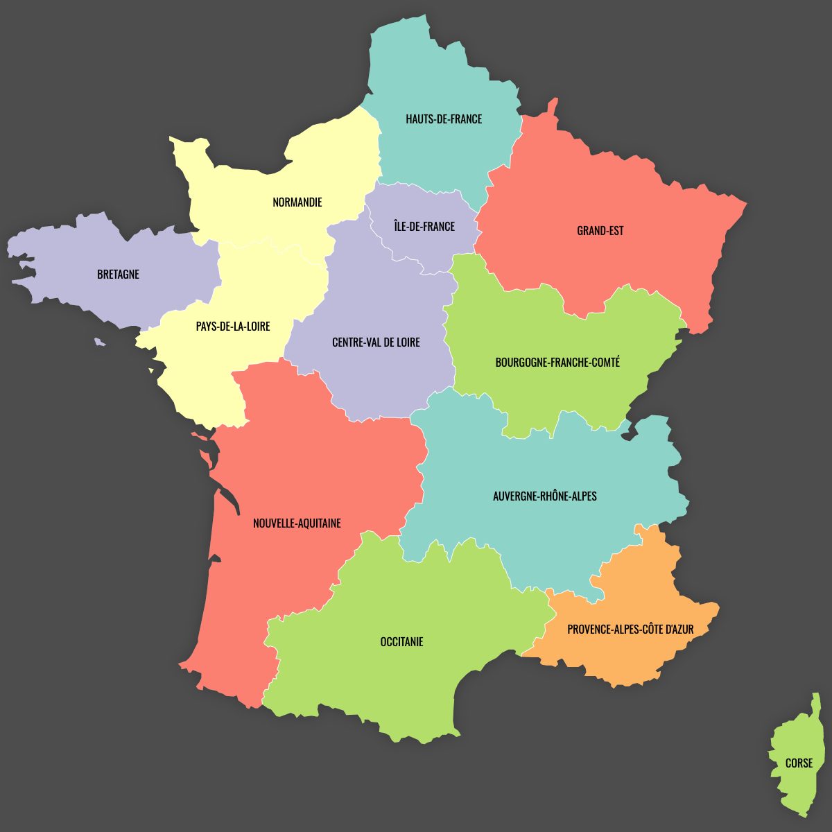
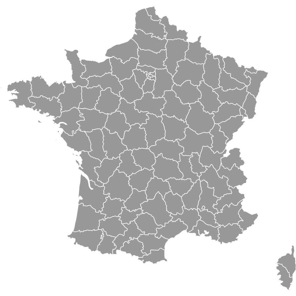
France's region map has used 13 metropolitan units since 1 January 2016, and all 13 appear on the map below. That date is when a national reform merged the 22 former metropolitan regions. France counts 18 regions in total. The 5 overseas regions (Guadeloupe, Martinique, French Guiana, Réunion and Mayotte) lie in the Caribbean, South America and the Indian Ocean, and this map does not include them.
Île-de-France, the region around Paris, the national capital, has the most people. Eurostat counted 12,549,288 residents there on 1 January 2025, or 18.8% of the 66,578,547 people living in the 13 metropolitan regions. Nouvelle-Aquitaine covers the most land at 84,036 km² (32,446 sq mi), and Corsica (Corse) covers the least at 8,680 km² (3,351 sq mi). Both area figures are INSEE figures for the post-2016 boundaries. Corsica also has the fewest residents, 362,253 on 1 January 2025 (Eurostat). The editor on this page colors each region from values you enter.
Interactive France Map with Regions
List of Regions (13)
| # | Region | Population (2025) | GDP per capita (EUR, 2024) | Unemployment rate (%, 2025) | Life expectancy at birth (years, 2024) |
|---|---|---|---|---|---|
| 1 | Auvergne-Rhône-Alpes | 8,270,088 | 41,900 | 7 | 83.90 |
| 2 | Bourgogne-Franche-Comté | 2,796,878 | 34,200 | 7.50 | 82.40 |
| 3 | Bretagne | 3,489,252 | 36,600 | 5.60 | 82.50 |
| 4 | Centre-Val de Loire | 2,588,306 | 35,500 | 6.10 | 82.60 |
| 5 | Corse | 362,253 | 37,500 | 7.30 | 84 |
| 6 | Grand Est | 5,550,155 | 35,400 | 6.60 | 82.10 |
| 7 | Hauts-de-France | 5,974,447 | 32,900 | 8.50 | 81.40 |
| 8 | Île-de-France | 12,549,288 | 69,500 | 8.80 | 84.60 |
| 9 | Normandie | 3,350,982 | 35,300 | 7.40 | 82.10 |
| 10 | Nouvelle-Aquitaine | 6,210,839 | 36,200 | 7.20 | 83.10 |
| 11 | Occitanie | 6,205,575 | 35,900 | 7.60 | 83.30 |
| 12 | Pays-de-la-Loire | 3,945,359 | 37,500 | 6.60 | 83.50 |
| 13 | Provence-Alpes-Côte d'Azur | 5,285,125 | 41,800 | 7.30 | 83.80 |
Data sources, all reuse with acknowledgement:
- Population: Eurostat, Population on 1 January (demo_r_pjanaggr3).
- GDP per capita: Eurostat, Gross domestic product at current market prices by NUTS 3 regions, euro per inhabitant (nama_10r_3gdp).
- Unemployment rate: Eurostat, Unemployment rates by NUTS 2 regions, ages 15-74 (lfst_r_lfu3rt).
- Life expectancy at birth: Eurostat, Life expectancy at birth by NUTS 2 regions (demo_r_mlifexp).
France Regions: Key Facts
- Total number of regions: 18 (13 metropolitan and 5 overseas). This map shows the 13 metropolitan regions. That is fewer than the 20 regions of Italy and the 17 autonomous communities of Spain
- Most populous region: Île-de-France (Paris), 12,549,288 residents (Eurostat, 1 January 2025)
- Least populous region: Corsica (Corse), 362,253 residents (Eurostat, 1 January 2025)
- Population of the 13 metropolitan regions: 66,578,547 (Eurostat, 1 January 2025), overseas regions not included
- Largest region by area: Nouvelle-Aquitaine, 84,036 km² (32,446 sq mi) (INSEE, post-2016 boundaries)
- Smallest region by area: Corsica, 8,680 km² (3,351 sq mi) (INSEE, post-2016 boundaries)
- Major urban centers: Paris (Île-de-France), Lyon (Auvergne-Rhône-Alpes), Marseille (Provence-Alpes-Côte d'Azur), Toulouse (Occitanie), Bordeaux (Nouvelle-Aquitaine), Lille (Hauts-de-France), Nantes (Pays de la Loire), Strasbourg (Grand Est), Rennes (Brittany)
- National capital: Paris, which is also the regional capital of Île-de-France
- Borders: Belgium, Luxembourg, Germany, Switzerland, Italy, Monaco, Andorra and Spain. The coastlines face the North Sea, the English Channel, the Atlantic Ocean and the Mediterranean Sea
- Subdivisions: the 13 regions contain 96 departments, and you can see them on the France departments map
- Time zone: Central European Time (UTC+1), with Central European Summer Time (UTC+2) from late March to late October
- Current boundaries: in force since 1 January 2016, when mergers cut the metropolitan count from 22 regions to 13
Interesting Facts
- In 2024, GDP per capita in Île-de-France was 69,500 EUR. That is more than twice the 32,900 EUR recorded in Hauts-de-France (Eurostat).
- Strasbourg, in Grand Est, is the official seat of the European Parliament.
- Since 1 January 2021, Alsace has formed the European Collectivity of Alsace, which merged the councils of Bas-Rhin and Haut-Rhin while remaining part of Grand Est.
- Six regions came through the 2016 reform with their borders unchanged: Brittany, Centre-Val de Loire, Corsica, Île-de-France, Pays de la Loire and Provence-Alpes-Côte d'Azur.
- Nantes, the historic seat of the Dukes of Brittany, belongs to Pays de la Loire, not to the modern region of Brittany.
Free Downloads
Free for personal and commercial use with a credit to Ultimaps. See the license terms for details.
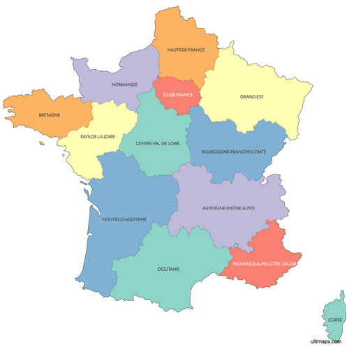 Colored France Map with Regionspng508 KB
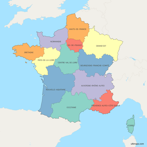 Political Map of France with Regionspng672 KB
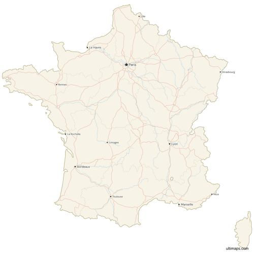 Map of France with Cities and Roadspng928 KB
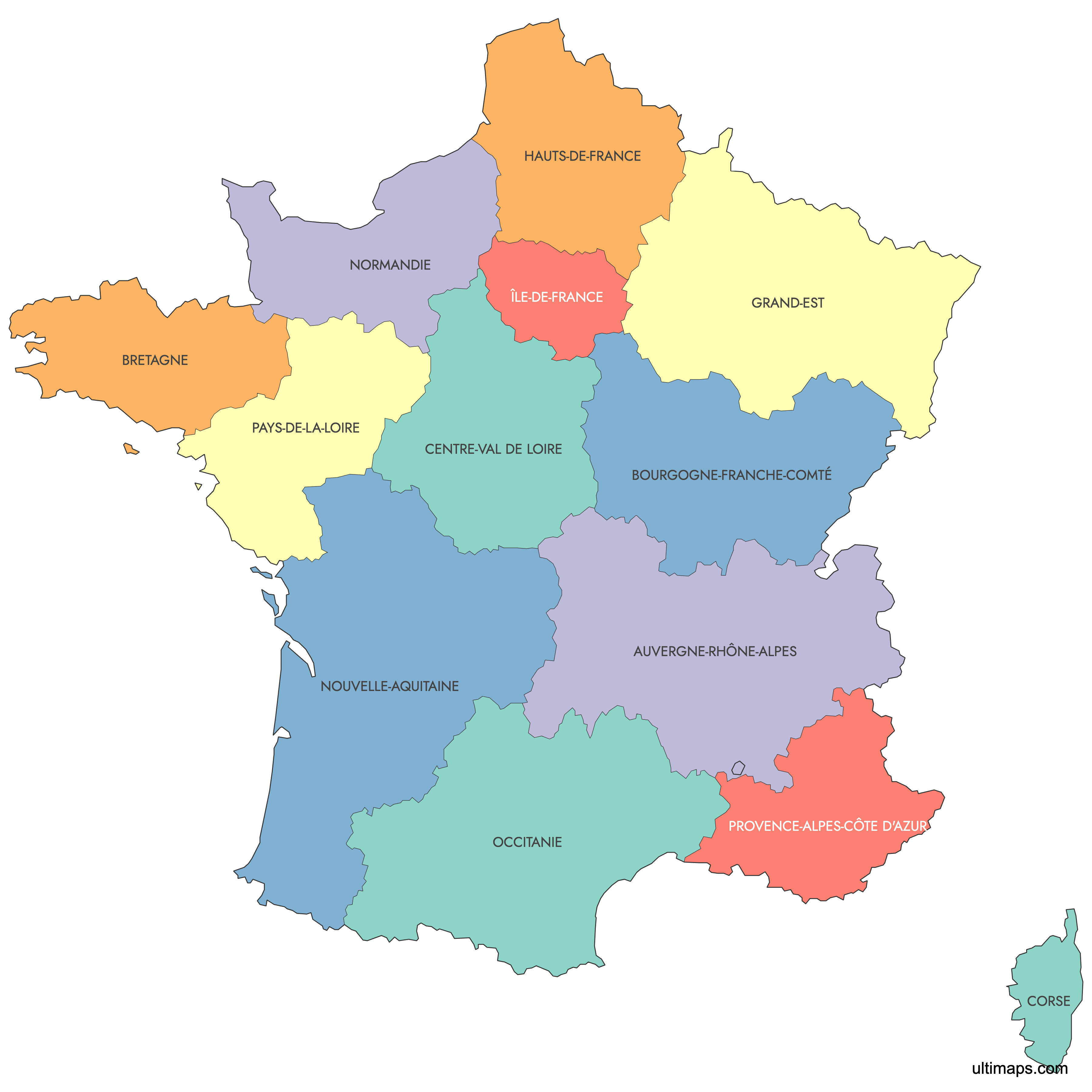
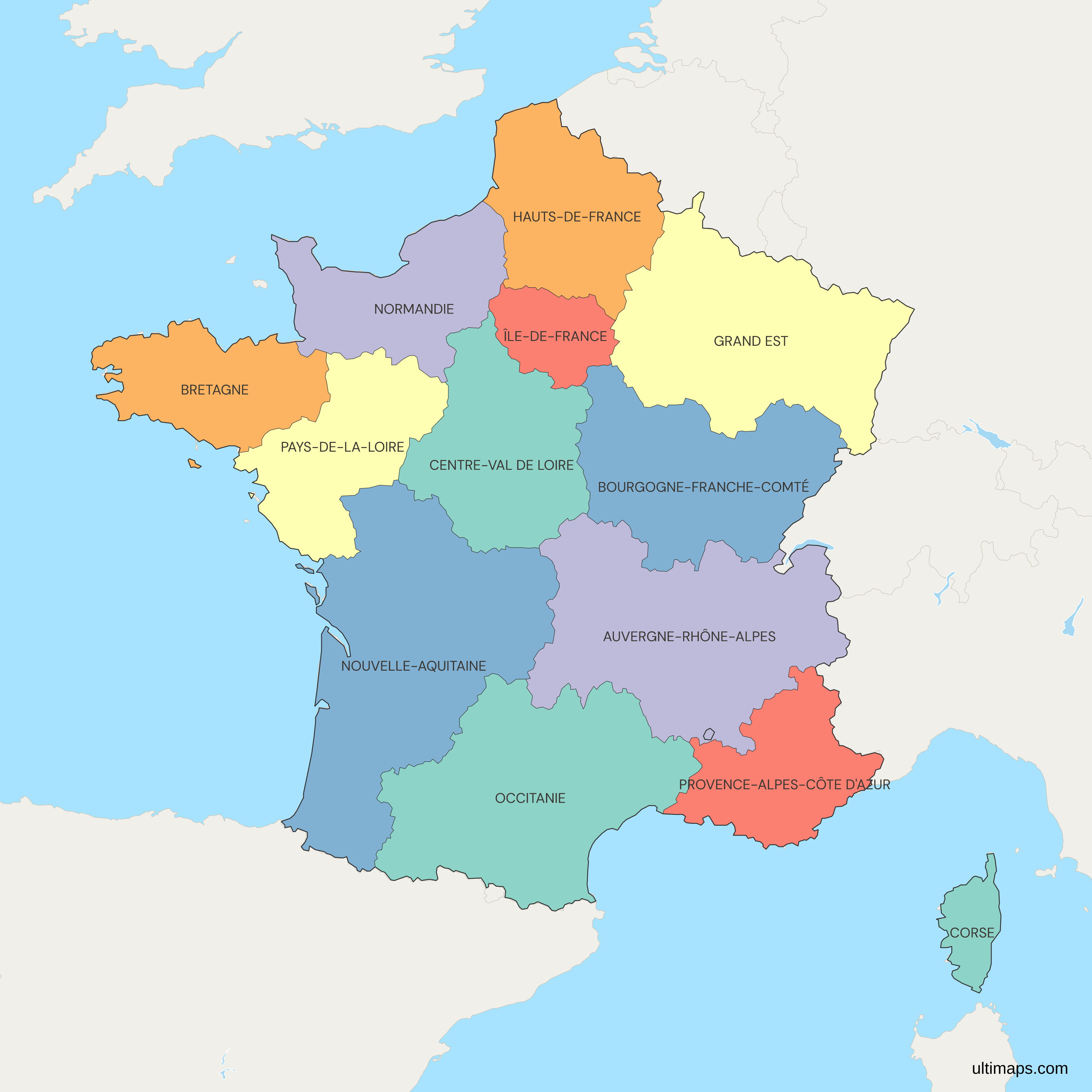
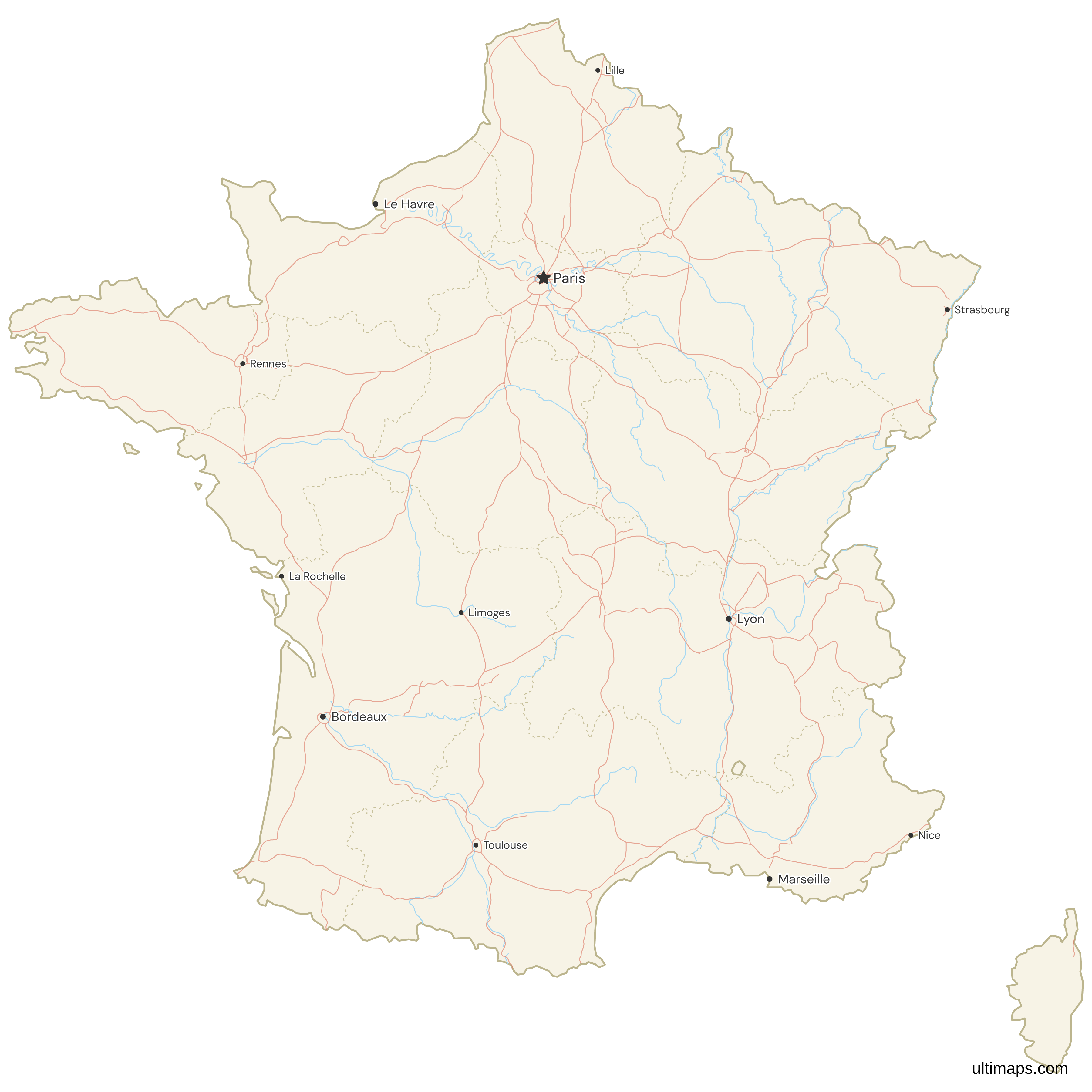
Need it without colors? The blank version of this map comes as a print-ready PDF (A4 and US Letter), a PNG and an editable SVG.
Custom Map Features
This map supports labels.
This map supports surrounding areas, roads, rivers and cities. New
This map is divided into 13 regions.
Updates
Sep 28, 2023:
- Added map of France Regions
Frequently Asked Questions
France has 18 regions: 13 in metropolitan France and 5 overseas. The map on this page shows the 13 metropolitan regions, which have been in force since 1 January 2016, when mergers cut the metropolitan count from 22. The 5 overseas regions are Guadeloupe, Martinique, French Guiana, Réunion and Mayotte, and they are not drawn here. The metropolitan regions are Auvergne-Rhône-Alpes, Bourgogne-Franche-Comté, Brittany (Bretagne), Centre-Val de Loire, Corsica (Corse), Grand Est, Hauts-de-France, Île-de-France, Normandy (Normandie), Nouvelle-Aquitaine, Occitanie, Pays de la Loire and Provence-Alpes-Côte d'Azur. Eurostat counted 66,578,547 residents across these 13 regions on 1 January 2025.
Nouvelle-Aquitaine is the largest region of France by area. INSEE gives it 84,036 km² (32,446 sq mi). It runs along the Atlantic coast from Charente-Maritime south to the Pyrenees and the Spanish border, and it reaches inland to the Limousin uplands. The region was created on 1 January 2016 by merging Aquitaine, Limousin and Poitou-Charentes. It has 12 departments, and its regional capital is Bordeaux. Eurostat counted 6,210,839 residents on 1 January 2025, the third-highest population among the metropolitan regions. At the other end of the scale, Corsica is the smallest metropolitan region at 8,680 km² (3,351 sq mi).
Île-de-France has the most people of any French region. Eurostat counted 12,549,288 residents there on 1 January 2025, or 18.8% of the 66,578,547 people in the 13 metropolitan regions. The region surrounds Paris, the national capital, and has 8 departments, including the City of Paris itself. It covers 12,012 km² (4,638 sq mi) (INSEE), which makes it the second-smallest region after Corsica. Its population grew from 12,082,144 in 2015. Île-de-France also recorded the highest GDP per capita in France in 2024, at 69,500 EUR (Eurostat). Auvergne-Rhône-Alpes, with Lyon as its capital, has the second-largest population at 8,270,088.
France cut its metropolitan regions from 22 to 13 under the law of 16 January 2015, and the new map took effect on 1 January 2016. The government said larger regions would be closer in size to regions elsewhere in Europe and would cost less to run. The reform created seven merged regions. Alsace, Champagne-Ardenne and Lorraine became Grand Est. Aquitaine, Limousin and Poitou-Charentes became Nouvelle-Aquitaine. Languedoc-Roussillon and Midi-Pyrénées became Occitanie. Nord-Pas-de-Calais and Picardy became Hauts-de-France. Auvergne joined Rhône-Alpes, Burgundy joined Franche-Comté, and Upper and Lower Normandy were reunited. Six regions kept their borders, including Brittany and Île-de-France.
The five overseas regions of France are Guadeloupe, Martinique, French Guiana, Réunion and Mayotte, and they lie thousands of kilometers from the mainland. That is why this map covers the 13 metropolitan regions. Guadeloupe and Martinique are Caribbean islands. French Guiana is on the South American mainland and borders Brazil and Suriname. Réunion and Mayotte are in the Indian Ocean. Mayotte became an overseas department and region in 2011. Since 1 January 2016, French Guiana and Martinique have each been governed by a single territorial collectivity that combines the roles of region and department. Adding the 5 overseas regions to the 13 on this map gives France's official total of 18.
Corsica (Corse) is one of the 13 metropolitan regions of France, and it has a special status that no other metropolitan region has. Since 1 January 2018, the Collectivité de Corse has governed the island as a single territorial collectivity. It replaced the former Collectivité territoriale de Corse and the two departmental councils of Corse-du-Sud and Haute-Corse. It has its own assembly and an executive council, and it holds wider powers than the mainland regions. The regional capital is Ajaccio, and Bastia is the other main town. Corsica is the smallest region at 8,680 km² (3,351 sq mi) (INSEE). It is also the least populous, with 362,253 residents on 1 January 2025 (Eurostat).
France's regions and departments are two levels of local government, and the regions sit above the departments. The 13 metropolitan regions contain 96 departments. Overseas departments bring the national total to 101. Regions are responsible for economic development, regional rail services (TER), high schools (lycées) and EU structural funds. Departments are responsible for social welfare, middle schools (collèges) and departmental roads. Departments date from 1790, and elected regional councils date from the 1980s. A single region can hold many departments. Nouvelle-Aquitaine has 12, for example, and Île-de-France has 8. If you need the finer level, the departments have their own France departments map on Ultimaps.
Three metropolitan regions of France had fewer residents on 1 January 2025 than in 2015, according to Eurostat. Hauts-de-France fell from 6,009,976 to 5,974,447, a loss of 35,529. Bourgogne-Franche-Comté fell from 2,820,940 to 2,796,878. Grand Est fell from 5,559,051 to 5,550,155. All three are in the north and east of the country. The other ten regions grew over the same period. Corsica had the fastest growth, rising 10.7% from 327,283 to 362,253. Occitanie added 431,390 people, reaching 6,205,575 by 2025. You can map these changes by entering the values for each region in the editor on this page.
The editor on this page lets you build a map of France's regions without creating an account. To show the 2016 reform, for example, give the seven merged regions one color and the six unchanged regions another. To map statistics, enter a value for each of the 13 regions, and the editor turns them into a choropleth with a legend. Pins can mark cities such as Lyon or Marseille, and labels, borders, fonts and background colors are all adjustable. Exports on the free plan are standard PNG images with a small Ultimaps credit. High-resolution PNG, SVG and PDF files need a Pro plan.