Swiss Cantons Map
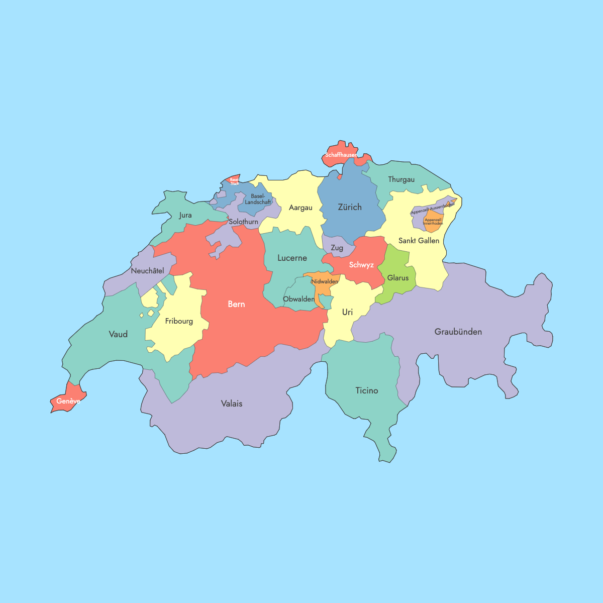
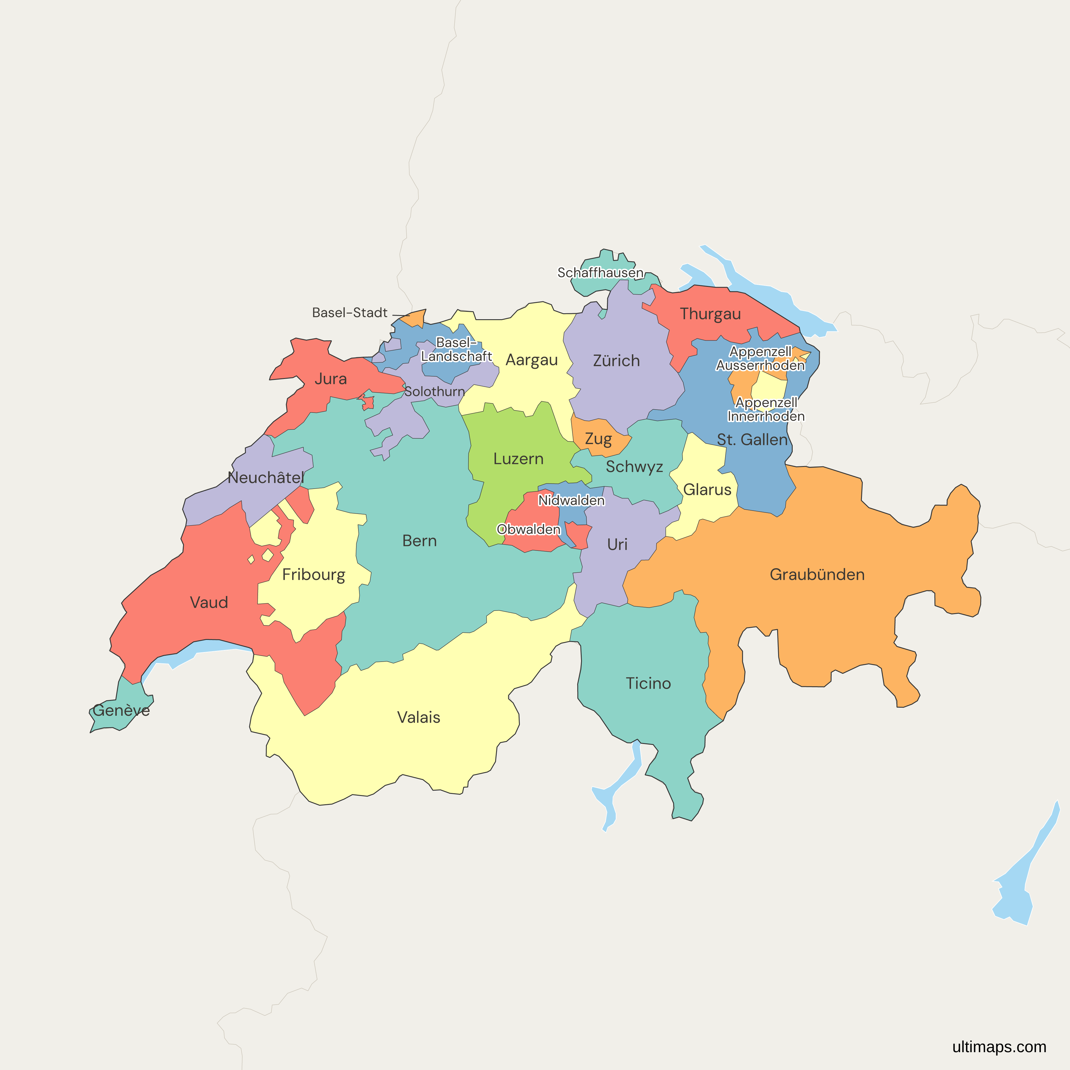
This map of Switzerland shows the 26 cantons listed in Article 1 of the 1999 Federal Constitution, with one shape for each canton. The Swiss cantons are the member states of the Confederation, and each has its own constitution, parliament, government and courts. Bern is the federal city and seat of government. The Federal Statistical Office (FSO) counted 1,620,020 permanent residents in the canton of Zürich on 31 December 2024, more than in any other canton. Graubünden, in the Alps, is the largest canton at 7,105 km² (2,743 sq mi), and the city canton of Basel-Stadt is the smallest at 37 km² (14 sq mi).
The map includes the most recent boundary change. On 28 March 2021, voters in Moutier chose to leave the canton of Bern, with 54.9% in favor, and the town joined the canton of Jura on 1 January 2026. You can color the cantons by referendum results, sales or any other figure per canton in the free editor. No account is needed.
Interactive Swiss Cantons Map
List of Cantons (26)
| # | Canton |
|---|---|
| 1 | Aargau |
| 2 | Appenzell Ausserrhoden |
| 3 | Appenzell Innerrhoden |
| 4 | Basel-Landschaft |
| 5 | Basel-Stadt |
| 6 | Bern |
| 7 | Fribourg |
| 8 | Genève |
| 9 | Glarus |
| 10 | Graubünden |
| 11 | Jura |
| 12 | Luzern |
| 13 | Neuchâtel |
| 14 | Nidwalden |
| 15 | Obwalden |
| 16 | Schaffhausen |
| 17 | Schwyz |
| 18 | Solothurn |
| 19 | St. Gallen |
| 20 | Thurgau |
| 21 | Ticino |
| 22 | Uri |
| 23 | Valais |
| 24 | Vaud |
| 25 | Zug |
| 26 | Zürich |
Swiss Cantons: Key Facts
- Total number of cantons: 26, the official count in the Federal Constitution. For comparison, Germany has 16 states and Austria has 9.
- Most populous canton: Zürich (capital Zürich), 1,620,020 residents (FSO STATPOP, 31 December 2024)
- Least populous canton: Appenzell Innerrhoden (capital Appenzell), 16,733 residents (FSO STATPOP, 31 December 2024)
- Largest canton by area: Graubünden, 7,105 km² (2,743 sq mi) according to the FSO. That is about 17% of Switzerland's 41,285 km² (15,940 sq mi).
- Smallest canton by area: Basel-Stadt, 37 km² (14 sq mi) according to the FSO
- Major urban centers: the city of Zürich and Winterthur in the canton of Zürich, Geneva in Genève, Basel in Basel-Stadt, Lausanne in Vaud, Bern in Bern, Lugano in Ticino, Lucerne in Luzern and St. Gallen in St. Gallen
- Seat of government: the Federal Assembly and the Federal Council meet in the city of Bern. The Federal Constitution does not name a capital.
- Borders: Germany to the north, France to the west, Italy to the south, and Austria and Liechtenstein to the east. Lake Geneva lies on the border with France, and Lake Constance lies on the borders with Germany and Austria.
- Official languages: German, French, Italian and Romansh. Bern, Fribourg and Valais are bilingual (French and German), and Graubünden is trilingual (German, Romansh and Italian).
- Canton names: the map labels each canton with its official-language name, such as Zürich, Luzern, Graubünden or Genève. Their English forms are Zurich, Lucerne, Grisons and Geneva.
- Time zone: Central European Time (UTC+1) and Central European Summer Time (UTC+2)
- Boundary history: the federal state of 1848 began with 22 cantons, 3 of them split into halves. Jura separated from Bern on 1 January 1979 and became the 26th canton. The town of Moutier moved from Bern to Jura on 1 January 2026, and this map draws it inside Jura.
Interesting Facts
- Obwalden, Nidwalden, Basel-Stadt, Basel-Landschaft, Appenzell Ausserrhoden and Appenzell Innerrhoden each elect one member of the Council of States instead of two. This gives the chamber 46 seats.
- Appenzell Innerrhoden and Glarus still hold a Landsgemeinde, an open-air assembly where citizens vote on cantonal laws by raising their hands.
- Ticino is the only canton where Italian is the sole official language.
- Jura is the youngest canton. Voters across Switzerland approved its creation on 24 September 1978.
Free Downloads
Free for personal and commercial use with a credit to Ultimaps. See the license terms for details.
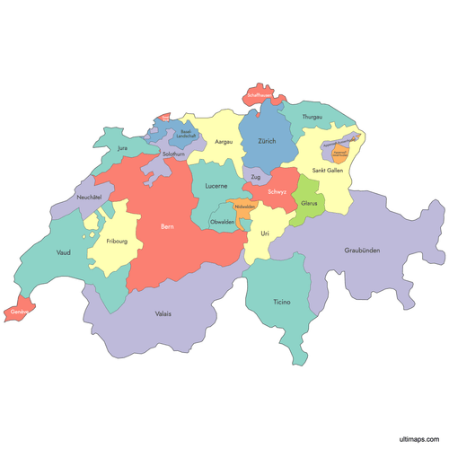 Colored Swiss Cantons Mappng568 KB
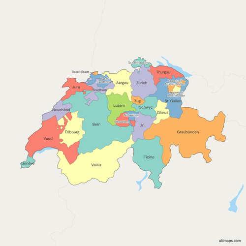 Political Map of Switzerland with Cantonspng611 KB
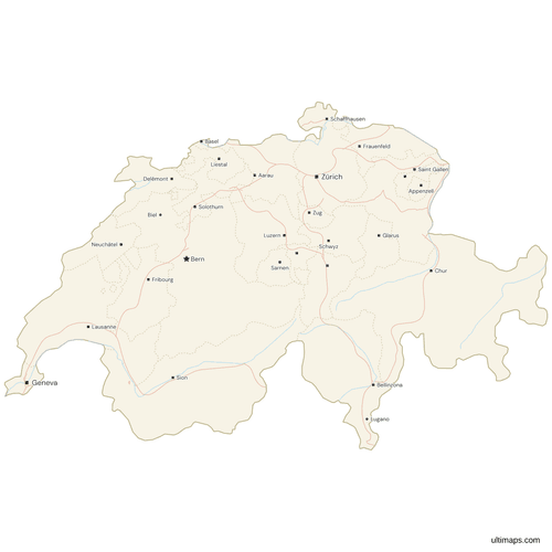 Map of Switzerland with Cities and Roadspng664 KB
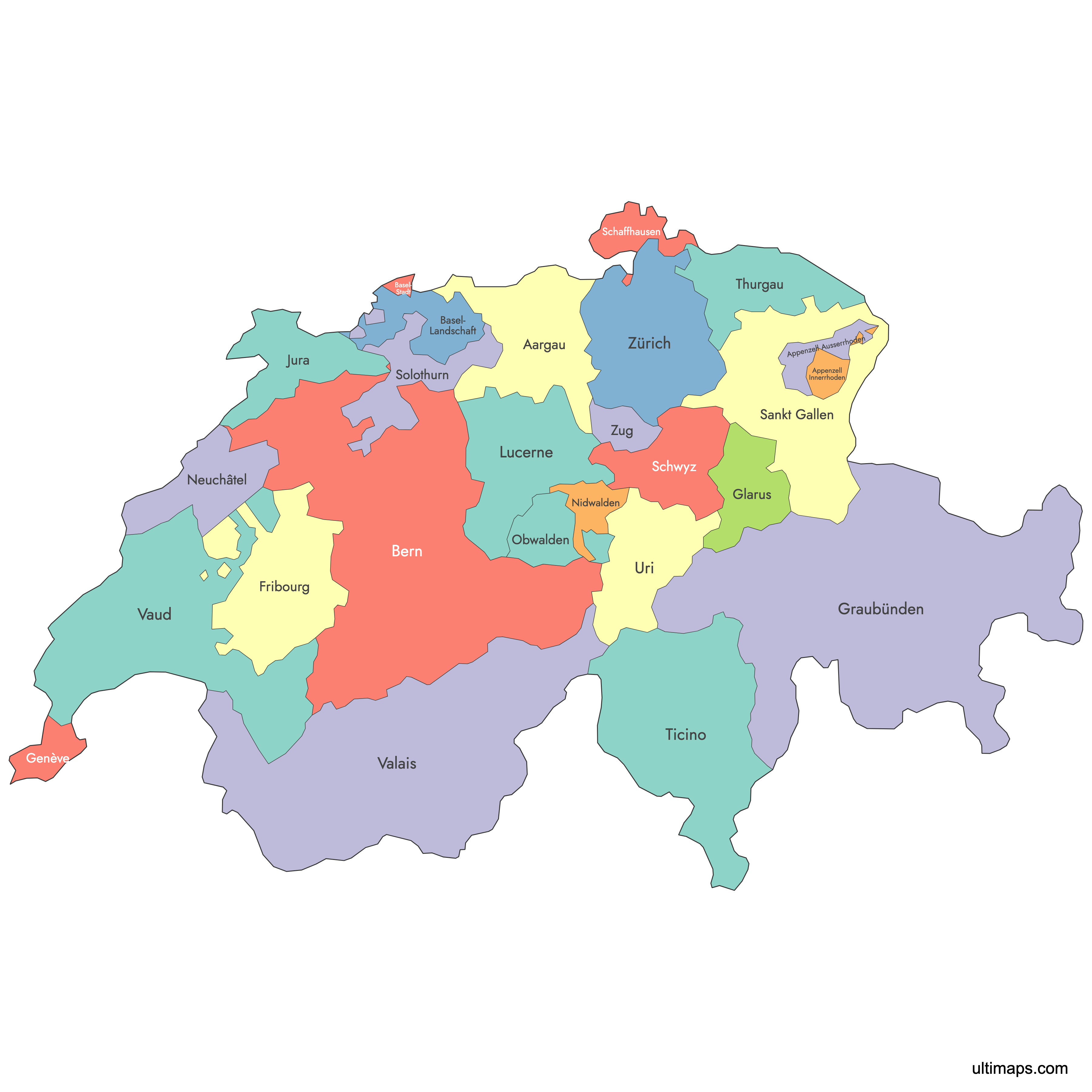
Need it without colors? The blank version of this map comes as a print-ready PDF (A4 and US Letter), a PNG and an editable SVG.
Custom Map Features
This map supports labels.
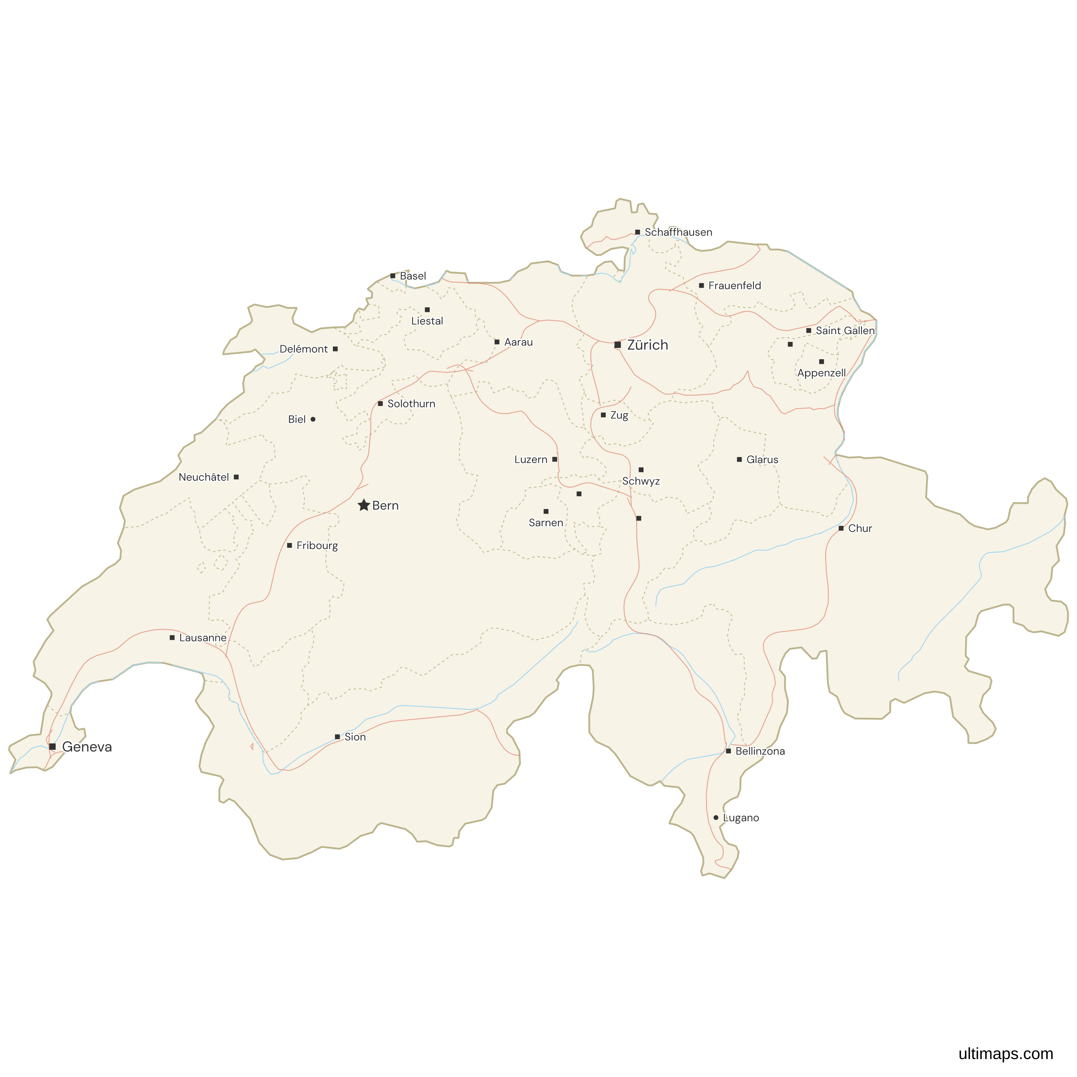
This map supports surrounding areas, roads, rivers and cities. New
This map is divided into 26 cantons.
Updates
Sep 28, 2023:
- Added map of Switzerland Cantons
Frequently Asked Questions
Switzerland has 26 cantons, the number set out in Article 1 of the Federal Constitution of 18 April 1999. The map on this page draws one shape for each of them. The count reached 26 on 1 January 1979, when Jura separated from the canton of Bern. Six of the 26 were long called half-cantons: Obwalden, Nidwalden, Basel-Stadt, Basel-Landschaft, Appenzell Ausserrhoden and Appenzell Innerrhoden. Because of this, some older sources describe Switzerland as 23 cantons. Populations range from 16,733 in Appenzell Innerrhoden to 1,620,020 in Zürich (FSO STATPOP, 31 December 2024).
Switzerland does not use the word states, but its 26 cantons are the member states of the Swiss Confederation. Each canton has its own constitution, parliament and government, as well as its own courts, police and tax laws. Article 3 of the Federal Constitution says the cantons are sovereign except where the constitution limits that sovereignty. They also hold every power that is not assigned to the Confederation. This makes a Swiss canton closer to a US state or a German Land than to a French department. A Switzerland map with states is therefore a map of the 26 cantons, from Zürich and Bern to Genève and Jura.
Switzerland's 26 cantons are listed here with their capitals in parentheses, in the order the Federal Constitution uses: Zürich (Zürich), Bern (Bern), Luzern (Lucerne), Uri (Altdorf), Schwyz (Schwyz), Obwalden (Sarnen), Nidwalden (Stans), Glarus (Glarus), Zug (Zug), Fribourg (Fribourg), Solothurn (Solothurn), Basel-Stadt (Basel), Basel-Landschaft (Liestal), Schaffhausen (Schaffhausen), Appenzell Ausserrhoden (Herisau), Appenzell Innerrhoden (Appenzell), St. Gallen (St. Gallen), Graubünden (Chur), Aargau (Aarau), Thurgau (Frauenfeld), Ticino (Bellinzona), Vaud (Lausanne), Valais (Sion), Neuchâtel (Neuchâtel), Genève (Geneva) and Jura (Delémont). In Appenzell Ausserrhoden, the government and parliament sit in Herisau and the cantonal courts sit in Trogen.
Graubünden, in the south-east of Switzerland, is the largest canton by area. Federal Statistical Office figures put it at 7,105 km² (2,743 sq mi), about 17% of the country's 41,285 km² (15,940 sq mi). Its capital is Chur. Graubünden is also the only trilingual canton, with German, Romansh and Italian as official languages, and the Swiss National Park, founded in 1914, lies inside its borders. The city canton of Basel-Stadt, at 37 km² (14 sq mi) on the same FSO figures, is the smallest of the 26 cantons.
On 31 December 2024, the FSO's STATPOP count put 1,620,020 permanent residents in the canton of Zürich, the highest population of the 26 Swiss cantons. Out of 9,051,029 people in Switzerland on the same count, that is nearly one in five. Besides the city of Zürich, the country's largest city and main financial center, the canton includes Winterthur, the sixth-largest Swiss city, and Zurich Airport in Kloten. Appenzell Innerrhoden, whose capital is Appenzell, had the smallest population in the same FSO series, 16,733 residents.
A half-canton is the traditional name for 6 Swiss cantons formed when a historical canton was divided. Obwalden and Nidwalden came from Unterwalden. Basel-Stadt and Basel-Landschaft came from Basel, which split in 1833. Appenzell Ausserrhoden and Appenzell Innerrhoden came from Appenzell, which split in 1597. The 1999 Federal Constitution no longer uses the term and calls all 6 of them cantons, each with full control of its own affairs. Two differences remain. Under Article 150, each of the 6 elects one member of the Council of States instead of two. Under Article 142, each counts as half a cantonal vote when a referendum needs a majority of the cantons.
Moutier, a French-speaking town in the Bernese Jura, moved from the canton of Bern to the canton of Jura on 1 January 2026. Its voters approved the change on 28 March 2021, with 54.9% in favor. An earlier vote from 2017 had been annulled because of irregularities. The transfer also needed approval from both cantons and from the Federal Assembly. The move is part of the long-running Jura question, which also produced the canton of Jura itself. Jura separated from Bern on 1 January 1979, after a national vote on 24 September 1978. This map draws Moutier inside Jura, so it matches data based on the 2026 boundaries.
Switzerland has four national languages: German, French, Italian and Romansh. Each canton decides its own official languages. German is the sole official language in 17 cantons. French is the sole official language in Vaud, Neuchâtel, Genève and Jura, and Italian is the sole official language in Ticino. Bern, Fribourg and Valais are bilingual in French and German. Graubünden is trilingual in German, Romansh and Italian. For this reason, canton names appear in several forms, such as Genève, Genf, Ginevra and Geneva, or Graubünden, Grisons and Grigioni. The map labels each canton with its own official-language name.
The map of Switzerland's 26 cantons on this page opens in the Ultimaps editor, free and without an account. For a grouping such as the language regions, choose a fill color for each canton individually. For figures such as referendum yes shares by canton, enter one number per canton, and the editor applies a color scale and adds a legend. Rows are matched to cantons by the official-language names on the map, such as Genève or Graubünden. Markers can mark towns such as Davos or Zermatt, or a company office, and the palette and label style are adjustable. The free plan exports a standard PNG with a small Ultimaps credit. High-resolution PNG, SVG and PDF export are Pro features.