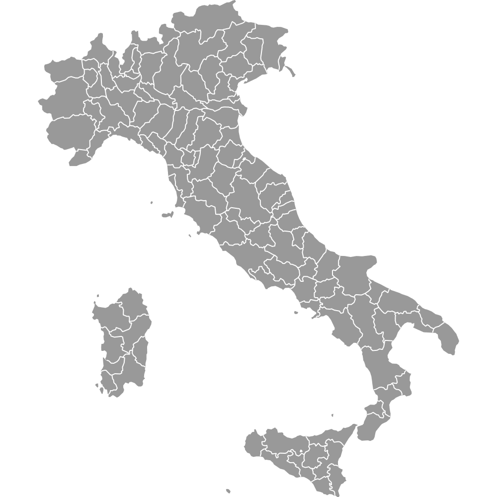
Italy Map with Regions
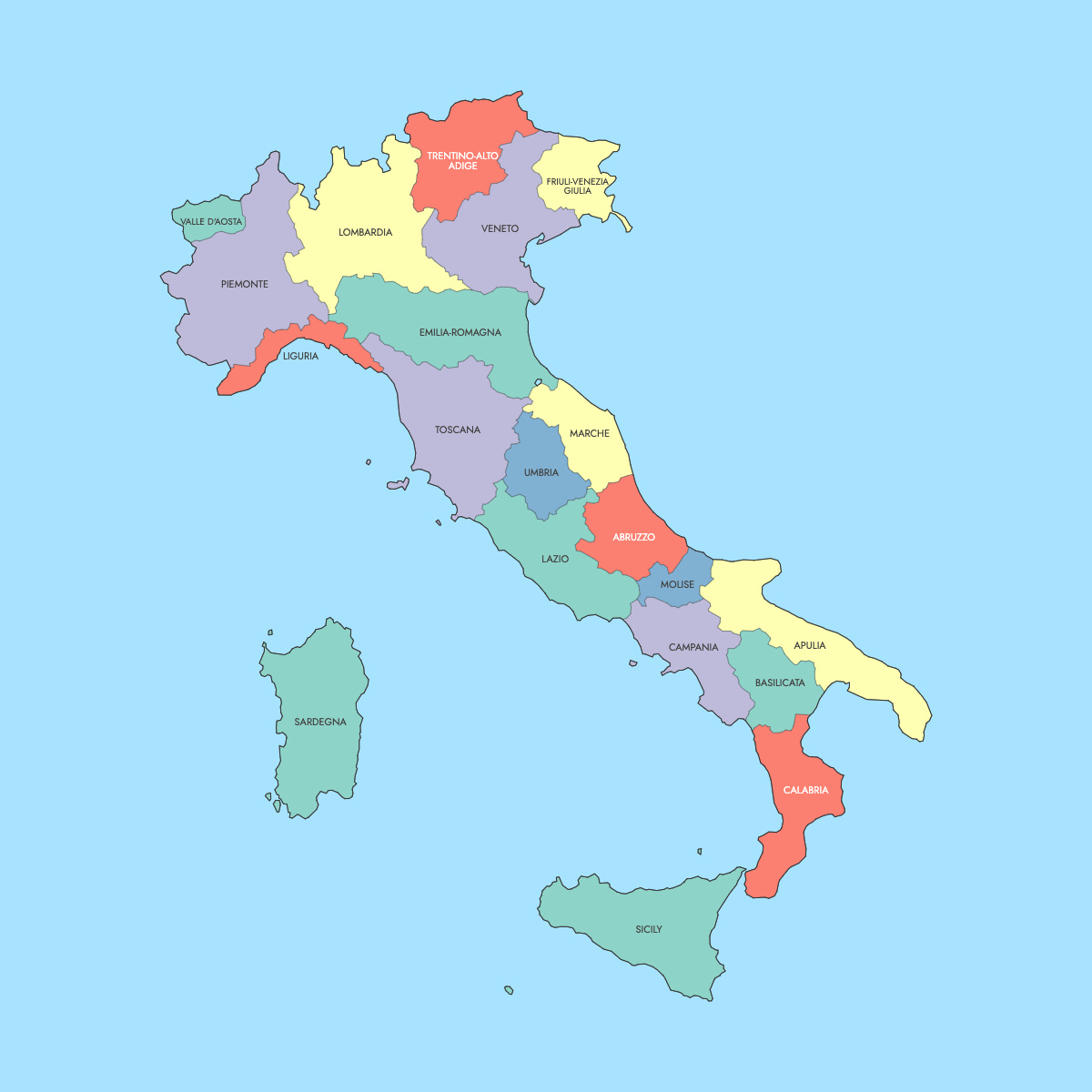
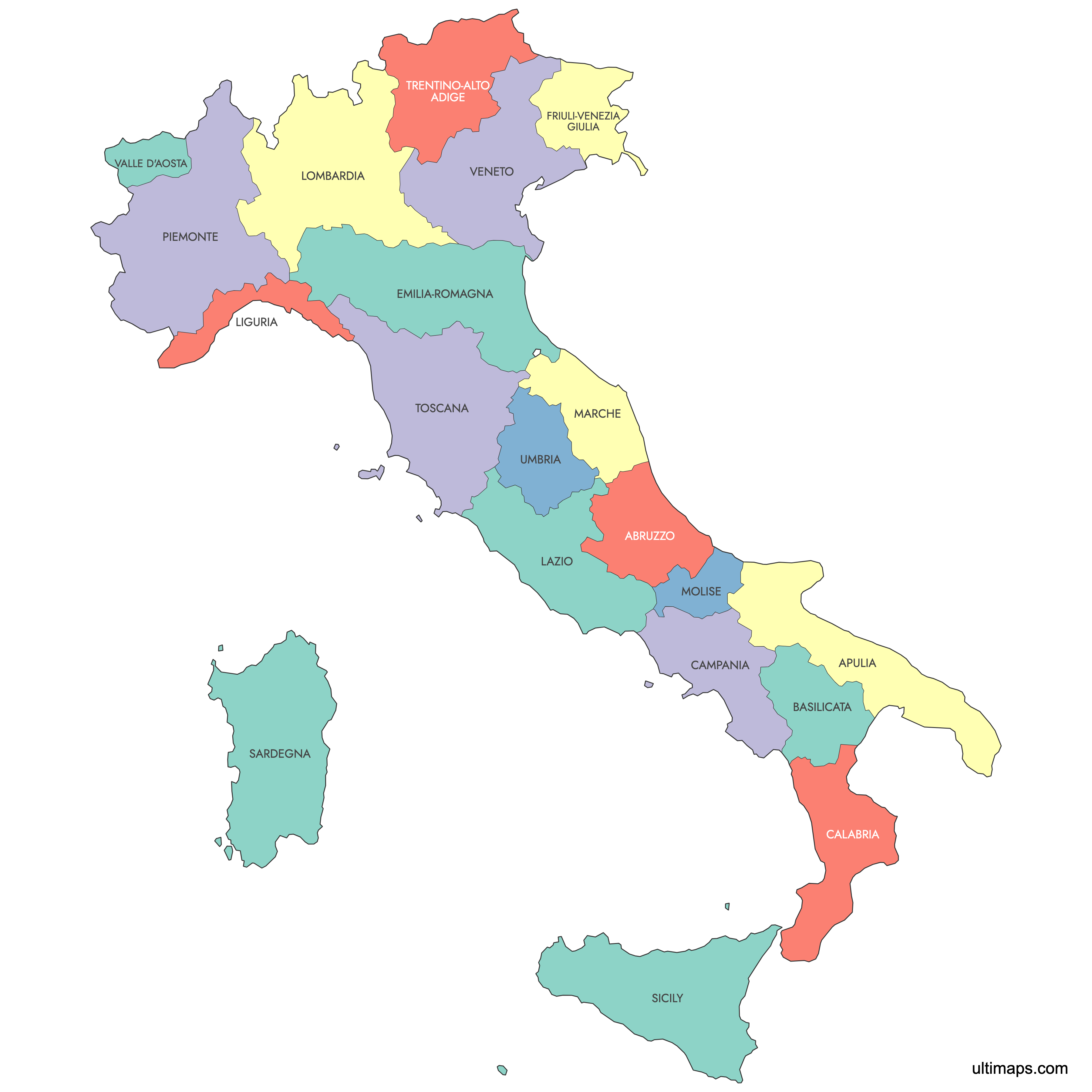
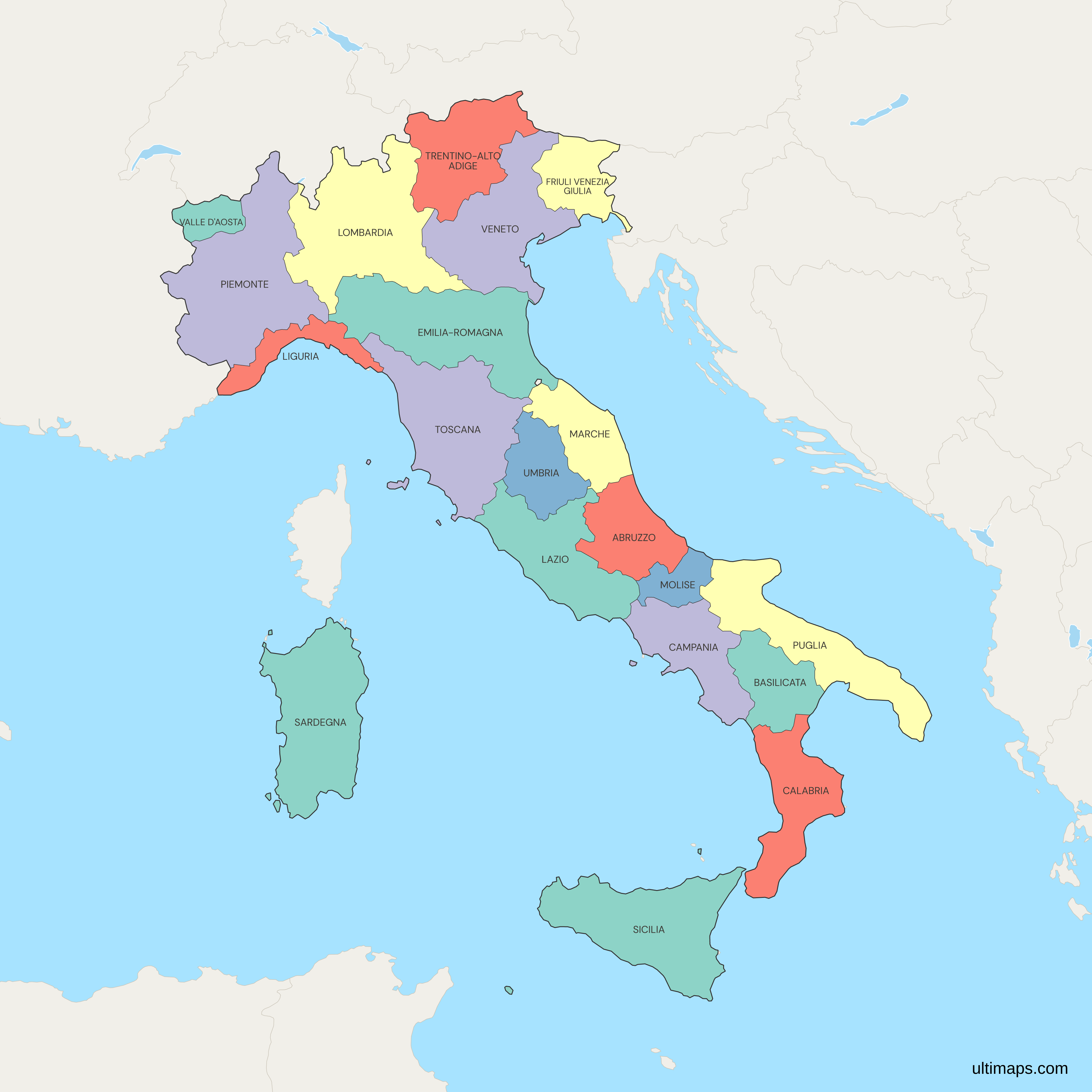
All 20 regions appear on this map of Italy, the first-level administrative units set out in the 1948 Constitution. Fifteen run under an ordinary statute. Five hold a special statute with broader powers: Sicily, Sardinia, Trentino-Alto Adige, Aosta Valley and Friuli Venezia Giulia. Four of those statutes were adopted as constitutional laws in 1948, Friuli Venezia Giulia's in 1963, the same year Molise was separated from Abruzzo. The ordinary regions only began operating as elected bodies after the first regional elections in 1970.
Lazio contains Rome, the national capital. Lombardy is the most populous region, with 10,033,918 residents on 1 January 2025 (Eurostat), against 122,532 in Aosta Valley on the same date. ISTAT measures Sicily as the largest region at 25,832 km² (9,974 sq mi) and Aosta Valley as the smallest at 3,261 km² (1,259 sq mi), within a national 302,068 km² (116,629 sq mi). Names in the table below stay in Italian (Lombardia, Piemonte, Toscana, Sicilia), and Trentino-Alto Adige is drawn as one region rather than as the provinces of Bolzano and Trento. The editor lets you color each region from your own numbers.
Interactive Italy Map with Regions
List of Regions (20)
| # | Region | Population (2025) | GDP per capita (EUR, 2024) | Unemployment rate (%, 2025) | Life expectancy at birth (years, 2024) |
|---|---|---|---|---|---|
| 1 | Abruzzo | 1,269,118 | 32,100 | 6.50 | 83.80 |
| 2 | Basilicata | 530,004 | 28,400 | 5.30 | 83.50 |
| 3 | Calabria | 1,834,646 | 21,800 | 9.80 | 82.70 |
| 4 | Campania | 5,582,337 | 24,600 | 13.90 | 82 |
| 5 | Emilia-Romagna | 4,461,998 | 44,500 | 4.10 | 84.30 |
| 6 | Friuli Venezia Giulia | 1,193,284 | 39,000 | 4.60 | 84.20 |
| 7 | Lazio | 5,709,178 | 43,200 | 5.50 | 83.60 |
| 8 | Liguria | 1,510,143 | 39,100 | 4.70 | 83.80 |
| 9 | Lombardia | 10,033,918 | 50,400 | 3 | 84.40 |
| 10 | Marche | 1,480,545 | 34,100 | 5.10 | 84.40 |
| 11 | Molise | 287,814 | 27,700 | 6.20 | 82.70 |
| 12 | Piemonte | 4,251,868 | 38,600 | 6 | 83.70 |
| 13 | Puglia | 3,877,395 | 24,300 | 10 | 83.50 |
| 14 | Sardegna | 1,562,381 | 27,700 | 9.30 | 83.20 |
| 15 | Sicilia | 4,787,390 | 23,400 | 12.20 | 82.60 |
| 16 | Toscana | 3,657,716 | 39,200 | 4.30 | 84.20 |
| 17 | Trentino-Alto Adige | 1,086,252 | 54,504 | 2 | 85 |
| 18 | Umbria | 851,473 | 32,500 | 4.60 | 84.10 |
| 19 | Valle d'Aosta | 122,532 | 47,700 | 3.90 | 83.20 |
| 20 | Veneto | 4,853,472 | 41,500 | 3.40 | 84.60 |
Data sources, all reuse with acknowledgement:
- Population: Eurostat, Population on 1 January (demo_r_pjanaggr3).
- GDP per capita: Eurostat, Gross domestic product at current market prices by NUTS 3 regions, euro per inhabitant (nama_10r_3gdp).
- Unemployment rate: Eurostat, Unemployment rates by NUTS 2 regions, ages 15-74 (lfst_r_lfu3rt).
- Life expectancy at birth: Eurostat, Life expectancy at birth by NUTS 2 regions (demo_r_mlifexp).
Italy's 20 Regions: Key Facts
- Total number of regions: 20, split into 15 ordinary statute regions and 5 special statute regions
- Most populous region: Lombardy, 10,033,918 residents on 1 January 2025 (Eurostat), about 17% of the national total of 58,943,464
- Least populous region: Aosta Valley, 122,532 residents on 1 January 2025 (Eurostat)
- Largest region by area: Sicily, 25,832 km² (9,974 sq mi), ISTAT
- Smallest region by area: Aosta Valley, 3,261 km² (1,259 sq mi), ISTAT
- Total area: 302,068 km² (116,629 sq mi), ISTAT
- Regions holding the main urban centers: Lazio (Rome), Lombardy (Milan), Campania (Naples), Piedmont (Turin), Sicily (Palermo), Liguria (Genoa), Veneto (Venice), Emilia-Romagna (Bologna), Tuscany (Florence), Puglia (Bari)
- National capital: Rome, in Lazio
- Borders: land borders with France, Switzerland, Austria and Slovenia, plus the two enclaved states of San Marino and Vatican City. Coasts on the Ligurian, Tyrrhenian, Ionian and Adriatic seas, the Sea of Sardinia and the Strait of Sicily
- Time zone: CET (UTC+1), moving to CEST (UTC+2) for summer time
- Lower tiers: about 110 second-level units, including 15 metropolitan cities, Sicily's 6 free municipal consortia and Friuli Venezia Giulia's 4 regional decentralization entities, and 7,894 municipalities (ISTAT, 2026)
- Boundary history: the 1948 Constitution provided for the regions. Four special statutes were adopted as constitutional laws in 1948 and Friuli Venezia Giulia's in 1963, the year Molise was separated from Abruzzo. The ordinary regions started work after the 1970 regional elections
Interesting Facts
- Trentino-Alto Adige has the highest GDP per capita of the 20 regions at 54,504 EUR (2024), the longest life expectancy at 85 years (2024) and the lowest unemployment rate at 2% (2025), all Eurostat figures.
- The GDP per capita gap between Trentino-Alto Adige (54,504 EUR) and Calabria (21,800 EUR) came to 32,704 EUR in 2024 (Eurostat).
- Campania had the highest unemployment rate in 2025 at 13.9%, down from 19.8% in 2015, and the shortest life expectancy at 82 years (2024), both Eurostat figures.
- Between 1 January 2015 and 1 January 2025, Lombardy added 79,149 residents while Sicily lost 240,876 and Campania 222,033 (Eurostat).
- Aosta Valley has had no provinces since 1945, when the Province of Aosta was abolished, and the region carries out provincial functions itself. Friuli Venezia Giulia abolished its provinces in 2017 and now works through four regional decentralization entities.
Free Downloads
Free for personal and commercial use with a credit to Ultimaps. See the license terms for details.
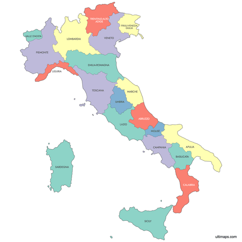 Colored Italy Map with Regionspng492 KB
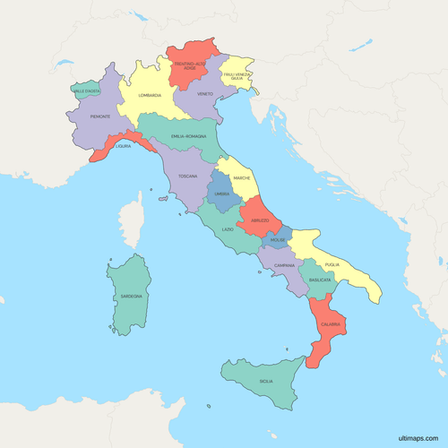 Political Map of Italy with Regionspng719 KB
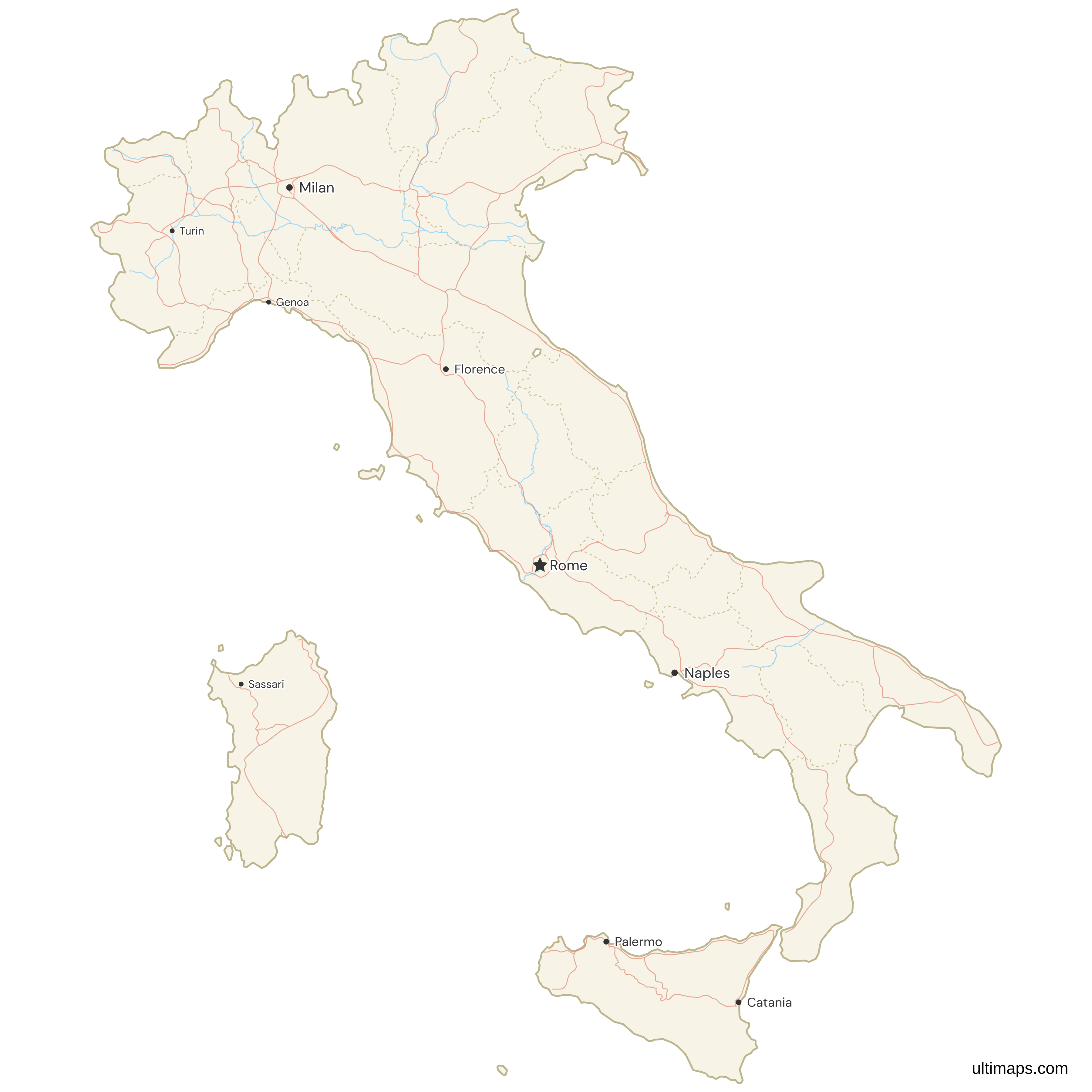
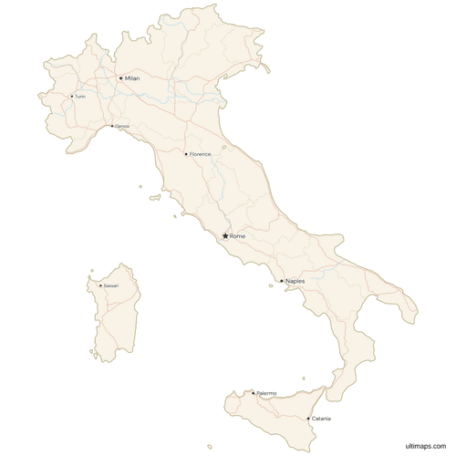 Map of Italy with Cities and Roadspng673 KB
Need it without colors? The blank version of this map comes as a print-ready PDF (A4 and US Letter), a PNG and an editable SVG.
Custom Map Features
This map supports labels.
This map supports surrounding areas, roads, rivers and cities. New
This map is divided into 20 regions.
Updates
Sep 28, 2023:
- Added map of Italy Regions
Frequently Asked Questions
Italy is divided into 20 regions, its first administrative level, and the map above shows each one as a separate shape. Sicily, Sardinia, Trentino-Alto Adige, Aosta Valley and Friuli Venezia Giulia have a special statute, and the other fifteen have an ordinary one. On 1 January 2025 the regions had a combined 58,943,464 residents (Eurostat). Below them are roughly 110 second-level units, among them 15 metropolitan cities, Sicily's six free municipal consortia and Friuli Venezia Giulia's four regional decentralization entities, and 7,894 municipalities (ISTAT, 2026). The 1948 Constitution provided for the regions, and the ordinary ones began functioning as elected bodies in 1970.
Sicily is the largest Italian region by area at 25,832 km² (9,974 sq mi) according to ISTAT, which is 8.6% of the national 302,068 km² (116,629 sq mi). Piedmont comes second with 25,387 km² (9,802 sq mi), followed by Sardinia at 24,100 km² (9,305 sq mi) and Lombardy at 23,864 km² (9,214 sq mi). As a special statute region, Sicily organizes its second-level administration into six free municipal consortia and the metropolitan cities of Palermo, Catania and Messina.
Lombardy (Lombardia) is the most populated region in Italy, with 10,033,918 residents on 1 January 2025 (Eurostat), roughly 17% of the country's 58,943,464. Milan is its regional capital and the main financial center of Italy. Lazio follows with 5,709,178 residents and Campania with 5,582,337 on the same date. Lombardy recorded 50,400 EUR of GDP per capita in 2024, second only to Trentino-Alto Adige, and an unemployment rate of 3% in 2025 (Eurostat). Its land area of 23,864 km² (9,214 sq mi) gives a density of about 420 people per km².
Five of Italy's 20 regions have a special statute: Sicily, Sardinia, Trentino-Alto Adige, Aosta Valley and Friuli Venezia Giulia. Sicily's statute dates from 1946 and received constitutional rank in 1948, the same year as those of Sardinia, Aosta Valley and Trentino-Alto Adige. Friuli Venezia Giulia followed in 1963. Special statute regions retain larger shares of tax revenue and legislate in fields the 15 ordinary regions do not control. Some also have co-official languages: German in the province of Bolzano, Ladin in the Ladin valleys of Bolzano and in Val di Fassa in Trentino, French in Aosta Valley, and Slovene in parts of Friuli Venezia Giulia. Trentino-Alto Adige had the highest GDP per capita of the 20 in 2024, 54,504 EUR (Eurostat).
With 122,532 residents on 1 January 2025 (Eurostat) and 3,261 km² (1,259 sq mi) of territory (ISTAT), Aosta Valley (Valle d'Aosta) is the least populous Italian region and the smallest by area, at about 38 people per km². Molise (287,814) and Basilicata (530,004) are the next least populous. Aosta Valley has had no provinces since 1945, when the Province of Aosta was abolished, and the regional administration performs provincial functions. Per resident, its GDP of 47,700 EUR in 2024 was the third highest of the 20 regions, and unemployment was 3.9% in 2025 (Eurostat).
Rome, the capital of Italy, is in Lazio. Lazio covers 17,232 km² (6,653 sq mi) according to ISTAT and had 5,709,178 residents on 1 January 2025 (Eurostat), the second largest regional population after Lombardy. GDP per capita in Lazio was 43,200 EUR in 2024 and the unemployment rate 5.5% in 2025 (Eurostat). Vatican City is an independent state enclaved within Rome and belongs to no Italian region. San Marino, the other enclaved state, is surrounded by Emilia-Romagna and Marche. Neither state is shown as a region on this map.
Italy's 20 regions form the first administrative tier, each with an elected council, a president and legislative powers. Provinces and their equivalents make up the tier underneath, about 110 units once Sardinia's 2025 reform entered the ISTAT codes on 1 January 2026. That figure covers 15 metropolitan cities, including Rome, Milan and Naples, Sicily's six free municipal consortia and Friuli Venezia Giulia's four regional decentralization entities. The lowest tier is 7,894 municipalities (comuni) as of 2026. For the finer breakdown of the country, see the Italy provinces map.
Trentino-Alto Adige/Südtirol is one region of Italy, so it appears as a single shape here, even though most of its powers belong to its two autonomous provinces, Trento and Bolzano. The German name of the region is Trentino-Südtirol, Trentino-South Tyrol in English. Südtirol by itself refers only to the province of Bolzano, where German is co-official, while Ladin is co-official in the Ladin valleys of Bolzano and in Val di Fassa in Trentino. Combined, the region had 1,086,252 residents on 1 January 2025, 54,504 EUR of GDP per capita in 2024 and 2% unemployment in 2025 (Eurostat).
To create a custom map of Italy, use the editor on this page. Click a single region to set its fill by hand, or paste a column of values covering all 20 regions and the editor builds a color scale and legend from them. Mark cities or branch locations with pins, rename or hide region labels, and adjust border width, fonts and background. Using the editor is free and needs no account. A free export is a standard-size PNG with a small Ultimaps credit, while SVG, PDF and high-resolution PNG files require the Pro plan.