Belgium Map with Provinces
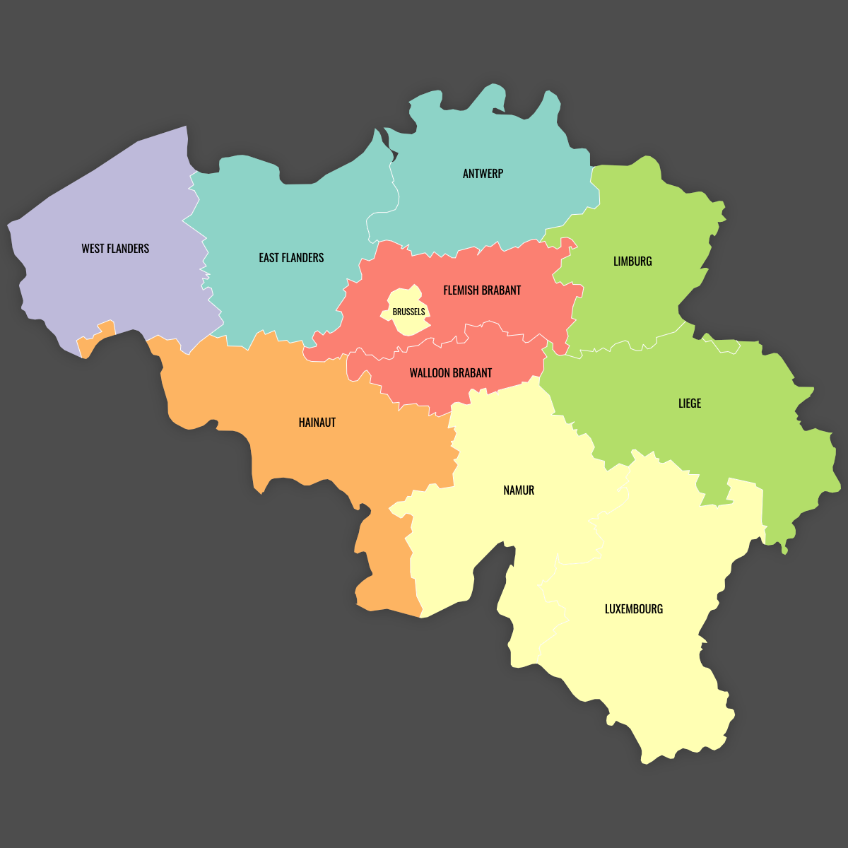
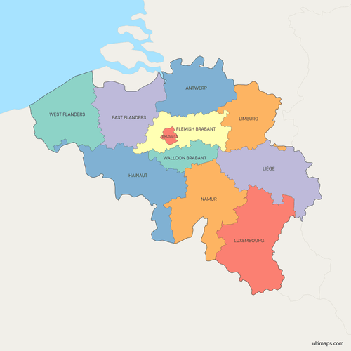
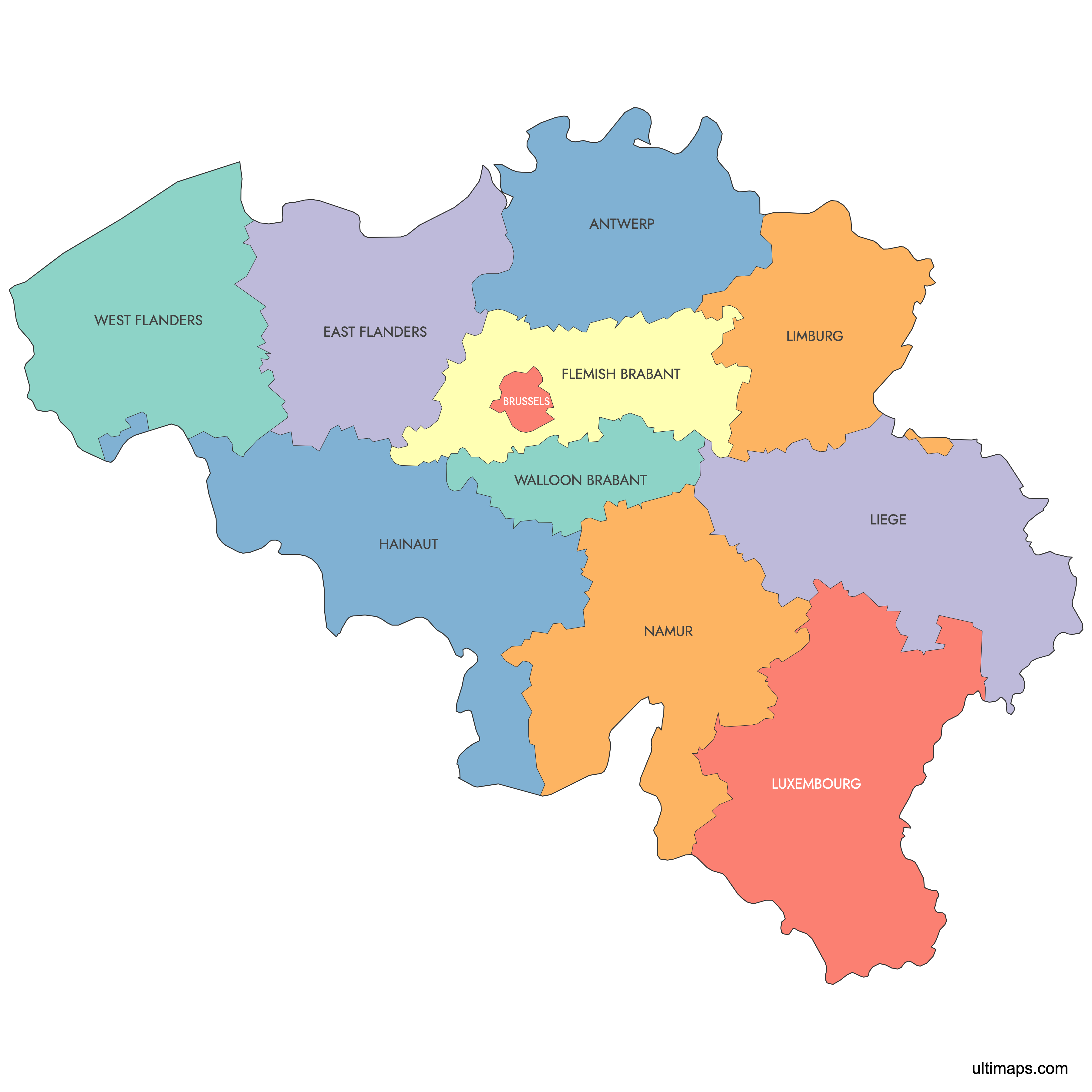
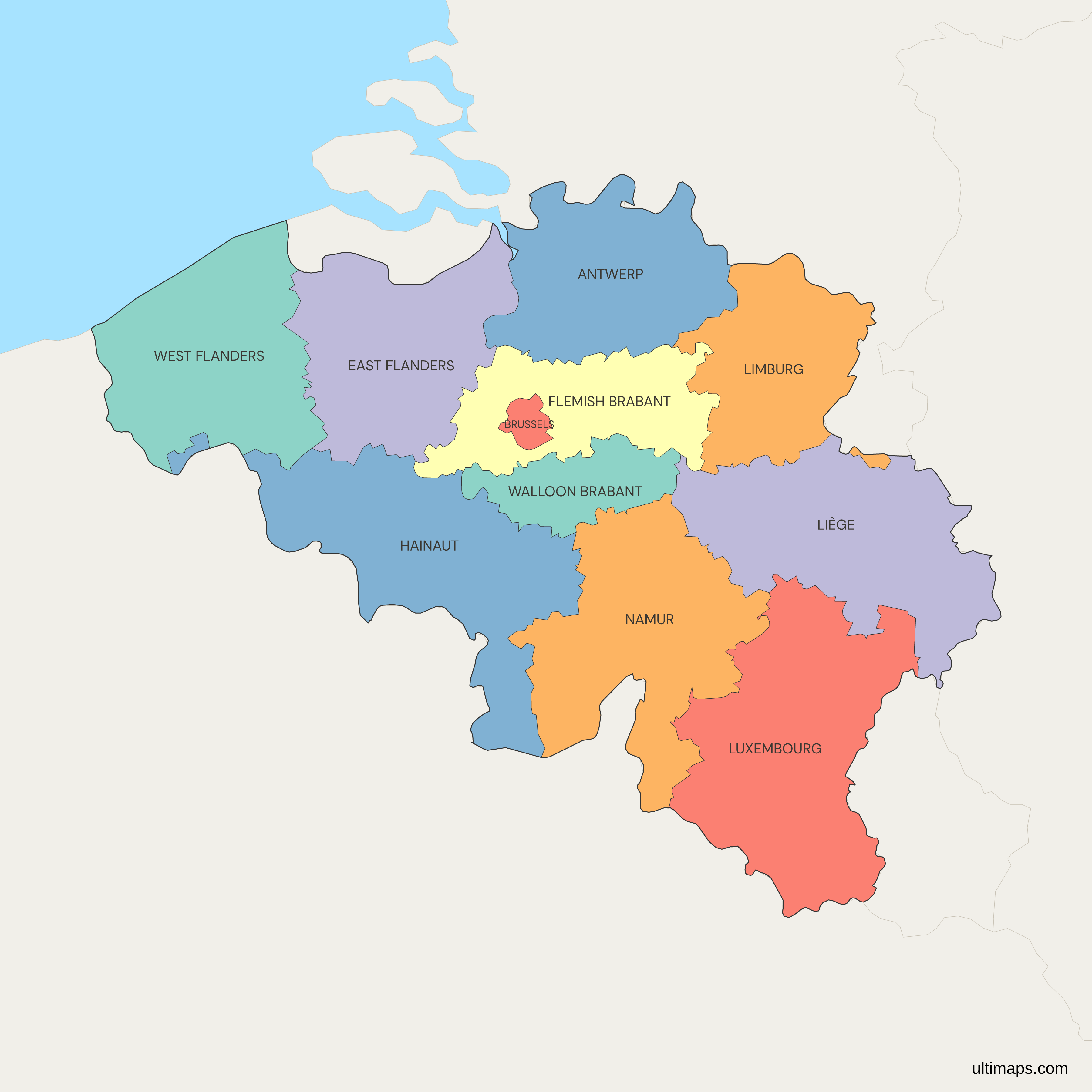
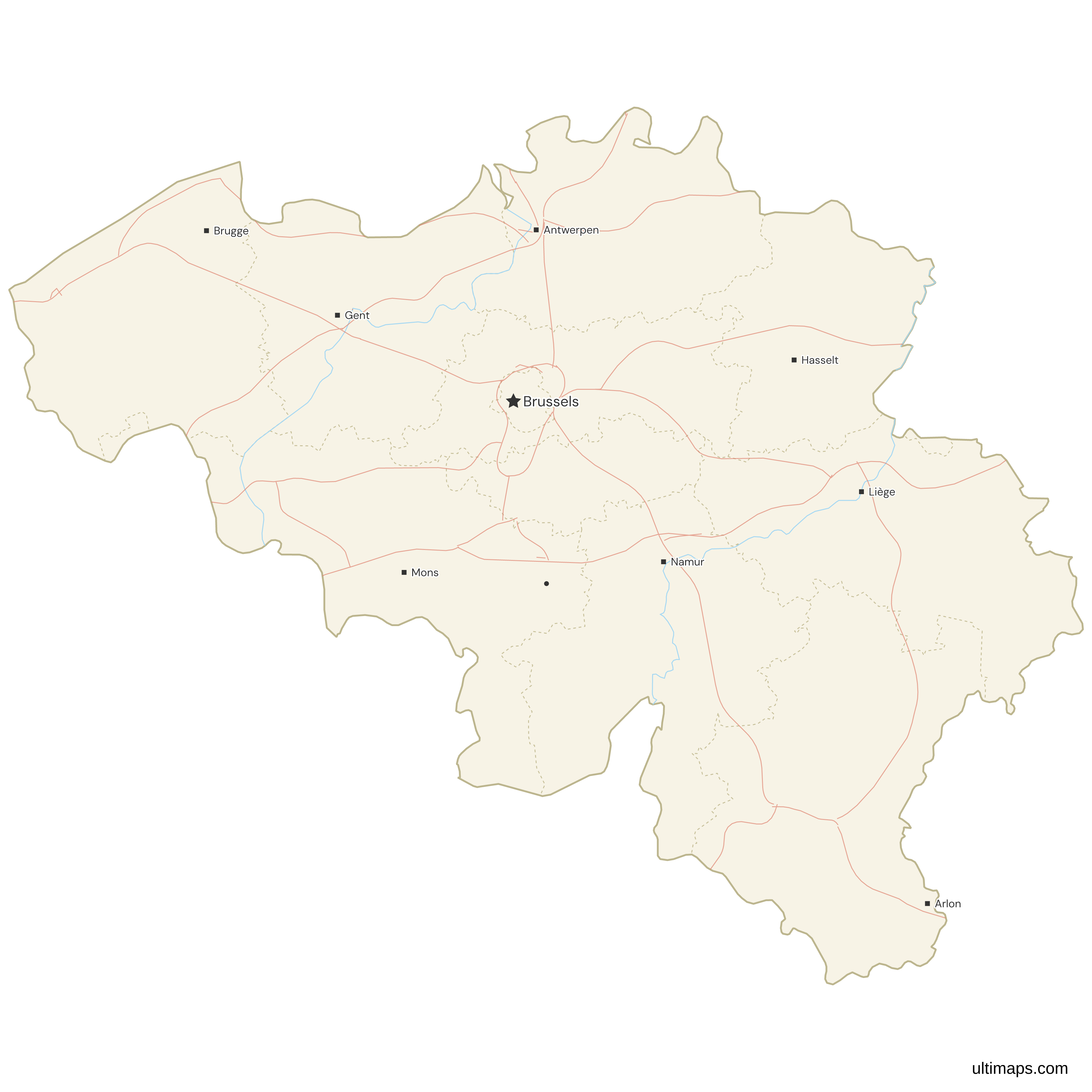
The Brussels-Capital Region sits at the center of this map of Belgium as an 11th area beside the 10 provinces, because it has belonged to no province since Brabant was split on 1 January 1995. Flanders contains five provinces (Antwerp, East Flanders, Flemish Brabant, Limburg and West Flanders). Wallonia contains the other five (Hainaut, Liège, Luxembourg, Namur and Walloon Brabant).
Brussels, the national capital, is a region of its own with about 1.25 million residents (Statbel, 1 January 2024). Antwerp is the most populous province, with about 1.9 million people on the same Statbel count. Luxembourg, in the Ardennes along the southeastern border, is the largest province at about 4,460 km² (1,722 sq mi). Walloon Brabant, just south of Brussels, is the smallest at about 1,100 km² (424 sq mi).
To compare the provinces with your own figures, color them in the editor.
Interactive Belgium Map with Provinces
List of Provinces (11)
| # | Province |
|---|---|
| 1 | Antwerp |
| 2 | Brussels |
| 3 | East Flanders |
| 4 | Flemish Brabant |
| 5 | Hainaut |
| 6 | Liège |
| 7 | Limburg |
| 8 | Luxembourg |
| 9 | Namur |
| 10 | Walloon Brabant |
| 11 | West Flanders |
Belgium Provinces: Key Facts
- Total number of provinces: 10, with 5 in Flanders and 5 in Wallonia. The map shows 11 areas because it also includes the Brussels-Capital Region, which is not part of any province.
- Most populous province: Antwerp, with about 1.9 million people (Statbel, 1 January 2024)
- Least populous province: Luxembourg, with just under 300,000 people (Statbel, 1 January 2024)
- Largest province by area: Luxembourg, about 4,460 km² (1,722 sq mi)
- Smallest province by area: Walloon Brabant, about 1,100 km² (424 sq mi). The Brussels-Capital Region covers about 161 km² (62 sq mi), but it is a region, not a province.
- Major urban centers: Antwerp city and its port (Antwerp), Ghent (East Flanders), Leuven (Flemish Brabant), Bruges (West Flanders), Charleroi and Mons (Hainaut), Liège (Liège) and Namur (Namur)
- Capital: Brussels is the national capital. It sits inside the Brussels-Capital Region, which is surrounded by Flemish Brabant. Namur is the capital of Wallonia.
- Provincial capitals: Antwerp, Ghent, Leuven, Hasselt, Bruges, Mons, Liège, Arlon, Namur and Wavre
- Borders: France to the south and west, the Netherlands to the north, Germany and Luxembourg to the east, and the North Sea along the West Flanders coast
- Time zone: Central European Time (CET, UTC+1), and Central European Summer Time (CEST, UTC+2) from late March to late October
- Historical note: The provinces are mostly based on the departments France created in 1795, and the 1831 Constitution kept nine of them. On 1 January 1995, Brabant was split into Flemish Brabant and Walloon Brabant, which left Brussels outside the provincial system and made the total 10.
Interesting Facts
- Baarle-Hertog, in Antwerp province, is split into 26 pieces, 22 of them Belgian exclaves surrounded by the Netherlands, mostly within the Dutch municipality of Baarle-Nassau.
- The Battle of Waterloo in 1815 was fought in what is now Walloon Brabant.
- The German-speaking Community covers nine municipalities in the east of Liège province, including Eupen and Sankt Vith.
- West Flanders holds the whole Belgian coastline on the North Sea, along with the seaside resorts from De Panne to Knokke-Heist.
- Luxembourg is the largest province by area but the least populous, while Antwerp has more than six times as many residents (Statbel, 1 January 2024).
Free Downloads
Free for personal and commercial use with a credit to Ultimaps. See the license terms for details.
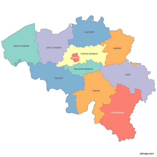 Colored Belgium Map with Provincespng440 KB
 Political Map of Belgium with Provincespng495 KB
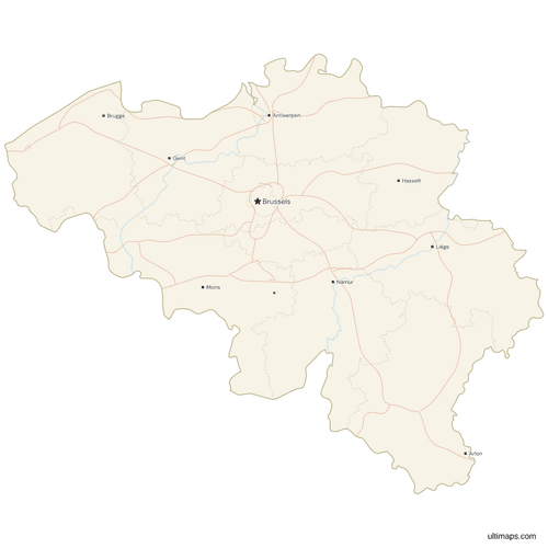 Map of Belgium with Cities and Roadspng589 KB
Need it without colors? The blank version of this map comes as a print-ready PDF (A4 and US Letter), a PNG and an editable SVG.
Custom Map Features
This map supports labels.
This map supports surrounding areas, roads, rivers and cities. New
This map is divided into 11 provinces.
Updates
Jun 16, 2025:
- Added map of Belgium Provinces
Frequently Asked Questions
Belgium has 10 provinces, split evenly between its two largest regions. The Flemish Region contains Antwerp, East Flanders, Flemish Brabant, Limburg and West Flanders. The Walloon Region contains Hainaut, Liège, Luxembourg, Namur and Walloon Brabant. The third region, Brussels-Capital, is not part of any province. The total became 10 on 1 January 1995, when the old province of Brabant was split into Flemish Brabant and Walloon Brabant. Before that, Belgium had nine provinces. The map on this page shows 11 areas, the 10 provinces plus the Brussels-Capital Region, so you can color the whole country without a gap in the middle.
Brussels is not a province of Belgium. The Brussels-Capital Region is one of the country's three regions, alongside Flanders and Wallonia, and it has its own parliament and government. It covers about 161 km² (62 sq mi), and Statbel counted about 1.25 million residents on 1 January 2024. Until 1995, Brussels was part of the province of Brabant. When Brabant was split, the capital region was left outside the provincial system, and provincial-level tasks there are carried out by the region itself. Brussels is officially bilingual in French and Dutch. It is also the national capital and the seat of the Flemish government.
Luxembourg is the largest Belgian province by area, at about 4,460 km² (1,722 sq mi). It lies in the southeast of the country, in the Ardennes, and borders France and the Grand Duchy of Luxembourg. Its capital is Arlon. Although it is the largest province, Luxembourg has the fewest residents, just under 300,000 on 1 January 2024 according to Statbel. That makes it the most thinly populated part of Belgium. The smallest province is Walloon Brabant, at about 1,100 km² (424 sq mi), south of Brussels. Liège and Hainaut are the next largest.
Antwerp is the most populous Belgian province, with about 1.9 million residents on 1 January 2024 according to Statbel. Its capital, the city of Antwerp, is the most populous municipality in Belgium and home to the Port of Antwerp-Bruges, one of Europe's largest seaports. The province lies in the north of Flanders and borders the Netherlands. East Flanders, with Ghent as its capital, is the second most populous province. At the other end, Luxembourg has just under 300,000 residents on the same Statbel count. The Brussels-Capital Region has about 1.25 million people, but it is a separate region and not a province.
Each of Belgium's 10 provinces has a capital where the provincial council and governor are based. In Flanders, the capitals are Antwerp (Antwerp), Ghent (East Flanders), Leuven (Flemish Brabant), Hasselt (Limburg) and Bruges (West Flanders). In Wallonia, they are Mons (Hainaut), Liège (Liège), Arlon (Luxembourg), Namur (Namur) and Wavre (Walloon Brabant). The capital is not always the largest city in its province. Charleroi has more residents than Mons in Hainaut, and Ostend is a major city in West Flanders, but Bruges is the capital. Namur is also the capital of the Walloon Region. Brussels is the national capital and belongs to no province.
The Belgian province of Luxembourg is a different place from the Grand Duchy of Luxembourg, the independent country to its east. Both were part of one territory until the Treaty of London in 1839, which gave the western, mostly French-speaking part to Belgium. The province's capital is Arlon, while the country's capital is Luxembourg City. Limburg has a similar history. Belgian Limburg, with Hasselt as its capital, and Dutch Limburg, with Maastricht as its capital, were also divided by the 1839 treaty and share a border along the Meuse. On this map, both names refer only to the Belgian provinces.
Flemish Brabant and Walloon Brabant were created on 1 January 1995 by splitting the old province of Brabant along the language border. Brabant had covered Dutch-speaking areas in the north, French-speaking areas in the south and bilingual Brussels in the middle. After the federal reforms of the 1980s and 1990s, Belgium placed each province entirely within one region. Flemish Brabant, with Leuven as its capital, went to Flanders and surrounds Brussels on all sides. Walloon Brabant, with Wavre as its capital, went to Wallonia and is now the smallest province, at about 1,100 km² (424 sq mi). Brussels became a region outside any province.
The German-speaking part of Belgium is in the east of Liège province, along the border with Germany. The German-speaking Community covers nine municipalities, including Eupen, where its parliament and government are based, and Sankt Vith. The area was transferred from Germany to Belgium after World War I under the 1919 Treaty of Versailles. The community has its own powers over education, culture and some social policy, Its territory is part of the Walloon Region and Liège province, although Wallonia has transferred some regional powers to it, such as employment, monuments and the supervision of municipalities. It is not shown as a separate shape on this map, because it is a community and not a province or a region.
Belgium's 11 areas can be colored in the browser editor on this page, and no account is needed. A common use is to give Flanders, Wallonia and Brussels one color each. For statistics, paste one value per area and the editor produces a choropleth with a legend. Pins can mark towns, offices or customer locations, and label text, border color and thickness, fonts and background are adjustable. Free exports are standard PNG images carrying a small Ultimaps credit, while SVG, PDF and high-resolution PNG come with Pro.