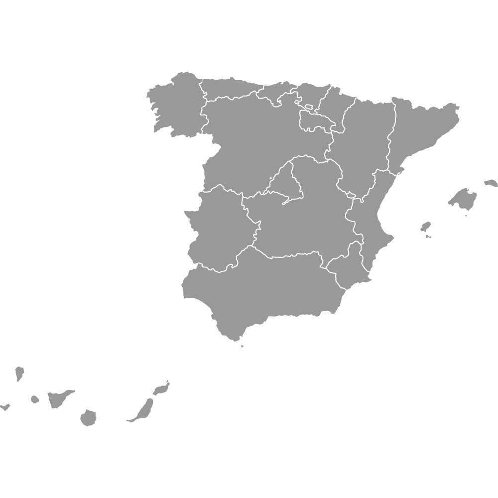
Spain Map with Provinces
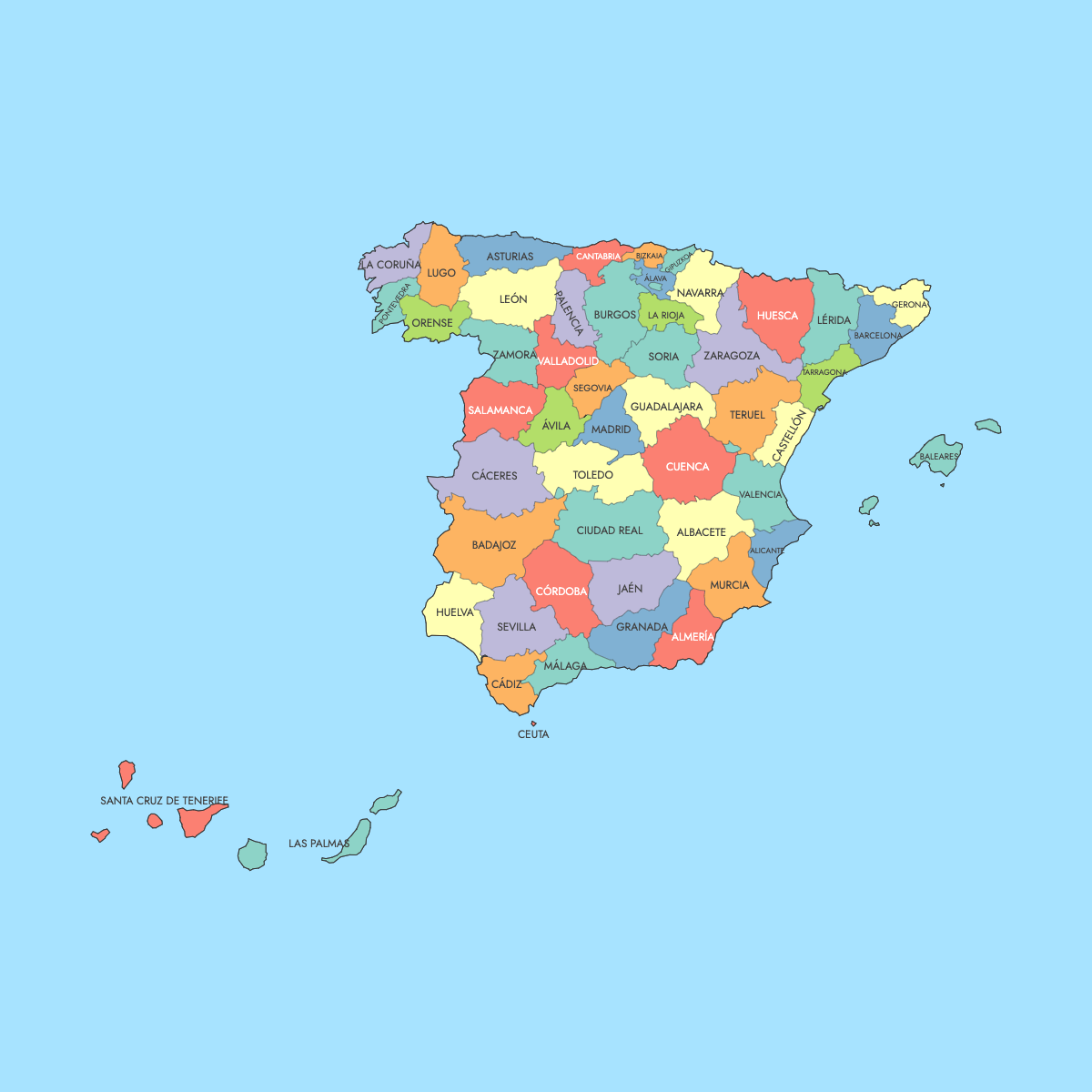
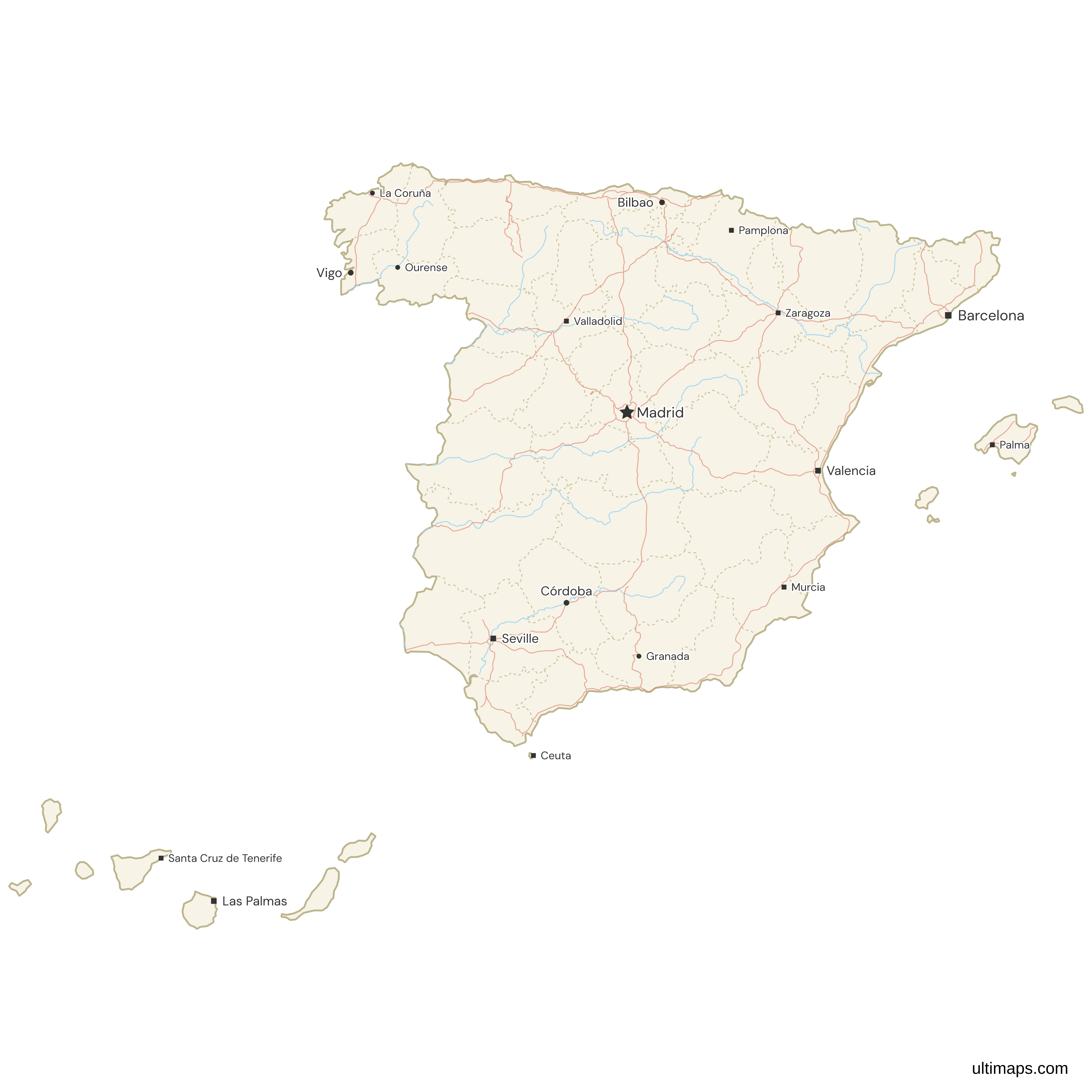
Spain has 50 provinces, and the map of Spain below adds Ceuta and Melilla, the two autonomous cities outside the provincial system, for 52 shapes. Provinces are the second administrative tier, grouped into 17 autonomous communities that appear on the map of Spain's autonomous communities. Their boundaries date from the division organized by Javier de Burgos in November 1833. The provinces of Las Palmas and Santa Cruz de Tenerife, which make up the Canary Islands, are placed in an inset.
Madrid, which contains the national capital of the same name, is the most populous province at about 7.0 million residents (INE, 1 January 2024). Soria has the fewest, about 90,000 on the same date. By area, Badajoz is the largest province at 21,766 km² (8,404 sq mi) and Gipuzkoa the smallest at 1,980 km² (764 sq mi), according to INE. You can also open the editor and color each province from your own figures.
Interactive Spain Map with Provinces
List of Provinces (52)
| # | Province |
|---|---|
| 1 | A Coruña |
| 2 | Álava |
| 3 | Albacete |
| 4 | Alicante |
| 5 | Almería |
| 6 | Asturias |
| 7 | Ávila |
| 8 | Badajoz |
| 9 | Barcelona |
| 10 | Bizkaia |
| 11 | Burgos |
| 12 | Cáceres |
| 13 | Cádiz |
| 14 | Cantabria |
| 15 | Castellón |
| 16 | Ceuta |
| 17 | Ciudad Real |
| 18 | Córdoba |
| 19 | Cuenca |
| 20 | Gipuzkoa |
| 21 | Girona |
| 22 | Granada |
| 23 | Guadalajara |
| 24 | Huelva |
| 25 | Huesca |
| 26 | Illes Balears |
| 27 | Jaén |
| 28 | La Rioja |
| 29 | Las Palmas |
| 30 | León |
| 31 | Lleida |
| 32 | Lugo |
| 33 | Madrid |
| 34 | Málaga |
| 35 | Melilla |
| 36 | Murcia |
| 37 | Navarra |
| 38 | Ourense |
| 39 | Palencia |
| 40 | Pontevedra |
| 41 | Salamanca |
| 42 | Santa Cruz de Tenerife |
| 43 | Segovia |
| 44 | Sevilla |
| 45 | Soria |
| 46 | Tarragona |
| 47 | Teruel |
| 48 | Toledo |
| 49 | Valencia |
| 50 | Valladolid |
| 51 | Zamora |
| 52 | Zaragoza |
Spain Provinces: Key Facts
- Shapes on this map: 52, made up of the 50 provinces and the autonomous cities of Ceuta and Melilla, which sit outside the provincial system
- Most populous province: Madrid, about 7.0 million (INE, 1 January 2024)
- Least populous province: Soria, about 90,000 (INE, 1 January 2024)
- Largest province by area: Badajoz, 21,766 km² (8,404 sq mi), INE
- Smallest province by area: Gipuzkoa, 1,980 km² (764 sq mi), INE
- Largest cities and their provinces: Madrid, Barcelona, Valencia, Seville, Zaragoza, Málaga, Murcia, Palma (Illes Balears) and Las Palmas de Gran Canaria (Las Palmas). Bilbao, in Bizkaia, is the largest city of the Basque Country
- National capital: Madrid, in the province of Madrid
- Provinces per community: Castile and León has nine, Andalusia eight, Castile-La Mancha five, and Catalonia and Galicia four each. At the other end, seven communities have one province each
- Borders: Portugal to the west, France and Andorra across the Pyrenees, and Gibraltar (United Kingdom) in the far south. Ceuta and Melilla border Morocco. Coastlines face the Atlantic Ocean, the Bay of Biscay and the Mediterranean Sea
- Time zones: CET/CEST on the mainland, in the Balearic Islands and in Ceuta and Melilla. WET/WEST in the Canary Islands
- Boundaries established: the provincial division of 1833, with 49 provinces at the start. The Canaries were split into Las Palmas and Santa Cruz de Tenerife in 1927, and Ceuta and Melilla left Cádiz and Málaga provinces to become autonomous cities in 1995
Interesting Facts
- Madrid province has close to 80 times the population of Soria (INE, 1 January 2024).
- Several provinces carry official names in a regional language, and this map labels them that way: A Coruña, Bizkaia, Gipuzkoa, Girona, Lleida, Ourense and Illes Balears.
- Three provinces are entirely insular. Illes Balears covers Mallorca, Menorca, Ibiza and Formentera, while Las Palmas and Santa Cruz de Tenerife split the Canary archipelago.
- Badajoz alone is larger than Slovenia, and Extremadura reaches 41,634 km² with only two provinces, Badajoz and Cáceres.
- Each province is a constituency for the Congress of Deputies and elects at least two deputies. Ceuta and Melilla elect one each.
- Provincial landmarks include the Sagrada Família in Barcelona, the Guggenheim Museum in Bizkaia, the Aqueduct of Segovia and Teide National Park in Santa Cruz de Tenerife.
Free Downloads
Free for personal and commercial use with a credit to Ultimaps. See the license terms for details.
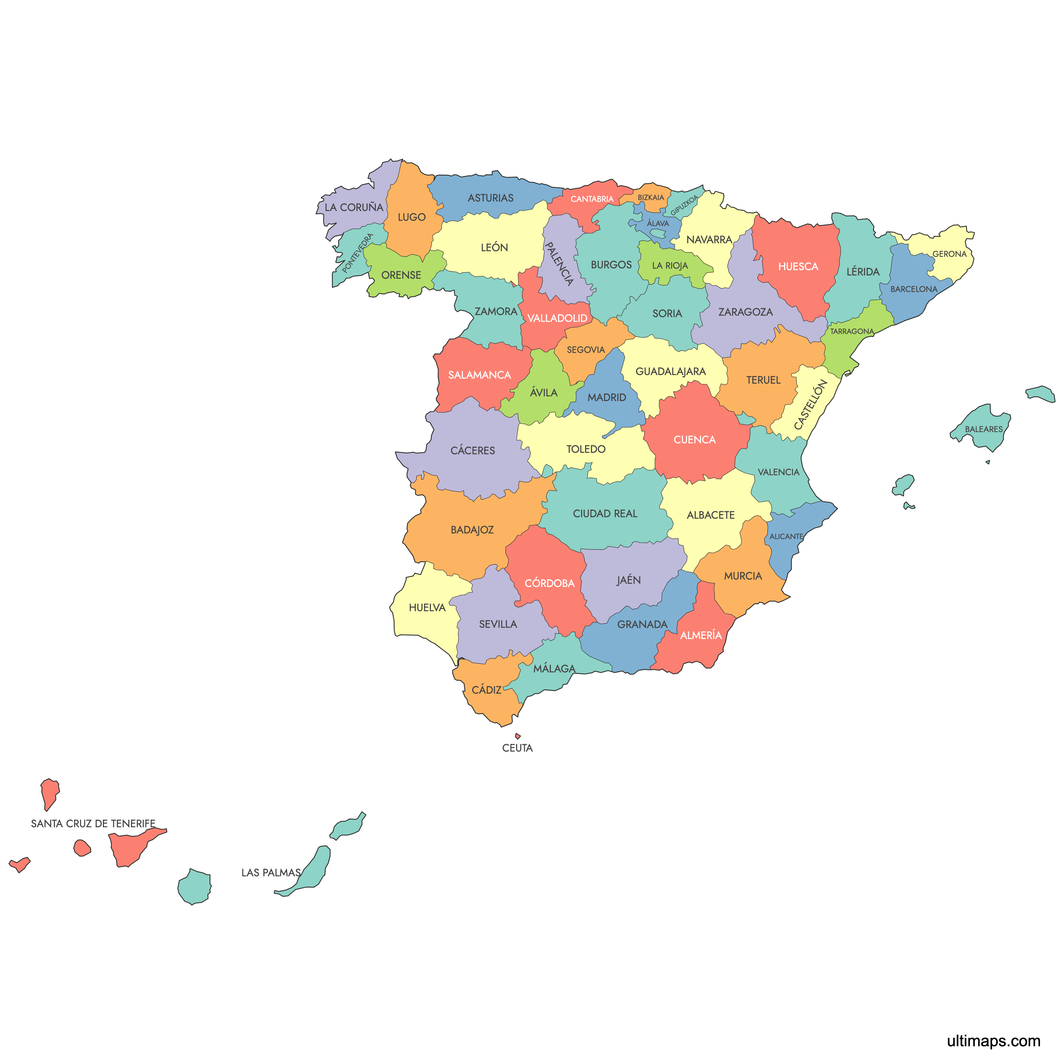
Need it without colors? The blank version of this map comes as a print-ready PDF (A4 and US Letter), a PNG and an editable SVG.
Custom Map Features
This map supports labels.
This map is divided into 52 provinces.
Updates
Sep 28, 2023:
- Added map of Spain Provinces
Frequently Asked Questions
Spain has 50 provinces, which form the second administrative level beneath the 17 autonomous communities. The framework comes from the division of 1833 organized by Javier de Burgos, which set out 49 provinces. The Canary Islands were separated into Las Palmas and Santa Cruz de Tenerife in 1927, bringing the total to 50, and that count has not changed since. The map on this page has 52 shapes because it also includes Ceuta and Melilla, the two autonomous cities on the North African coast that belong to no province. Castile and León has the most provinces of any community, with nine.
Badajoz is the largest Spanish province by area at 21,766 km² (8,404 sq mi), covering the southern half of Extremadura along the Portuguese border, according to INE. Cáceres, the other Extremaduran province, ranks second at 19,868 km² (7,671 sq mi), so the two of them together take up roughly 8 percent of Spain. Gipuzkoa is the smallest province at 1,980 km² (764 sq mi), about eleven times smaller than Badajoz. Badajoz is also larger than the whole of Slovenia, yet it had fewer than 700,000 residents on 1 January 2024 (INE), less than a tenth of the population of Madrid province.
Madrid is the most populated province in Spain, with about 7.0 million residents (INE, 1 January 2024). Its boundaries match those of the Community of Madrid exactly, and it contains Madrid, the national capital. Barcelona province ranks second and Valencia third, followed by Alicante, Seville and Málaga. Soria is the least populated province, with about 90,000 residents on the same date. Population is concentrated in the Madrid area, along the Mediterranean coast and in the two archipelagos, while many interior provinces such as Soria, Teruel and Zamora have far fewer residents than their area would suggest.
Until 1995, Ceuta was administered as part of Cádiz province and Melilla as part of Málaga province. Their statutes of autonomy that year made each of them an autonomous city, so neither belongs to a province today. Each consists of a single municipality with no provincial layer above it. For statistical purposes INE gives them the province-level codes 51 and 52, which continue the 01 to 50 sequence used for the provinces. In elections to the Congress of Deputies, each city is a constituency electing one deputy. This is why the map on this page has 52 shapes rather than 50.
Madrid is all three. The city of Madrid is the national capital and the seat of the Spanish government. The province of Madrid surrounds it and includes municipalities such as Móstoles, Alcalá de Henares and Getafe. The Community of Madrid is one of the 17 autonomous communities and shares the same borders as the province, making it one of seven single-province communities in Spain, along with Asturias, the Balearic Islands, Cantabria, Murcia, Navarre and La Rioja. With about 7.0 million residents (INE, 1 January 2024), it is the most populous province in the country.
Andalusia has eight provinces: Almería, Cádiz, Córdoba, Granada, Huelva, Jaén, Málaga and Seville. That is the second highest total of any autonomous community, behind Castile and León with nine. Seville hosts the regional government and is the largest Andalusian province in both area and population, with Málaga close behind on population. The community stretches from the Atlantic coast of Huelva and Cádiz to the Mediterranean shores of Málaga and Almería. The Sierra Nevada range lies in Granada and Almería, and Doñana National Park spans land in Huelva, Seville and Cádiz.
Several Spanish provinces have official names in a co-official regional language as well as a Castilian form, and in some cases only the regional form is legally official. Examples include A Coruña (La Coruña), Bizkaia (Vizcaya), Gipuzkoa (Guipúzcoa), Araba/Álava, Girona (Gerona), Lleida (Lérida), Ourense (Orense) and Illes Balears (Islas Baleares). National laws adopted the Catalan and Galician forms in the 1990s and the Basque forms Araba/Álava, Bizkaia and Gipuzkoa in 2011. This map uses the regional forms for most of them, so look for Bizkaia rather than Vizcaya, while Álava keeps its Castilian label. You can rename any label in the editor.
Autonomous communities are the first administrative level in Spain and hold real political power, with their own parliaments, presidents and budgets, and responsibility for areas such as health and education. Provinces are the second level, grouped inside those communities. Most are run by a provincial council (diputación) that supports smaller municipalities. The Basque provinces have foral deputations, the islands have island councils (cabildos and consells), and the seven single-province communities absorbed their councils. The communities date from the 1978 Constitution and the provincial boundaries from 1833. Each province is also a constituency for the Congress of Deputies.
The editor on this page works directly in your browser. Pick one province and give it a color, or paste a list of values for all 52 units to produce a choropleth with its own legend. Pins can mark cities or sites, and you can edit or hide province labels and change border thickness, fonts and background. You do not need an account to use the editor. On the free plan, exports are standard PNG files with a small Ultimaps credit, and the Pro plan adds high-resolution PNG, SVG and PDF.