Germany Map with States
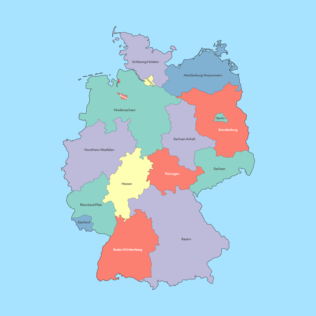
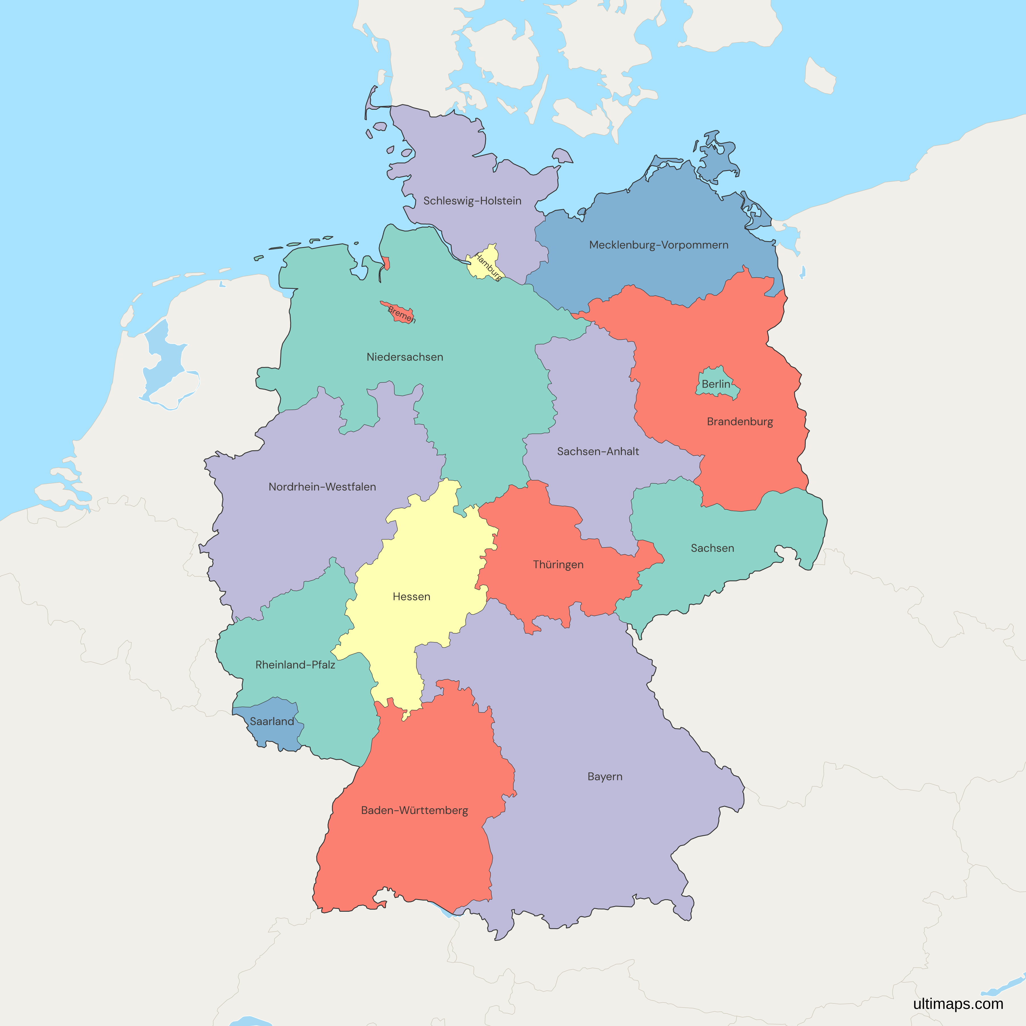
This map of Germany is divided into the 16 Bundesländer of the Federal Republic, each with its own constitution, parliament and government. Thirteen are area states and three are city-states. North Rhine-Westphalia (Nordrhein-Westfalen) leads on population with 18,034,454 residents on 1 January 2025 (Eurostat), while Bavaria (Bayern) is the largest by area at 70,542 km² (27,236 sq mi) out of the country's 357,684 km² (Destatis, 2023). Berlin, the national capital, is a state in its own right and is drawn as an enclave inside Brandenburg. Bremen appears in two separate pieces, the city of Bremen and the port of Bremerhaven to the north.
Five of the 16 states (Brandenburg, Mecklenburg-Western Pomerania, Saxony, Saxony-Anhalt and Thuringia) joined the Federal Republic on 3 October 1990, and East and West Berlin were merged on the same day. In the editor, you can color the states by population, sales figures or any other numbers you work with.
Interactive Germany Map with States
List of States (16)
| # | State | Population (2025) | GDP per capita (EUR, 2024) | Unemployment rate (%, 2025) | Life expectancy at birth (years, 2024) |
|---|---|---|---|---|---|
| 1 | Baden-Württemberg | 11,245,898 | 58,300 | 3.30 | 82.30 |
| 2 | Bayern | 13,248,928 | 60,300 | 3 | 81.90 |
| 3 | Berlin | 3,685,265 | 56,600 | 6.50 | 81.20 |
| 4 | Brandenburg | 2,556,747 | 38,300 | 3.80 | 81 |
| 5 | Bremen | 704,881 | 58,900 | 5.10 | 79.70 |
| 6 | Hamburg | 1,862,565 | 87,500 | 5.30 | 81.20 |
| 7 | Hessen | 6,280,793 | 59,100 | 3.40 | 81.50 |
| 8 | Mecklenburg-Vorpommern | 1,573,597 | 39,100 | 3.50 | 79.70 |
| 9 | Niedersachsen | 8,004,489 | 47,900 | 3.50 | 80.60 |
| 10 | Nordrhein-Westfalen | 18,034,454 | 48,600 | 4.20 | 80.70 |
| 11 | Rheinland-Pfalz | 4,129,569 | 44,800 | 3.40 | 81 |
| 12 | Saarland | 1,012,141 | 42,200 | 4.10 | 79.90 |
| 13 | Sachsen | 4,042,422 | 40,100 | 4.80 | 81.40 |
| 14 | Sachsen-Anhalt | 2,135,597 | 37,200 | 4.90 | 79.50 |
| 15 | Schleswig-Holstein | 2,959,517 | 43,100 | 3.70 | 80.80 |
| 16 | Thüringen | 2,100,277 | 37,100 | 3.70 | 80.70 |
Data sources, all reuse with acknowledgement:
- Population: Eurostat, Population on 1 January (demo_r_pjanaggr3).
- GDP per capita: Eurostat, Gross domestic product at current market prices by NUTS 3 regions, euro per inhabitant (nama_10r_3gdp).
- Unemployment rate: Eurostat, Unemployment rates by NUTS 2 regions, ages 15-74 (lfst_r_lfu3rt).
- Life expectancy at birth: Eurostat, Life expectancy at birth by NUTS 2 regions (demo_r_mlifexp).
Germany's 16 States: Key Facts
- Total number of states: 16 Bundesländer, 13 area states plus the city-states of Berlin, Hamburg and Bremen
- National totals: 83,577,140 residents across the 16 states (Eurostat, 1 January 2025) on 357,684 km² (138,103 sq mi, Destatis 2023)
- Most populous state: North Rhine-Westphalia, 18,034,454 (Eurostat, 1 January 2025), roughly 22 percent of the country
- Least populous state: Bremen, 704,881 (Eurostat, 1 January 2025)
- Largest state by area: Bavaria, 70,542 km² (27,236 sq mi), ahead of Lower Saxony at 47,710 km² (18,421 sq mi), Destatis 2023
- Smallest state by area: Bremen, 420 km² (162 sq mi), followed by Hamburg at 755 km² (292 sq mi) and Berlin at 891 km² (344 sq mi), Destatis 2023
- Smallest area state: Saarland, 2,572 km² (993 sq mi, Destatis 2023) with 1,012,141 residents (Eurostat, 1 January 2025)
- Major urban centers: Cologne, Düsseldorf, Dortmund and Essen in North Rhine-Westphalia, Munich in Bavaria, Stuttgart in Baden-Württemberg, Frankfurt in Hesse, Dresden and Leipzig in Saxony, plus the city-states of Berlin, Hamburg and Bremen
- Capital: Berlin, 3,685,265 residents (Eurostat, 1 January 2025). Other state capitals include Munich, Stuttgart, Düsseldorf, Hanover, Mainz, Kiel, Schwerin, Magdeburg, Potsdam, Erfurt, Saarbrücken, Wiesbaden and Dresden
- Borders: nine countries, Denmark, Poland, the Czech Republic, Austria, Switzerland, France, Luxembourg, Belgium and the Netherlands
- Coastlines: the North Sea and the Baltic Sea, touching Schleswig-Holstein, Mecklenburg-Western Pomerania, Lower Saxony, Hamburg and Bremen
- Time zone: Central European Time, UTC+1, with Central European Summer Time, UTC+2, from late March to late October
- Boundary history: most Länder were formed in 1945 to 1947 under Allied occupation. Baden-Württemberg followed in 1952 and Saarland joined in 1957, which gave West Germany ten states until 1990, with West Berlin under special status. Only minor changes have happened since reunification, such as the 1993 transfer of Amt Neuhaus from Mecklenburg-Western Pomerania to Lower Saxony
Interesting Facts
- Berlin and Bremen are each bordered on land by a single state: Berlin by Brandenburg, and both parts of Bremen by Lower Saxony. Hamburg, by contrast, borders both Lower Saxony and Schleswig-Holstein.
- GDP per capita ranges from 87,500 EUR in Hamburg to 37,100 EUR in Thuringia (Eurostat, 2024). Berlin rose from 37,500 EUR in 2015 to 56,600 EUR in 2024, an increase of about 51 percent.
- Unemployment was highest in Berlin at 6.5 percent and lowest in Bavaria at 3.0 percent in 2025 (Eurostat). Berlin's rate fell from 9.5 percent in 2015.
- Life expectancy at birth reaches 82.3 years in Baden-Württemberg and 79.5 years in Saxony-Anhalt (Eurostat, 2024).
- Voters rejected a merger of Berlin and Brandenburg in a 1996 referendum, so the capital stays a separate state on the map.
- Saxony-Anhalt fell from 2,235,548 in 2015 to 2,135,597 in 2025, while Baden-Württemberg gained more than half a million over the same period (Eurostat).
Free Downloads
Free for personal and commercial use with a credit to Ultimaps. See the license terms for details.
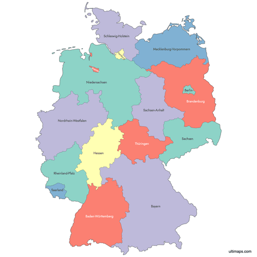 Colored Germany Map with Statespng586 KB
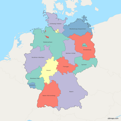 Political Map of Germany with Statespng743 KB
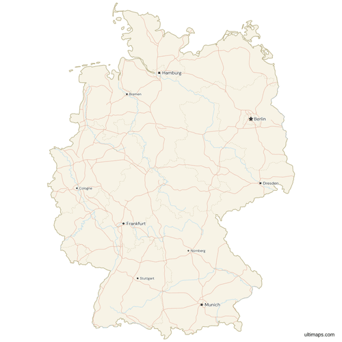 Map of Germany with Cities and Roadspng988 KB
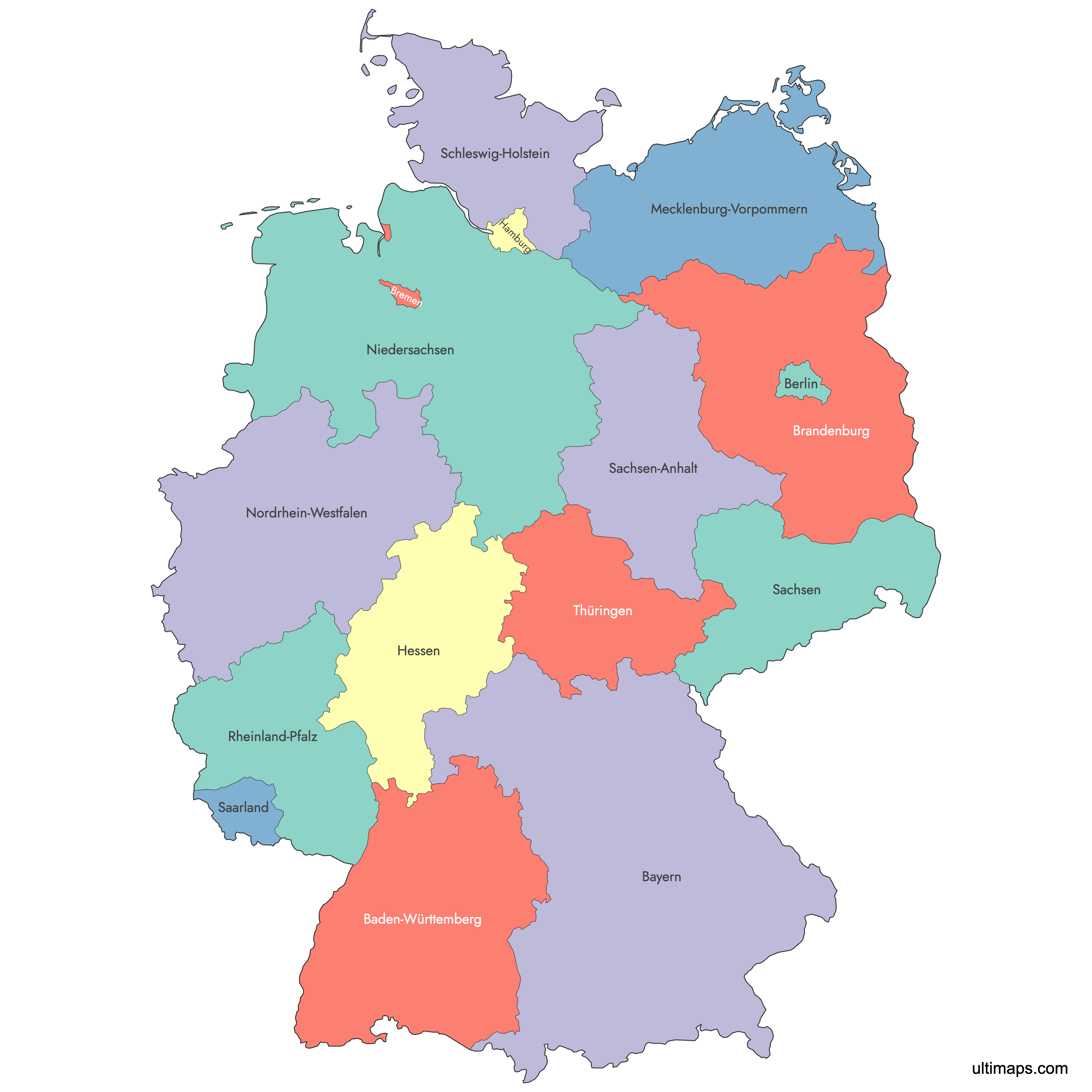
Need it without colors? The blank version of this map comes as a print-ready PDF (A4 and US Letter), a PNG and an editable SVG.
Custom Map Features
This map supports labels.
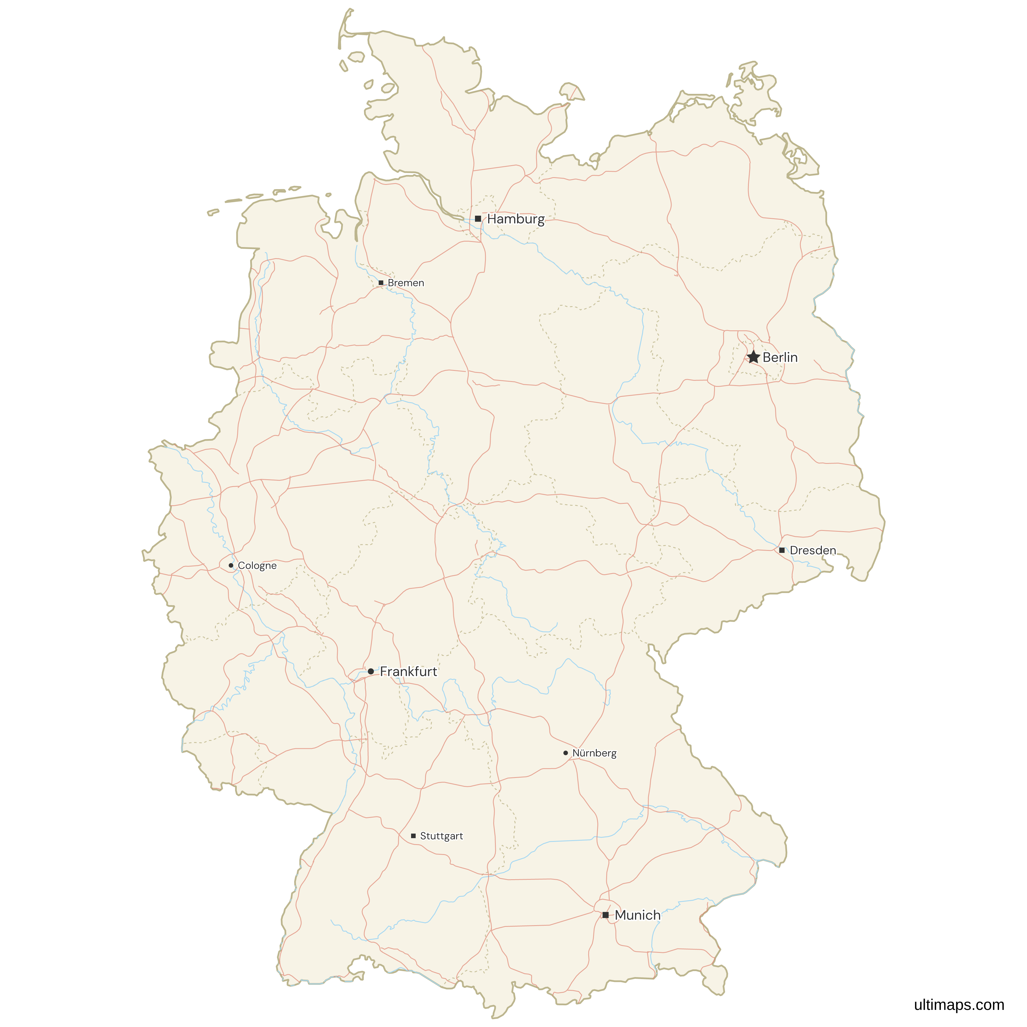
This map supports surrounding areas, roads, rivers and cities. New
This map is divided into 16 states.
Updates
Sep 12, 2024:
- Added labels
Sep 28, 2023:
- Added map of Germany States
Frequently Asked Questions
Germany has 16 federal states, known in German as Bundesländer, and all 16 are drawn on this map, matching the official count. Thirteen are area states and three are city-states: Berlin, Hamburg and Bremen. Each state has its own constitution, parliament and government, and each sends members to the Bundesrat, the federal chamber that votes on national legislation. Together the 16 hold 83,577,140 residents (Eurostat, 1 January 2025) and cover 357,684 km² (138,103 sq mi, Destatis 2023). The current set has been in place since 3 October 1990, when five eastern states joined the Federal Republic.
Bavaria, or Bayern, is the largest German state by area at 70,542 km² (27,236 sq mi), close to a fifth of the national territory of 357,684 km² (Destatis, 2023). Lower Saxony is second at 47,710 km² (18,421 sq mi), Baden-Württemberg third at 35,748 km² (13,802 sq mi) and North Rhine-Westphalia fourth at 34,112 km² (13,171 sq mi). Its 13,248,928 residents on 1 January 2025 (Eurostat) are the second largest state population after North Rhine-Westphalia, and its capital is Munich. Its southern boundary follows the Alps along the border with Austria, and its eastern edge borders the Czech Republic.
North Rhine-Westphalia (Nordrhein-Westfalen) had 18,034,454 residents on 1 January 2025 (Eurostat), up from 17,638,098 in 2015, more than any other German state and about 22 percent of the national total of 83,577,140. Its capital is Düsseldorf, and Cologne, Bonn and the Ruhr cities of Dortmund, Essen and Duisburg lie within its 34,112 km² (13,171 sq mi). The Ruhr area is one of the most densely settled parts of Europe. GDP per capita stood at 48,600 EUR in 2024 (Eurostat), behind Hamburg, Bavaria, Hesse, Bremen, Baden-Württemberg and Berlin.
Berlin, Hamburg and Bremen are Germany's three city-states, meaning each city functions as a federal state on its own. Berlin covers 891 km² (344 sq mi) with 3,685,265 residents, Hamburg 755 km² (292 sq mi) with 1,862,565, and Bremen 420 km² (162 sq mi) with 704,881 (Eurostat, 1 January 2025, areas from Destatis 2023). Berlin is fully surrounded by Brandenburg and appears as an enclave on the map. Bremen is made up of two separate territories, the city of Bremen and Bremerhaven, while Hamburg touches both Lower Saxony and Schleswig-Holstein.
Most of Germany's states were created between 1945 and 1947 under the Allied occupation authorities. Baden-Württemberg was formed from three of them in 1952, and Saarland joined in 1957, so from then until 1990 West Germany had ten states, with West Berlin held under a special status outside the normal federal structure. On 3 October 1990 Brandenburg, Mecklenburg-Western Pomerania, Saxony, Saxony-Anhalt and Thuringia joined the Federal Republic and East and West Berlin were merged into a single state, bringing the total to 16. The five eastern states have lower incomes: Thuringia recorded 37,100 EUR GDP per capita and Saxony-Anhalt 37,200 EUR in 2024, against a high of 87,500 EUR in Hamburg (Eurostat).
Bremen is the smallest German state on both measures, covering 420 km² (162 sq mi) per Destatis 2023 and holding 704,881 residents on 1 January 2025 (Eurostat). Among the 13 area states, Saarland is the smallest at 2,572 km² (993 sq mi) with 1,012,141 residents, the only area state under one and a half million. Bremen still ranked fourth on GDP per capita in 2024 at 58,900 EUR (Eurostat), ahead of much larger states. Commuters from Lower Saxony add to its output without counting as residents, and the city has port, logistics, automotive and aerospace industries.
Germany's state borders have seen only minor adjustments since reunification in 1990. The clearest example is Amt Neuhaus, a group of villages on the east bank of the Elbe transferred from Mecklenburg-Western Pomerania to Lower Saxony in 1993. A larger reform was attempted in 1996, when Berlin and Brandenburg held a referendum on merging into one state. Voters in Brandenburg rejected it, so the two remain separate and Berlin is still drawn as an enclave inside Brandenburg. No other state has been created, merged or dissolved since 3 October 1990.
Hamburg records the highest GDP per capita of Germany's 16 states at 87,500 EUR in 2024, up from 64,400 EUR in 2015 (Eurostat). Bavaria follows at 60,300 EUR, Hesse at 59,100 EUR and Bremen at 58,900 EUR. The lowest figures are in Thuringia at 37,100 EUR and Saxony-Anhalt at 37,200 EUR. Note that city-states score high partly because commuters from neighboring states add to output without counting as residents. On life expectancy the ranking looks different: Baden-Württemberg leads at 82.3 years and Saxony-Anhalt is lowest at 79.5 years (Eurostat, 2024).
You can build a custom map of Germany directly in the browser on this page. Click any of the 16 states to set its color by hand, or paste a table of your own values to color all states by number as a choropleth with a legend. Add pins for cities, offices or project sites, edit state labels, and change border width, fonts and background. The free plan needs no sign-up and exports a standard PNG with a small Ultimaps attribution. High-resolution PNG, SVG and PDF export are Pro features.