Europe Map with Countries
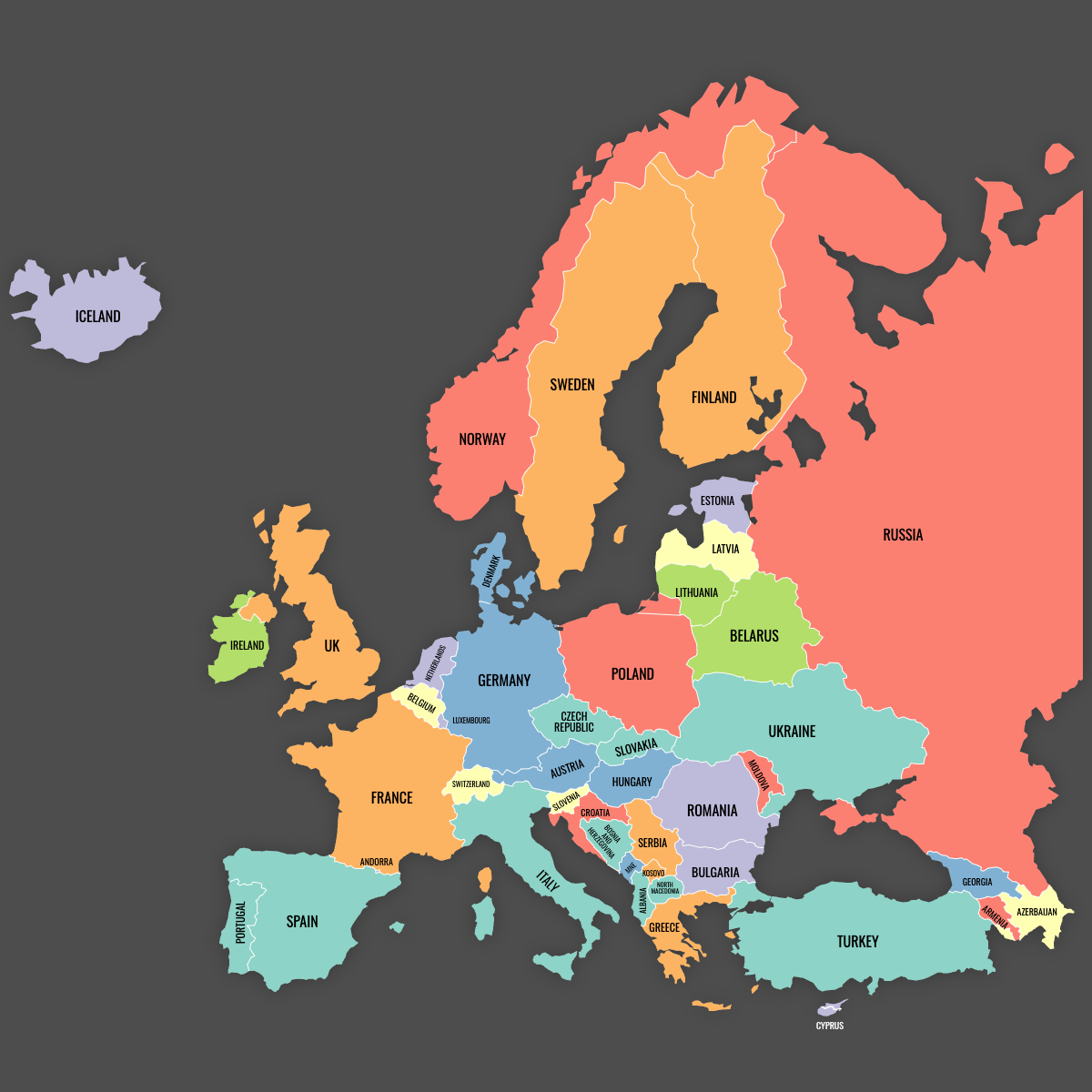
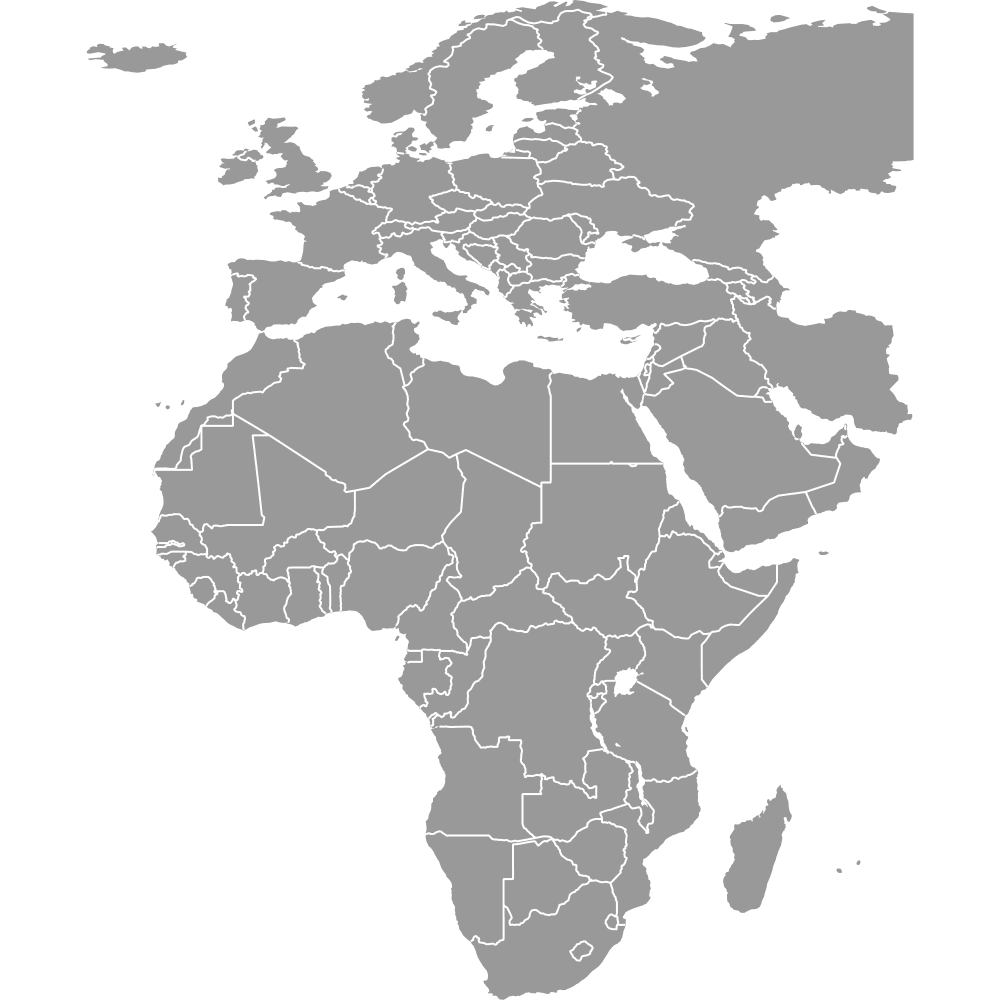
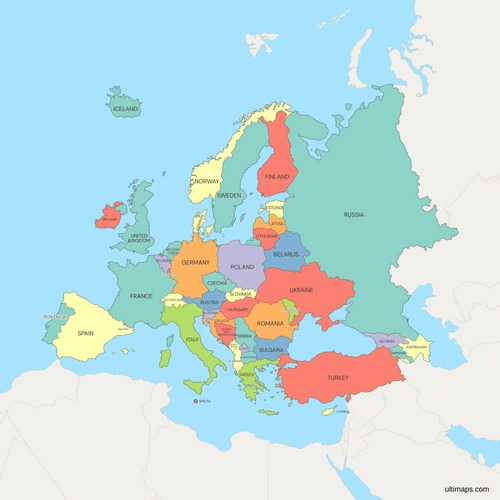
Europe is usually counted as 44 countries, and this map of Europe has 46, from Iceland in the North Atlantic to Azerbaijan on the Caspian. The usual 44 is the UN's European grouping, which already includes Russia and the four microstates. This map leaves out Liechtenstein, Monaco, San Marino and Vatican City, which are too small to show usefully at continental scale, and adds Turkey, Cyprus, Armenia, Azerbaijan, Georgia and Kosovo.
Russia is the most populous country shown, at 143,513,328 people (World Bank, 2025). That figure covers the whole federation, including its Asian part, while the shape on the map stops at the Urals administrative boundary and covers about 3.84 million km² (1.48 million sq mi) of European territory. Germany, at 83,491,249 (World Bank, 2025), is the most populous country lying entirely in Europe, and its capital is Berlin. To color the 46 countries from your own data, paste your numbers into the editor.
Interactive Europe Map with Countries
List of Countries (46)
| # | Country | Population (2025) | GDP per capita (US$, 2024) | Unemployment rate (%, 2024) | Life expectancy at birth (years, 2024) |
|---|---|---|---|---|---|
| 1 | Albania | 2,349,580 | 11,374 | 10.70 | 79.80 |
| 2 | Andorra | 82,904 | 49,357 | — | 84.20 |
| 3 | Armenia | 3,086,700 | 8,556 | 12.40 | 78.30 |
| 4 | Austria | 9,208,163 | 58,269 | 5.20 | 82 |
| 5 | Azerbaijan | 10,246,996 | 7,295 | 5.60 | 74.60 |
| 6 | Belarus | 9,085,991 | 8,606 | 3.50 | 74.40 |
| 7 | Belgium | 11,941,781 | 56,582 | 5.70 | 82.30 |
| 8 | Bosnia and Herzegovina | 3,140,095 | 9,398 | 10.70 | 78 |
| 9 | Bulgaria | 6,433,302 | 17,597 | 4.20 | 75.80 |
| 10 | Croatia | 3,876,200 | 24,050 | 5 | 78.90 |
| 11 | Cyprus | 1,370,754 | 38,674 | 4.90 | 81.80 |
| 12 | Czech Republic | 10,886,878 | 31,828 | 2.60 | 80 |
| 13 | Denmark | 6,009,169 | 71,026 | 5.40 | 82.30 |
| 14 | Estonia | 1,366,475 | 31,428 | 7.60 | 79.30 |
| 15 | Finland | 5,646,436 | 53,156 | 8.40 | 82.30 |
| 16 | France | 68,720,337 | 46,103 | 7.40 | 83 |
| 17 | Georgia | 3,935,766 | 8,968 | 11.60 | 74.70 |
| 18 | Germany | 83,491,249 | 56,104 | 3.40 | 80.80 |
| 19 | Greece | 10,413,962 | 24,626 | 10 | 81.80 |
| 20 | Hungary | 9,514,251 | 23,305 | 4.50 | 76.70 |
| 21 | Iceland | 392,404 | 85,863 | 3.60 | 82.80 |
| 22 | Ireland | 5,484,367 | 112,895 | 4.30 | 83 |
| 23 | Italy | 58,915,656 | 40,430 | 6.50 | 84 |
| 24 | Kosovo | 1,576,876 | 7,027 | — | 78.20 |
| 25 | Latvia | 1,847,785 | 23,579 | 6.90 | 76.40 |
| 26 | Lithuania | 2,888,774 | 29,604 | 6.90 | 77.20 |
| 27 | Luxembourg | 686,970 | 137,782 | 6.40 | 83.20 |
| 28 | Malta | 579,704 | 44,024 | 3.10 | 83 |
| 29 | Moldova | 2,360,527 | 7,579 | 1.40 | 71.30 |
| 30 | Montenegro | 623,129 | 13,270 | 13.20 | 77.90 |
| 31 | Netherlands | 18,087,633 | 67,465 | 3.70 | 82 |
| 32 | North Macedonia | 1,820,909 | 9,292 | 12.30 | 76.60 |
| 33 | Norway | 5,610,870 | 89,889 | 4 | 83.20 |
| 34 | Poland | 36,435,861 | 25,104 | 2.80 | 78.40 |
| 35 | Portugal | 10,804,871 | 29,328 | 6.50 | 82.40 |
| 36 | Romania | 19,020,271 | 20,080 | 5.40 | 76.50 |
| 37 | Russian Federation | 143,513,328 | 14,962 | 2.40 | 73.40 |
| 38 | Serbia | 6,549,143 | 13,678 | 7.20 | 76 |
| 39 | Slovakia | 5,413,813 | 25,993 | 5.30 | 78.40 |
| 40 | Slovenia | 2,130,986 | 34,301 | 3.70 | 82.30 |
| 41 | Spain | 49,355,143 | 35,327 | 11.40 | 83.90 |
| 42 | Sweden | 10,596,620 | 57,223 | 8.40 | 84.10 |
| 43 | Switzerland | 9,092,436 | 107,702 | 4.30 | 84.40 |
| 44 | Turkey | 85,878,556 | 15,893 | 8.80 | 77.40 |
| 45 | Ukraine | 38,980,376 | 5,392 | — | 74.70 |
| 46 | United Kingdom | 69,487,000 | 53,341 | 4.40 | 81.40 |
Data sources, all CC BY 4.0:
- Population: World Bank, World Development Indicators (SP.POP.TOTL).
- GDP per capita: World Bank, World Development Indicators (NY.GDP.PCAP.CD).
- Unemployment rate: World Bank, World Development Indicators (SL.UEM.TOTL.ZS, ILO modelled estimates).
- Life expectancy at birth: World Bank, World Development Indicators (SP.DYN.LE00.IN).
Europe Map with Countries: Key Facts
- Countries on this map: 46. The UN's European grouping lists 44, including Russia and the four microstates. This map omits Liechtenstein, Monaco, San Marino and Vatican City and adds Turkey, Cyprus, Armenia, Azerbaijan, Georgia and Kosovo.
- Most populous country: Russia, 143,513,328 (World Bank, 2025), a national total that includes Asian Russia. Germany leads among countries lying wholly in Europe with 83,491,249, followed by the United Kingdom at 69,487,000 (World Bank, 2025).
- Least populous country drawn: Andorra, 82,904 (World Bank, 2025). Iceland is next at 392,404 and Malta at 579,704.
- Combined population of the 46: 848,940,997 (World Bank, 2025), counting Russia and Turkey whole.
- Largest country by area: Russia. The part drawn here covers about 3.84 million km² (1.48 million sq mi). Ukraine is the largest country lying entirely in Europe at 603,550 km² (233,032 sq mi), ahead of Spain at 505,990 km² (195,363 sq mi).
- Smallest country drawn: Malta, 316 km² (122 sq mi), then Andorra at 468 km² (181 sq mi).
- Largest cities: Istanbul, about 15.7 million (TÜİK, 2023), which spans the Bosporus, and Moscow, about 13.1 million (Rosstat, 2023), the largest city lying wholly in Europe. London, Saint Petersburg, Berlin, Madrid, Kyiv, Rome and Paris are among the other largest cities.
- Administrative centers: Europe has no single capital. EU institutions sit in Brussels, Luxembourg and Strasbourg, the European Central Bank is in Frankfurt, and the Council of Europe is in Strasbourg.
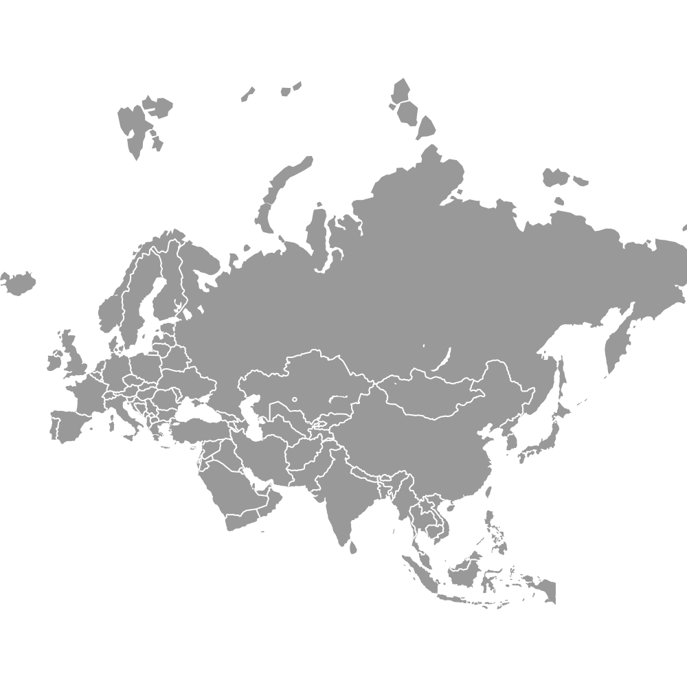
- Borders: Arctic Ocean to the north, Atlantic Ocean to the west, Mediterranean Sea to the south with Africa beyond it, and Asia to the east across the Ural Mountains, the Ural River, the Caspian Sea, the Caucasus and the Turkish Straits. For the wider landmass see the Eurasia map.
- Time zones: from UTC+0 in Iceland, mainland Portugal, Ireland and the United Kingdom to UTC+4 in the South Caucasus and UTC+5 in the easternmost part of European Russia (standard time)
- Boundary history: the current border layout dates from the post-1991 settlement. The Soviet Union dissolved in December 1991, Czechoslovakia split on 1 January 1993, the Yugoslav successor states formed between 1991 and 2006, Montenegro became independent on 3 June 2006, and Kosovo declared independence on 17 February 2008. Ukraine appears with its internationally recognized borders.
Interesting Facts
- Countries are drawn at their true relative sizes, so Scandinavia does not look larger than it is and the Mediterranean countries do not look smaller.
- All 27 EU members are on the map. Twenty-one use the euro, Bulgaria being the newest since 1 January 2026. The Schengen area covers 29 countries, including non-EU Iceland, Norway and Switzerland, while EU members Ireland and Cyprus are outside it.
- Fourteen of the 46 are landlocked: Andorra, Armenia, Austria, Azerbaijan, Belarus, Czech Republic, Hungary, Kosovo, Luxembourg, Moldova, North Macedonia, Serbia, Slovakia and Switzerland. Azerbaijan fronts the Caspian, which is an inland body of water.
- Kazakhstan also has territory west of the Ural River, which is conventionally counted as part of Europe, but Kazakhstan is not drawn on this map.
- Large inland waters are cut out of the land, including Saimaa in Finland, the IJsselmeer in the Netherlands, Lake Peipus on the Estonia-Russia border and Lake Sevan in Armenia.
- The Council of Europe also has 46 member states, down from 47 after Russia was expelled on 16 March 2022, but its list differs from this map's: it includes Liechtenstein, Monaco and San Marino and excludes Belarus, Kosovo and Russia. Vatican City is an observer.
Free Downloads
Free for personal and commercial use with a credit to Ultimaps. See the license terms for details.
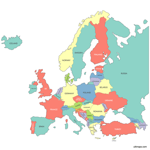 Colored Europe Map with Countriespng1012 KB
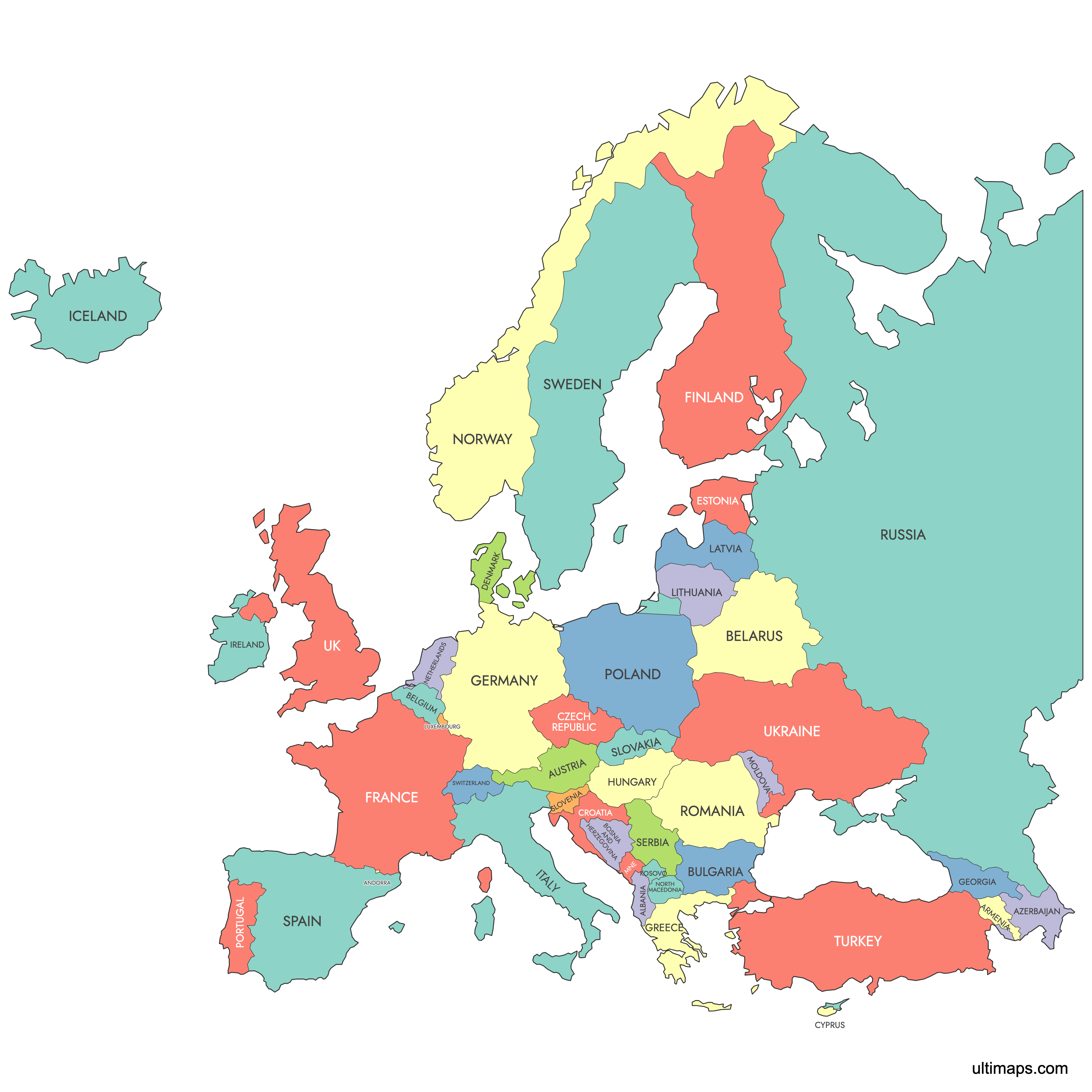
 Political Map of Europe with Countriespng1118 KB
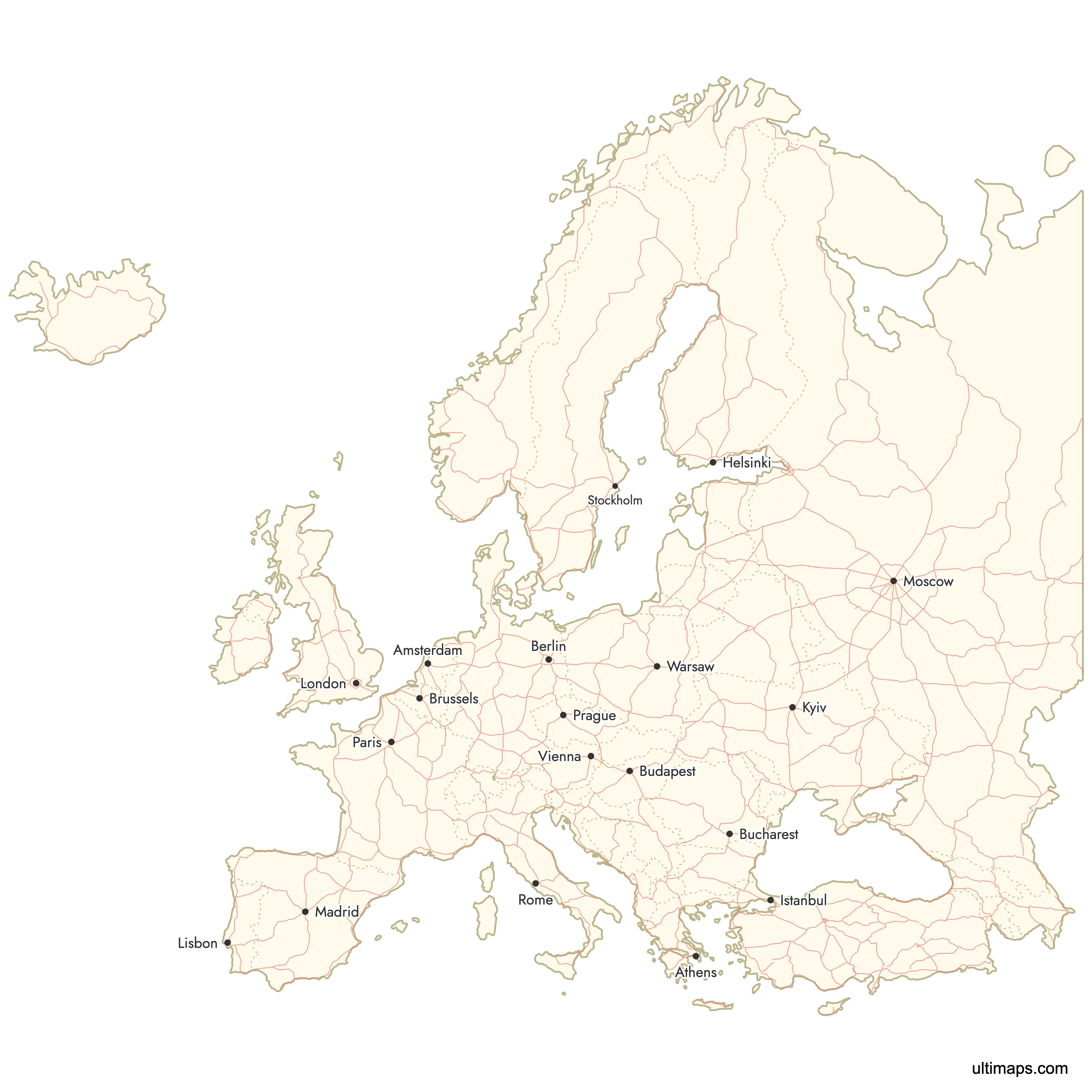
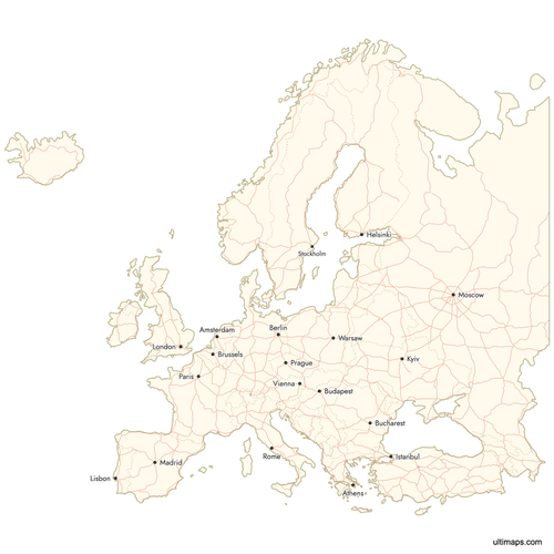 Map of Europe with Cities and Roadspng1672 KB
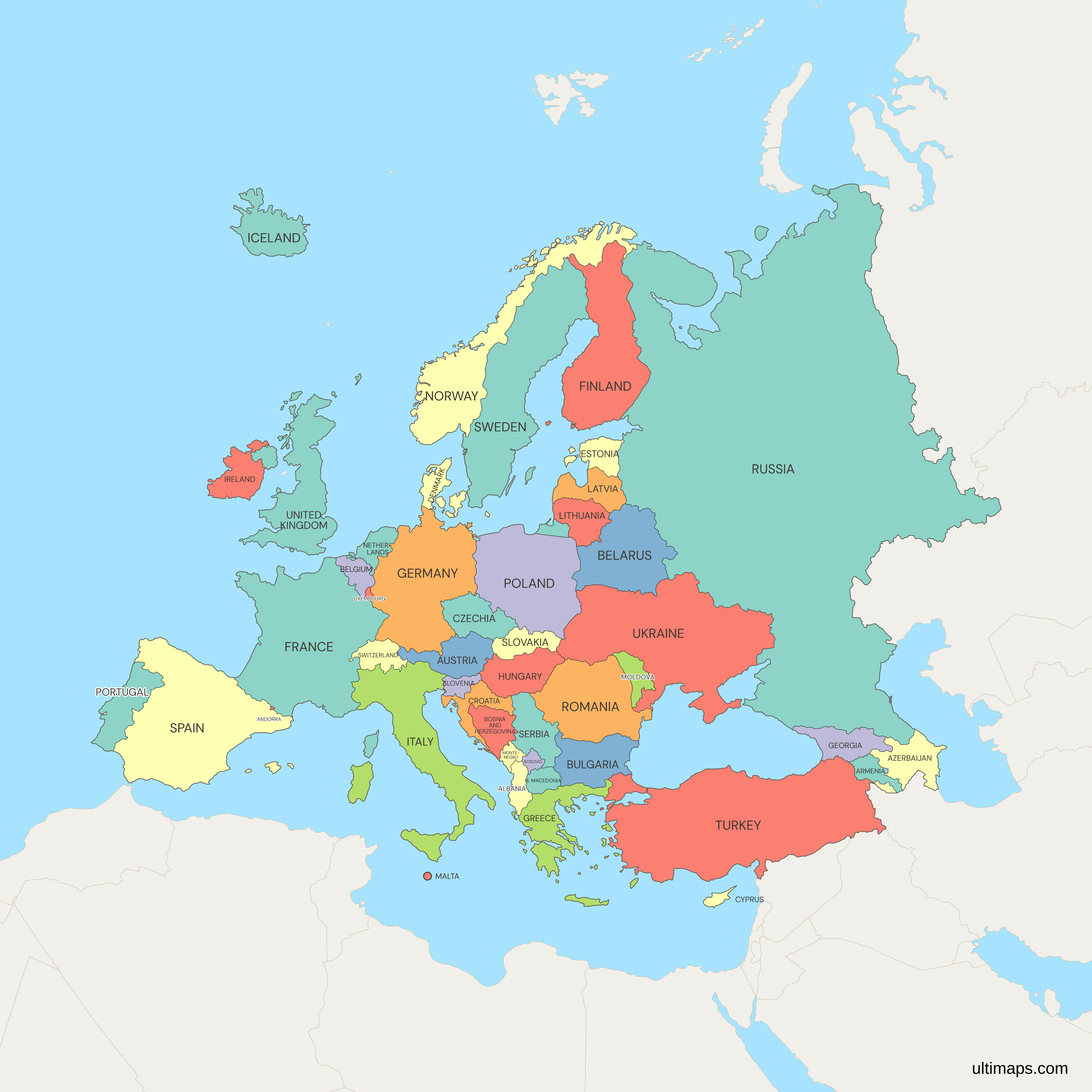
Need it without colors? The blank version of this map comes as a print-ready PDF (A4 and US Letter), a PNG and an editable SVG.
Custom Map Features
This map supports labels.
This map supports surrounding areas, roads and cities. New
This map is divided into 46 countries.
Updates
Nov 21, 2024:
- Added Russia and removed Canary islands
Nov 1, 2024:
- Added labels
Oct 27, 2023:
- Added map of European Countries
Frequently Asked Questions
Europe is most often counted as 44 countries, the UN's European grouping, and published counts range from about 40 to 51 depending on how transcontinental and partly recognized states are treated. This map of Europe has 46. It includes Russia, which appears in the usual 44, and adds Turkey, Cyprus, the South Caucasus states of Armenia, Azerbaijan and Georgia, and Kosovo, which is not a UN member. It leaves out Liechtenstein, Monaco, San Marino and Vatican City, which are too small to show usefully at continental scale. The Council of Europe, a different grouping, also has 46 members.
Russia is the largest country in Europe by area. This map draws it only as far as its Urals administrative boundary, about 3.84 million km² (1.48 million sq mi), with the rest of the federation shown as muted surrounding land. Ukraine is the largest country lying entirely within Europe at 603,550 km² (233,032 sq mi), followed by metropolitan France at 551,695 km² (213,011 sq mi) and Spain at 505,990 km² (195,363 sq mi). Turkey covers 783,562 km² (302,535 sq mi) in total, but only its East Thrace region, about 23,764 km² (9,175 sq mi), lies west of the Turkish Straits.
Russia has the largest population of any European country at 143,513,328 (World Bank, 2025), a national figure covering territory on both sides of the Urals. Turkey is second with 85,878,556 and Germany third with 83,491,249, which makes Germany the most populous country lying completely in Europe. Istanbul, with about 15.7 million residents (TÜİK, 2023), is the largest city, but it spans the Bosporus. Moscow, with about 13.1 million (Rosstat, 2023), is the largest city lying wholly in Europe. The smallest populations among the drawn countries are Andorra's 82,904 and Iceland's 392,404 (World Bank, 2025).
The conventional Europe-Asia boundary runs along the Ural Mountains and Ural River, across the Caspian Sea, through the Caucasus, then along the Black Sea, the Bosporus and the Dardanelles. That line splits Russia, Turkey and Kazakhstan, and leaves Armenia, Azerbaijan and Georgia in a zone that different sources assign to either continent. On this map, Russia is drawn only west of its Urals administrative boundary, Turkey, Armenia, Azerbaijan, Georgia and Cyprus are drawn whole, and Kazakhstan is not drawn. World Bank population and economic figures for Russia and Turkey cover each country in full, including its Asian territory.
Kosovo appears as a separate country because it has functioned as an independent state since its declaration of independence on 17 February 2008 and is recognized by more than 100 UN member states, including the United States and 22 of the 27 EU members. Serbia, Russia and China do not recognize it, and neither do five EU members: Cyprus, Greece, Romania, Slovakia and Spain. Kosovo is not a UN member, but it joined the International Monetary Fund and the World Bank in 2009. Some atlases still draw it as part of Serbia, and you can merge the two by coloring them alike in the editor.
All 27 EU members are drawn on this map of Europe: Austria, Belgium, Bulgaria, Croatia, Cyprus, Czech Republic, Denmark, Estonia, Finland, France, Germany, Greece, Hungary, Ireland, Italy, Latvia, Lithuania, Luxembourg, Malta, Netherlands, Poland, Portugal, Romania, Slovakia, Slovenia, Spain and Sweden. The other 19 countries shown are outside the EU, among them the United Kingdom, which left on 31 January 2020, plus Norway, Switzerland, Iceland, Serbia, Ukraine, Turkey and Russia. Twenty-one EU members use the euro. The six that do not are the Czech Republic, Denmark, Hungary, Poland, Romania and Sweden.
Monaco, San Marino, Liechtenstein and Vatican City are not drawn as separate countries here because they are too small to show usefully at continental scale. Vatican City covers 0.49 km² (0.19 sq mi) and is the world's smallest sovereign state, Monaco 2.1 km² (0.81 sq mi), San Marino 61 km² (24 sq mi) and Liechtenstein 160 km² (62 sq mi). Monaco and Vatican City would be smaller than a single pixel. Andorra, at 468 km² (181 sq mi), is large enough and is included. Liechtenstein and San Marino have their own detailed maps: San Marino and Liechtenstein.
Europe has no capital, because it is a continent of sovereign states rather than a single country. Brussels comes closest in common usage, since it hosts the European Commission, the Council of the European Union and part of the European Parliament's work. Other EU institutions sit elsewhere: the Court of Justice in Luxembourg, Parliament plenary sessions in Strasbourg, and the European Central Bank in Frankfurt. The Council of Europe, a separate organization, is also based in Strasbourg. Each of the 46 countries on this map has its own national capital, from Reykjavík in Iceland to Baku in Azerbaijan.
Open the editor on this page to make your own map of Europe. Give individual countries a color to show groupings such as EU members or the Nordic and Baltic states, or enter one number per country to produce a choropleth, with the legend added for you. Pins, country labels, border width, fonts and the background can all be changed. The editor is free to use and does not ask you to sign up. Exports on the free plan are standard PNG images that include a small Ultimaps credit. SVG, PDF and high-resolution PNG files come with the Pro plan.