Suriname Map with Districts
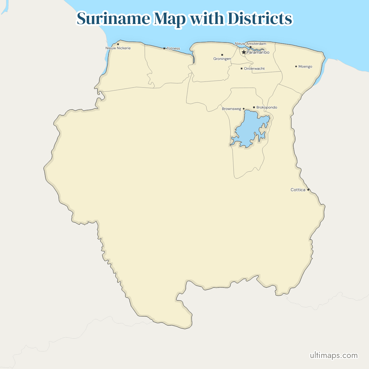
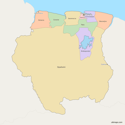
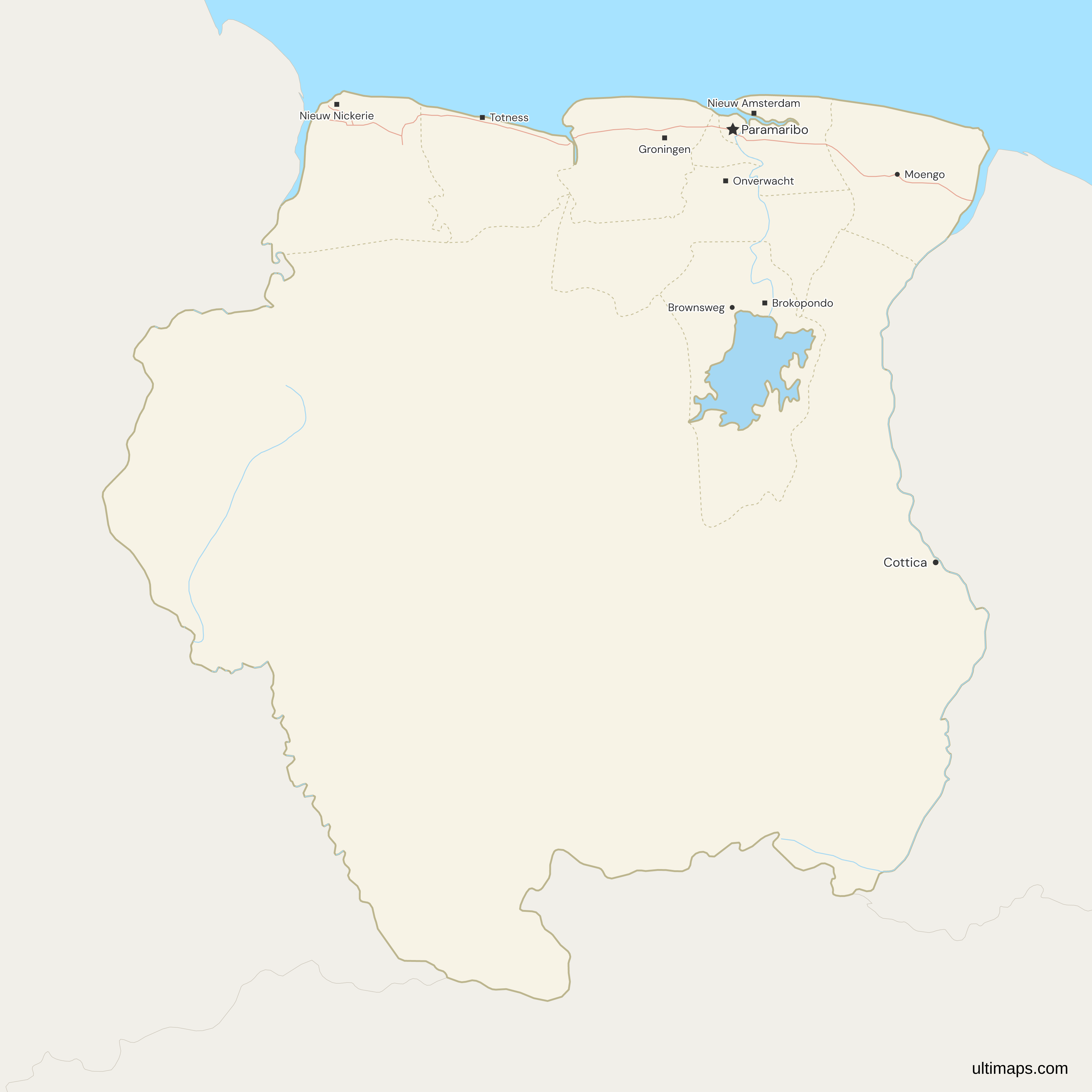
This map of Suriname shows all 10 districts, the division set by a 1983 decree and in force since 1 January 1985. Sipaliwini, the largest, has no district capital and is administered from Paramaribo. Paramaribo, the national capital, has 240,924 residents (2012 census), about twice Wanica's 118,222. Sipaliwini's published area of 130,567 km² (ABS Suriname, 2023) also counts two tracts that the map leaves outside it: the New River Triangle, under Guyana's administration, and the land between the Litani and the Marouini rivers, two headwaters of the Lawa, under French administration as part of French Guiana. Suriname claims both.
Open the map in the free Ultimaps editor to make your own custom map of Suriname. You can color the districts by your data, add pins and labels, and share or embed the finished map.
Interactive Suriname Map with Districts
List of Districts (10)
| # | District | Capital | Population (2012) | Area (km², 2023) |
|---|---|---|---|---|
| 1 | Brokopondo | Brokopondo | 15,909 | 7,364 |
| 2 | Commewijne | Nieuw Amsterdam | 31,420 | 2,353 |
| 3 | Coronie | Totness | 3,391 | 3,902 |
| 4 | Marowijne | Albina | 18,294 | 4,627 |
| 5 | Nickerie | Nieuw Nickerie | 34,233 | 5,353 |
| 6 | Para | Onverwacht | 24,700 | 5,393 |
| 7 | Paramaribo | Paramaribo | 240,924 | 182 |
| 8 | Saramacca | Groningen | 17,480 | 3,636 |
| 9 | Sipaliwini | — | 37,065 | 130,567 |
| 10 | Wanica | Lelydorp | 118,222 | 443 |
Data sources:
- Capital: Statoids, Districts of Suriname (cross-checked against GeoNames and Natural Earth). License: facts compiled by Ultimaps, CC BY 4.0.
- Population: ABS Suriname, Census 2012 definitive results (Statistical Yearbook 2020-2022, Tabel 3.1). License: CC BY 4.0.
- Area: ABS Suriname, Statistical Yearbook 2020-2022, Tabel 2.1a. License: CC BY 4.0.
Suriname Districts: Key Facts
- Number of districts: 10. Suriname, in South America, has no states or provinces. Each district divides into ressorts, 63 in all, which the map does not draw.
- National capital: Paramaribo, which is also the district of the same name, code SR-PM.
- District capitals: Nieuw Nickerie (Nickerie), Totness (Coronie), Groningen (Saramacca), Lelydorp (Wanica), Onverwacht (Para), Nieuw Amsterdam (Commewijne), Albina (Marowijne) and Brokopondo (Brokopondo). Sipaliwini has none. The map marks Paramaribo and six of these towns, but not Albina or Lelydorp.
- Largest and smallest by area: Sipaliwini is by far the largest district. Brokopondo follows with 7,364 km² and Para with 5,393 km². Paramaribo is the smallest at 182 km², then Wanica at 443 km² (total area, ABS Suriname, 2023).
- Most and least populous: Paramaribo has 240,924 residents and Wanica 118,222, together about two thirds of the 541,638 counted. Coronie has the fewest, 3,391 (ABS Suriname, 2012 census).
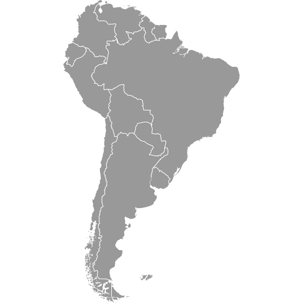
- Borders: Suriname borders three countries: Guyana, Brazil and France, through French Guiana. Guyana lies to the west, along Sipaliwini and Nickerie. France lies to the east, along Marowijne and Sipaliwini. Brazil lies to the south, along Sipaliwini alone.
- Coast: seven districts reach the Atlantic Ocean: Nickerie, Coronie, Saramacca, Wanica, Paramaribo, Commewijne and Marowijne. Wanica's shore is only a few kilometers long. Para, Brokopondo and Sipaliwini are inland.
- Lake: the Brokopondo Reservoir (Professor Dr. Ir. W. J. van Blommestein Lake) is drawn as water, so Brokopondo's land on the map is smaller than its published area of 7,364 km², which includes the reservoir.
- Last reform: the ten districts were set by a decree of 1983 and have applied since 1 January 1985. A decree of 17 January 1985 adapted the laws to them. No district line has changed since.
- Codes: ISO 3166-2 codes run SR-BR (Brokopondo), SR-CM, SR-CR, SR-MA, SR-NI, SR-PR, SR-PM, SR-SA, SR-SI and SR-WA (Wanica).
Interesting Facts
- The 1983 district decree, in force from 1 January 1985, renamed the reduced Suriname district Wanica and created Sipaliwini. It shrank Nickerie, Saramacca, Commewijne, Brokopondo and Marowijne, and enlarged Coronie, Para and Paramaribo.
- The map follows the administered line, so it shows a smaller Sipaliwini than the published area, which counts claimed land.
- Cottica, a village on the Lawa River, is marked on the map and labeled larger than Nieuw Nickerie because of how its population is recorded in the underlying data.
Free Downloads
Free for personal and commercial use with a credit to Ultimaps. See the license terms for details.
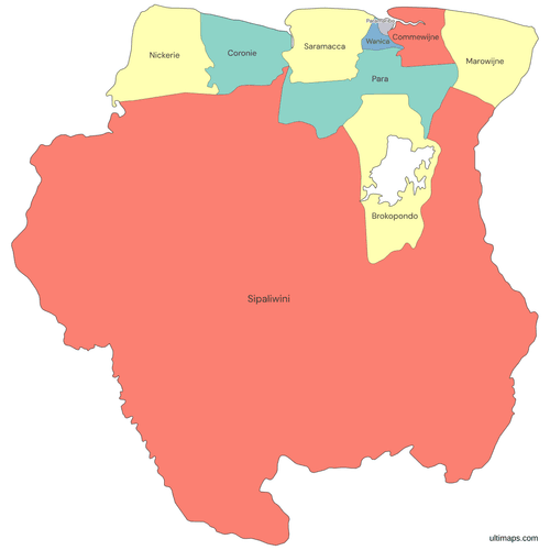 Colored Suriname Map with Districtspng391 KB
 Political Map of Suriname with Districtspng415 KB
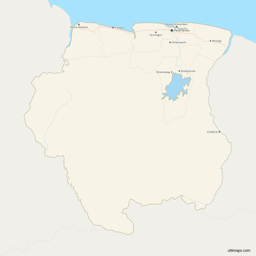 Map of Suriname with Cities and Roadspng456 KB
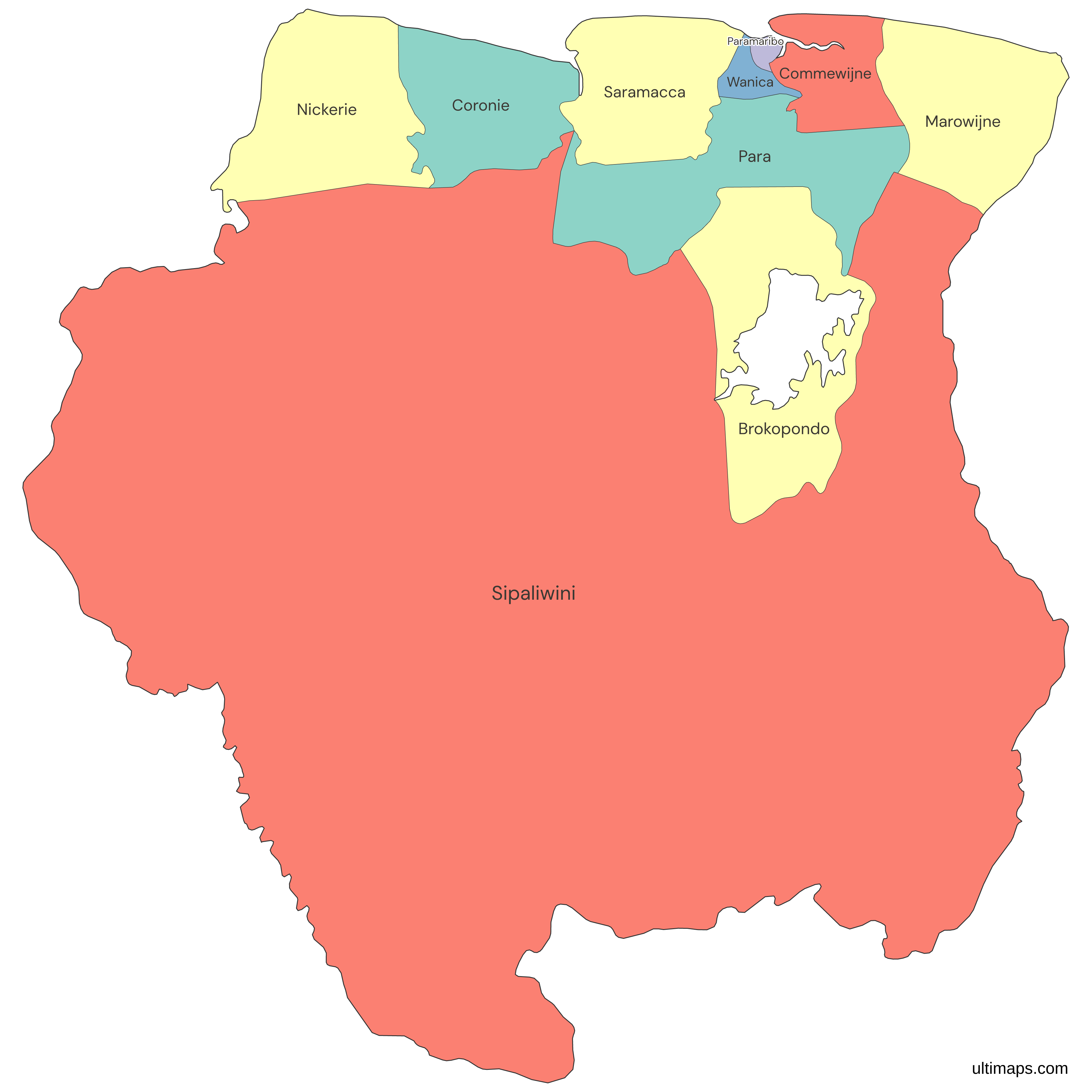
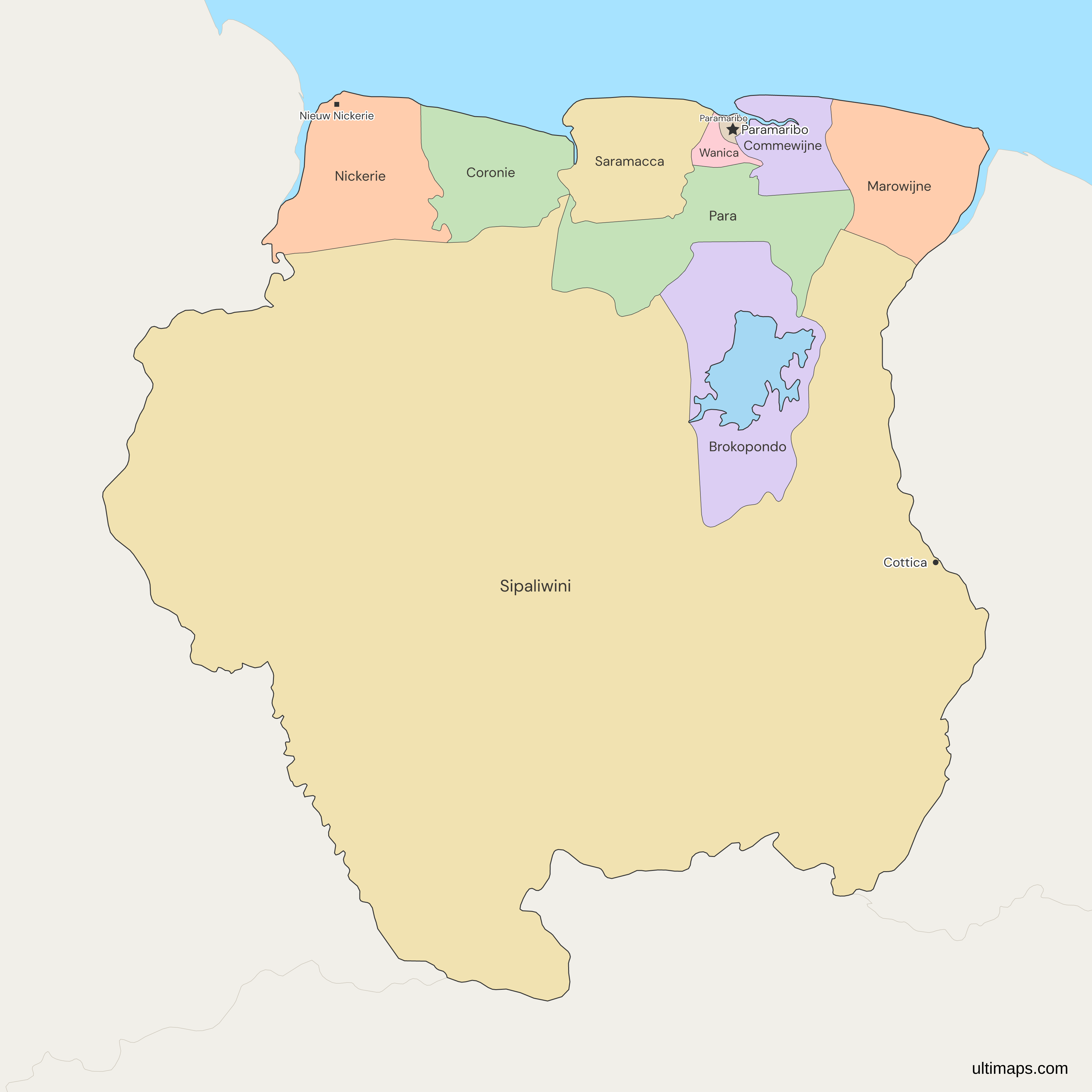
Need it without colors? The blank version of this map comes as a print-ready PDF (A4 and US Letter), a PNG and an editable SVG.
Custom Map Features
This map supports labels.
This map supports surrounding areas, roads, rivers and cities. New
This map is divided into 10 districts.
Updates
Nov 5, 2026:
- Added map of Suriname districts
Frequently Asked Questions
Suriname has 10 districts: Brokopondo, Commewijne, Coronie, Marowijne, Nickerie, Para, Paramaribo, Saramacca, Sipaliwini and Wanica. A decree of 1983 set them, and they have applied since 1 January 1985. A decree of 17 January 1985 adapted the laws to the new division, and no reform has changed it at district level since. The districts are not the lowest tier. Below them sit 63 ressorts, which the map does not draw. The ressorts follow a separate law of 1989, and a 2025 decree for Wanica only groups that district's ressorts into administrative areas. Neither moved a district line.
Paramaribo is the national capital of Suriname and also one of its 10 districts, the smallest at 182 km² (ABS Suriname, 2023). The city lies inside the district of the same name, which has 240,924 residents (2012 census). On the map it is a unit like the other nine, with its own code, SR-PM, and the capital star marks it. Paramaribo is also the seat from which Sipaliwini is administered, although Sipaliwini lies outside the district. The map marks six more district capitals: Nieuw Nickerie, Totness, Groningen, Onverwacht, Nieuw Amsterdam and Brokopondo.
Sipaliwini covers the southern interior of Suriname, with a published area of 130,567 km² (ABS Suriname, 2023). The 1983 district decree created it. It has no district capital and is administered from Paramaribo. It borders all three neighbors, Guyana, France through French Guiana, and Brazil, and it is the only district that reaches Brazil. That published area counts land that Suriname claims but does not administer, so the map draws a smaller shape of about 112,000 km² along the administered line.
Wanica is a district of Suriname that lies between Paramaribo, Saramacca, Commewijne and Para, and its capital is Lelydorp. It has 118,222 residents, the second most of the 10 districts, in 443 km² (ABS Suriname, 2012 census and 2023 area). Wanica took its name from the 1983 district decree, in force from 1985, which gave the reduced Suriname district its new name. Decrees of 2017 and 2025 group the ressorts inside Wanica into two and then three administrative areas, named Centrum, Zuid-Oost and Noord-West. Those decrees did not change the district's line on the map.
Only two districts fall under 1,000 km²: Paramaribo at 182 km² and Wanica at 443 km² (ABS Suriname, 2023). Paramaribo, the smaller of the two, contains the national capital, and both districts lie on the Atlantic coast in the north. The next district in size is Commewijne at 2,353 km², and Sipaliwini, at 130,567 km², is hundreds of times larger than Paramaribo. Para, at 5,393 km², is about 30 times larger than Paramaribo. The map draws Paramaribo slightly smaller than its published 182 km².
Paramaribo holds about 44 percent of the 541,638 people counted in the 2012 census (ABS Suriname), 240,924 residents, which makes it the most populous of the 10 districts. Wanica adds another 22 percent with 118,222, so the two coastal districts together hold about two thirds of the total. Sipaliwini ranks third with 37,065, ahead of Nickerie at 34,233 and Commewijne at 31,420, each near 6 percent, and Coronie has the fewest, 3,391. The 2012 census is the latest count by district.
Suriname divides into 10 districten, in English districts, and the word covers every first-level unit, including the capital district of Paramaribo. The map also matches Commewyne and Marowyne, older Dutch spellings of Commewijne and Marowijne. Below the districts sit 63 ressorts. The Wet Regionale Organen of 1989 defines the ressort as an administrative area and leaves its borders to a separate law. Paramaribo, the national capital, is one of the 10 districts and carries the code SR-PM. This map does not show the ressorts.
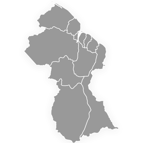
The New River Triangle lies inside Guyana on this map, because Guyana administers it as part of its East Berbice-Corentyne region. The land between the Litani and the Marouini rivers, two headwaters of the Lawa, lies inside French Guiana, because France administers it. Suriname claims both tracts and counts them in Sipaliwini's published area, so the drawn Sipaliwini covers about 112,000 km², against the published 130,567 km² (ABS Suriname, 2023). Guyana and French Guiana appear as neighboring territory around Suriname.
The free Ultimaps editor opens from this page with the 10 districts already drawn, and you need no account to start. Paste or import a table with one row per district, or click districts to color them by hand. Rows match on the district name, with or without the word District, on the old Dutch spellings Commewyne and Marowyne, or on an ISO code such as SR-WA. Pins add towns the map does not mark, such as Albina or Lelydorp. A free account lets you save and publish the map, then share a link or embed it. A free export is a standard PNG with a small Ultimaps credit. High-resolution PNG, SVG and PDF files need Ultimaps Pro.