Map of North Dakota Counties
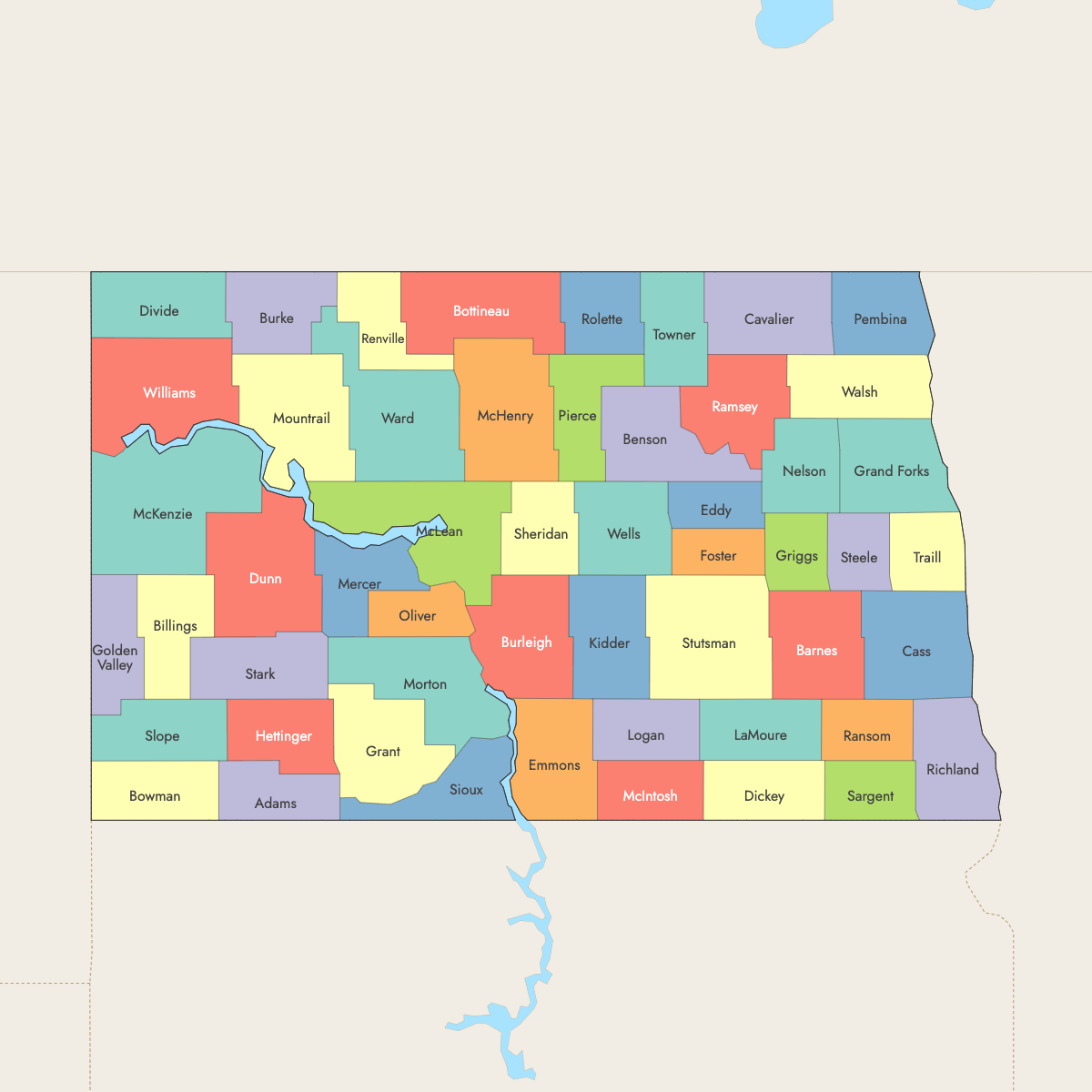
North Dakota is divided into 53 counties. Use the interactive maps below to explore county boundaries and urban centers. Download free maps or learn more about creating a custom map of North Dakota to visualize your own data.
Interactive Map of North Dakota Counties
List of Counties (53)
| # | County | County seat | Year founded |
|---|---|---|---|
| 1 | Adams | Hettinger | 1885 |
| 2 | Barnes | Valley City | 1875 |
| 3 | Benson | Minnewaukan | 1883 |
| 4 | Billings | Medora | 1879 |
| 5 | Bottineau | Bottineau | 1873 |
| 6 | Bowman | Bowman | 1883 |
| 7 | Burke | Bowbells | 1910 |
| 8 | Burleigh | Bismarck | 1873 |
| 9 | Cass | Fargo | 1873 |
| 10 | Cavalier | Langdon | 1873 |
| 11 | Dickey | Ellendale | 1881 |
| 12 | Divide | Crosby | 1910 |
| 13 | Dunn | Manning | 1883 |
| 14 | Eddy | New Rockford | 1885 |
| 15 | Emmons | Linton | 1879 |
| 16 | Foster | Carrington | 1873 |
| 17 | Golden Valley | Beach | 1912 |
| 18 | Grand Forks | Grand Forks | 1873 |
| 19 | Grant | Carson | 1916 |
| 20 | Griggs | Cooperstown | 1882 |
| 21 | Hettinger | Mott | 1883 |
| 22 | Kidder | Steele | 1873 |
| 23 | LaMoure | LaMoure | 1873 |
| 24 | Logan | Napoleon | 1873 |
| 25 | McHenry | Towner | 1873 |
| 26 | McIntosh | Ashley | 1883 |
| 27 | McKenzie | Watford City | 1905 |
| 28 | McLean | Washburn | 1883 |
| 29 | Mercer | Stanton | 1875 |
| 30 | Morton | Mandan | 1873 |
| 31 | Mountrail | Stanley | 1873 |
| 32 | Nelson | Lakota | 1883 |
| 33 | Oliver | Center | 1885 |
| 34 | Pembina | Cavalier | 1867 |
| 35 | Pierce | Rugby | 1887 |
| 36 | Ramsey | Devils Lake | 1873 |
| 37 | Ransom | Lisbon | 1873 |
| 38 | Renville | Mohall | 1873 |
| 39 | Richland | Wahpeton | 1873 |
| 40 | Rolette | Rolla | 1873 |
| 41 | Sargent | Forman | 1883 |
| 42 | Sheridan | McClusky | 1908 |
| 43 | Sioux | Fort Yates | 1915 |
| 44 | Slope | Amidon | 1915 |
| 45 | Stark | Dickinson | 1879 |
| 46 | Steele | Finley | 1883 |
| 47 | Stutsman | Jamestown | 1873 |
| 48 | Towner | Cando | 1883 |
| 49 | Traill | Hillsboro | 1875 |
| 50 | Walsh | Grafton | 1881 |
| 51 | Ward | Minot | 1888 |
| 52 | Wells | Fessenden | 1881 |
| 53 | Williams | Williston | 1891 |
North Dakota Counties: Key Facts
- Number of counties: 53
- Total state area: 70,700 sq mi (183,123 km²)
- Largest county by area: McKenzie County - 2,742 sq mi (7,102 km²)
- Smallest county by area: Eddy County - 632 sq mi (1,637 km²)
- Most populous county: Cass County - 192,734 people, 1,768 sq mi (4,581 km²)
- Least populous county: Slope County - 660 people, 1,218 sq mi (3,155 km²)
- Major urban centers: Fargo (Cass County), Bismarck (Burleigh County), Grand Forks (Grand Forks County), Minot (Ward County), Williston (Williams County)
- Time zones: Central Time and Mountain Time
- Neighboring states: New York, Pennsylvania, Delaware
Interesting Facts
- Geographic center of North America: Near Rugby in Pierce County
- Badlands counties: Include Billings, McKenzie, Slope, Stark, featuring the North Dakota Badlands and Theodore Roosevelt National Park
- Native American reservations: Sioux County is largely part of the Standing Rock Indian Reservation
Free Downloads
Free for personal and commercial use with a credit to Ultimaps. See the license terms for details.
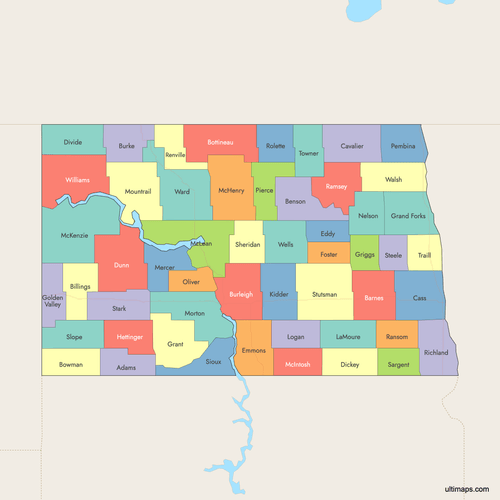 Colored Map of North Dakota Counties with Surrounding Areaspng474 KB
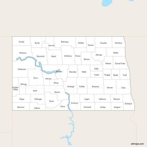 Labeled Map of North Dakota Counties with Surrounding Areaspng459 KB
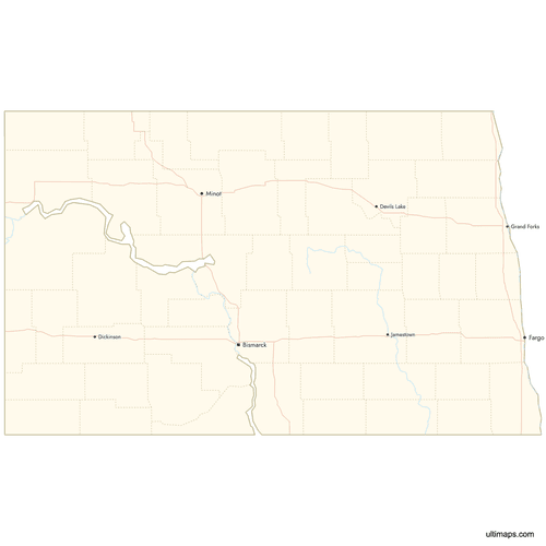 Map of North Dakota Counties with Citiespng437 KB
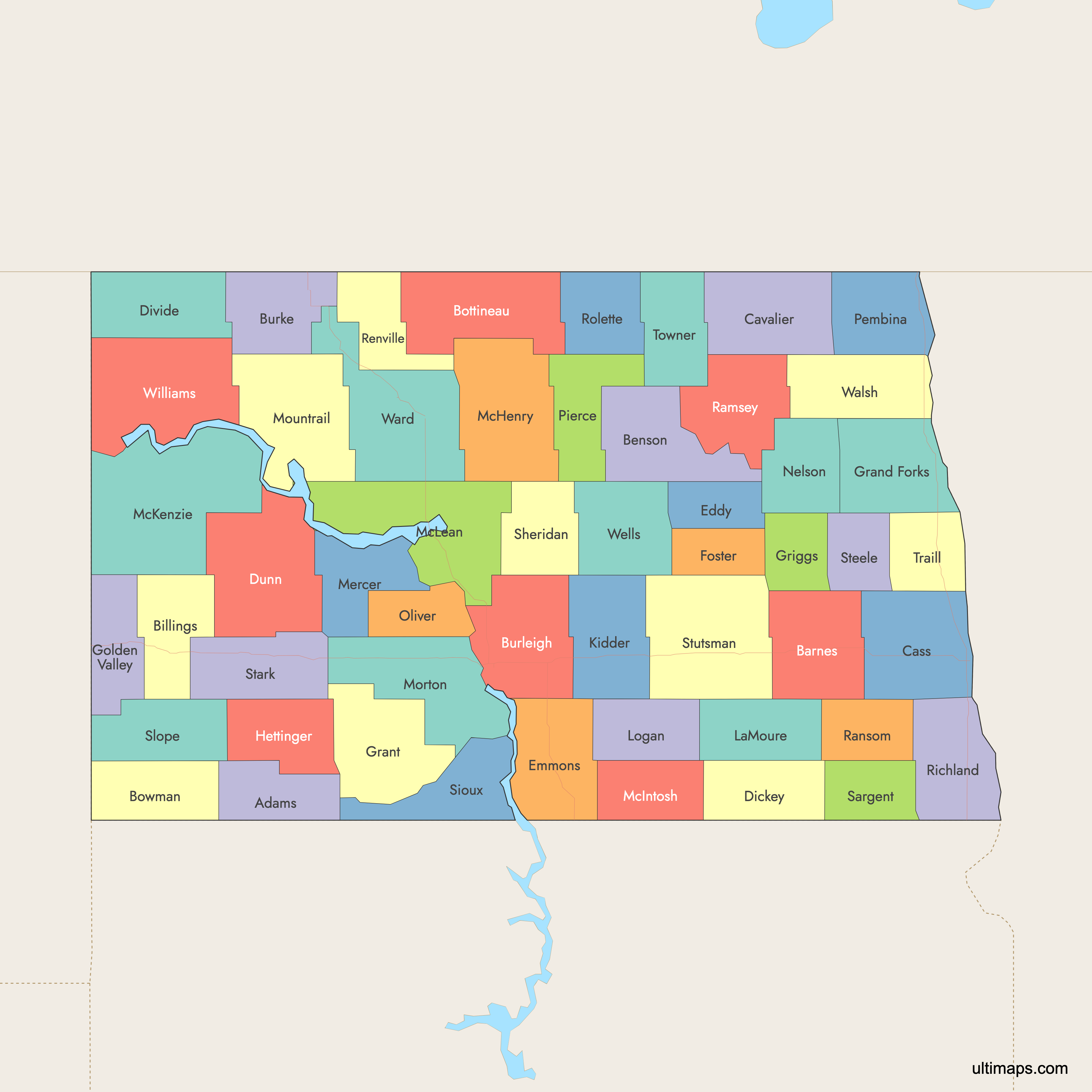
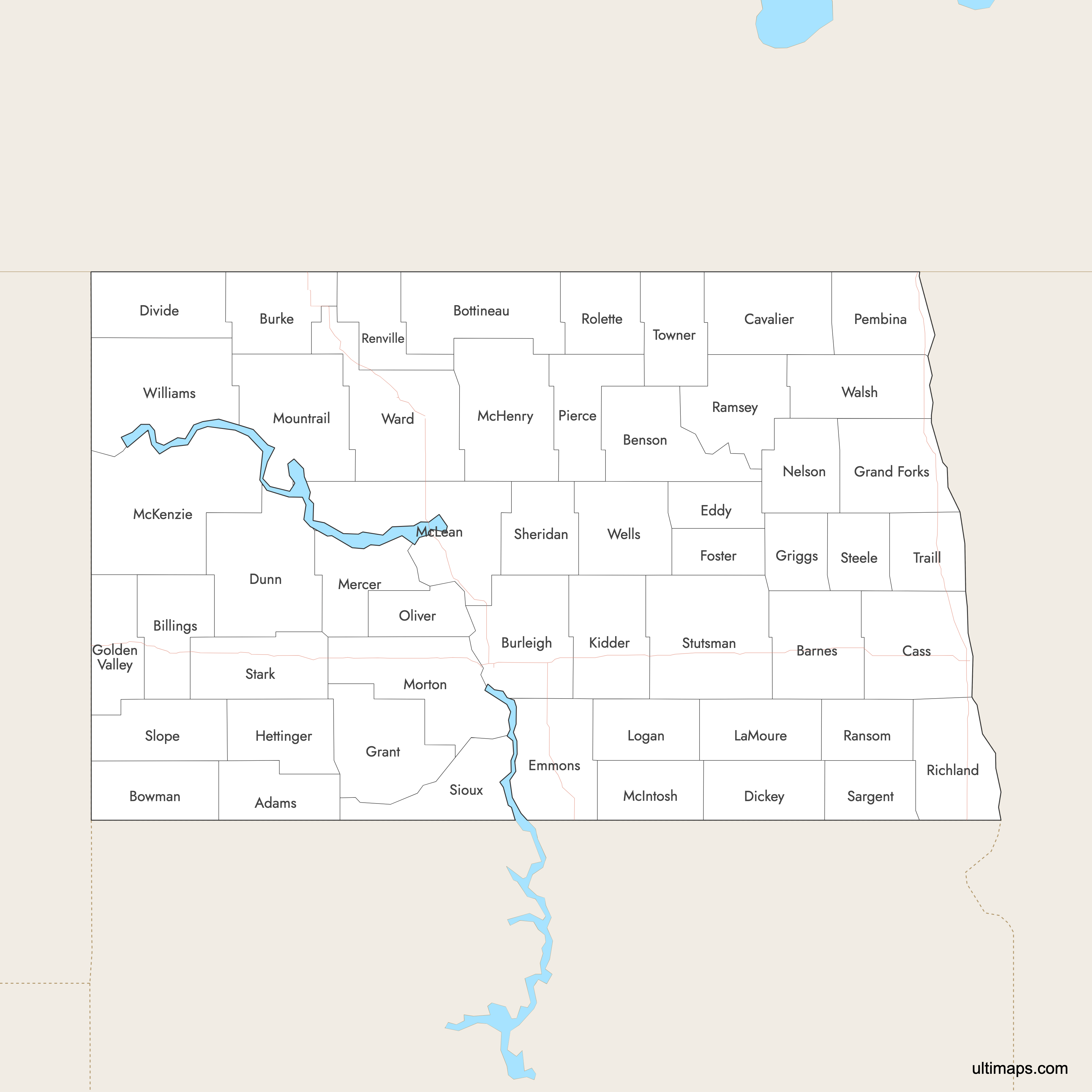
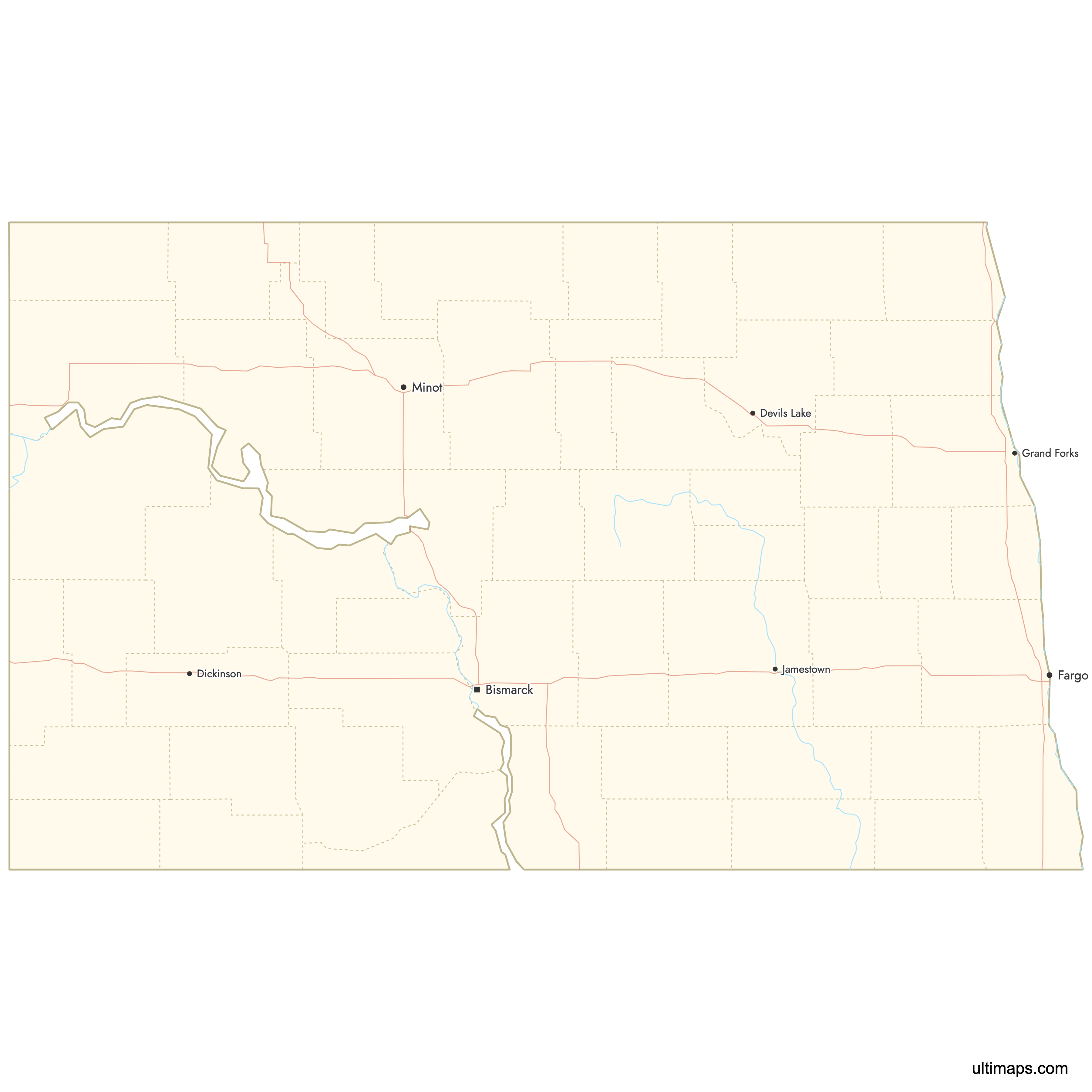
Need it without colors? The blank version of this map comes as a print-ready PDF (A4 and US Letter), a PNG and an editable SVG.
Custom Map Features
This map supports labels.
This map supports surrounding areas, roads, rivers and cities. New
This map is divided into 53 counties.
Updates
Jan 12, 2026:
- Improved map quality
- Added support for surrounding areas and lakes
Aug 26, 2024:
- Added map of North Dakota Counties
Frequently Asked Questions
There are 53 counties in North Dakota.
The largest county by area is McKenzie County, covering 2,742 sq mi (7,102 km²).
The smallest county by area is Eddy County, with an area of 632 sq mi (1,637 km²).
Cass County is the most populous county in North Dakota, with 192,734 people.
Slope County has the smallest population, with 660 people.
The state capital of North Dakota is Bismarck, located in Burleigh County.
You can use Ultimaps to create custom maps of North Dakota. Color-code counties manually or upload data, place pins, customize look and feel, and export to PNG, PDF, or SVG.