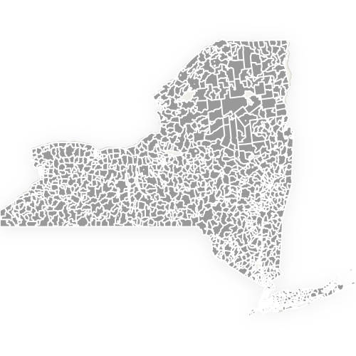
Map of New York Counties
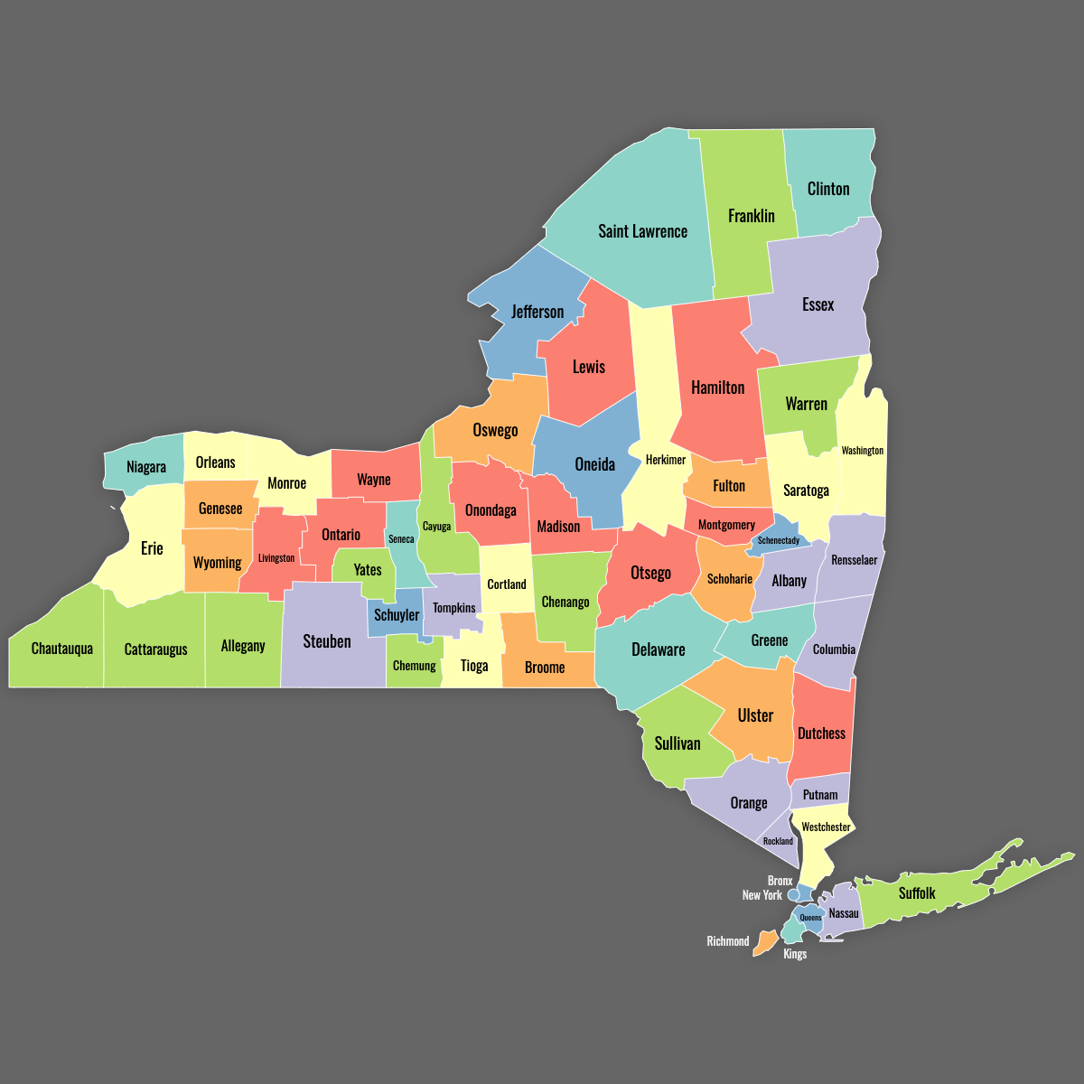
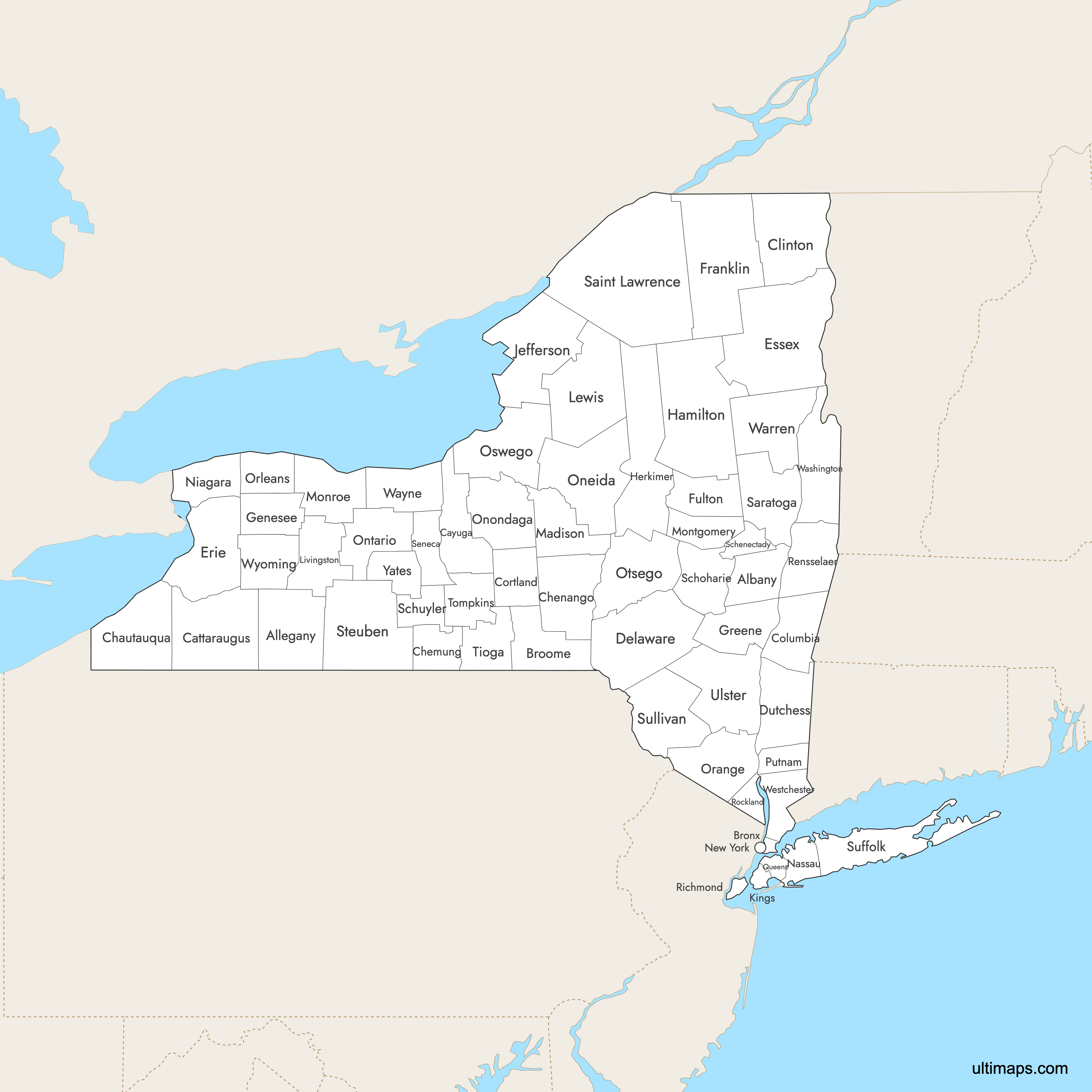
New York State is divided into 62 counties that range from the 33-square-mile island of Manhattan to the 2,821-square-mile forests of St. Lawrence County. Use the interactive maps below to explore New York counties and their boundaries. Download free maps or learn more about creating a custom New York county map to highlight your own data.
Interactive Map of New York Counties
List of Counties (62)
| # | County | County seat | Year founded |
|---|---|---|---|
| 1 | Albany | Albany | 1683 |
| 2 | Allegany | Belmont | 1806 |
| 3 | Bronx | Bronx | 1914 |
| 4 | Broome | Binghamton | 1806 |
| 5 | Cattaraugus | Little Valley | 1808 |
| 6 | Cayuga | Auburn | 1799 |
| 7 | Chautauqua | Mayville | 1808 |
| 8 | Chemung | Elmira | 1836 |
| 9 | Chenango | Norwich | 1798 |
| 10 | Clinton | Plattsburgh | 1788 |
| 11 | Columbia | Hudson | 1786 |
| 12 | Cortland | Cortland | 1808 |
| 13 | Delaware | Delhi | 1797 |
| 14 | Dutchess | Poughkeepsie | 1683 |
| 15 | Erie | Buffalo | 1821 |
| 16 | Essex | Elizabethtown | 1799 |
| 17 | Franklin | Malone | 1808 |
| 18 | Fulton | Johnstown | 1838 |
| 19 | Genesee | Batavia | 1802 |
| 20 | Greene | Catskill | 1800 |
| 21 | Hamilton | Lake Pleasant | 1816 |
| 22 | Herkimer | Herkimer | 1791 |
| 23 | Jefferson | Watertown | 1805 |
| 24 | Kings | Brooklyn | 1683 |
| 25 | Lewis | Lowville | 1805 |
| 26 | Livingston | Geneseo | 1821 |
| 27 | Madison | Wampsville | 1806 |
| 28 | Monroe | Rochester | 1821 |
| 29 | Montgomery | Fonda | 1772 |
| 30 | Nassau | Mineola | 1899 |
| 31 | New York | Manhattan | 1683 |
| 32 | Niagara | Lockport | 1808 |
| 33 | Oneida | Utica | 1798 |
| 34 | Onondaga | Syracuse | 1794 |
| 35 | Ontario | Canandaigua | 1789 |
| 36 | Orange | Goshen | 1683 |
| 37 | Orleans | Albion | 1824 |
| 38 | Oswego | Oswego | 1816 |
| 39 | Otsego | Cooperstown | 1791 |
| 40 | Putnam | Carmel | 1812 |
| 41 | Queens | Queens | 1683 |
| 42 | Rensselaer | Troy | 1791 |
| 43 | Richmond | Staten Island | 1683 |
| 44 | Rockland | New City | 1798 |
| 45 | Saint Lawrence | Canton | 1802 |
| 46 | Saratoga | Ballston Spa | 1791 |
| 47 | Schenectady | Schenectady | 1809 |
| 48 | Schoharie | Schoharie | 1795 |
| 49 | Schuyler | Watkins Glen | 1854 |
| 50 | Seneca | Waterloo | 1804 |
| 51 | Steuben | Bath | 1796 |
| 52 | Suffolk | Riverhead | 1683 |
| 53 | Sullivan | Monticello | 1809 |
| 54 | Tioga | Owego | 1791 |
| 55 | Tompkins | Ithaca | 1817 |
| 56 | Ulster | Kingston | 1683 |
| 57 | Warren | Queensbury | 1813 |
| 58 | Washington | Fort Edward | 1772 |
| 59 | Wayne | Lyons | 1823 |
| 60 | Westchester | White Plains | 1683 |
| 61 | Wyoming | Warsaw | 1841 |
| 62 | Yates | Penn Yan | 1823 |
New York Counties: Key Facts
- Number of counties: 62
- Largest county by area: St. Lawrence County - about 2,821 square miles
- Smallest county by area: New York County (Manhattan) - about 23 square miles of land
- Most populous county: Kings County (Brooklyn) - roughly 2.7 million residents (2020 Census)
- Counties with major cities: New York County (Manhattan), Queens County, Bronx County, Erie County (Buffalo), Monroe County (Rochester)
- State capital: Albany (Albany County)
- Time zone: Eastern Time
- Neighbouring states: Vermont, Massachusetts, Connecticut, New Jersey, Pennsylvania
- International border: with Ontario and Quebec, Canada
- Oldest county: Albany County (established 1683)
- County borders last changed in 1915 when Bronx County reached its current size
- St. Lawrence County is larger than the entire state of Delaware
- Adirondack Park, spanning several northern counties, is the largest protected area in the contiguous United States
Free Downloads
Free for personal and commercial use with a credit to Ultimaps. See the license terms for details.
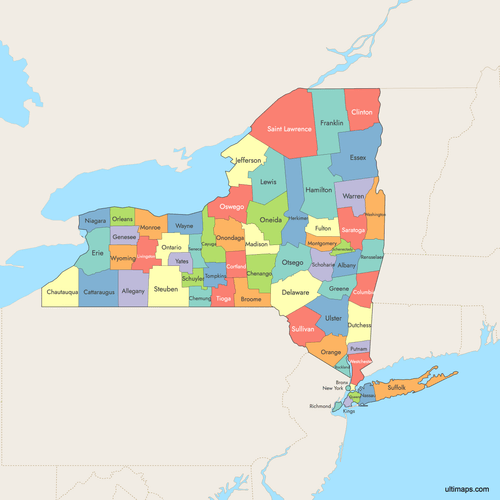 Colored Map of New York Counties with Surrounding Areaspng862 KB
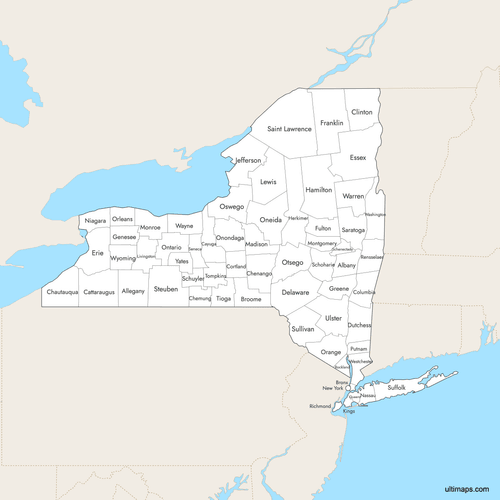 Labeled Map of New York Counties with Surrounding Areaspng847 KB
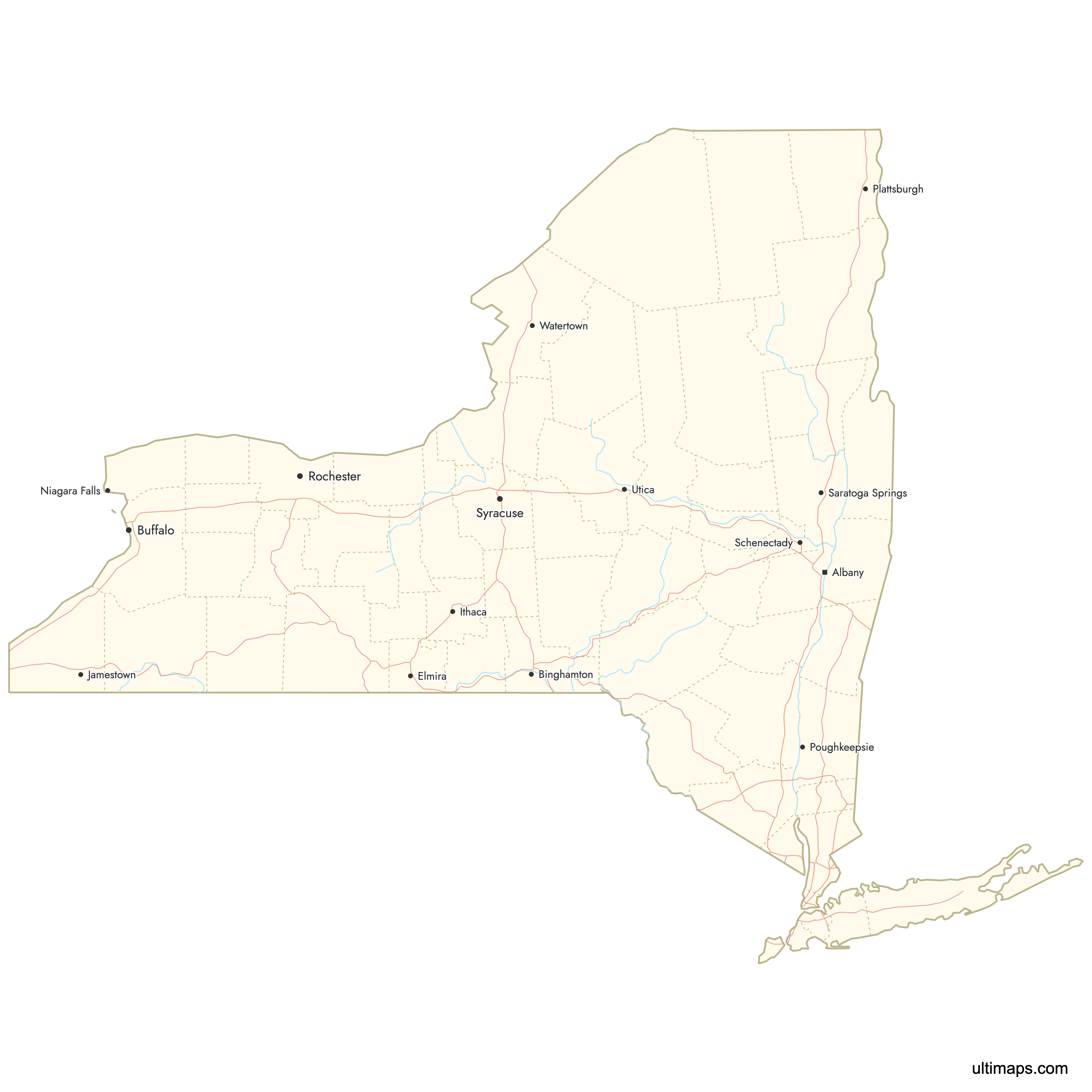
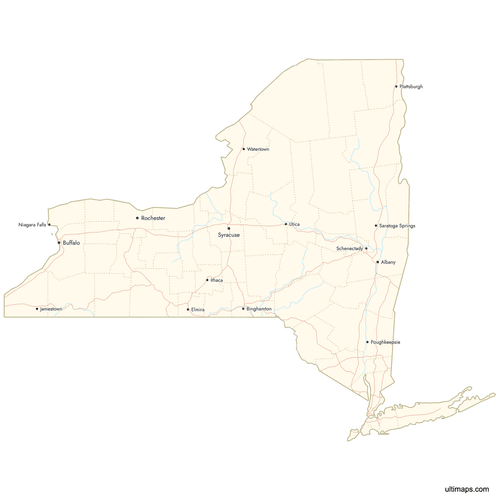 Map of New York Counties with Citiespng723 KB
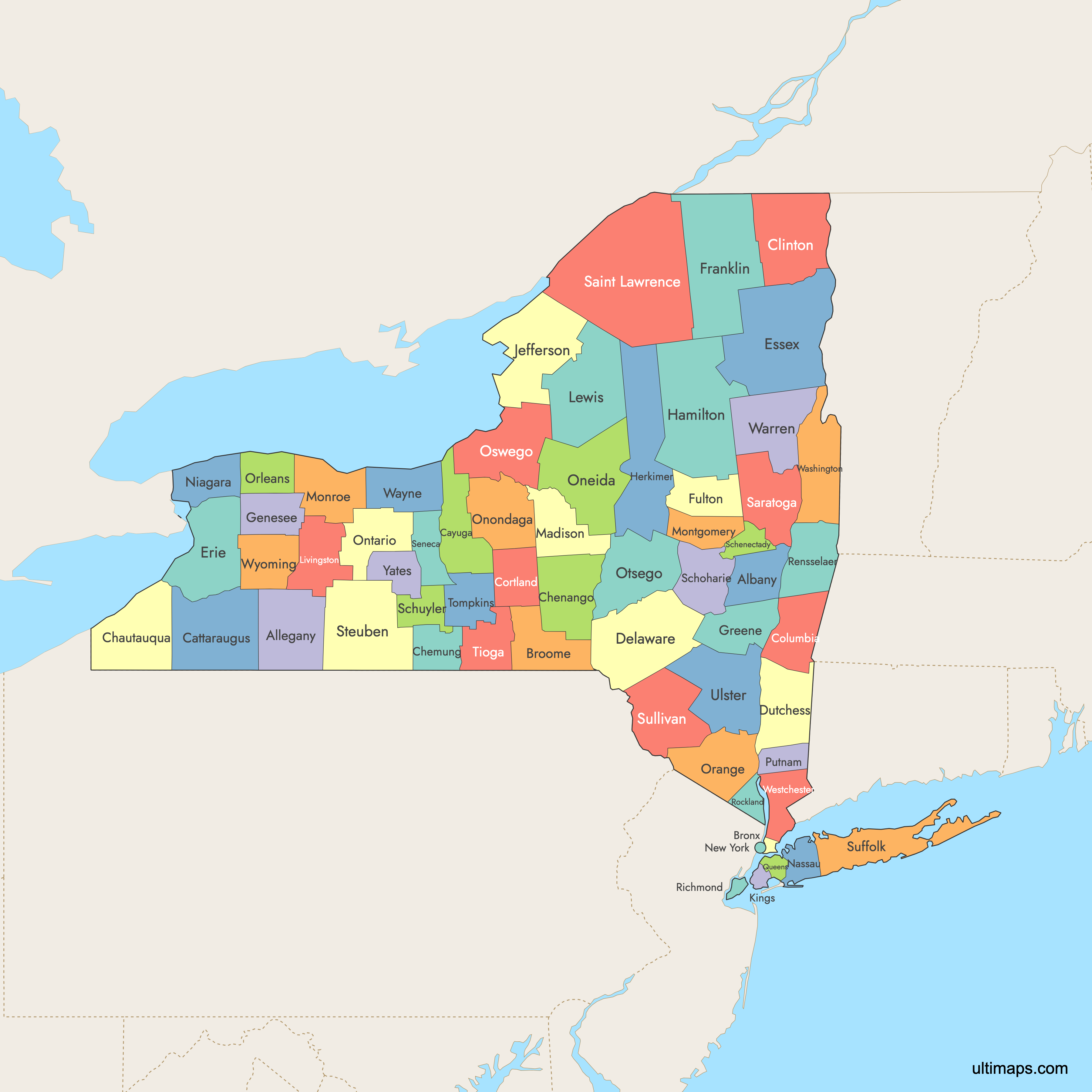
Need it without colors? The blank version of this map comes as a print-ready PDF (A4 and US Letter), a PNG and an editable SVG.
Custom Map Features
This map supports labels.
This map supports surrounding areas, roads, rivers and cities. New
This map is divided into 62 counties.
Updates
Aug 6, 2025:
- Improved map quality
- Added support for surrounding areas and lakes
Aug 26, 2024:
- Added map of New York Counties