Map of Montana Counties
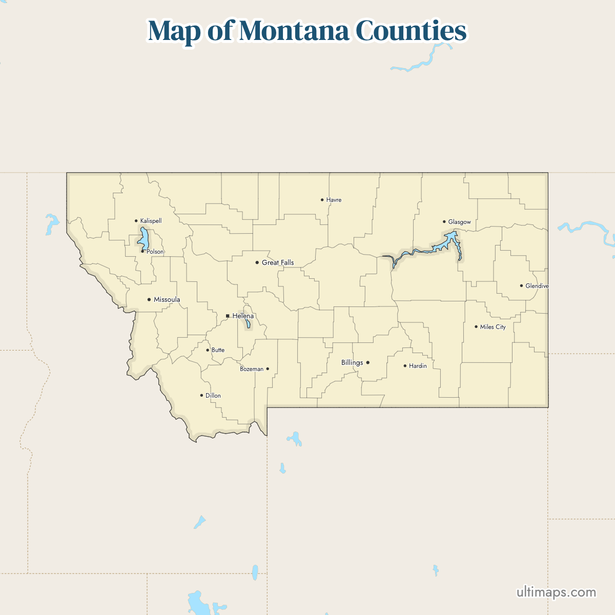
Montana is divided into 56 counties, including two consolidated city-counties: Anaconda-Deer Lodge County and Butte-Silver Bow County. Use the interactive maps below to explore counties and their boundaries. Download free maps or learn more about creating a custom map of Montana to visualize your own data.
Interactive Map of Montana Counties
List of Counties (56)
| # | County | County seat | Year founded |
|---|---|---|---|
| 1 | Beaverhead | Dillon | 1865 |
| 2 | Big Horn | Hardin | 1913 |
| 3 | Blaine | Chinook | 1912 |
| 4 | Broadwater | Townsend | 1897 |
| 5 | Carbon | Red Lodge | 1895 |
| 6 | Carter | Ekalaka | 1917 |
| 7 | Cascade | Great Falls | 1887 |
| 8 | Chouteau | Fort Benton | 1865 |
| 9 | Custer | Miles City | 1865 |
| 10 | Daniels | Scobey | 1920 |
| 11 | Dawson | Glendive | 1869 |
| 12 | Deer Lodge | Anaconda | 1865 |
| 13 | Fallon | Baker | 1913 |
| 14 | Fergus | Lewistown | 1885 |
| 15 | Flathead | Kalispell | 1893 |
| 16 | Gallatin | Bozeman | 1865 |
| 17 | Garfield | Jordan | 1919 |
| 18 | Glacier | Cut Bank | 1919 |
| 19 | Golden Valley | Ryegate | 1920 |
| 20 | Granite | Philipsburg | 1893 |
| 21 | Hill | Havre | 1912 |
| 22 | Jefferson | Boulder | 1865 |
| 23 | Judith Basin | Stanford | 1920 |
| 24 | Lake | Polson | 1923 |
| 25 | Lewis and Clark | Helena | 1865 |
| 26 | Liberty | Chester | 1920 |
| 27 | Lincoln | Libby | 1909 |
| 28 | Madison | Virginia City | 1865 |
| 29 | McCone | Circle | 1919 |
| 30 | Meagher | White Sulphur Springs | 1867 |
| 31 | Mineral | Superior | 1914 |
| 32 | Missoula | Missoula | 1860 |
| 33 | Musselshell | Roundup | 1911 |
| 34 | Park | Livingston | 1887 |
| 35 | Petroleum | Winnett | 1926 |
| 36 | Phillips | Malta | 1915 |
| 37 | Pondera | Conrad | 1919 |
| 38 | Powder River | Broadus | 1919 |
| 39 | Powell | Deer Lodge | 1901 |
| 40 | Prairie | Terry | 1915 |
| 41 | Ravalli | Hamilton | 1893 |
| 42 | Richland | Sidney | 1914 |
| 43 | Roosevelt | Wolf Point | 1919 |
| 44 | Rosebud | Forsyth | 1901 |
| 45 | Sanders | Thompson Falls | 1905 |
| 46 | Sheridan | Plentywood | 1913 |
| 47 | Silver Bow | Butte | 1881 |
| 48 | Stillwater | Columbus | 1913 |
| 49 | Sweet Grass | Big Timber | 1895 |
| 50 | Teton | Choteau | 1893 |
| 51 | Toole | Shelby | 1914 |
| 52 | Treasure | Hysham | 1919 |
| 53 | Valley | Glasgow | 1893 |
| 54 | Wheatland | Harlowton | 1917 |
| 55 | Wibaux | Wibaux | 1914 |
| 56 | Yellowstone | Billings | 1883 |
Montana Counties: Key Facts
- Total number of counties: 56
- Largest county by area: Rosebud County - 5,012 square miles (12,981 km²)
- Smallest county by area: Silver Bow County - 718 square miles (1,860 km²)
- Most populous county: Yellowstone County - 171,583 residents
- Least populous county: Treasure County - 739 residents
- Counties with significant urban centers: Yellowstone (Billings), Silver Bow (Butte), Missoula (Missoula), Cascade (Great Falls), Flathead (Kalispell), Gallatin (Bozeman)
- Neighboring states: Idaho (west), Wyoming (south), North Dakota (east), South Dakota (southeast); borders Canadian provinces Alberta and Saskatchewan (north)
- Time zone: Mountain Time Zone (UTC-7 standard, UTC-6 daylight)
Interesting Facts
- Treasure County was named to attract settlers, despite its small size and population.
- Stillwater County is named for the river known for its fast current.
- Powder River County is named for the sand on the river's shores, resembling gunpowder.
- Richland County's name reflects its fertile soil.
- The portion of Yellowstone National Park in Montana was not part of any county until 1978.
Free Downloads
Free for personal and commercial use with a credit to Ultimaps. See the license terms for details.
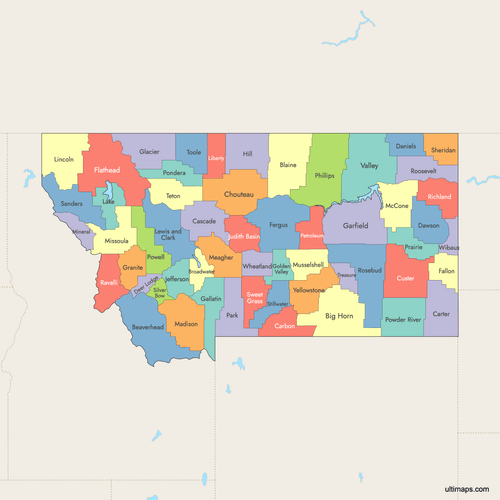 Colored Map of Montana Counties with Surrounding Areaspng611 KB
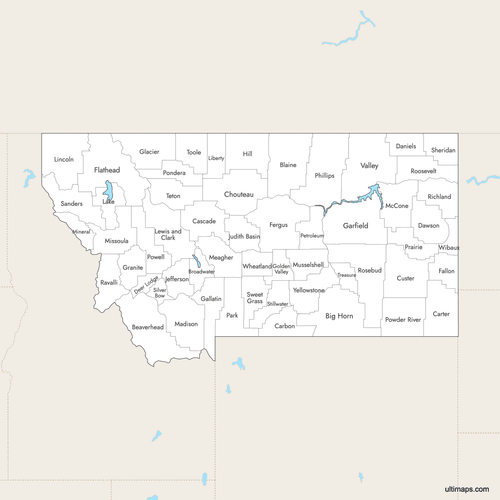 Labeled Map of Montana Counties with Surrounding Areaspng597 KB
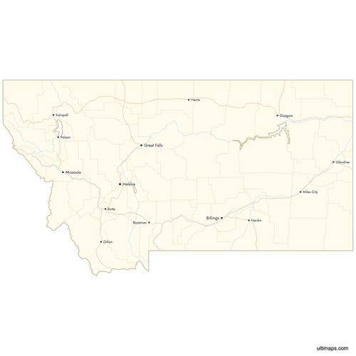 Map of Montana Counties with Citiespng647 KB
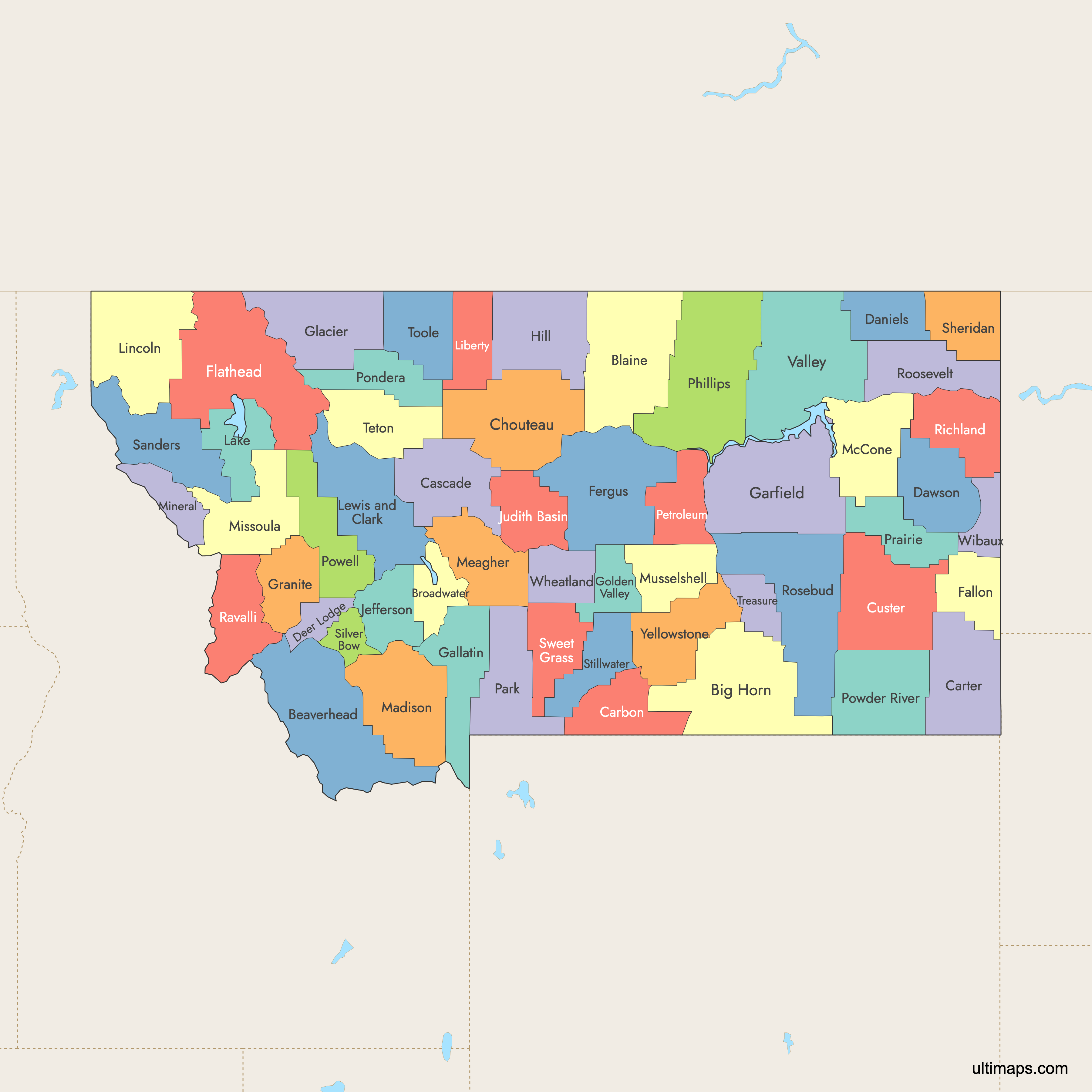
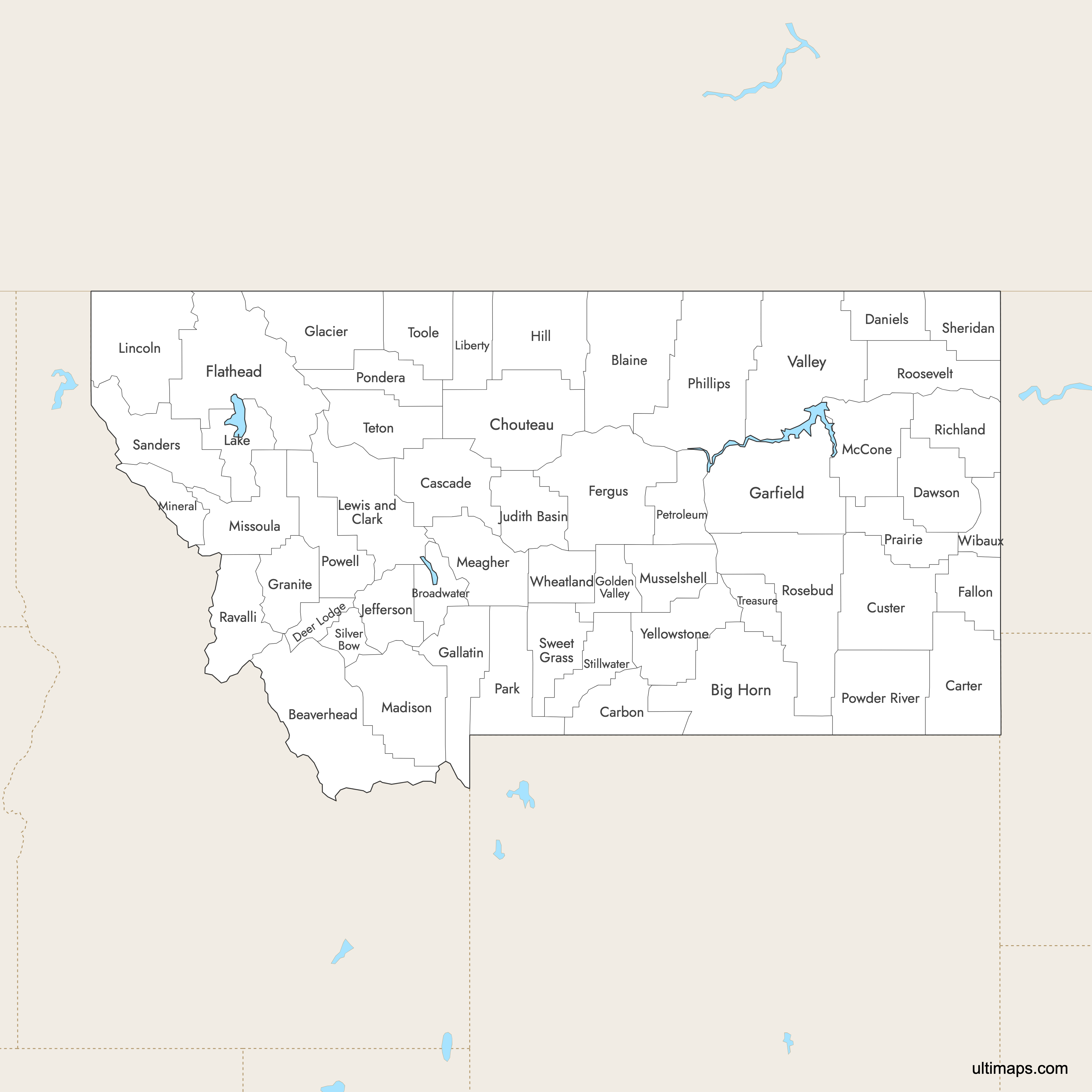
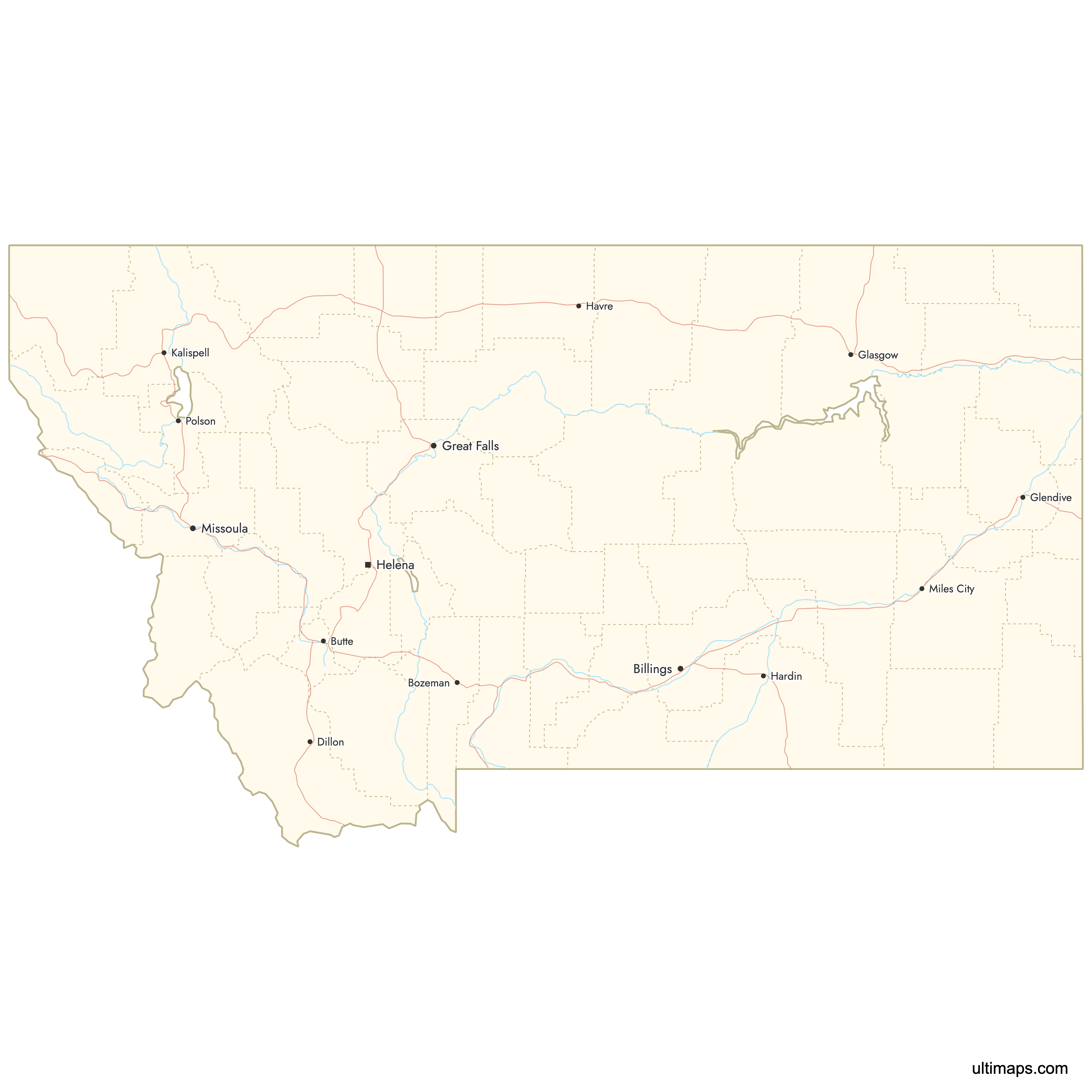
Need it without colors? The blank version of this map comes as a print-ready PDF (A4 and US Letter), a PNG and an editable SVG.
Custom Map Features
This map supports labels.
This map supports surrounding areas, roads, rivers and cities. New
This map is divided into 56 counties.
Updates
Feb 2, 2026:
- Improved map quality
- Added support for surrounding areas and lakes
Aug 26, 2024:
- Added map of Montana Counties
Frequently Asked Questions
Montana has 56 counties, including two consolidated city-counties: Anaconda-Deer Lodge County and Butte-Silver Bow County.
Rosebud County is the largest by land area at 5,012 square miles (12,981 km²).
Silver Bow County is the smallest by area at 718 square miles (1,860 km²).
Yellowstone County is the most populous with 171,583 residents.
Treasure County is the least populous with 739 residents.
You can use Ultimaps to create custom maps of Montana. Color-code counties manually or upload data, place pins, customize look and feel and export to PNG, PDF or SVG.