Map of West Virginia Counties
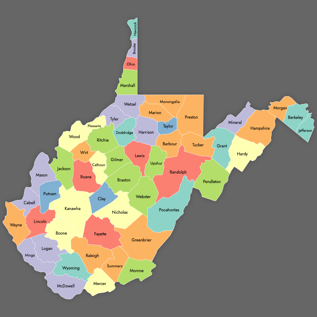
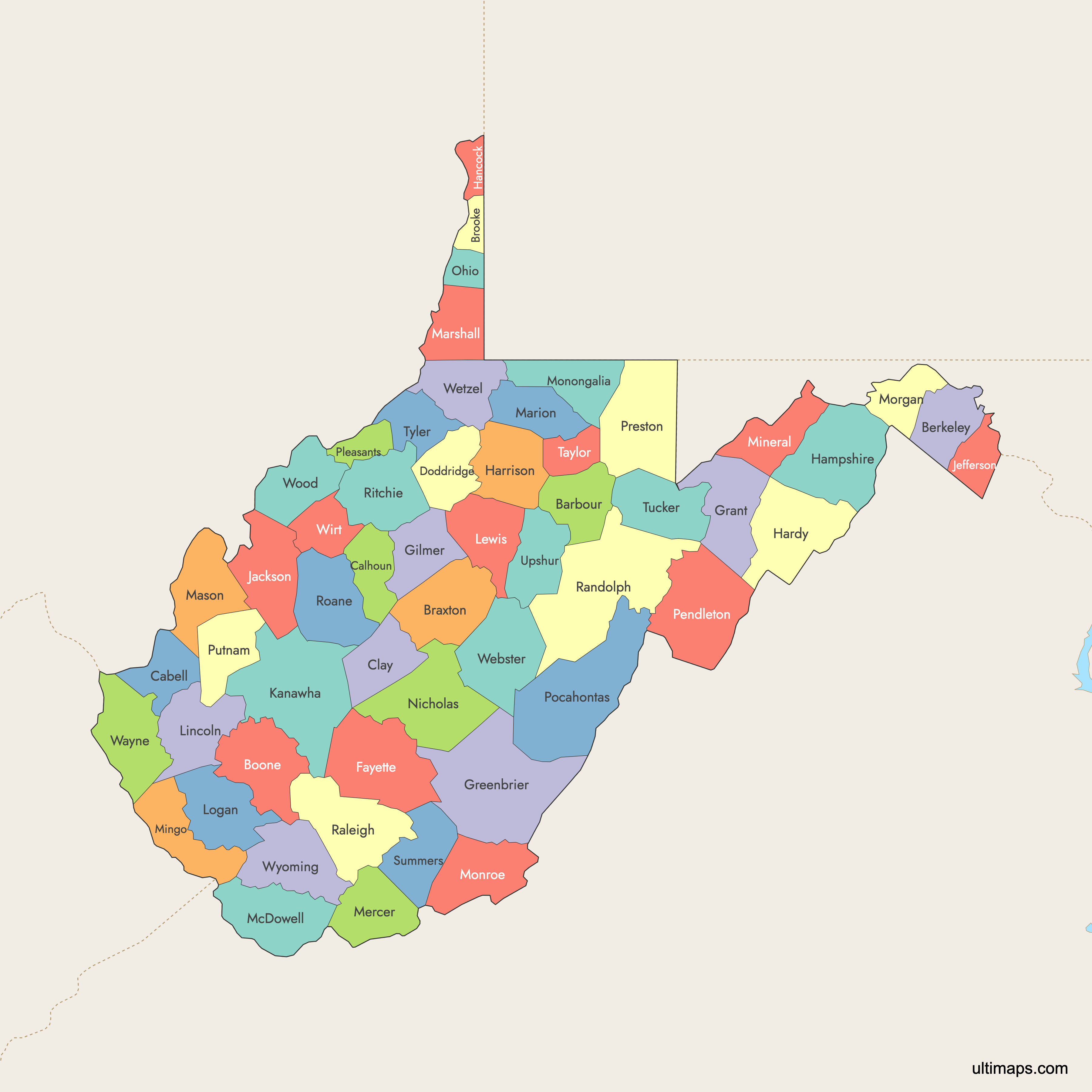
West Virginia is divided into 55 counties. These counties range from urban centers like Kanawha County, home to the state capital Charleston, to the rural landscapes of Randolph and Hancock counties. Use the interactive maps below to explore county boundaries and learn more about the state's regional diversity. Download free maps or learn how to create a custom map of West Virginia to visualize your data.
Interactive Map of West Virginia Counties
List of Counties (55)
| # | County | County seat | Year founded |
|---|---|---|---|
| 1 | Barbour | Philippi | 1843 |
| 2 | Berkeley | Martinsburg | 1772 |
| 3 | Boone | Madison | 1847 |
| 4 | Braxton | Sutton | 1836 |
| 5 | Brooke | Wellsburg | 1797 |
| 6 | Cabell | Huntington | 1809 |
| 7 | Calhoun | Grantsville | 1856 |
| 8 | Clay | Clay | 1858 |
| 9 | Doddridge | West Union | 1845 |
| 10 | Fayette | Fayetteville | 1831 |
| 11 | Gilmer | Glenville | 1845 |
| 12 | Grant | Petersburg | 1866 |
| 13 | Greenbrier | Lewisburg | 1778 |
| 14 | Hampshire | Romney | 1754 |
| 15 | Hancock | New Cumberland | 1848 |
| 16 | Hardy | Moorefield | 1786 |
| 17 | Harrison | Clarksburg | 1784 |
| 18 | Jackson | Ripley | 1831 |
| 19 | Jefferson | Charles Town | 1801 |
| 20 | Kanawha | Charleston | 1789 |
| 21 | Lewis | Weston | 1816 |
| 22 | Lincoln | Hamlin | 1867 |
| 23 | Logan | Logan | 1824 |
| 24 | Marion | Fairmont | 1842 |
| 25 | Marshall | Moundsville | 1835 |
| 26 | Mason | Point Pleasant | 1804 |
| 27 | McDowell | Welch | 1858 |
| 28 | Mercer | Princeton | 1837 |
| 29 | Mineral | Keyser | 1866 |
| 30 | Mingo | Williamson | 1895 |
| 31 | Monongalia | Morgantown | 1776 |
| 32 | Monroe | Union | 1799 |
| 33 | Morgan | Berkeley Springs | 1820 |
| 34 | Nicholas | Summersville | 1818 |
| 35 | Ohio | Wheeling | 1776 |
| 36 | Pendleton | Franklin | 1788 |
| 37 | Pleasants | St. Marys | 1851 |
| 38 | Pocahontas | Marlinton | 1821 |
| 39 | Preston | Kingwood | 1818 |
| 40 | Putnam | Winfield | 1848 |
| 41 | Raleigh | Beckley | 1850 |
| 42 | Randolph | Elkins | 1787 |
| 43 | Ritchie | Harrisville | 1843 |
| 44 | Roane | Spencer | 1856 |
| 45 | Summers | Hinton | 1871 |
| 46 | Taylor | Grafton | 1844 |
| 47 | Tucker | Parsons | 1856 |
| 48 | Tyler | Middlebourne | 1814 |
| 49 | Upshur | Buckhannon | 1851 |
| 50 | Wayne | Wayne | 1842 |
| 51 | Webster | Webster Springs | 1860 |
| 52 | Wetzel | New Martinsville | 1846 |
| 53 | Wirt | Elizabeth | 1848 |
| 54 | Wood | Parkersburg | 1798 |
| 55 | Wyoming | Pineville | 1850 |
West Virginia Counties: Key Facts
- Total number of counties: 55
- Largest county by land area: Randolph County - 1,040 square miles (2,694 km²)
- Smallest county by land area: Hancock County - 83 square miles (215 km²)
- Most populous county: Kanawha County - 173,906 residents (2024)
- State capital location: Kanawha County (Charleston)
- Bordering states: Pennsylvania, Maryland, Virginia, Kentucky, and Ohio
Interesting Facts
- Kanawha County is historically significant for contributing land to form 12 other counties in the state.
- West Virginia's county system has been stable since its admission to the Union, with few changes after the Civil War: 50 counties formed during the Civil War in 1863, with 5 additional counties formed later
Free Downloads
Free for personal and commercial use with a credit to Ultimaps. See the license terms for details.
 Colored Map of West Virginia Counties with Surrounding Areaspng735 KB
 Labeled Map of West Virginia Counties with Surrounding Areaspng723 KB
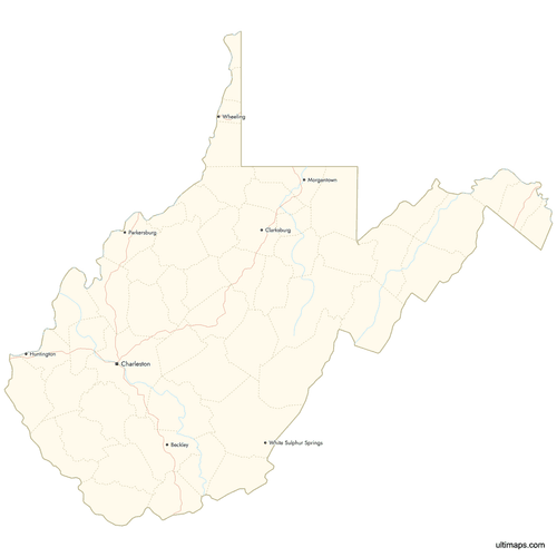 Map of West Virginia Counties with Citiespng708 KB
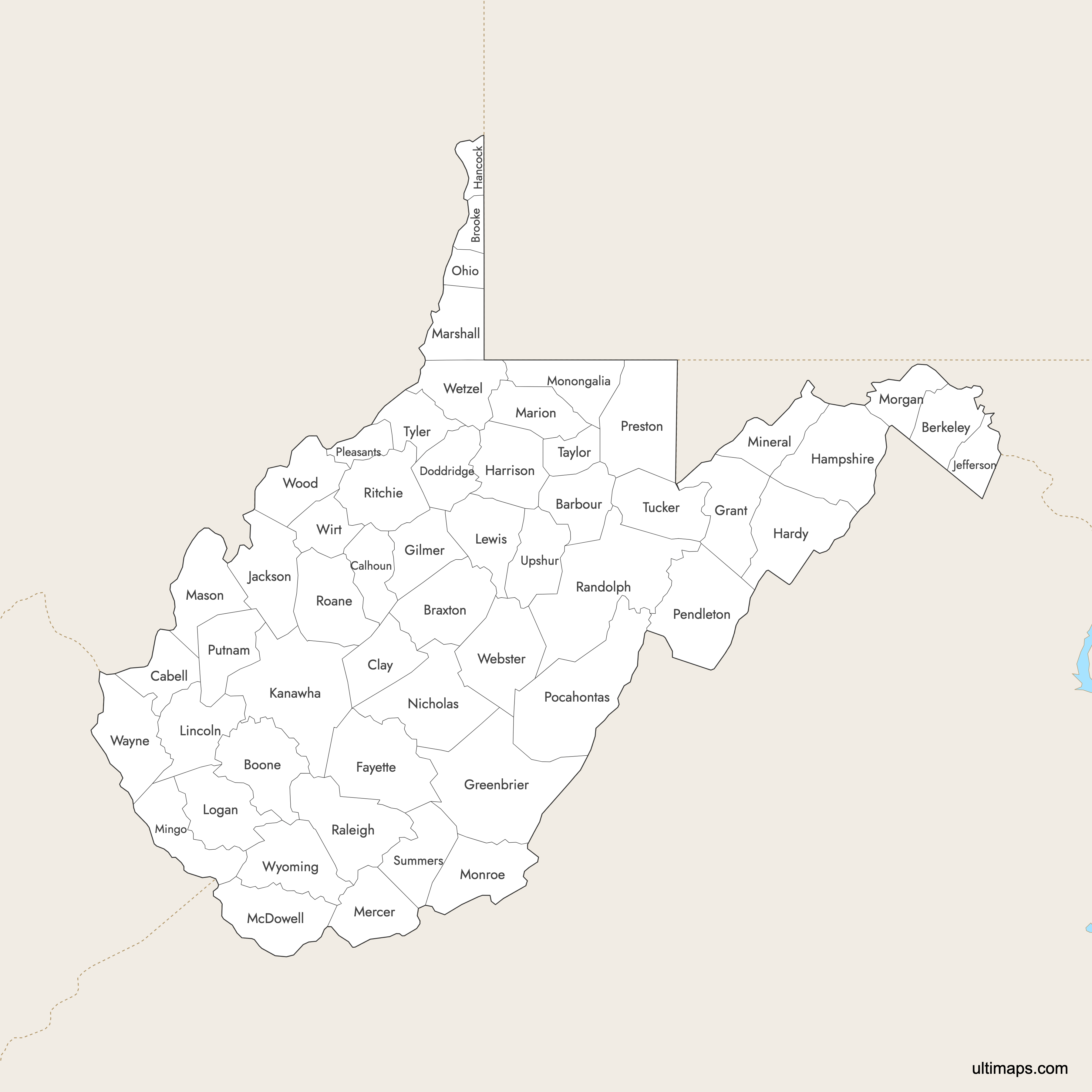
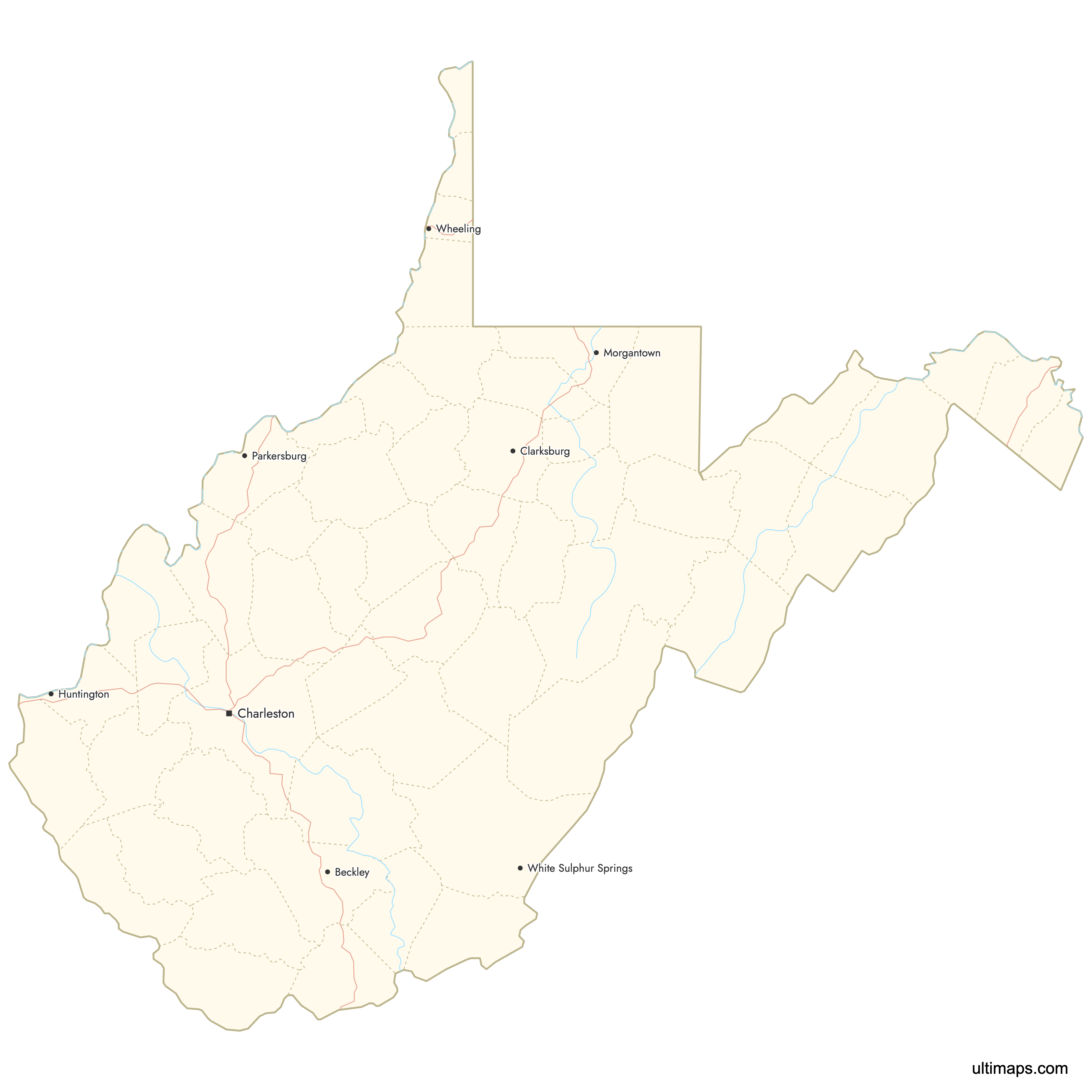
Need it without colors? The blank version of this map comes as a print-ready PDF (A4 and US Letter), a PNG and an editable SVG.
Custom Map Features
This map supports labels.
This map supports surrounding areas, roads, rivers and cities. New
This map is divided into 55 counties.
Updates
Sep 15, 2025:
- Improved map quality
- Added support for surrounding areas and lakes
Aug 26, 2024:
- Added map of West Virginia Counties
Frequently Asked Questions
West Virginia is divided into 55 counties.
Randolph County is the largest by area, covering 1,040 square miles (2,694 km²).
Kanawha County is the most populous with 173,906 residents as of 2024.
Initially, 50 counties seceded from Virginia during the Civil War in 1863. Five additional counties were formed later to accommodate growth and administrative needs.
You can use Ultimaps to create custom maps of West Virginia. Color-code counties manually or upload data, place pins, customize look and feel, and export to PNG, PDF, or SVG.