Map of United Arab Emirates
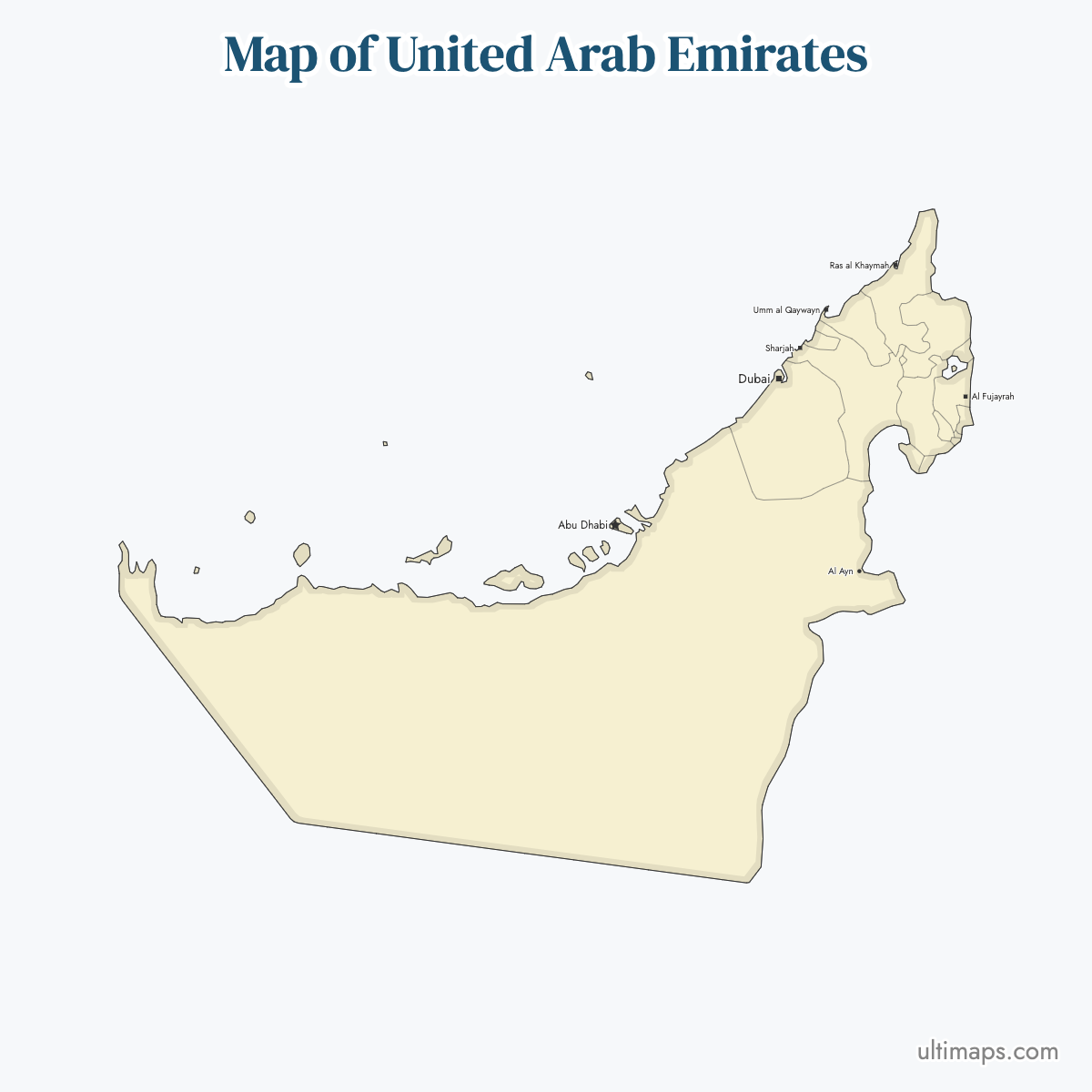
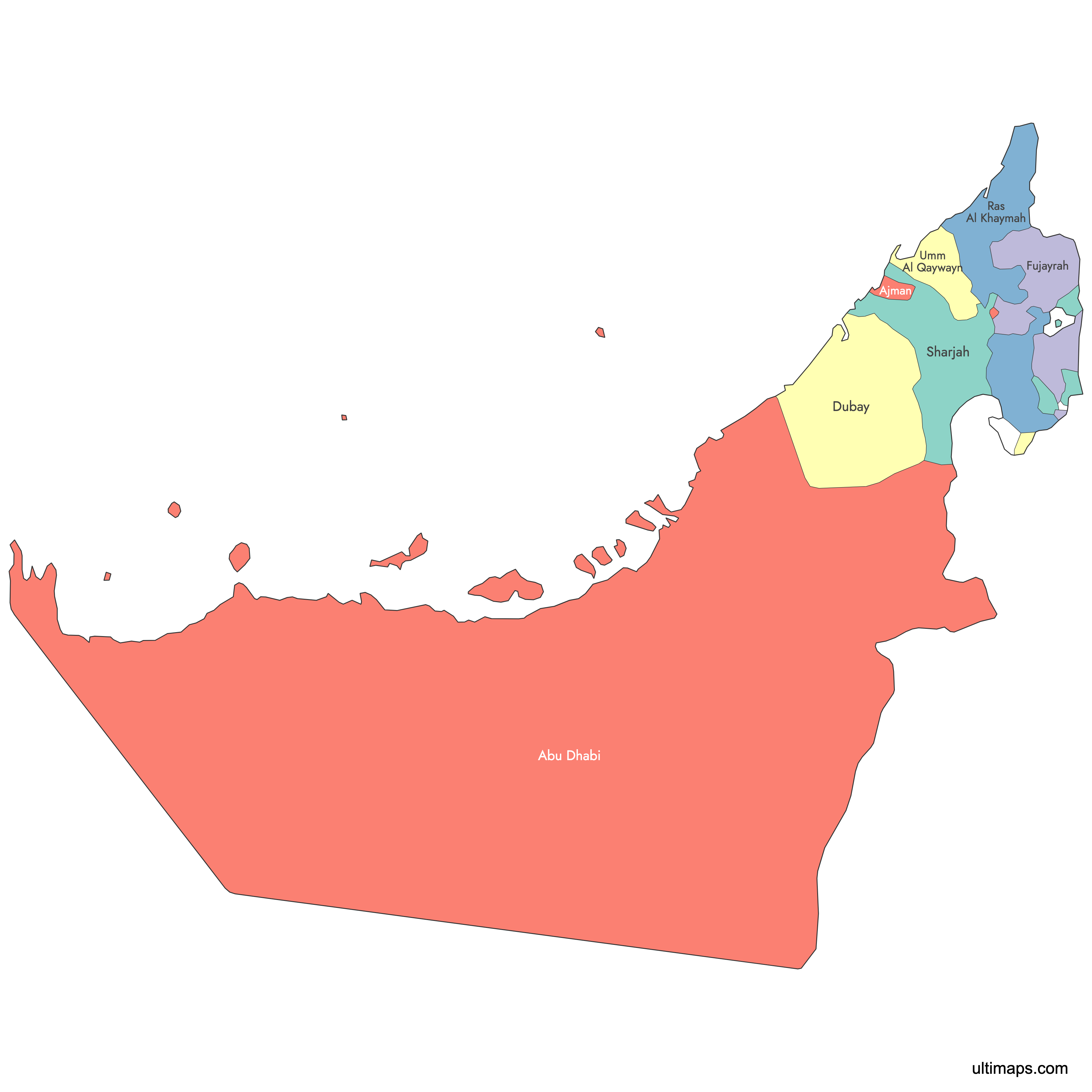
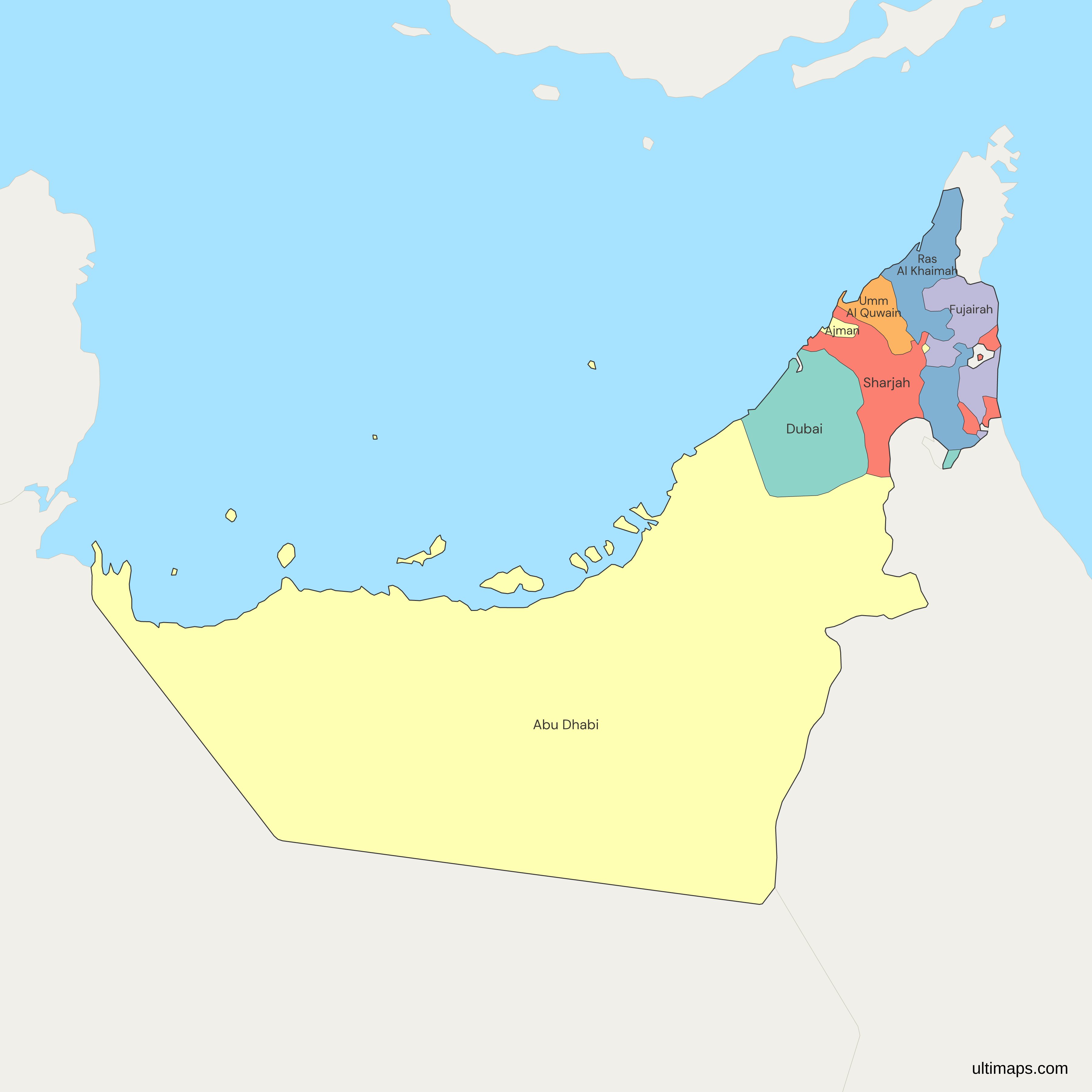
This UAE map shows the seven emirates of the United Arab Emirates: Abu Dhabi, Dubai, Sharjah, Ajman, Umm Al Quwain, Ras Al Khaimah and Fujairah. Abu Dhabi city is the federal capital, and the Emirate of Abu Dhabi covers 67,340 km² (26,000 sq mi), about 84% of the country by the government's own figure. Six emirates formed the federation on 2 December 1971, and Ras Al Khaimah joined on 10 February 1972.
Dubai is the most populous emirate, with about 4.58 million residents at the end of 2025 according to the Dubai Data and Statistics Establishment. Abu Dhabi followed with 4,135,985 in 2024, as counted by the Statistics Centre Abu Dhabi. Some emirates are split into separate pieces, so the map also shows Hatta, Dubai's exclave in the Hajar Mountains, and Sharjah's towns of Khor Fakkan and Kalba on the Gulf of Oman. You can color the 7 emirates by your own figures in the free editor.
Interactive Map of United Arab Emirates
List of Emirates (7)
| # | Emirate |
|---|---|
| 1 | Abu Dhabi |
| 2 | Ajman |
| 3 | Dubai |
| 4 | Fujairah |
| 5 | Ras Al Khaimah |
| 6 | Sharjah |
| 7 | Umm Al Quwain |
United Arab Emirates: Key Facts
- Political structure: federation of seven emirates, each led by its own ruler. The seven rulers form the Federal Supreme Council
- Capital city: Abu Dhabi
- Largest city: Dubai
- Total area: 71,023.6 km² (27,422 sq mi) of land including islands, per the Federal Competitiveness and Statistics Centre (FCSC)
- Largest emirate by area: Abu Dhabi, 67,340 km² (26,000 sq mi), about 84% of the country
- Smallest emirate by area: Ajman, 259 km² (100 sq mi)
- Most populous emirate: Dubai, about 4.58 million residents (end of 2025)
- Population: 11,294,243 (end of 2024, FCSC)
- Land boundaries: 1,066 km in total, with Oman (609 km) and Saudi Arabia (457 km), per the CIA World Factbook
- Coastline length: 1,318 km, on the Persian Gulf and the Gulf of Oman
- Neighboring states (land): Saudi Arabia, Oman
- Neighboring states (maritime): Iran, Qatar
- Disputed islands: Abu Musa and the Greater and Lesser Tunbs have been held by Iran since 1971 and are claimed by the UAE. They are not drawn as part of any emirate on this map
- Time zone: UTC+4 (Gulf Standard Time), with no daylight saving time
Interesting Facts
- Most residents live along the Persian Gulf coast between Abu Dhabi and Ras Al Khaimah. Al Ain, inland on the Omani border, is the main exception, with about 1 million people in Abu Dhabi's Al Ain Region in 2024.
- Sharjah is the only emirate with coastlines on both the Persian Gulf and the Gulf of Oman, through its east-coast towns of Khor Fakkan and Kalba.
- Fujairah is the only emirate located entirely on the Gulf of Oman coast, so its ports lie outside the Strait of Hormuz.
- Madha, a small part of Oman, is surrounded by UAE territory, and inside Madha lies Nahwa, a village that belongs to Sharjah.
- Dubai's Palm Jumeirah is an artificial island built from 2001, and its first residents moved in in 2007.
Free Downloads
Free for personal and commercial use with a credit to Ultimaps. See the license terms for details.
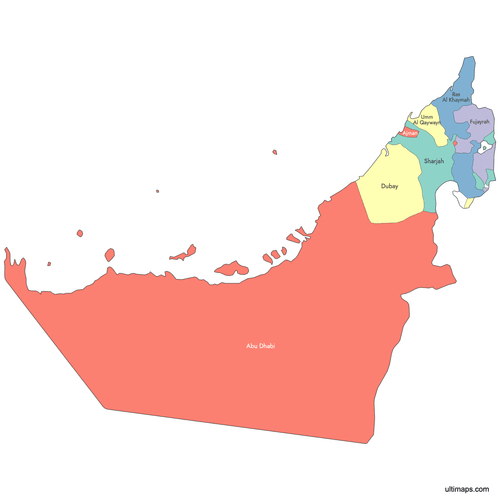 Colored Map of United Arab Emiratespng306 KB
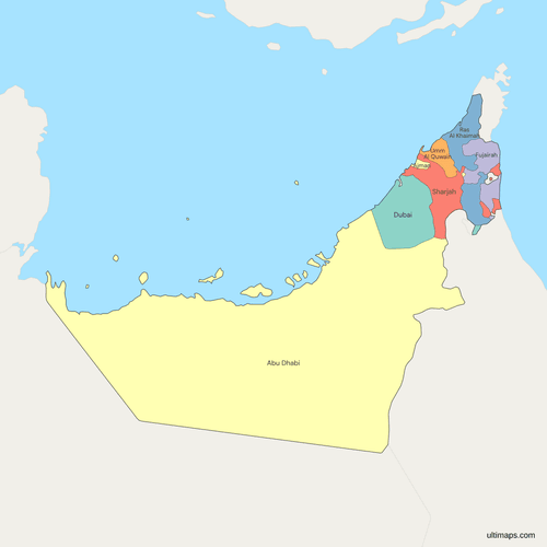 Political Map of UAE with Emiratespng374 KB
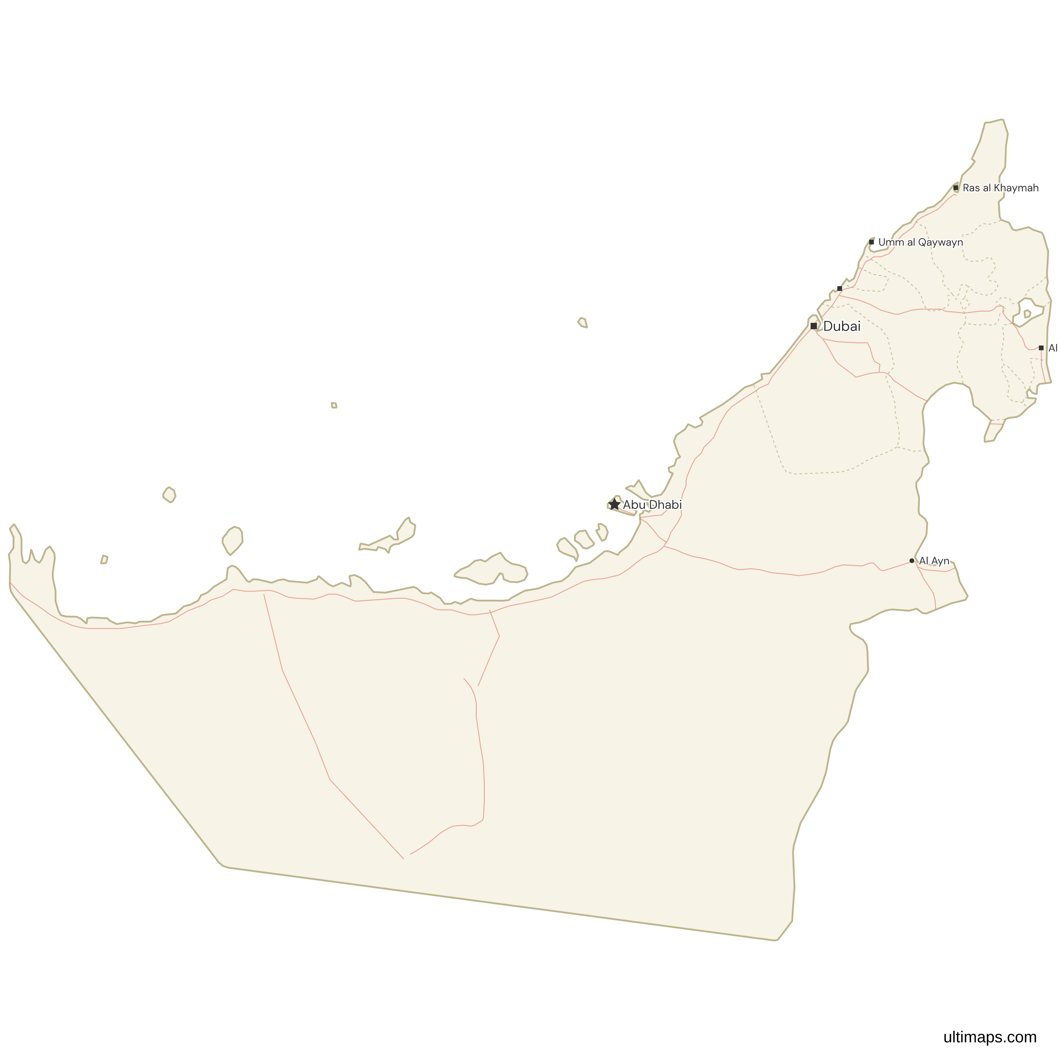
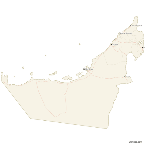 Map of UAE with Cities and Roadspng383 KB
Need it without colors? The blank version of this map comes as a print-ready PDF (A4 and US Letter), a PNG and an editable SVG.
Custom Map Features
This map supports labels.
This map supports surrounding areas, roads and cities. New
This map is divided into 7 emirates.
Updates
September 28, 2026:
- Updated border lengths, area and population figures
Sep 12, 2024:
- Added labeled version
Apr 14, 2024:
- Added map of UAE
Frequently Asked Questions
The United Arab Emirates is in the Middle East, on the southeastern edge of the Arabian Peninsula. Most of its coast faces the Persian Gulf, and a shorter eastern coast faces the Gulf of Oman. Saudi Arabia lies to the west and south, and Oman to the east. Oman's Musandam Peninsula, separated from the rest of Oman by UAE territory, sits at the northern tip on the Strait of Hormuz. Across the Gulf are Qatar to the west and Iran to the north. Abu Dhabi, the capital, is on an island off the Gulf coast, and Dubai lies about 140 km (87 mi) to the northeast.
The UAE has land borders with two countries. Oman is the longer, at 609 km (378 mi), and Saudi Arabia is 457 km (284 mi), for a total of 1,066 km, according to the CIA World Factbook. The Saudi border runs along Abu Dhabi's western and southern edges through the Rub' al Khali desert. The Omani border is more complex. It runs through the Hajar Mountains, splits around the Musandam Peninsula in the north and surrounds the Omani enclave of Madha. The UAE also has sea boundaries with Qatar and Iran.
The UAE has seven emirates: Abu Dhabi, Dubai, Sharjah, Ajman, Umm Al Quwain, Ras Al Khaimah and Fujairah. Each one's capital city shares its name. Six of them formed the federation on 2 December 1971. Ras Al Khaimah joined on 10 February 1972, which brought the count to seven. The emirates differ greatly in size. Abu Dhabi covers about 84% of the country, while Ajman, the smallest, covers 259 km² (100 sq mi). All seven are on this map, and the region list uses the same seven English names.
Abu Dhabi is the largest emirate by area, at 67,340 km² (26,000 sq mi). The UAE government puts its share at about 84% of the country. It covers the whole west and south of the UAE, including the Al Dhafra desert, the oasis city of Al Ain and many islands in the Persian Gulf. The Statistics Centre Abu Dhabi divides the emirate into three regions: Abu Dhabi Region, Al Ain Region and Al Dhafra Region. Dubai is the second largest emirate at 4,114 km² (1,588 sq mi), and Ajman is the smallest at 259 km² (100 sq mi).
Dubai has the most people of the seven emirates. The Dubai Data and Statistics Establishment reported about 4.58 million residents at the end of 2025. Abu Dhabi is second, with 4,135,985 residents in 2024, according to the Statistics Centre Abu Dhabi. Sharjah is third, with about 1.8 million in its 2022 census. Each emirate publishes its own figures, for different years, so compare them with care. The Federal Competitiveness and Statistics Centre counted 11,294,243 people in the whole UAE at the end of 2024. Umm Al Quwain is the least populous emirate, according to the UAE government portal.
The UAE has no states or provinces. Its constituent units are the seven emirates, and each one is ruled by its own hereditary ruler. The seven rulers sit on the Federal Supreme Council, the country's highest authority, which elects the President. By convention the President is the Ruler of Abu Dhabi. Mohamed bin Zayed has held the office since 14 May 2022. The emirates keep wide control over their own affairs, and some are divided further. Abu Dhabi, for example, has three regions. When a dataset lists UAE states, it means these seven emirates.
Several emirates have exclaves, pieces of territory that are separated from the rest of the emirate. Hatta belongs to Dubai but lies in the Hajar Mountains near the Omani border. Sharjah holds Khor Fakkan and Kalba on the Gulf of Oman coast, so it has coastlines on both seas. Ajman has small inland exclaves at Masfout and Manama. There is also Madha, a small part of Oman surrounded by UAE territory, which in turn surrounds Nahwa, a village that belongs to Sharjah. On this map, an emirate's exclaves are part of the same region, so a value you give Dubai also colors Hatta.
Open this UAE map in the Ultimaps editor. It runs in your browser, it is free and it needs no account. To group the emirates, pick a color for each one by hand, for example to set the east-coast emirate of Fujairah apart from the Gulf coast. To map a statistic, enter one value per emirate. The editor then colors the seven emirates on a scale with a legend. Exclaves such as Hatta take their emirate's color automatically. A free export is a standard PNG with a small Ultimaps credit. High-resolution PNG, SVG and PDF export are part of the Pro plan.