Qatar Municipalities Map
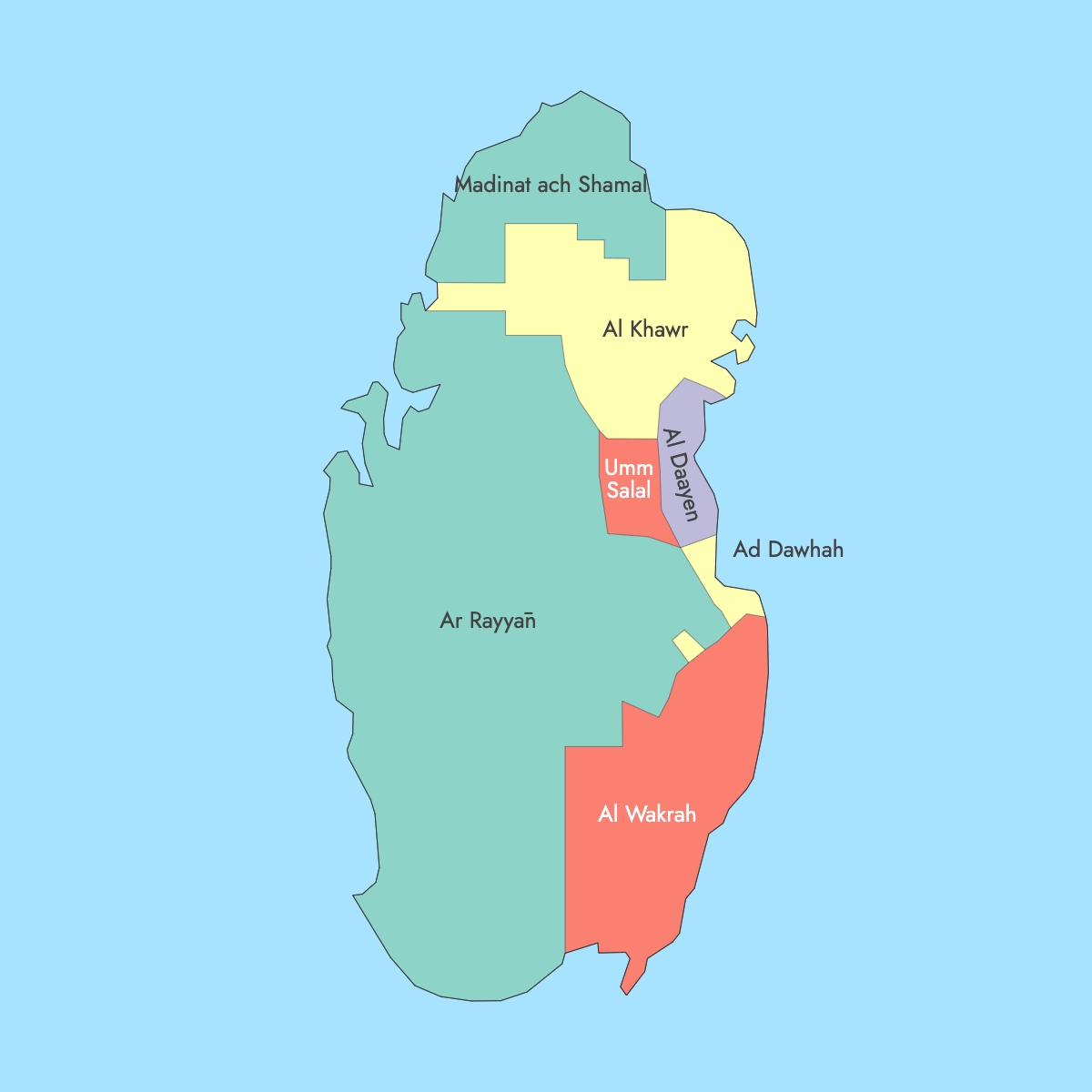
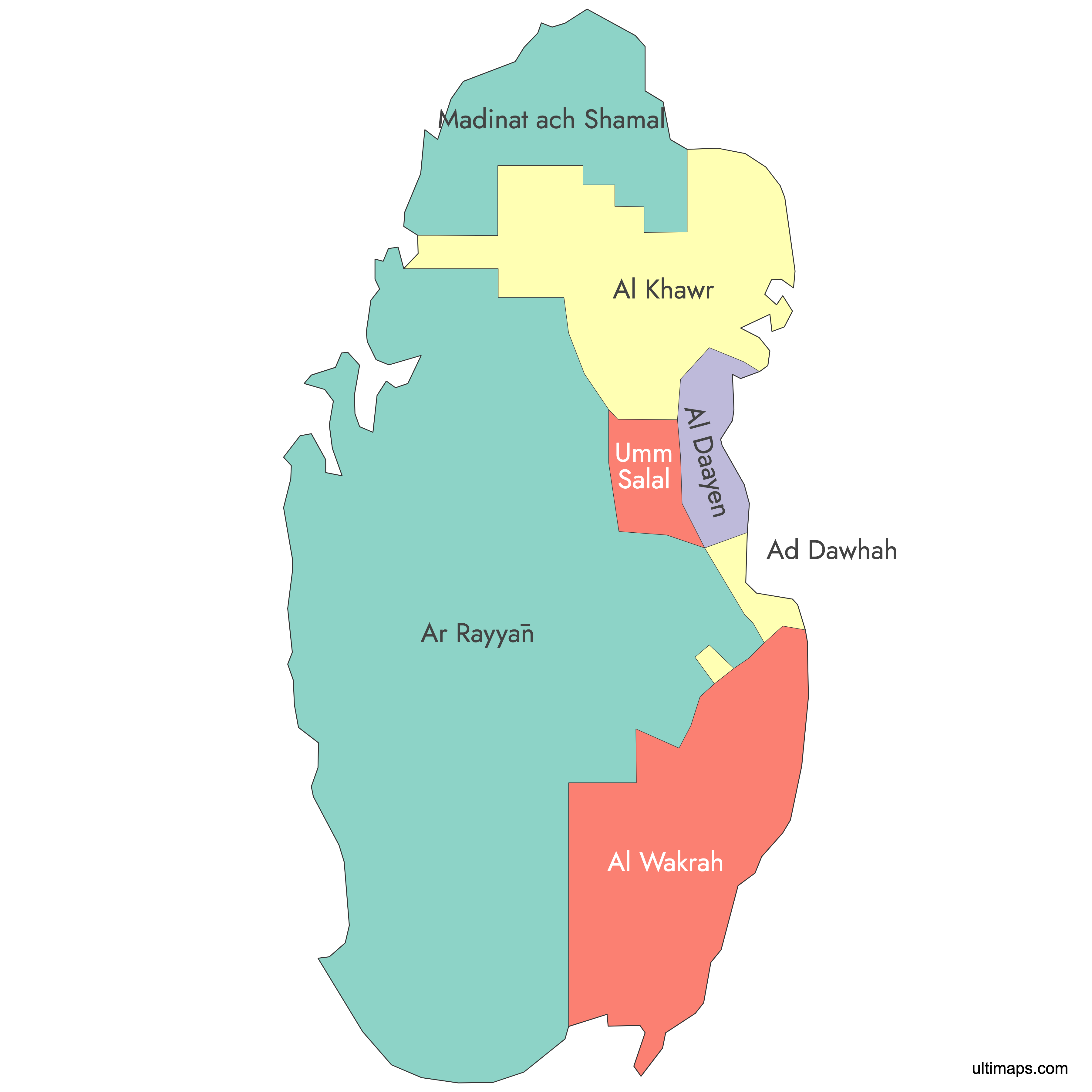
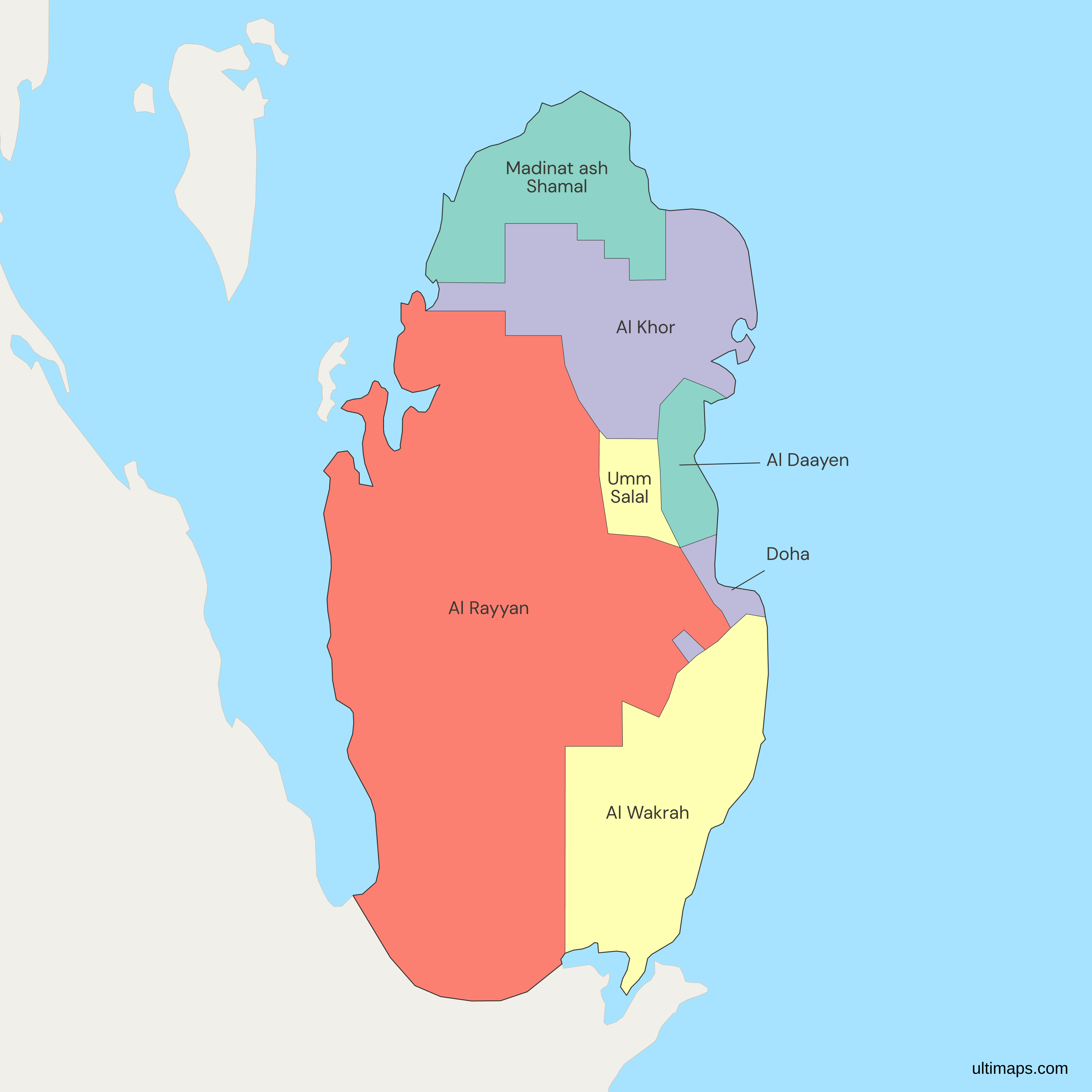
This map of Qatar's municipalities is drawn with 7 units: Al Daayen, Al Khor, Al Rayyan, Al Wakrah, Doha, Madinat ash Shamal (Al Shamal) and Umm Salal. Qatar's official count today is 8. The eighth, Al Shahaniya, was carved out of western Al Rayyan in 2014 and is not a separate shape here, so its territory in the central interior remains inside the Al Rayyan outline. The rest matches the structure left by the 2004 reorganization, which folded older units such as Al Ghuwariyah, Al Jumaliyah and Jariyan al Batnah into their neighbors, and by the 2006 absorption of Mesaieed into Al Wakrah.
Doha, the national capital, recorded 1,186,023 residents at the 2020 census from the Planning and Statistics Authority, about 42 percent of Qatar's 2,846,118 people. The capital is also the smallest municipality by land at 202.7 km² (78.3 sq mi). Al Shamal at the northern tip counted 16,730 residents at the 2020 census, the fewest of any municipality. To compare the municipalities with your own figures, color the 7 shapes in the free editor.
Interactive Qatar Municipalities Map
List of Municipalities (7)
Qatar Municipalities: Key Facts
- Municipalities on this map: 7 (Al Daayen, Al Khor, Al Rayyan, Al Wakrah, Doha, Madinat ash Shamal, Umm Salal)
- Official count today: 8 baladiyat. Al Shahaniya was separated from Al Rayyan in 2014 and is not drawn as its own unit here, so this map reflects the pre-2014 arrangement
- Most populous municipality: Doha, 1,186,023 people (2020 census), about 42 percent of the national 2,846,118
- Least populous municipality: Al Shamal, 16,730 people (2020 census), labeled Madinat ash Shamal on this map after its seat
- Largest municipality by area: Al Shahaniya, 3,309.0 km² (1,277.6 sq mi, 2015 municipality figures), about 28 percent of Qatar. Because it is not drawn separately here, the largest shape on this map is Al Rayyan at its pre-2014 extent
- Smallest municipality by area: Doha, 202.7 km² (78.3 sq mi, 2015 municipality figures)
- Country total: 11,621.1 km² (4,486.7 sq mi, 2015 municipality figures), 2,846,118 residents (2020 census)
- Major urban centers: Doha holds the capital and the largest urban core. Al Rayyan contains Education City and the western suburbs, Lusail sits in Al Daayen, and Al Wakrah, Al Khor and Umm Salal each have their own towns
- Municipality seats: Madinat ash Shamal (Al Shamal), Al Khor City, Al Shahaniya City, Umm Salal Ali, Umm Qarn (Al Daayen), Doha, Al Rayyan City and Al Wakrah
- Borders: one land neighbor, Saudi Arabia, across the southern frontier. The Persian Gulf, also called the Arabian Gulf, surrounds the peninsula on the other three sides, with maritime boundaries facing Bahrain, the UAE and Iran
- Time zone: Arabia Standard Time, UTC+3, with no daylight saving change
- Boundary history: the framework comes from the 2004 reorganization, adjusted twice since. Mesaieed was absorbed into Al Wakrah in 2006, leaving the 7 units drawn here, and Al Shahaniya was created from Al Rayyan in 2014, producing today's 8
- Lower tier: the municipalities are subdivided into 98 zones
Interesting Facts
- Doha holds 1,186,023 of Qatar's 2,846,118 residents (2020 census) in 202.7 km², making the smallest municipality by area the most populous.
- Al Shamal at the northern tip had 16,730 residents at the 2020 census, about 1.4 percent of Doha's total, and contains the Al Zubarah archaeological site, a UNESCO World Heritage property.
- Al Shahaniya's 3,309.0 km² (1,277.6 sq mi) makes it the biggest of the 8 official municipalities, yet its 2020 population was 161,240, far below Doha's.
- Al Daayen, created in the 2004 reorganization, counted 100,083 residents at the 2020 census. The planned city of Lusail sits on its coast.
Free Downloads
Free for personal and commercial use with a credit to Ultimaps. See the license terms for details.
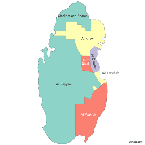 Colored Qatar Municipalities Mappng304 KB
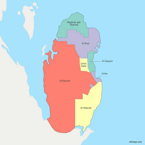 Political Map of Qatar with Municipalitiespng378 KB
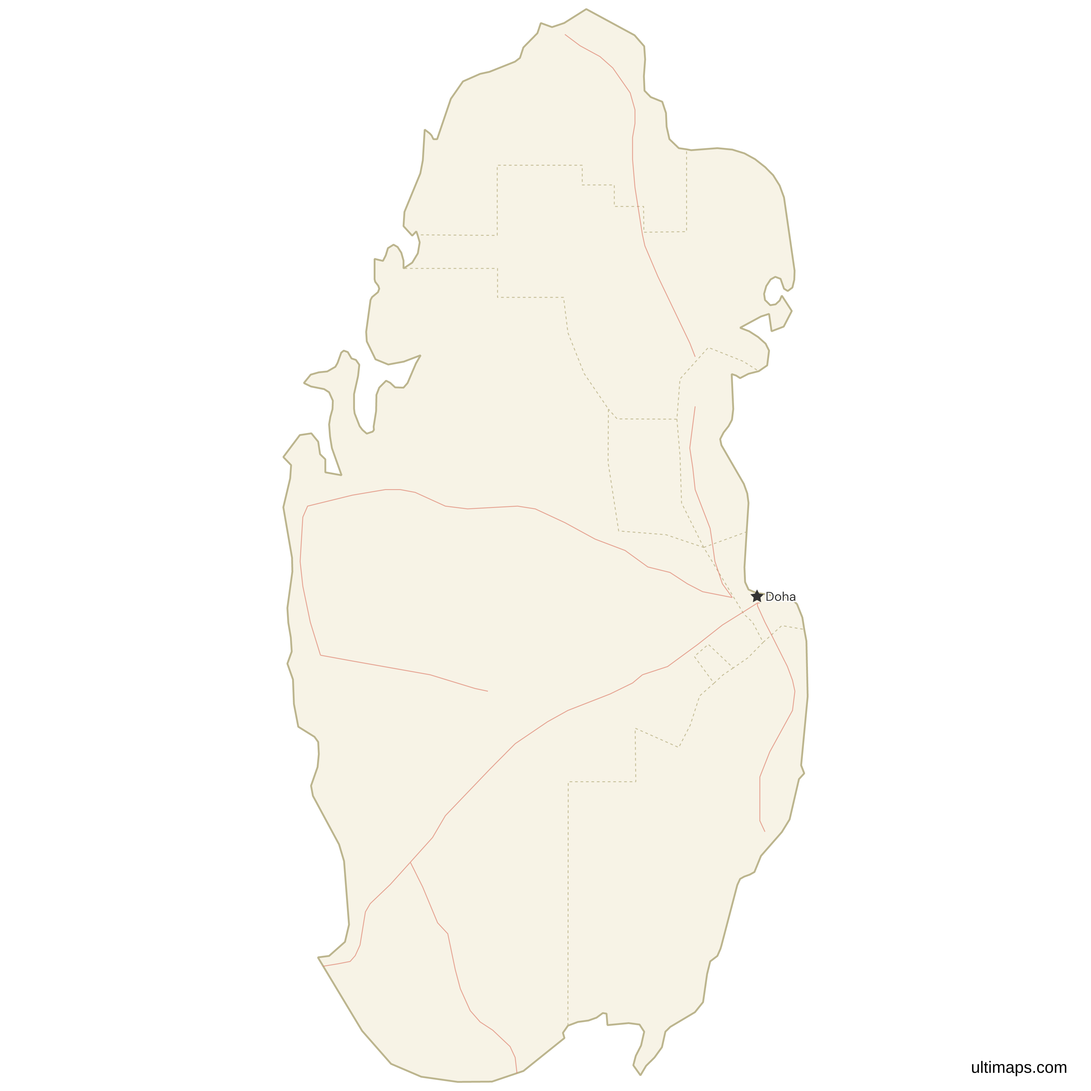
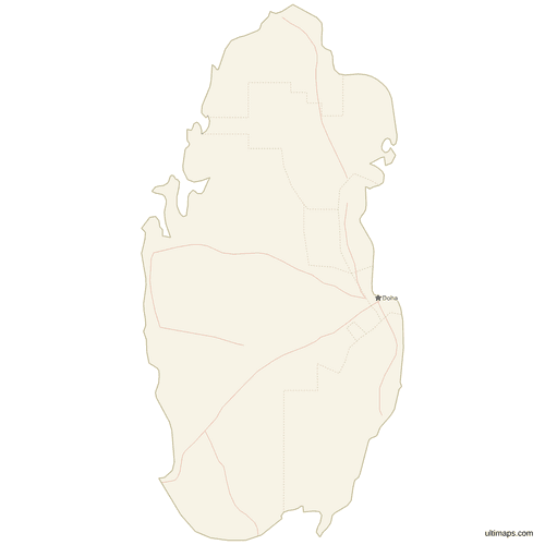 Map of Qatar with Cities and Roadspng345 KB
Need it without colors? The blank version of this map comes as a print-ready PDF (A4 and US Letter), a PNG and an editable SVG.
Custom Map Features
This map supports labels.
This map supports surrounding areas, roads and cities. New
This map is divided into 7 municipalities.
Updates
September 28, 2026:
- This map now replaces the earlier Qatar map at this address, with labels on all 7 municipalities
May 14, 2026:
- Added map of Qatar Municipalities with surrounding countries and cities
Frequently Asked Questions
Qatar has 8 municipalities, known in Arabic as baladiyat: Al Shamal, Al Khor, Al Shahaniya, Umm Salal, Al Daayen, Doha, Al Rayyan and Al Wakrah. The map on this page draws 7 of them, because Al Shahaniya, created in 2014 from western Al Rayyan, is not shown as a separate unit. Its territory is included in the Al Rayyan shape. Before 2014 the national count was 7, reached through the 2004 reorganization, which merged older municipalities including Al Ghuwariyah, Al Jumaliyah and Jariyan al Batnah, and the 2006 absorption of Mesaieed into Al Wakrah. Below the municipalities, Qatar is divided further into 98 zones.
This Qatar map shows 7 municipalities because it uses the boundaries in force before 2014, when Al Shahaniya was still part of Al Rayyan. Al Shahaniya became Qatar's eighth municipality in 2014, taking 3,309.0 km² (1,277.6 sq mi) of the central and western interior out of Al Rayyan. On this map that land is inside the Al Rayyan outline, which is why Al Rayyan is the largest drawn shape. The seven units are Al Daayen, Al Khor, Al Rayyan, Al Wakrah, Doha, Madinat ash Shamal and Umm Salal. The 2004 mergers of older municipalities are already reflected.
Al Shahaniya is the largest of Qatar's 8 municipalities by area, covering 3,309.0 km² (1,277.6 sq mi) according to 2015 municipality figures, roughly 28 percent of the country's 11,621.1 km² (4,486.7 sq mi). It stretches across the central and western interior and is far less populous than Doha. Since this map predates the 2014 split, Al Shahaniya has no outline of its own, and the largest shape drawn is Al Rayyan, which here spans both its current territory and Al Shahaniya's. At the other end, Doha is the smallest municipality at 202.7 km² (78.3 sq mi).
Doha is the most populated municipality in Qatar, with 1,186,023 residents at the 2020 census, about 42 percent of the national total of 2,846,118. It holds Doha city, the national capital, along with the Corniche, the Museum of Islamic Art and Hamad International Airport. Doha also has the smallest land area of any municipality at 202.7 km² (78.3 sq mi), so its population density is far above the rest of the country. Al Rayyan, immediately west, counted 826,786 residents in 2020 and covers much of the suburban metropolis, including Education City.
Qatar has neither provinces nor counties. Its first-level administrative divisions are municipalities, called baladiyat in Arabic, and there are 8 of them today, of which 7 appear on this map. Each municipality has an administrative seat: Doha, Al Rayyan City, Al Wakrah, Al Khor City, Umm Salal Ali, Umm Qarn and Madinat ash Shamal, plus Al Shahaniya City for the eighth unit. Beneath the municipalities the country is split into 98 zones, which are used for addressing and statistics. English-language sources sometimes translate baladiyat as municipalities, districts or governorates, but the units are the same.
Lusail lies in Al Daayen municipality, immediately north of Doha along the coast. Al Daayen is administered from Umm Qarn and covers the strip of coastal development that runs from the Doha boundary northward. Lusail is Qatar's planned city, built from scratch on this stretch, and Lusail Stadium there hosted the final of the 2022 FIFA World Cup. Al Daayen appears on this map as one of the 7 municipality shapes. Other landmarks fall elsewhere: Education City is in Al Rayyan, the Al Wakrah Souq is in Al Wakrah, and Al Zubarah is in Al Shamal.
Two dates matter for Qatar's municipal boundaries. A 2004 reorganization consolidated the map, merging Al Ghuwariyah, Al Jumaliyah and Jariyan al Batnah into neighboring units and creating Al Daayen. Mesaieed followed in 2006, absorbed into Al Wakrah, which left the 7 municipalities this map draws. The second date is 2014, when Al Shahaniya was separated from Al Rayyan as the eighth municipality, with Al Shahaniya City as its seat. A dataset with 8 rows therefore includes Al Shahaniya, whose territory appears inside Al Rayyan on this page.
Open this Qatar map in the Ultimaps editor, which runs in the browser and is free to use without an account. You can color each of the 7 municipalities by hand, for example to set Doha and Al Rayyan apart from the rural north, or load one figure per municipality to build a data map with a legend. If your data has 8 rows, the Al Shahaniya row has no shape of its own here, so add its value to Al Rayyan or leave it out. A free export is a standard PNG with a small Ultimaps credit. High-resolution PNG, SVG and PDF export are part of the Pro plan.