US, Canada and Mexico Map with States and Provinces
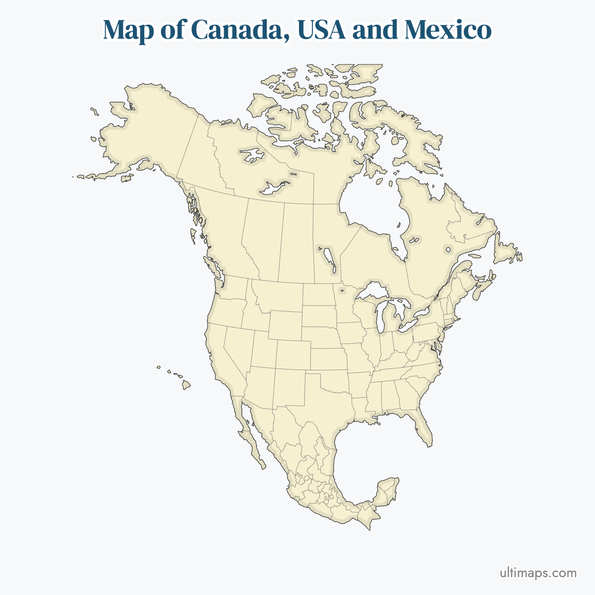
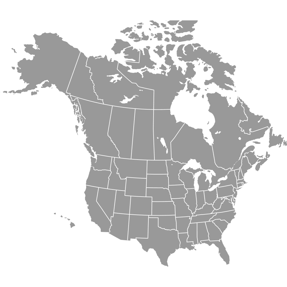
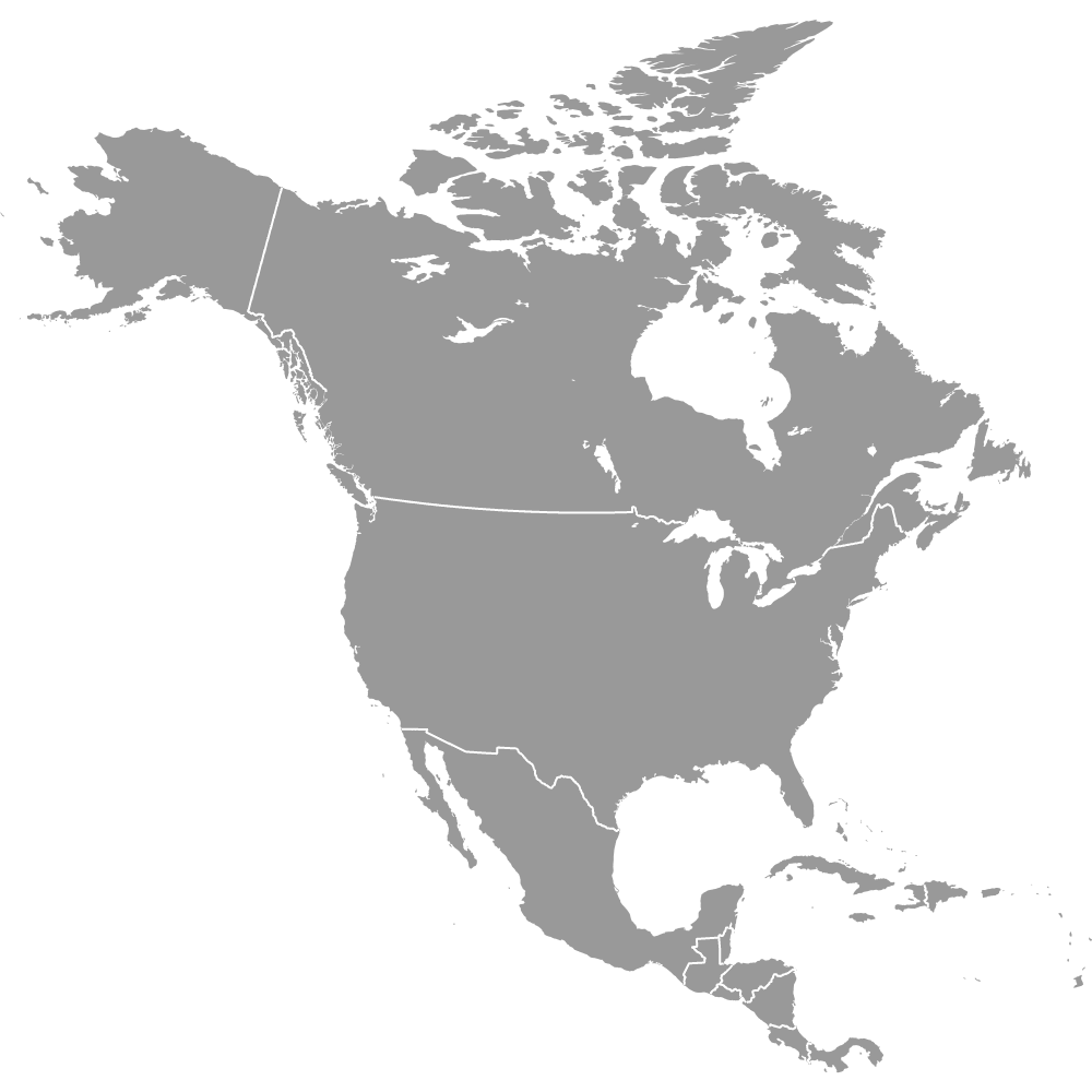
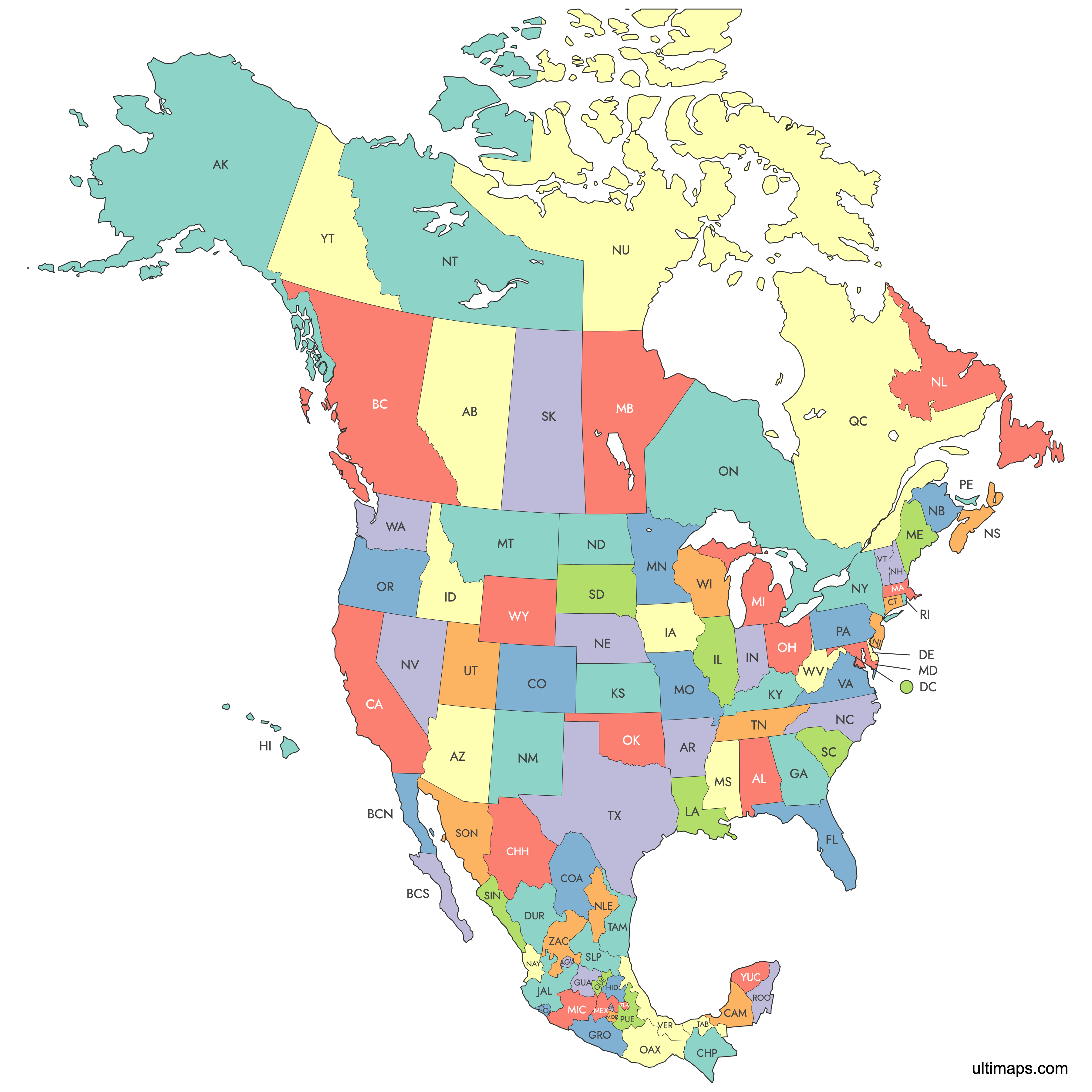
The United States, Canada and Mexico together contain 96 first-level administrative divisions: 50 U.S. states plus the District of Columbia, 10 Canadian provinces and 3 territories, and 32 Mexican federal entities (31 states and Mexico City). Each of the 96 is a separate shape on the US, Canada and Mexico map below. Mexico City is listed there under its pre-2016 name, Distrito Federal. The three national capitals are Washington, D.C., Ottawa and Mexico City.
California has the most residents of any region, with 39,538,223 in the 2020 U.S. Census. Statistics Canada gives Nunavut a total area of 2,093,190 km² (808,185 sq mi), which makes it the largest region. Its 36,858 residents in Canada's 2021 Census also make it the least populous. Four U.S. states and six Mexican states meet along the U.S.-Mexico border, which the International Boundary and Water Commission measures at 1,954 miles (3,145 km). You can color the regions from a spreadsheet in the free editor.
Interactive US, Canada and Mexico Map with States and Provinces
List of States/Provinces (96)
US, Canada and Mexico: Key Facts
- Total regions on the map: 96 (51 U.S. + 13 Canadian + 32 Mexican).
- United States: 50 states and the District of Columbia. The capital is Washington, D.C., and the most populous state is California, with 39,538,223 residents (2020 U.S. Census). See the United States map.
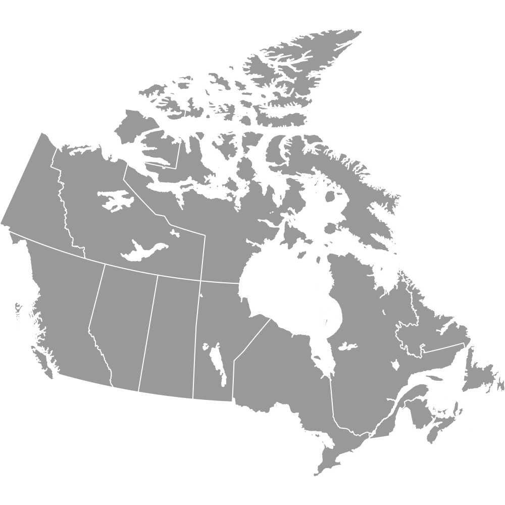
- Canada: 10 provinces and 3 territories. The capital is Ottawa, in Ontario, and the most populous province is Ontario, with 14,223,942 residents (2021 Census). See the Canada map.
- Mexico: 31 states and Mexico City. The capital is Mexico City, and the most populous state is the State of Mexico (Estado de México), with 16,992,418 residents (INEGI, 2020 Census). See the Mexico map.
- Largest region by area: Nunavut, at 2,093,190 km² of total area (808,185 sq mi) according to Statistics Canada. It is also the least populous region, with 36,858 residents (2021 Census).
- Smallest region by area: the District of Columbia, at 68 square miles (177 km²) (U.S. Census Bureau, 2010). Rhode Island is the smallest U.S. state at 1,545 square miles (4,001 km²) (U.S. Census Bureau, 2010), and Prince Edward Island is the smallest province at 5,660 km² (2,185 sq mi) (Statistics Canada). Tlaxcala is the smallest Mexican state. Mexico City, which is not a state, is smaller than Tlaxcala.
- Bordering Countries: The United States borders Canada to the north and Mexico to the south. On the mainland, Canada borders the United States alone. A 2022 agreement that took effect in December 2023 divided Hans Island, which gave Canada a short land boundary with Greenland (Denmark). Mexico borders the United States, Guatemala and Belize.
- Border length: The U.S.-Canada border runs about 5,525 miles (8,891 km), counting the Alaska section. It is the longest international border in the world, counting its water sections.
How States, Provinces and Territories Differ
- U.S. states vs the District of Columbia: States hold powers under the U.S. Constitution. The District of Columbia is a federal district under the authority of Congress. It is part of no state and sends a non-voting delegate to the House.
- Canadian provinces vs territories: Provinces get their powers directly from the Constitution Act, 1867. Yukon, the Northwest Territories and Nunavut use powers that the federal Parliament delegates to them.
- Mexican states vs Mexico City: Each of the 31 states has its own constitution and is divided into municipalities. Mexico City is the seat of the federal government. Its own constitution, adopted after the 2016 reform, took effect in 2018, and it is divided into 16 alcaldías.
Along the Borders
- U.S. states on the Canadian border (13): Alaska, Washington, Idaho, Montana, North Dakota, Minnesota, Michigan, Ohio, Pennsylvania, New York, Vermont, New Hampshire and Maine. The Ohio and Pennsylvania sections run through Lake Erie.
- Canadian provinces and territories on the U.S. border (8): Yukon, British Columbia, Alberta, Saskatchewan, Manitoba, Ontario, Québec and New Brunswick. Yukon and British Columbia border Alaska.
- U.S. states on the Mexican border (4): California, Arizona, New Mexico and Texas. The Texas section follows the Rio Grande, which Mexico calls the Río Bravo del Norte.
- Mexican states on the U.S. border (6): Baja California, Sonora, Chihuahua, Coahuila, Nuevo León and Tamaulipas.
- No overlap: No U.S. state borders both Canada and Mexico.
- Point Roberts, Washington: This community sits at the tip of the Tsawwassen peninsula, south of the 49th parallel. By land, you can reach it from the rest of the United States only through British Columbia.
- Northwest Angle, Minnesota: This area on Lake of the Woods is the northernmost point of the contiguous United States. Its only road access runs through Manitoba.
Mapping Data Across Three Countries
- Match rows by code, not by name: ISO 3166-2 codes such as US-TX, CA-ON and MX-JAL are unique across all three countries. Names are not.
- Check names that are easy to confuse: California and Baja California (and Baja California Sur) are different regions. So are New Mexico, the State of Mexico (titled "México" on this map) and Mexico the country. Accents also vary between sources in Québec, Nuevo León, Michoacán, Querétaro, Yucatán and San Luis Potosí.
- Mexico City's label: This map lists Mexico City as Distrito Federal (MX-DIF). Newer datasets use Ciudad de México and the code MX-CMX, so check that row before you map.
- Use one currency and relative figures: Convert USD, CAD and MXN at a single date's exchange rate. Regions range from 177 km² to more than 2 million km², so per-capita figures and rates compare better than raw totals.
- Note the census years: The U.S. and Mexico held censuses in 2020, and Canada held one in 2021. Put the years in your legend or source line.
Interesting Facts
- Nunavut's total area of 2,093,190 km² (Statistics Canada), including lakes and rivers, is larger than all of Mexico, which INEGI measures at 1,964,375 km².
- California's 2020 Census population of 39,538,223 is higher than Canada's 2021 Census total of 36,991,981.
- Mexico's official name is Estados Unidos Mexicanos (United Mexican States). That makes two of the three countries federations named "United States".
- Nunavut split from the Northwest Territories on 1 April 1999. Baja California Sur and Quintana Roo, the newest Mexican states, gained statehood in 1974.
Free Downloads
Free for personal and commercial use with a credit to Ultimaps. See the license terms for details.
Need it without colors? The blank version of this map comes as a print-ready PDF (A4 and US Letter), a PNG and an editable SVG.
Custom Map Features
This map supports labels.
This map is divided into 96 states/provinces.
Updates
Feb 7, 2025:
- Added map of Canada, USA and Mexico states/provinces
Frequently Asked Questions
The US, Canada and Mexico map has 96 regions. The United States accounts for 51: its 50 states plus the District of Columbia, which is part of no state. Canada accounts for 13: 10 provinces and 3 territories (Yukon, the Northwest Territories and Nunavut). Mexico accounts for 32 federal entities, which are 31 states and Mexico City. Puerto Rico, Guam and the other U.S. overseas territories are not among the 96. They appear on the United States with Outlying Territories map.
Mexico has 31 states, and Mexico City is not one of them. Together they make 32 federal entities. Until 2016 the capital was the Distrito Federal, a federal district. A constitutional reform published on 29 January 2016 renamed it Ciudad de México and allowed it to adopt its own constitution, which took effect in 2018. Mexico City is divided into 16 alcaldías instead of municipalities, and INEGI's 2020 Census counted 9,209,944 residents. On this map it appears under its older name, Distrito Federal, with the code MX-DIF. Its current ISO 3166-2 code is MX-CMX. The State of Mexico, a separate entity, is titled "México" on the map.
Four U.S. states border Mexico: California, Arizona, New Mexico and Texas. On the Mexican side, six states border the United States: Baja California, Sonora, Chihuahua, Coahuila, Nuevo León and Tamaulipas. The International Boundary and Water Commission measures the border at 1,954 miles (3,145 km). The Texas section follows the Rio Grande, called the Río Bravo del Norte in Mexico, and Texas borders four Mexican states: Chihuahua, Coahuila, Nuevo León and Tamaulipas. The busiest twin-city pairs on the border include San Diego and Tijuana, and El Paso and Ciudad Juárez. Texas had 29,145,505 residents in the 2020 U.S. Census, second only to California among the four U.S. border states.
Thirteen U.S. states border Canada: Alaska, Washington, Idaho, Montana, North Dakota, Minnesota, Michigan, Ohio, Pennsylvania, New York, Vermont, New Hampshire and Maine. The Ohio and Pennsylvania sections run through Lake Erie, and much of the Michigan section follows the Great Lakes and connecting rivers. Alaska borders Yukon and British Columbia. Eight Canadian provinces and territories are on the border: Yukon, British Columbia, Alberta, Saskatchewan, Manitoba, Ontario, Québec and New Brunswick. The border runs about 5,525 miles (8,891 km), making it the longest international border in the world, counting its water sections. If you only need the two northern countries, use the United States and Canada map.
No U.S. state borders both Canada and Mexico. The 13 states on the Canadian border and the 4 states on the Mexican border are separate groups, with other states between them. On the Pacific coast, for example, Oregon lies between Washington, which borders British Columbia, and California, which borders Baja California. Alaska borders Canada alone, and Texas borders Mexico alone. As a result, a trip over land from Canada to Mexico always crosses at least three U.S. states: one on the northern border, one or more in the interior and one on the southern border. Canada and Mexico share no border with each other.
Nunavut is the largest of the 96 regions by total area, at 2,093,190 km² (808,185 sq mi), according to Statistics Canada. Alaska is the largest U.S. state at 665,384 square miles (1,723,337 km²) (U.S. Census Bureau, 2010), and Québec is the largest Canadian province at 1,542,056 km² (Statistics Canada). California is the most populous region, with 39,538,223 residents in the 2020 U.S. Census. Los Angeles is its largest city. The State of Mexico (16,992,418, INEGI 2020 Census) and Ontario (14,223,942, 2021 Census) have the most residents in their own countries. Nunavut has the fewest residents of all 96, with 36,858 in 2021.
To combine data from the United States, Canada and Mexico in one map, key every row by its ISO 3166-2 code, such as US-TX, CA-QC or MX-NLE. Codes are unique across the three countries, while names such as California and Baja California are easy to confuse. This map lists Mexico City as Distrito Federal (MX-DIF), and newer sources use MX-CMX. Convert U.S. dollars, Canadian dollars and Mexican pesos to one currency at a single date's rate. Use per-capita values or rates, because the District of Columbia covers 177 km² and Nunavut more than 2 million km². Note the census years too: 2020 for the U.S. and Mexico, 2021 for Canada.
The US, Canada and Mexico map covers exactly the three members of the United States-Mexico-Canada Agreement (USMCA), so you can use it to show trade figures by state or province. USMCA entered into force on 1 July 2020 and replaced NAFTA, which had applied since 1 January 1994. Canada calls the agreement CUSMA (Canada-United States-Mexico Agreement), and Mexico calls it T-MEC (Tratado entre México, Estados Unidos y Canadá). The map itself shows political divisions and has no trade data. You add figures such as exports per state, border-crossing counts or trade with each partner country yourself.
A custom US, Canada and Mexico map starts from the interactive map at the top of this page. The editor is free and does not require an account. For a category map, pick a color for each region, for example one color per country or one for the ten states along the U.S.-Mexico border. For a data map, supply one number per region, and the editor colors the 96 regions on a scale with a legend. Ports of entry such as Laredo can go on as pins. Free exports are standard PNG files with a small Ultimaps credit. High-resolution PNG, SVG and PDF require Pro.