Map of Washington Counties
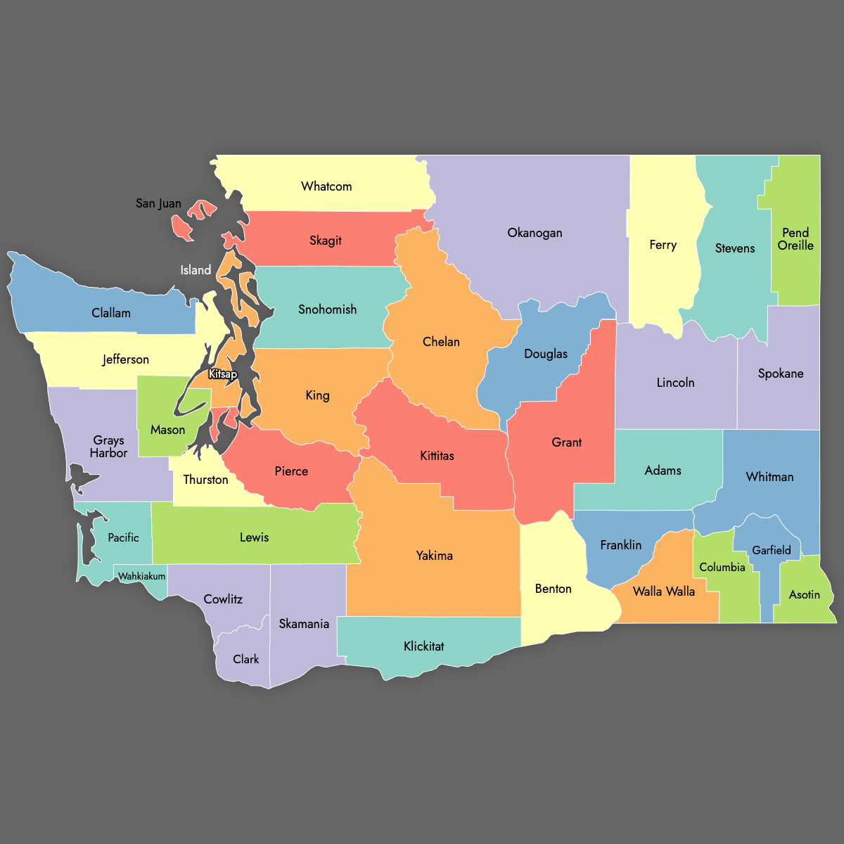
Washington is divided into 39 counties. Use the interactive maps below to explore Washington's counties and their boundaries. Download free maps or learn more about creating a custom map of Washington to visualize your own data.
Interactive Map of Washington Counties
List of Counties (39)
| # | County | County seat | Year founded |
|---|---|---|---|
| 1 | Adams | Ritzville | 1883 |
| 2 | Asotin | Asotin | 1883 |
| 3 | Benton | Prosser | 1905 |
| 4 | Chelan | Wenatchee | 1899 |
| 5 | Clallam | Port Angeles | 1854 |
| 6 | Clark | Vancouver | 1845 |
| 7 | Columbia | Dayton | 1875 |
| 8 | Cowlitz | Kelso | 1854 |
| 9 | Douglas | Waterville | 1883 |
| 10 | Ferry | Republic | 1899 |
| 11 | Franklin | Pasco | 1883 |
| 12 | Garfield | Pomeroy | 1881 |
| 13 | Grant | Ephrata | 1909 |
| 14 | Grays Harbor | Montesano | 1854 |
| 15 | Island | Coupeville | 1852 |
| 16 | Jefferson | Port Townsend | 1852 |
| 17 | King | Seattle | 1852 |
| 18 | Kitsap | Port Orchard | 1857 |
| 19 | Kittitas | Ellensburg | 1883 |
| 20 | Klickitat | Goldendale | 1859 |
| 21 | Lewis | Chehalis | 1845 |
| 22 | Lincoln | Davenport | 1883 |
| 23 | Mason | Shelton | 1854 |
| 24 | Okanogan | Okanogan | 1888 |
| 25 | Pacific | South Bend | 1851 |
| 26 | Pend Oreille | Newport | 1911 |
| 27 | Pierce | Tacoma | 1852 |
| 28 | San Juan | Friday Harbor | 1873 |
| 29 | Skagit | Mount Vernon | 1883 |
| 30 | Skamania | Stevenson | 1854 |
| 31 | Snohomish | Everett | 1861 |
| 32 | Spokane | Spokane | 1879 |
| 33 | Stevens | Colville | 1863 |
| 34 | Thurston | Olympia | 1852 |
| 35 | Wahkiakum | Cathlamet | 1854 |
| 36 | Walla Walla | Walla Walla | 1854 |
| 37 | Whatcom | Bellingham | 1854 |
| 38 | Whitman | Colfax | 1871 |
| 39 | Yakima | Yakima | 1865 |
Washington Counties: Key Facts
- Total number of counties: 39
- Total state area: 71,362 square miles (184,827 km²)
- Largest county by land area: Okanogan County - 5,268 square miles (13,647 km²)
- Smallest county by land area: San Juan County - 174 square miles (451 km²)
- Most populous county: King County (Seattle) - 2,269,675 residents
- Least populous county: Garfield County - 2,404 residents
- Major urban centers: Seattle (King County), Tacoma (Pierce County), Spokane (Spokane County)
- State capital: Olympia (Thurston County)
- Timezone: Pacific Time
- Neighboring states and borders: Idaho, Oregon, and British Columbia (Canada)
Interesting and Fun Facts
- Island-only counties: San Juan and Island Counties consist entirely of islands
- Least-dense county: Garfield County with a density of 3.4 people per square mile
- Economic diversity: King County is a tech hub, while Yakima County is known for agriculture
Free Downloads
Free for personal and commercial use with a credit to Ultimaps. See the license terms for details.
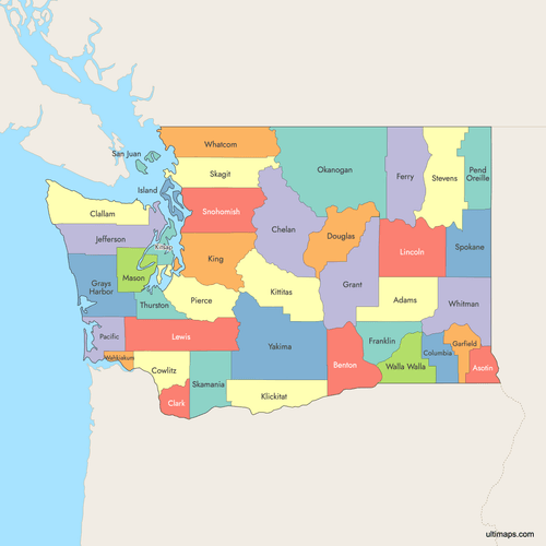 Colored Map of Washington Counties with Surrounding Areaspng757 KB
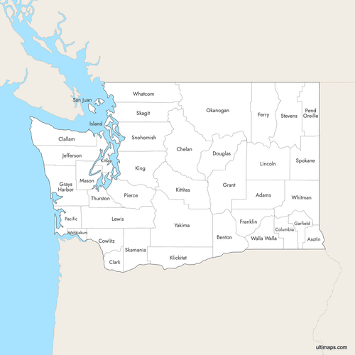 Labeled Map of Washington Counties with Surrounding Areaspng742 KB
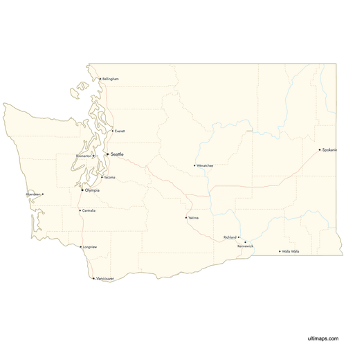 Map of Washington Counties with Citiespng643 KB
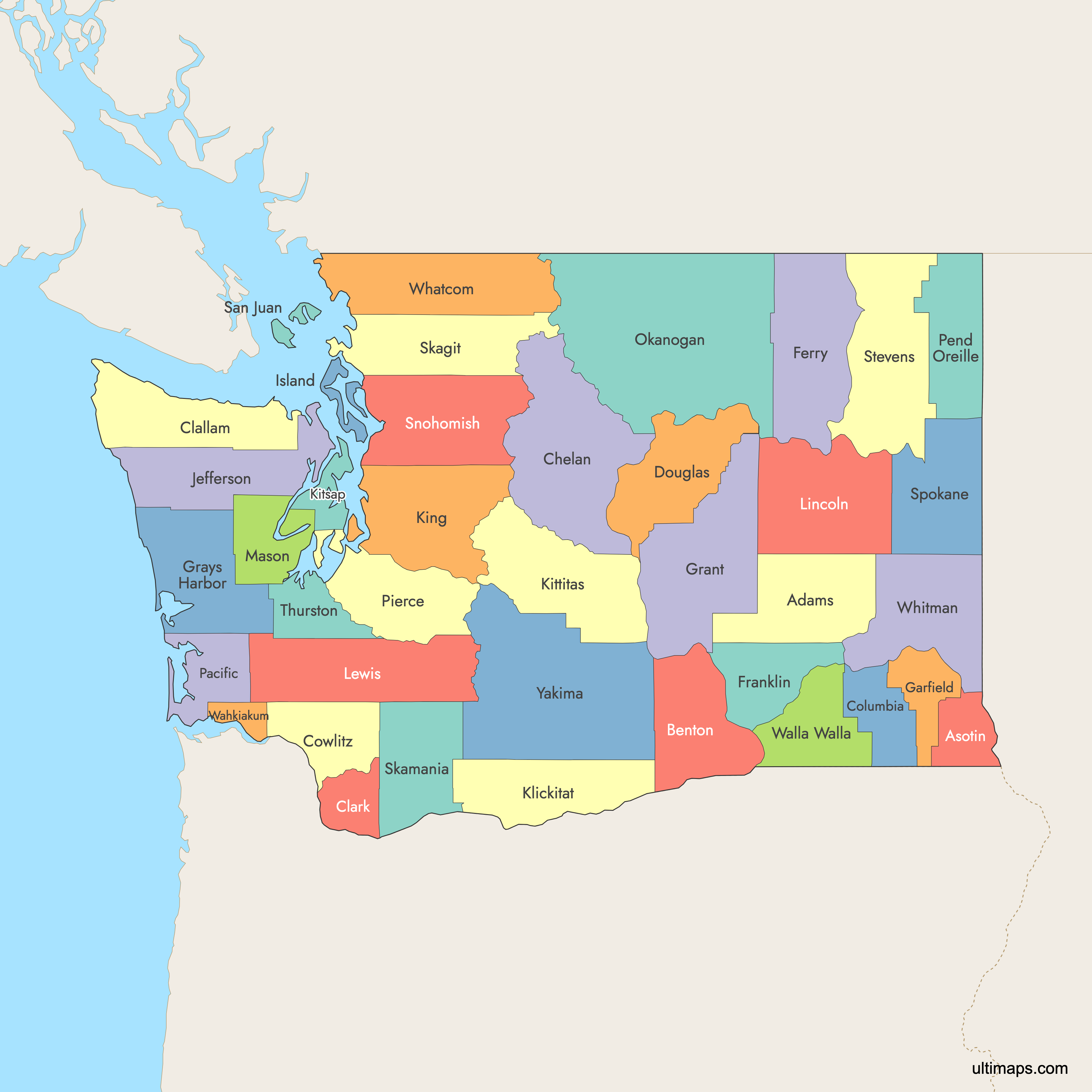
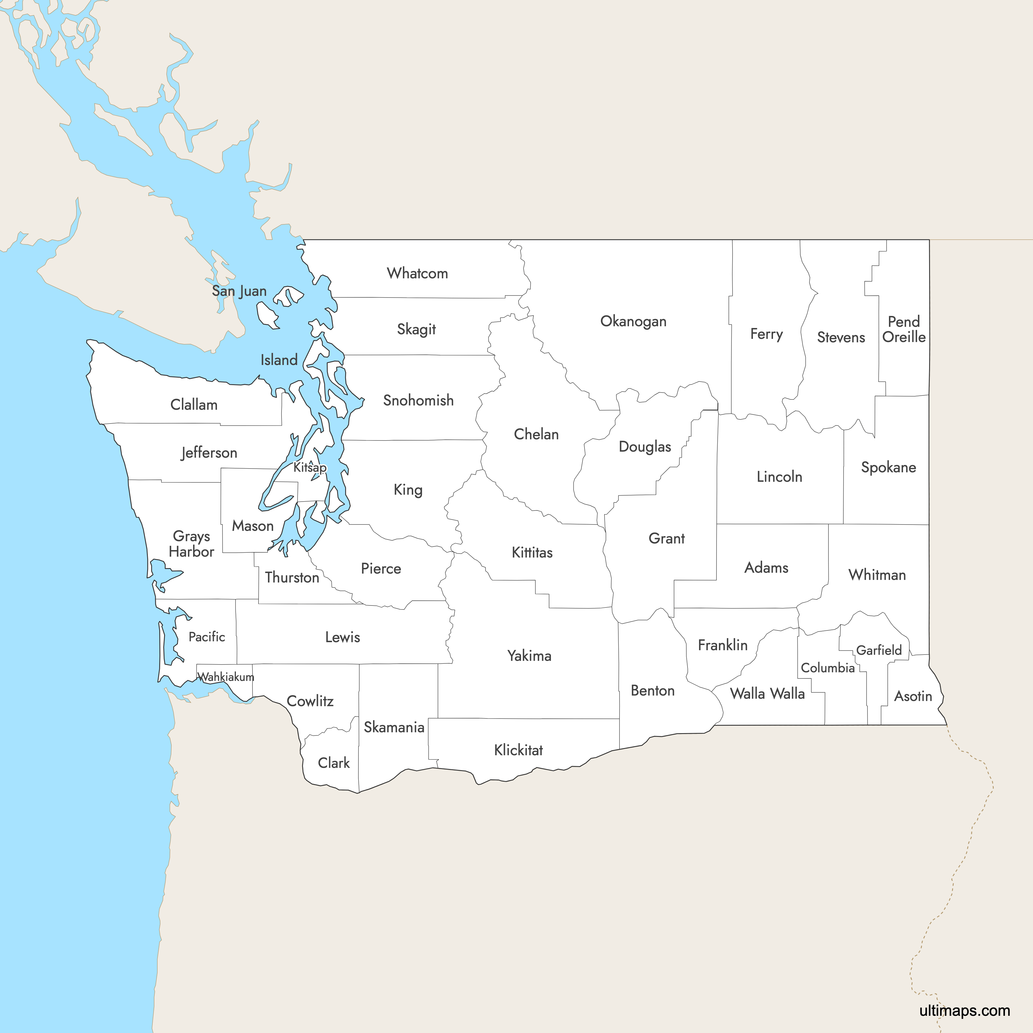

Need it without colors? The blank version of this map comes as a print-ready PDF (A4 and US Letter), a PNG and an editable SVG.
Custom Map Features
This map supports labels.
This map supports surrounding areas, roads, rivers and cities. New
This map is divided into 39 counties.
Updates
Sep 15, 2025:
- Improved map quality
- Added support for surrounding areas and lakes
Aug 26, 2024:
- Added map of Washington Counties
Frequently Asked Questions
Washington has 39 counties.
The largest county by land area in Washington is Okanogan County, covering 5,268 square miles (13,647 km²).
The smallest county by land area is San Juan County, with 174 square miles (451 km²) of land, entirely composed of islands.
King County is Washington’s most populous county, with 2,269,675 residents. It includes Seattle, the largest city in the state.
Garfield County has the lowest population, with 2,404 residents.
You can use Ultimaps to create custom maps of Washington. Color-code counties manually or upload data, place pins, customize look and feel, and export to PNG, PDF, or SVG.