Map of South Carolina Counties
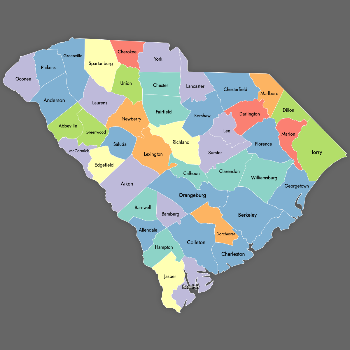
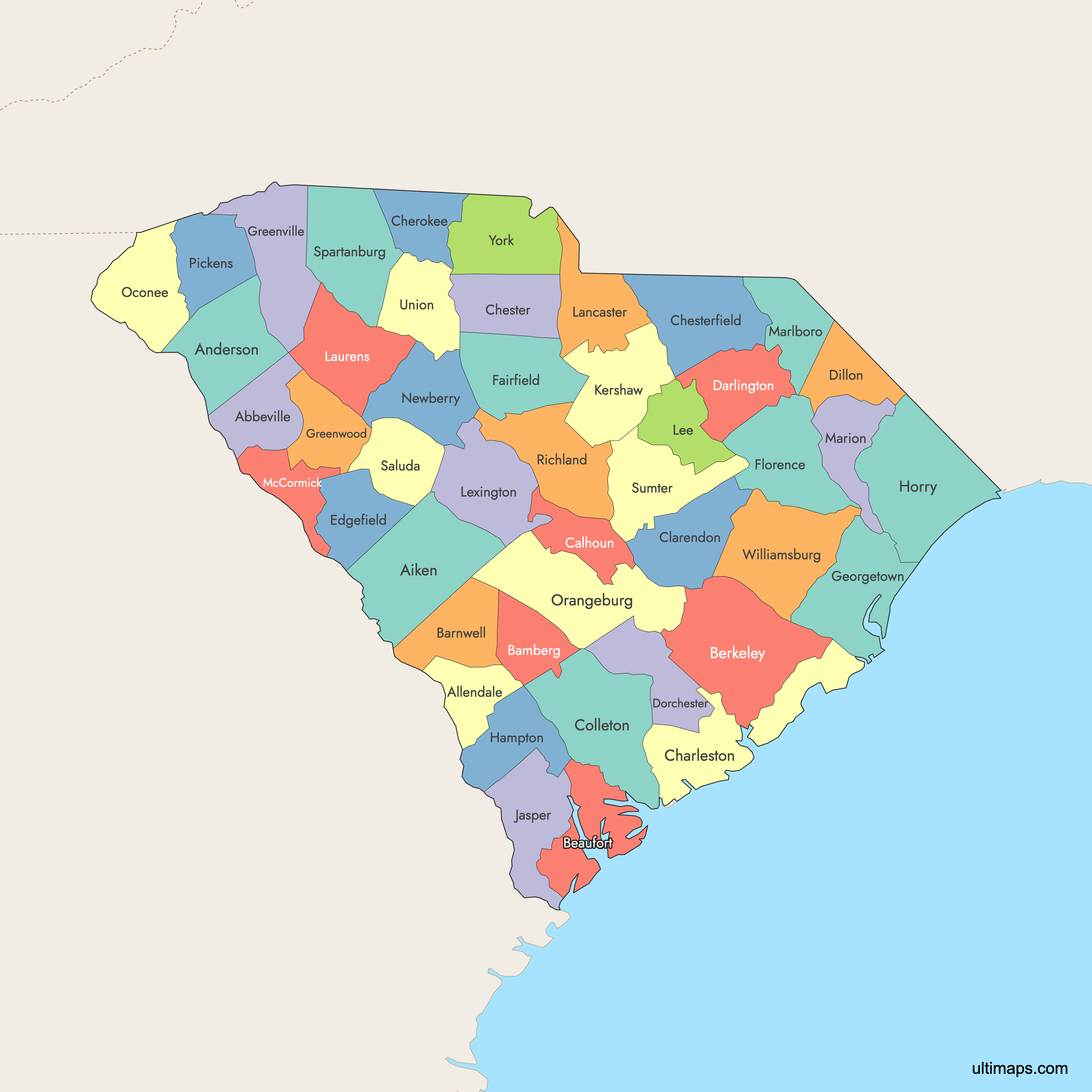
South Carolina is divided into 46 counties. Use the interactive maps below to explore counties and their boundaries. Download free maps or learn more about creating a custom map of South Carolina to visualize your own data.
Interactive Map of South Carolina Counties
List of Counties (46)
| # | County | County seat | Year founded |
|---|---|---|---|
| 1 | Abbeville | Abbeville | 1785 |
| 2 | Aiken | Aiken | 1871 |
| 3 | Allendale | Allendale | 1919 |
| 4 | Anderson | Anderson | 1826 |
| 5 | Bamberg | Bamberg | 1897 |
| 6 | Barnwell | Barnwell | 1798 |
| 7 | Beaufort | Beaufort | 1769 |
| 8 | Berkeley | Moncks Corner | 1882 |
| 9 | Calhoun | St. Matthews | 1908 |
| 10 | Charleston | Charleston | 1769 |
| 11 | Cherokee | Gaffney | 1897 |
| 12 | Chester | Chester | 1785 |
| 13 | Chesterfield | Chesterfield | 1798 |
| 14 | Clarendon | Manning | 1855 |
| 15 | Colleton | Walterboro | 1800 |
| 16 | Darlington | Darlington | 1785 |
| 17 | Dillon | Dillon | 1910 |
| 18 | Dorchester | St. George | 1897 |
| 19 | Edgefield | Edgefield | 1785 |
| 20 | Fairfield | Winnsboro | 1785 |
| 21 | Florence | Florence | 1888 |
| 22 | Georgetown | Georgetown | 1769 |
| 23 | Greenville | Greenville | 1786 |
| 24 | Greenwood | Greenwood | 1897 |
| 25 | Hampton | Hampton | 1878 |
| 26 | Horry | Conway | 1801 |
| 27 | Jasper | Ridgeland | 1912 |
| 28 | Kershaw | Camden | 1798 |
| 29 | Lancaster | Lancaster | 1798 |
| 30 | Laurens | Laurens | 1785 |
| 31 | Lee | Bishopville | 1902 |
| 32 | Lexington | Lexington | 1804 |
| 33 | Marion | Marion | 1800 |
| 34 | Marlboro | Bennettsville | 1785 |
| 35 | McCormick | McCormick | 1914 |
| 36 | Newberry | Newberry | 1785 |
| 37 | Oconee | Walhalla | 1868 |
| 38 | Orangeburg | Orangeburg | 1769 |
| 39 | Pickens | Pickens | 1826 |
| 40 | Richland | Columbia | 1799 |
| 41 | Saluda | Saluda | 1896 |
| 42 | Spartanburg | Spartanburg | 1785 |
| 43 | Sumter | Sumter | 1798 |
| 44 | Union | Union | 1798 |
| 45 | Williamsburg | Kingstree | 1802 |
| 46 | York | York | 1798 |
South Carolina Counties: Key Facts
- Number of counties: 46
- Largest county by area: Berkeley County - 1,229 square miles (3,183 km²)
- Smallest county by area: Calhoun County - 382 square miles (988 km²)
- Most populous county: Greenville County - 525,534 residents (2020)
- Least populous county: Allendale County - 8,039 residents (2020)
- Counties with major urban centers: Greenville (Greenville County), Columbia (Richland County), Charleston (Charleston County), Spartanburg (Spartanburg County), Myrtle Beach (Horry County)
- State capital location: Richland County (Columbia)
- Neighboring states: North Carolina, Georgia
- Coastline: Atlantic Ocean
- Time zone: Eastern Time Zone (ET)
Interesting and Fun Facts
- Horry County is known for Myrtle Beach, a popular tourist destination along the Grand Strand.
- Greenville & Spartanburg counties form part of the I-85 industrial corridor, a significant manufacturing region.
- Charleston, Berkeley, and Dorchester counties comprise the historic Lowcountry region.
- York County includes Rock Hill, an area experiencing rapid growth as part of the Charlotte metro region.
Free Downloads
Free for personal and commercial use with a credit to Ultimaps. See the license terms for details.
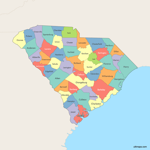 Colored Map of South Carolina Counties with Surrounding Areaspng778 KB
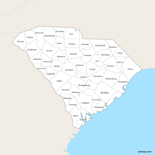 Labeled Map of South Carolina Counties with Surrounding Areaspng757 KB
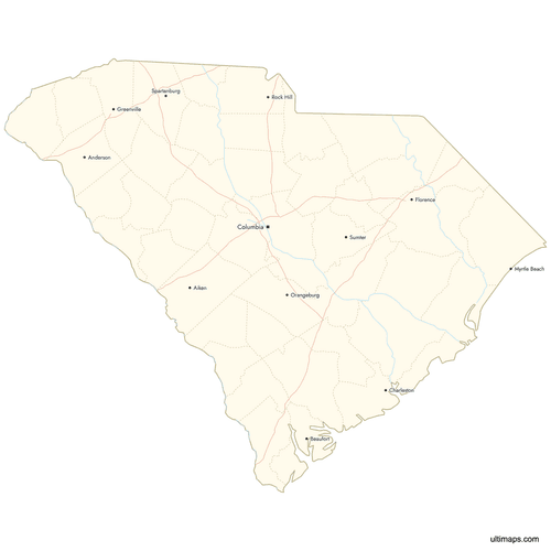 Map of South Carolina Counties with Citiespng773 KB
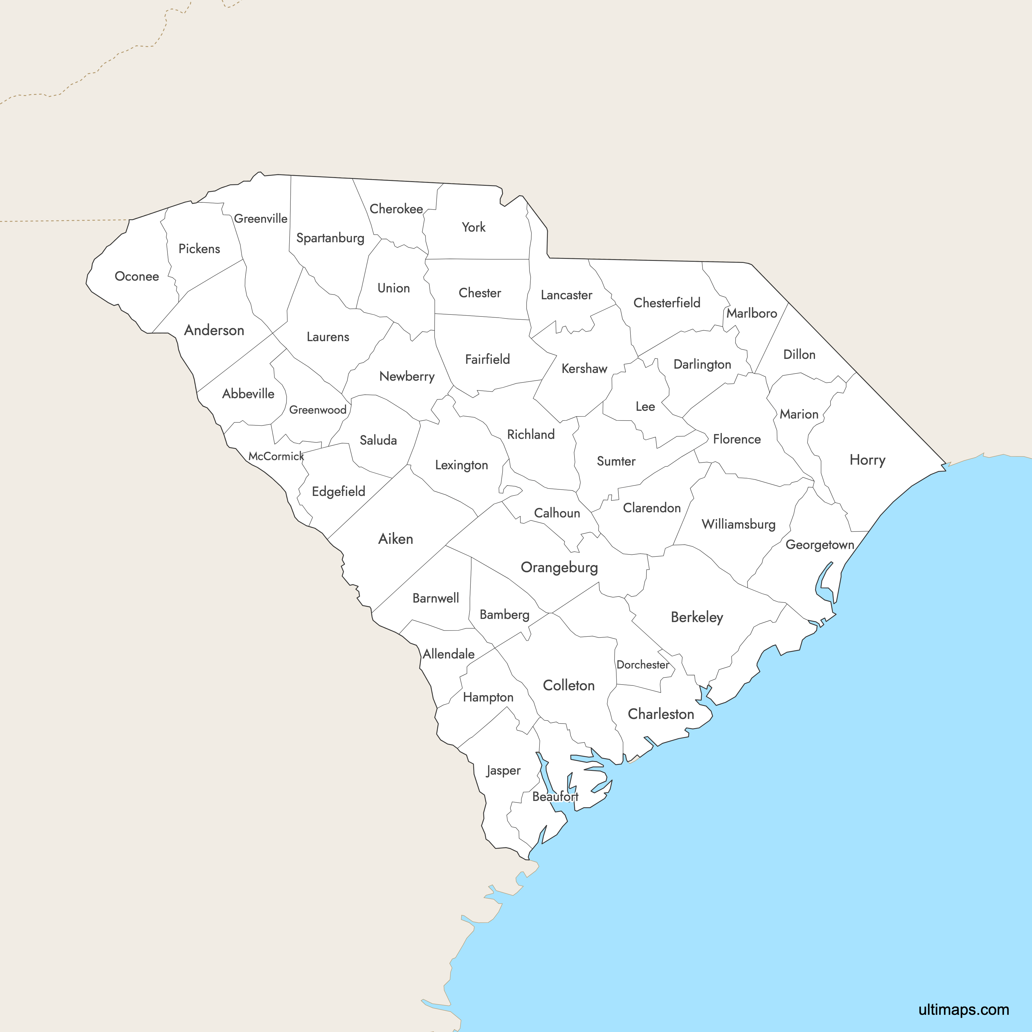
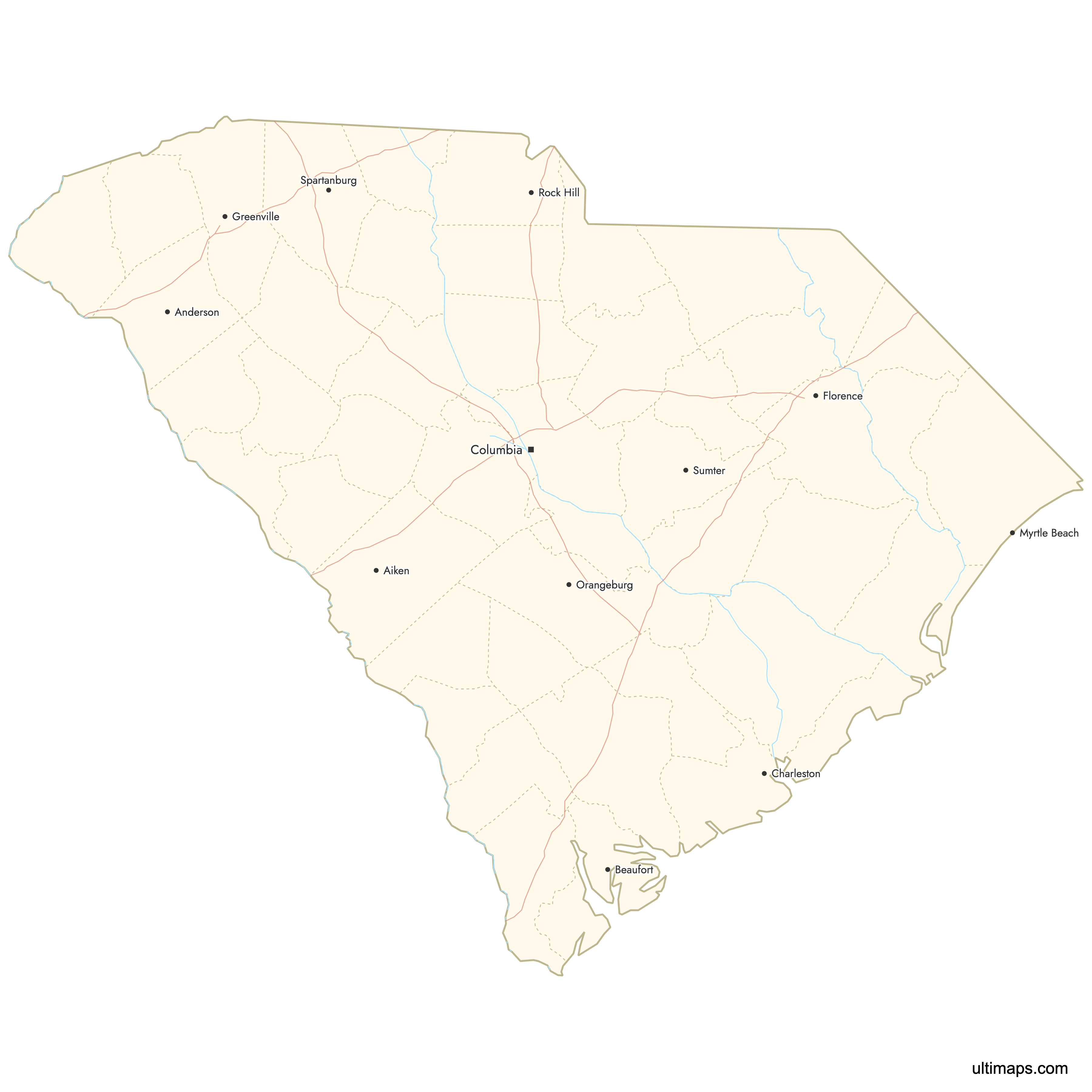
Need it without colors? The blank version of this map comes as a print-ready PDF (A4 and US Letter), a PNG and an editable SVG.
Custom Map Features
This map supports labels.
This map supports surrounding areas, roads, rivers and cities. New
This map is divided into 46 counties.
Updates
Oct 2, 2025:
- Improved map quality
- Added support for surrounding areas and lakes
Aug 26, 2024:
- Added map of South Carolina Counties
Frequently Asked Questions
South Carolina has 46 counties, serving as the primary local government units for administration and public services.
The largest county is Berkeley County, covering 1,229 square miles (3,183 km²). The smallest is Calhoun County, with 382 square miles (988 km²).
Greenville County is the most populous, with 525,534 residents in 2020.
Allendale County is the least populous, with 8,039 residents in 2020.
You can use Ultimaps to create custom maps of South Carolina. Color-code counties manually or upload data, place pins, customize look and feel, and export to PNG, PDF, or SVG.