Map of New Mexico Counties
New Mexico is divided into 33 counties. Use the interactive maps below to explore New Mexico counties and their boundaries. Download free maps or learn how to create a custom map of New Mexico to visualize your data.
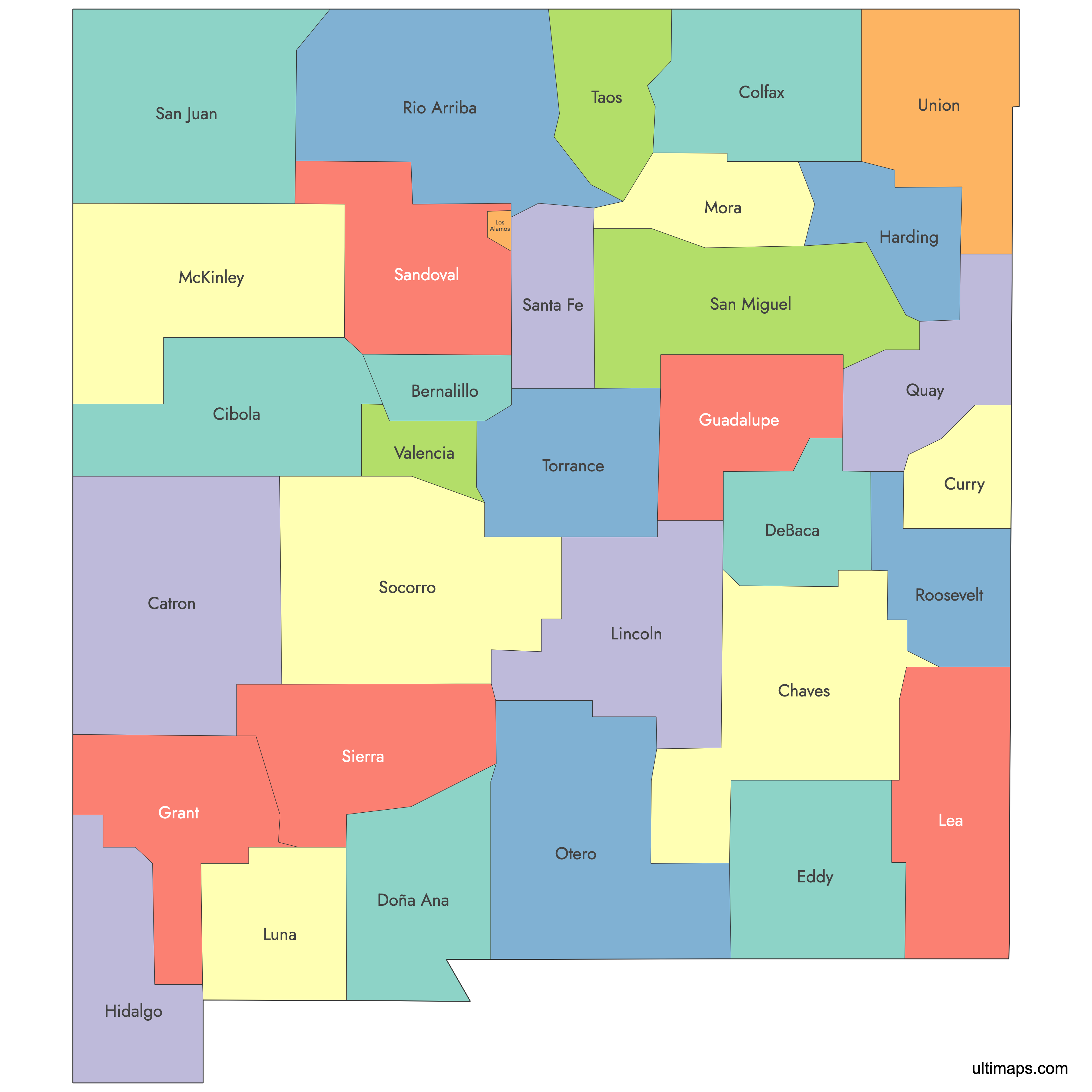
Interactive Map of New Mexico Counties
New Mexico Counties: Key Facts
- Total number of counties: 33
- Largest county by land area: Catron County - 6,929 sq mi (17,948 km²)
- Smallest county by area: Los Alamos County - 109 sq mi (282 km²)
- Most populous county: Bernalillo County (Albuquerque) - 676,444 people
- Least populous county: Harding County - 657 people
- Counties with major urban centers: Bernalillo (Albuquerque), Doña Ana (Las Cruces), Santa Fe (Santa Fe)
- State capital location: Santa Fe County (Santa Fe)
- Neighboring states: Colorado, Texas, Oklahoma, Arizona
- International border: Mexico (Chihuahua and Sonora) along Doña Ana, Luna, Hidalgo, and parts of Otero and Eddy
- Time zone: Mountain Time (MT)
Interesting and Fun Facts
- Albuquerque, located in Bernalillo County, is New Mexico’s largest city and primary economic hub.
- Santa Fe, in Santa Fe County, is one of the oldest capitals in the US.
- Los Alamos County, despite its small size, houses the Los Alamos National Laboratory, central to the Manhattan Project during WWII.
- Cibola County, created in 1981, is the newest county in New Mexico.
- Catron County is notable for being the largest by area but among the least densely populated.
Free Downloads
You can download free blank Map of New Mexico Counties and other maps in high resolution PNG, SVG and PDF formats from the blank maps section of the site: Download Blank Map of New Mexico Counties
Custom Map Features
This map supports labels.
This map is divided into 33 counties.
Updates
Aug 26, 2024:
- Added map of New Mexico Counties
Frequently Asked Questions
There are 33 counties in the U.S. state of New Mexico. This total was reached after the creation of Cibola County in 1981, the last county to be formed.
The largest county is Catron County, with an area of 6,929 sq mi (17,948 km²). It was created in 1921 and remains predominantly rural.
The smallest county is Los Alamos County, covering only 109 sq mi (282 km²). Despite its small size, it includes the community of Los Alamos and Los Alamos National Laboratory.
Bernalillo County is the most populous, with 676,444 residents and an area of 1,167 sq mi (3,023 km²). Its county seat is Albuquerque, the largest city in the state.
Harding County is the least populous, with only 657 residents over 2,125 sq mi (5,505 km²). This makes it one of the most sparsely populated counties in the United States.
You can use Ultimaps to create custom maps of New Mexico. Color-code counties manually or upload data, place pins, customize look and feel, and export to PNG, PDF, or SVG.


