New Zealand Map with Regions
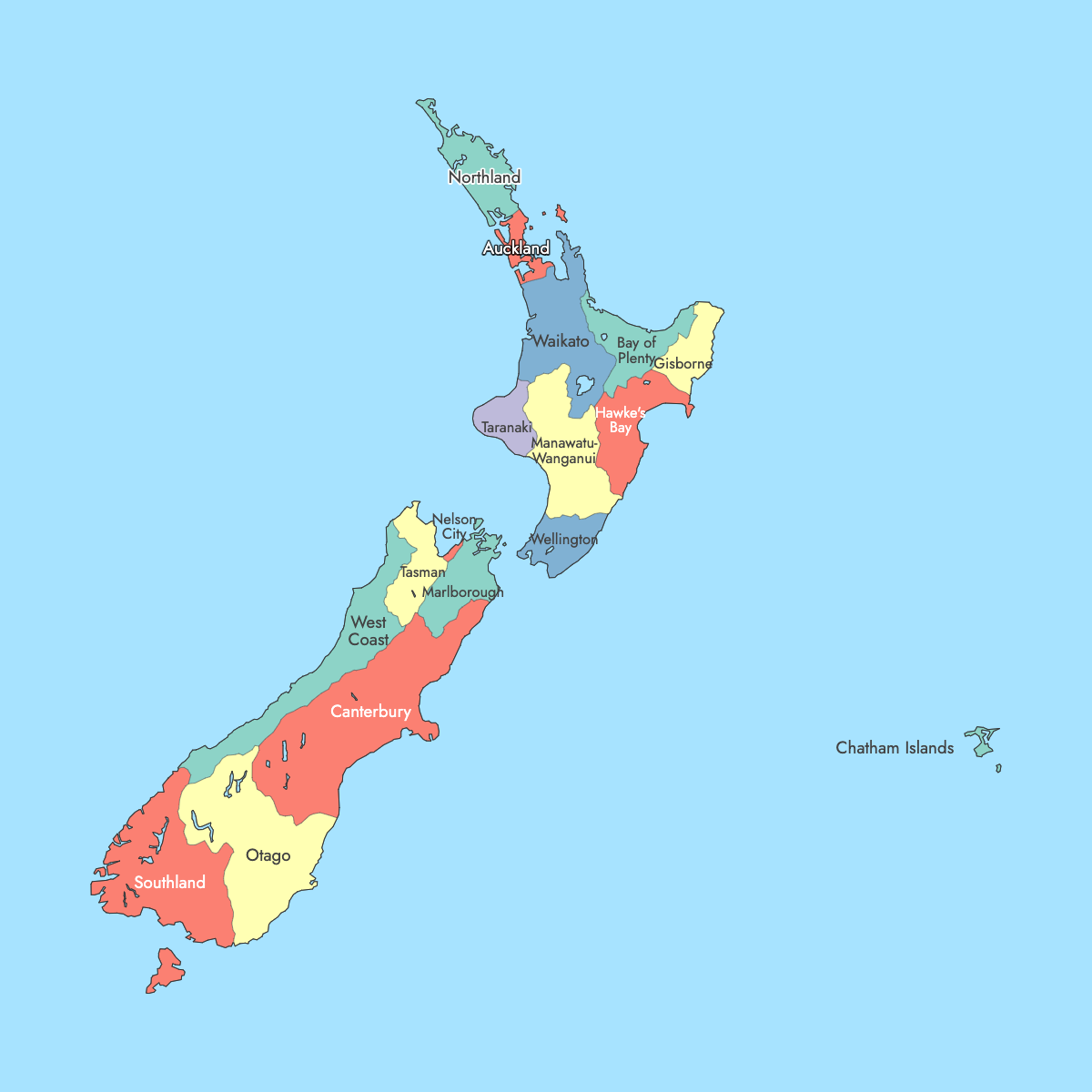
New Zealand has 16 regions, and the map of New Zealand below adds the Chatham Islands Territory as a 17th shape because those islands belong to no region and have their own council. Regional councils govern 11 of the 16 regions. The other five, Auckland, Gisborne, Marlborough, Nelson and Tasman, are unitary authorities, where one council handles both regional and district work. Most of today's regional boundaries date from the local government reform of 1 November 1989.
Auckland is the most populous region, with 1,656,486 usual residents at the 2023 Census. That is a third of the national count of 4,993,923. Wellington, the national capital since 1865, is in the Wellington Region at the southern end of the North Island. Canterbury has the largest land area at about 44,500 km² (17,200 sq mi), and Nelson has the smallest at about 422 km² (163 sq mi). You can enter one figure per region in the editor to color the regions by your own data.
Interactive New Zealand Map with Regions
List of Regions (17)
| # | Region |
|---|---|
| 1 | Auckland |
| 2 | Bay of Plenty |
| 3 | Canterbury |
| 4 | Chatham Islands Territory |
| 5 | Gisborne District |
| 6 | Hawke's Bay |
| 7 | Manawatu-Wanganui |
| 8 | Marlborough |
| 9 | Nelson City |
| 10 | Northland |
| 11 | Otago |
| 12 | Southland |
| 13 | Taranaki |
| 14 | Tasman |
| 15 | Waikato |
| 16 | Wellington |
| 17 | West Coast |
New Zealand Regions: Key Facts
- Total number of regions: 16 regions, 9 on the North Island and 7 on the South Island. The map adds the Chatham Islands Territory as a 17th shape.
- Governance split: 11 regional councils (Northland, Waikato, Bay of Plenty, Hawke's Bay, Taranaki, Manawatū-Whanganui, Wellington, West Coast, Canterbury, Otago, Southland) and 5 unitary authorities (Auckland, Gisborne, Marlborough, Nelson, Tasman)
- Most populous region: Auckland, 1,656,486 residents (2023 Census)
- Least populous unit: Chatham Islands Territory, fewer than 1,000 residents (2023 Census). Among the 16 regions, West Coast has the fewest at about 33,400 (2023 Census).
- Largest region by area: Canterbury, about 44,500 km² (17,200 sq mi) of land
- Smallest region by area: Nelson, about 422 km² (163 sq mi) of land
- National population: 4,993,923 (2023 Census)
- Capital: Wellington, in the Wellington Region, the seat of government since 1865
- Major urban centers: Auckland (Auckland Region), Christchurch (Canterbury), Wellington and Lower Hutt (Wellington), Hamilton (Waikato), Tauranga (Bay of Plenty), Dunedin (Otago), Palmerston North (Manawatū-Whanganui)
- Regional council seats: Whangārei (Northland), Hamilton (Waikato), Whakatāne (Bay of Plenty), Napier (Hawke's Bay), Stratford (Taranaki), Palmerston North (Manawatū-Whanganui), Greymouth (West Coast), Christchurch (Canterbury), Dunedin (Otago), Invercargill (Southland)
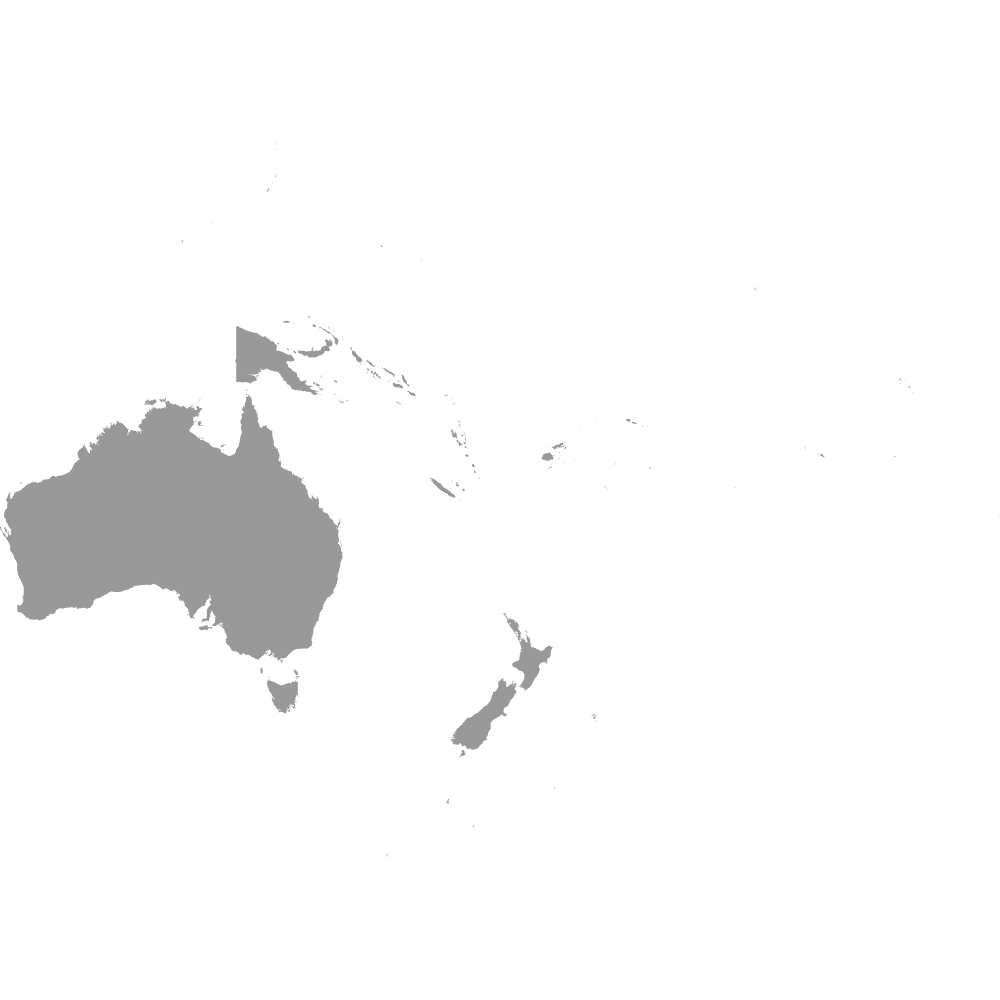
- Borders: New Zealand has no land borders. The Tasman Sea lies to the west and the Pacific Ocean to the east. Cook Strait separates the North and South Islands, and Foveaux Strait separates Stewart Island (part of Southland) from the South Island. Australia is the nearest large neighbor across the Tasman Sea. See the Oceania map for the wider region.
- Time zones: New Zealand Standard Time (UTC+12) and New Zealand Daylight Time (UTC+13). The Chatham Islands keep their own time, 45 minutes ahead of the mainland (UTC+12:45, or UTC+13:45 in summer).
- Historical note: The regions were created in the local government reform of 1 November 1989. The Nelson-Marlborough Regional Council was abolished in 1992, which made Nelson, Tasman and Marlborough unitary authorities. Auckland Council replaced the Auckland Regional Council and seven city and district councils on 1 November 2010.
Interesting Facts
- Stewart Island (Rakiura), the third largest island of New Zealand, is part of the Southland Region.
- Canterbury's land area is more than 100 times that of Nelson.
- The Chatham Islands go by two other names, Rēkohu in Moriori and Wharekauri in Māori.
- Tokelau, the Cook Islands, Niue, the Ross Dependency and the subantarctic islands are not drawn as regions on this map.
- Some region names on the map use older or council forms, such as Manawatu-Wanganui, Gisborne District and Nelson City.
Free Downloads
Free for personal and commercial use with a credit to Ultimaps. See the license terms for details.
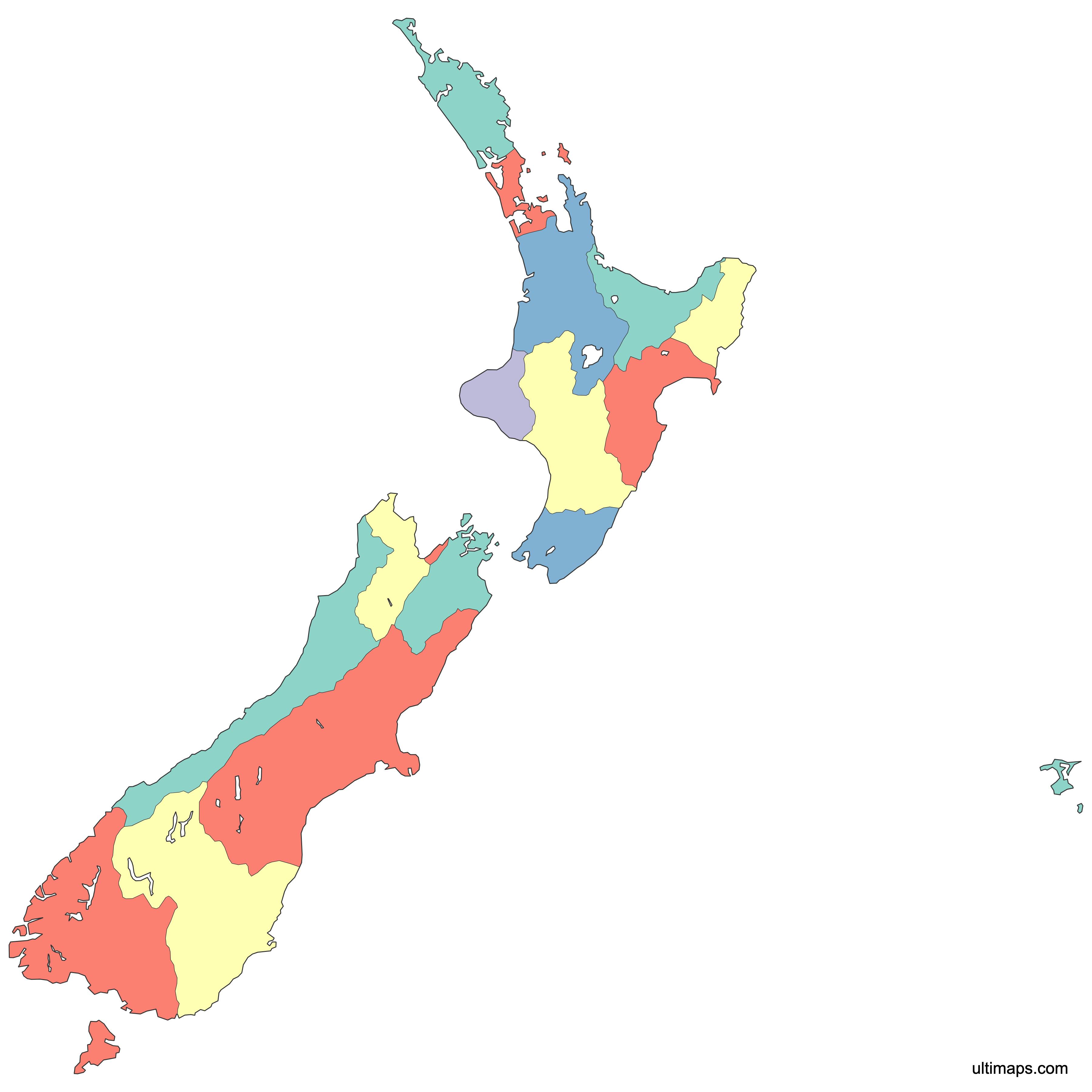
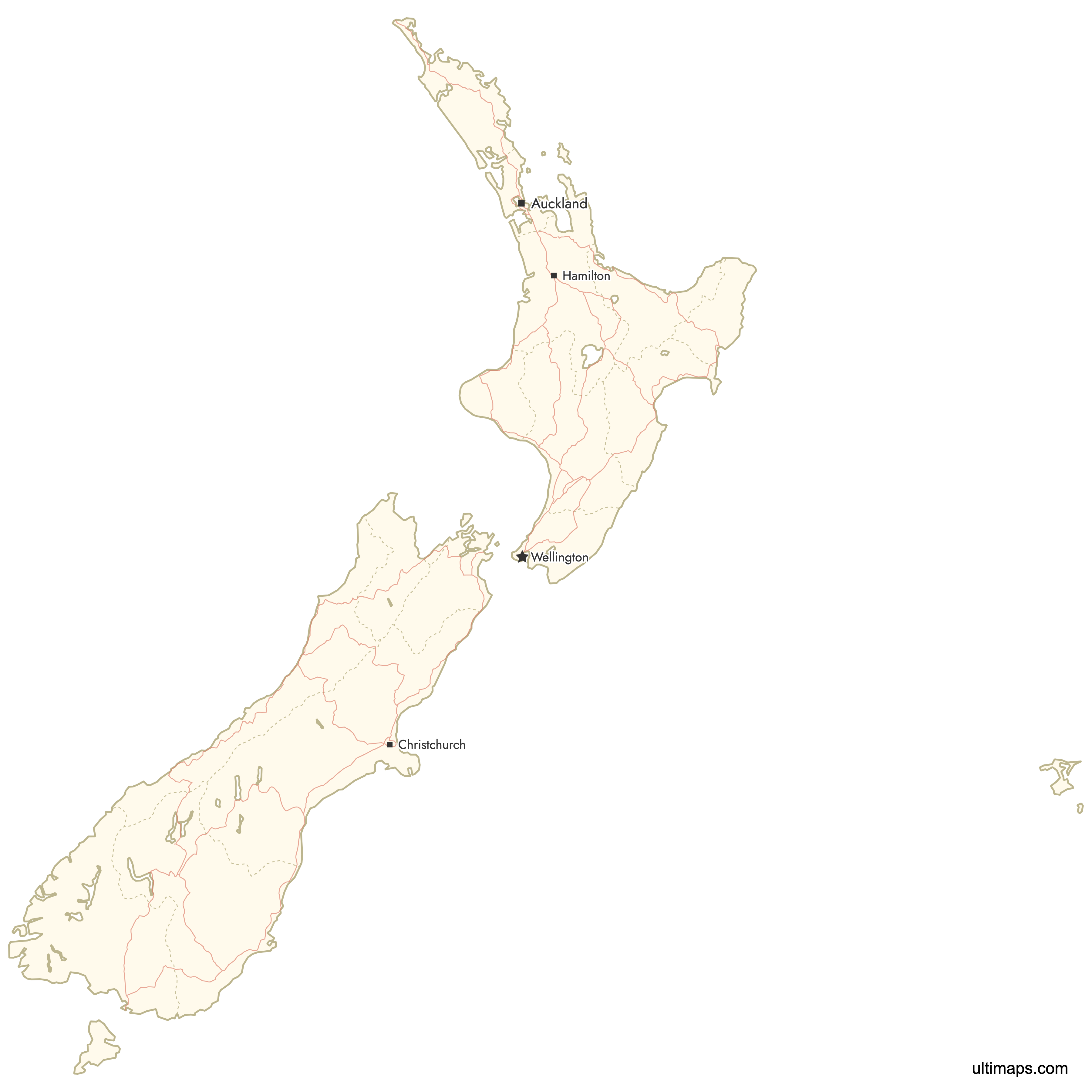
Need it without colors? The blank version of this map comes as a print-ready PDF (A4 and US Letter), a PNG and an editable SVG.
Custom Map Features
This map supports labels.
This map is divided into 17 regions.
Updates
Apr 9, 2026:
- Added map of New Zealand regions with cities and roads
Frequently Asked Questions
New Zealand has 16 regions, the upper tier of its local government. Regional councils govern 11 of them: Northland, Waikato, Bay of Plenty, Hawke's Bay, Taranaki, Manawatū-Whanganui, Wellington, West Coast, Canterbury, Otago and Southland. The other five (Auckland, Gisborne, Marlborough, Nelson and Tasman) are unitary authorities, where one council does both regional and district work. The Chatham Islands Territory is outside the regional system, and the Ultimaps map draws it as a separate 17th shape. Nine regions are on the North Island and seven on the South Island. The structure dates from the local government reform of 1 November 1989.
Canterbury is New Zealand's largest region by area, with about 44,500 km² (17,200 sq mi) of land. The region covers the eastern side of the South Island from the Clarence River north of Kaikōura down to the Waitaki River, which forms its boundary with Otago. It includes the Canterbury Plains and the city of Christchurch, where Environment Canterbury, the regional council, has its seat. Canterbury is also the second most populous region, with about 651,000 residents at the 2023 Census. Nelson is at the other end of the scale. At about 422 km² (163 sq mi), it has less than one hundredth of Canterbury's land area.
Auckland is New Zealand's most populous region. The 2023 Census counted 1,656,486 usual residents there, out of 4,993,923 nationwide, so about one in three New Zealanders lives in the region. Auckland is also the country's largest city, although Wellington is the capital. Since 1 November 2010, one unitary body, Auckland Council, has governed the region. It replaced the former Auckland Regional Council and seven city and district councils. The region's Māori name is Tāmaki Makaurau. At the 2023 Census, Auckland had more people than the seven South Island regions combined.
The Chatham Islands are not one of New Zealand's 16 regions. The Chatham Islands Territory has its own council, set up under the Chatham Islands Council Act 1995. That council does the work of a district council and holds some regional council powers as well. The group lies about 840 km east of Christchurch and includes Chatham Island and Pitt Island. The Moriori name for the islands is Rēkohu, and the Māori name is Wharekauri. The territory had fewer than 1,000 residents at the 2023 Census. The islands keep their own local time, 45 minutes ahead of mainland New Zealand. The Ultimaps map shows the territory as its 17th shape.
In New Zealand, a regional council is responsible for region-wide work such as freshwater, air quality, flood control, regional transport and civil defense. City and district councils handle local services such as roads, water supply, rubbish collection and building consents. Eleven of New Zealand's 16 regions split the work this way. The other five (Auckland, Gisborne, Marlborough, Nelson and Tasman) are unitary authorities, where one council does both jobs. Gisborne became unitary in 1989. Nelson, Tasman and Marlborough became unitary when the Nelson-Marlborough Regional Council was abolished in 1992, and Auckland followed on 1 November 2010.
Manawatū-Whanganui is the current official spelling of the New Zealand region that the map labels Manawatu-Wanganui. The newer form adds the macron over the u in Manawatū and uses the h in Whanganui, matching the Māori spelling of the river and city. Many older maps and datasets still use Manawatu-Wanganui, so both forms refer to the same region. The regional council calls itself Horizons Regional Council and has its seat in Palmerston North. Other titles on the map also use council names, such as Gisborne District and Nelson City. Each of these is a unitary authority, so the council name also covers the whole region.
Wellington, New Zealand's capital, is in the Wellington Region at the southern end of the North Island, on Cook Strait. The city has been the seat of government since 1865. The region also includes Lower Hutt, Upper Hutt and Porirua, as well as the Wairarapa districts of Masterton, Carterton and South Wairarapa. Greater Wellington Regional Council is based in Wellington. For comparison, Christchurch is in Canterbury, Hamilton in Waikato, Tauranga in Bay of Plenty and Dunedin in Otago. Auckland is the largest city and has a region of its own. The national capital and the largest city are in two different regions.
The editor on this page opens in the browser, free and without an account. A territory map gives each region a fill of your choosing, for example one color for the nine North Island regions and another for the seven South Island regions. A data map takes one figure per region, such as 2023 Census counts, and colors the 17 shapes on a scale with a legend. Pins can mark Queenstown, Napier or your own sites, and labels, lines, typeface and background are adjustable. The free plan exports a standard PNG carrying a small Ultimaps credit. High-resolution PNG, SVG and PDF come with Pro.