Australia Map with States and Territories
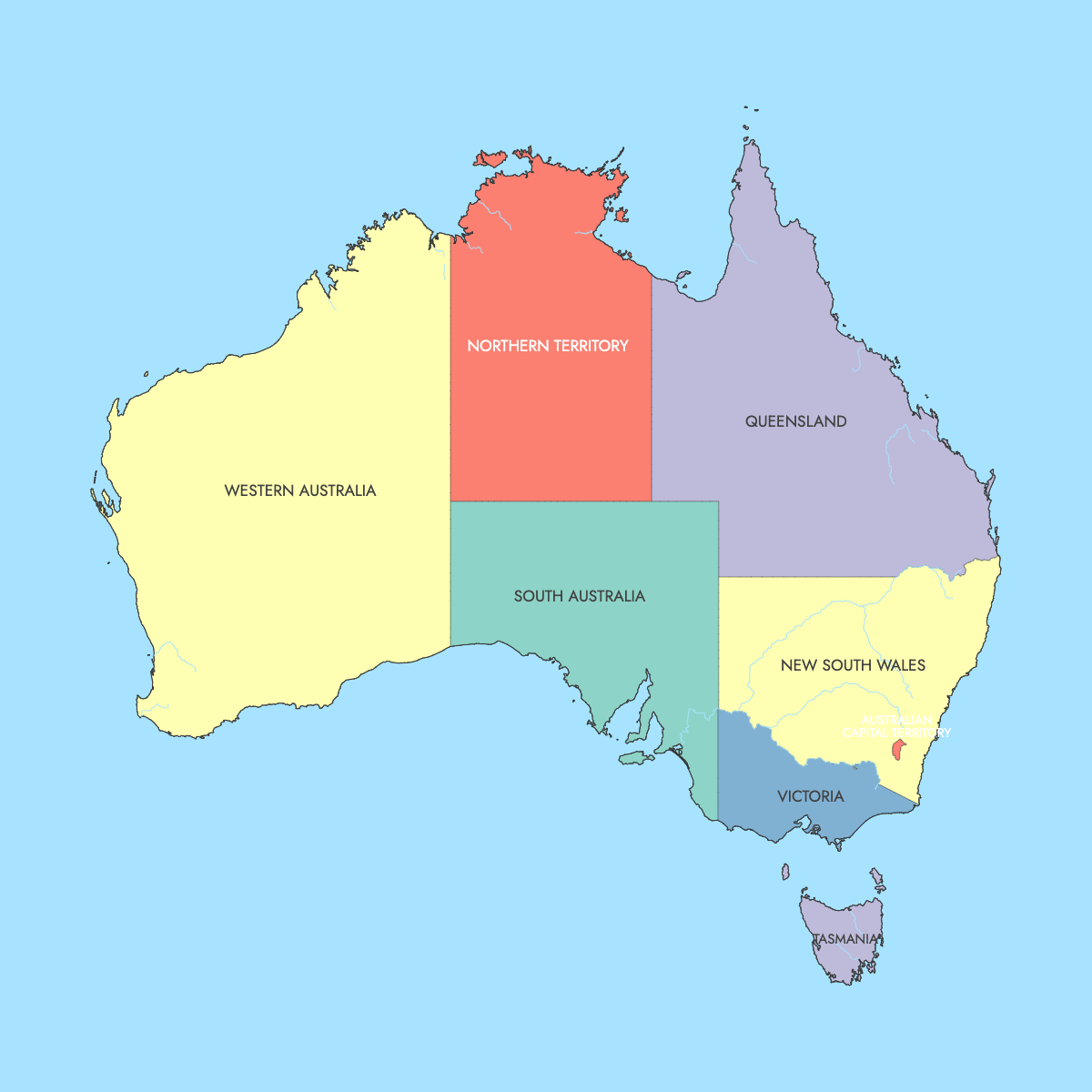
When the six Australian colonies federated on 1 January 1901, they became the six states on this map of Australia. Two mainland territories created later, the Northern Territory and the Australian Capital Territory, bring the total to 8 regions. Canberra, the national capital, is in the Australian Capital Territory, a small federal district surrounded entirely by New South Wales.
The regions vary widely in size. Geoscience Australia puts Western Australia at 2,527,013 km² (975,685 sq mi), about a third of the continent, and the Australian Capital Territory at 2,358 km² (910 sq mi). New South Wales, with Sydney as its capital, had the largest population at 8,072,163 in the 2021 Census run by the Australian Bureau of Statistics (ABS). The Northern Territory had the smallest at 232,605 in the same census. To build a data map, enter one value per state or territory in the editor and it produces a color scale and legend. The Jervis Bay Territory and the external territories, such as Norfolk Island and Christmas Island, are not drawn as separate shapes.
Interactive Australia Map with States and Territories
List of States/Territories (8)
| # | State/Territory |
|---|---|
| 1 | Australian Capital Territory |
| 2 | New South Wales |
| 3 | Northern Territory |
| 4 | Queensland |
| 5 | South Australia |
| 6 | Tasmania |
| 7 | Victoria |
| 8 | Western Australia |
Australia States and Territories: Key Facts
- Total number of states and territories on this map: 8 (6 states plus 2 mainland self-governing territories). Australia also has the Jervis Bay Territory and 7 external territories, for 10 federal territories in total, but those are not drawn here. For comparison, Canada has 13 provinces and territories.
- Most populous state: New South Wales (Sydney), 8,072,163 (2021 Census, ABS)
- Least populous state or territory: Northern Territory (Darwin), 232,605 (2021 Census, ABS). The least populous state is Tasmania at 557,571 (2021 Census, ABS).
- Largest by area: Western Australia, 2,527,013 km² (975,685 sq mi) (Geoscience Australia)
- Smallest by area: Australian Capital Territory, 2,358 km² (910 sq mi) (Geoscience Australia). Tasmania is the smallest state at 68,401 km² (26,410 sq mi).
- Capital cities: Sydney (New South Wales), Melbourne (Victoria), Brisbane (Queensland), Perth (Western Australia), Adelaide (South Australia), Hobart (Tasmania), Darwin (Northern Territory) and Canberra (Australian Capital Territory)
- National capital: Canberra, in the Australian Capital Territory. The territory had 454,499 residents in the 2021 Census (ABS).
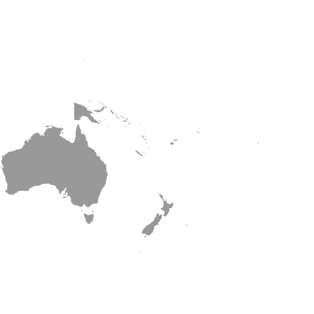
- Borders: Australia has no land borders. The Indian Ocean lies to the west and the Southern Ocean to the south, and the Timor Sea, Arafura Sea, Coral Sea and Tasman Sea separate it from Indonesia, Timor-Leste, Papua New Guinea and New Zealand. See the Oceania map for the wider region. Inside the country, South Australia shares a border with 5 of the other regions: Western Australia, the Northern Territory, Queensland, New South Wales and Victoria.
- Time zones: Australian Western Standard Time (UTC+8) in Western Australia, Australian Central Standard Time (UTC+9:30) in South Australia and the Northern Territory, and Australian Eastern Standard Time (UTC+10) in Queensland, most of New South Wales, Victoria, Tasmania and the ACT. Broken Hill in New South Wales uses Central time. Daylight saving applies in South Australia, New South Wales, Victoria, Tasmania and the ACT, but not in Queensland, the Northern Territory or Western Australia.
- Historical note: The states date from Federation on 1 January 1901. On 1 January 1911 the Northern Territory passed from South Australia to the Commonwealth, and the Federal Capital Territory, later renamed the ACT, was created. The Northern Territory gained self-government in 1978 and the ACT in 1989.
Interesting Facts
- Western Australia makes up 32.9% of Australia's total area of 7,688,287 km² (2,968,464 sq mi), per Geoscience Australia.
- New South Wales and Victoria had 14,575,654 residents between them in the 2021 Census, or 57.3% of the national count of 25,422,788 (ABS).
- The Northern Territory had about 0.17 residents per km² at the 2021 Census, based on 232,605 people across 1,347,791 km² (520,385 sq mi).
- Mount Kosciuszko in New South Wales, at 2,228 m (7,310 ft), is the highest point on the Australian mainland.
- Kati Thanda-Lake Eyre in South Australia, about 15 m (49 ft) below sea level, is the lowest point in Australia.
Free Downloads
Free for personal and commercial use with a credit to Ultimaps. See the license terms for details.
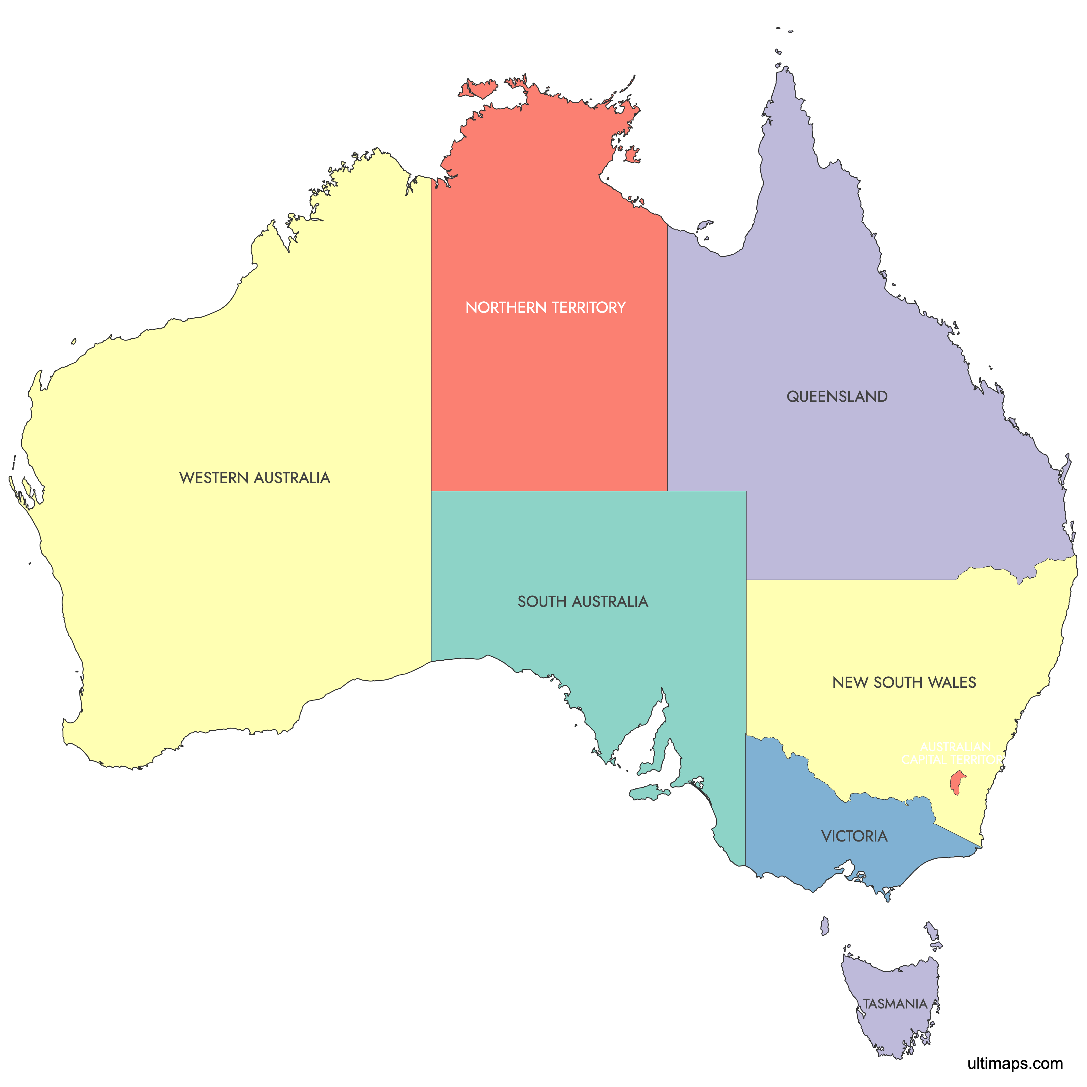
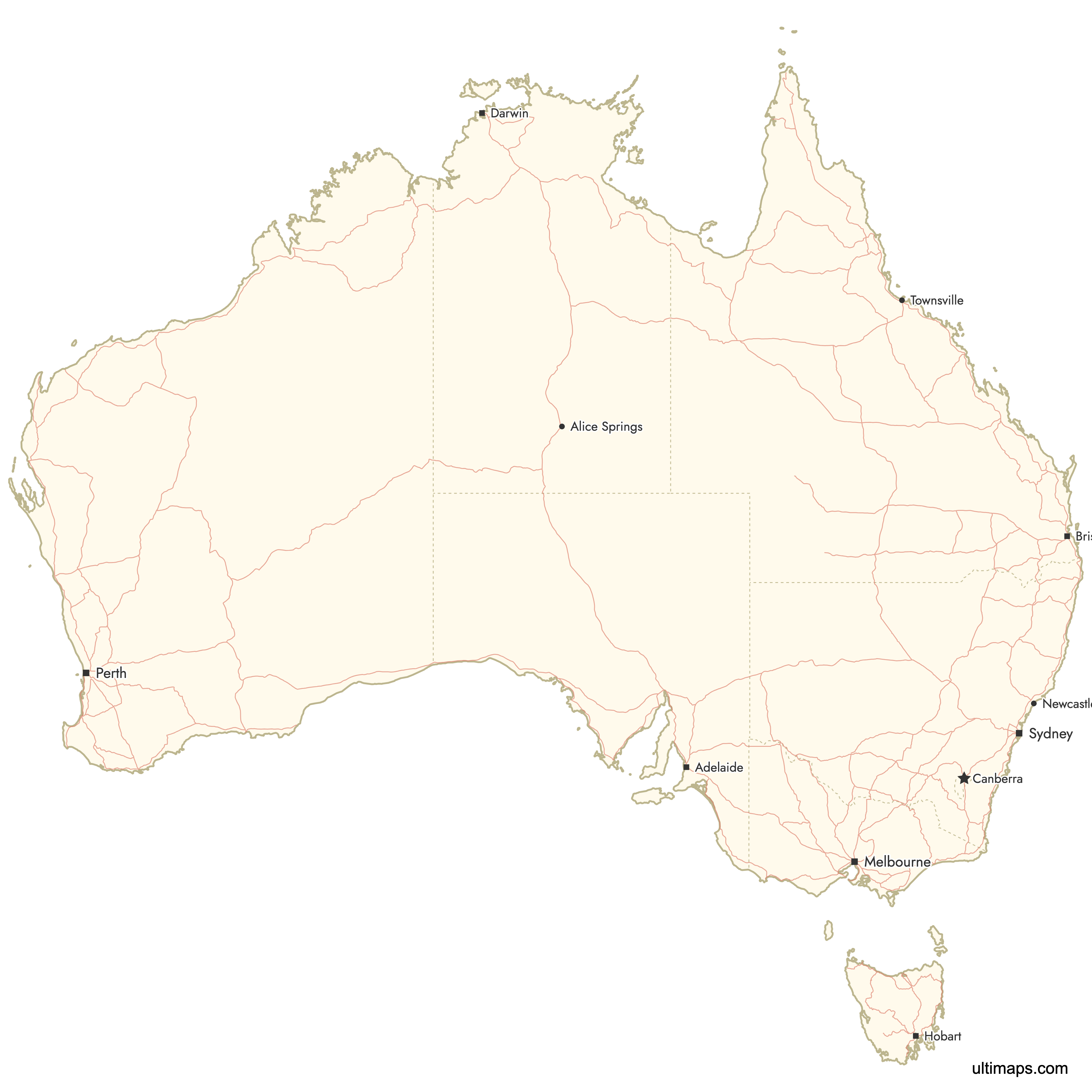
Need it without colors? The blank version of this map comes as a print-ready PDF (A4 and US Letter), a PNG and an editable SVG.
Custom Map Features
This map supports labels.
This map is divided into 8 states/territories.
Updates
Apr 14, 2024:
- Added map of Australia (without external territories)
Frequently Asked Questions
Australia has 6 states and 2 mainland self-governing territories, and these 8 regions are what the map on this page shows. The states are New South Wales, Victoria, Queensland, Western Australia, South Australia and Tasmania. The mainland territories are the Northern Territory and the Australian Capital Territory. The Commonwealth also administers the Jervis Bay Territory on the New South Wales coast and 7 external territories, including Norfolk Island, Christmas Island, the Cocos (Keeling) Islands and the Australian Antarctic Territory. Counting those, Australia has 10 federal territories in total. They are either very small or far offshore, so this map does not draw them as separate shapes.
Western Australia is the largest Australian state by area at 2,527,013 km² (975,685 sq mi), according to Geoscience Australia. That is 32.9% of the country's total area of 7,688,287 km². Queensland is second at 1,729,742 km² (667,857 sq mi), and the Northern Territory, a territory rather than a state, covers 1,347,791 km² (520,385 sq mi). Western Australia's population is small for its size. The 2021 Census counted 2,660,026 residents, and most of them live in and around Perth, the state capital. At the other end, Tasmania is the smallest state at 68,401 km² (26,410 sq mi), and the Australian Capital Territory covers 2,358 km² (910 sq mi).
New South Wales has the most people of any Australian state or territory. The Australian Bureau of Statistics counted 8,072,163 residents there in the 2021 Census, out of a national total of 25,422,788. Sydney, the state capital and Australia's largest city, holds most of that population. Victoria was second in the 2021 Census with 6,503,491 residents, most of them in Melbourne. Queensland was third with 5,156,138. The smallest count belonged to the Northern Territory at 232,605. Among the six states, Tasmania was the least populous with 557,571 residents in 2021.
The Australian Capital Territory is not a state. It is a federal territory created on 1 January 1911 to hold the national capital, Canberra, and it is surrounded entirely by New South Wales. The ACT covers 2,358 km² (910 sq mi), according to Geoscience Australia, and had 454,499 residents in the 2021 Census. It has run its own Legislative Assembly since self-government in 1989. Canberra was chosen as a compromise between the rival cities of Sydney and Melbourne. Federal Parliament met in Melbourne until 1927, when it moved to the Provisional Parliament House in Canberra.
The six Australian states and the two mainland territories differ in where their powers come from. Each state existed as a British colony before Federation on 1 January 1901, keeps its own constitution, and holds powers that the Commonwealth Constitution protects. The Northern Territory and the Australian Capital Territory get self-government from Acts of federal Parliament, passed in 1978 for the Northern Territory and in 1988 for the ACT. Federal Parliament can override territory laws. Representation in the Senate also differs. Each state elects 12 senators, and each mainland territory elects 2. Day to day, both territories run their own parliaments and governments much like the states do.
Tasmania is the Australian state that is an island. Bass Strait separates it from Victoria on the mainland. Geoscience Australia lists its area as 68,401 km² (26,410 sq mi), which makes it the smallest of the six states, and the 2021 Census counted 557,571 residents. Hobart is the state capital and largest city. Cradle Mountain-Lake St Clair National Park and Freycinet National Park are among its best-known protected areas. Tasmania uses Australian Eastern Standard Time (UTC+10) and observes daylight saving in summer, as New South Wales, Victoria and the ACT do.
Norfolk Island and Christmas Island are external territories of Australia, and this map shows only the 6 states and 2 mainland self-governing territories. Australia administers 7 external territories: Norfolk Island, Christmas Island, the Cocos (Keeling) Islands, the Ashmore and Cartier Islands, the Coral Sea Islands, Heard Island and McDonald Islands, and the Australian Antarctic Territory. Most of them sit hundreds or thousands of kilometers from the mainland. At the scale of a national map most would be too small to see, and all of them would need separate inset boxes. The Jervis Bay Territory, a small federal territory on the New South Wales coast, is also not drawn as its own shape.
Mainland Australia and Tasmania use three standard time zones. Western Australia uses Australian Western Standard Time (UTC+8). South Australia and the Northern Territory use Australian Central Standard Time (UTC+9:30). Queensland, most of New South Wales, Victoria, Tasmania and the Australian Capital Territory use Australian Eastern Standard Time (UTC+10). Daylight saving adds one hour from early October to early April in South Australia, New South Wales, Victoria, Tasmania and the ACT. Queensland, the Northern Territory and Western Australia do not change their clocks. As a result, Australia runs on five different clock times during the summer months. Broken Hill in New South Wales is an exception and uses Central time.
A custom map of Australia starts in the browser editor on this page, which is free and needs no account. For categories, such as the states that observe daylight saving, choose a color for each state or territory. For numbers, paste one value per region, for example 2021 Census population, and the 8 regions are colored on a scale with a legend. Pins can mark places such as Alice Springs or Cairns, and label text, line color, typeface and background are all adjustable. The free plan exports a standard PNG with a small Ultimaps credit, and SVG, PDF and high-resolution PNG need Pro.