Japan Map with Prefectures
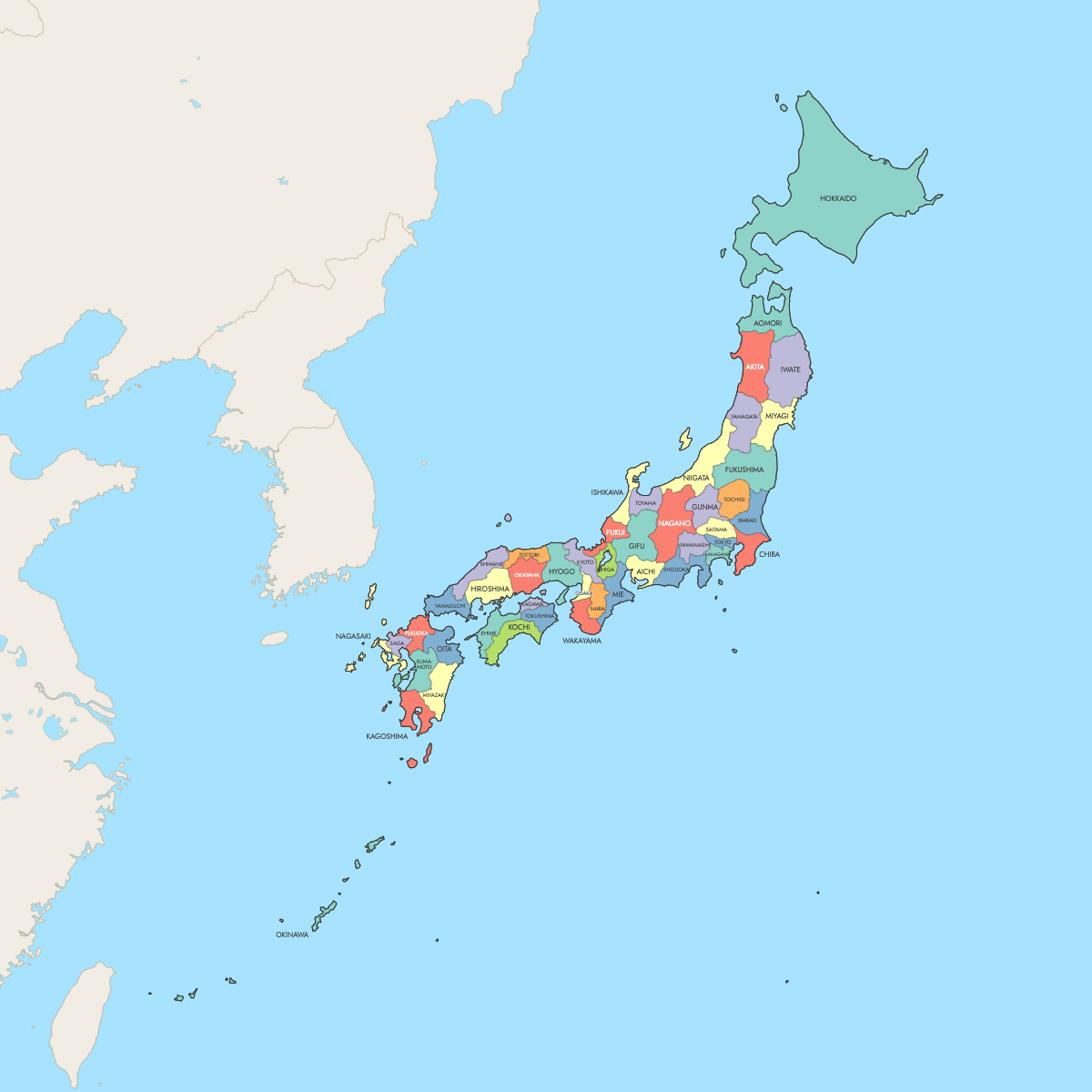
This Japan map is divided along the 47 prefectures that have formed the country's top level of local government since Okinawa returned to Japanese administration on 15 May 1972. The prefecture system is older. It dates from 1871, when the Meiji government abolished the feudal domains (han) in the reform known as haihan-chiken. Four labels are in use today. Tokyo is a metropolis (to), Hokkaido is a circuit (dō), Osaka and Kyoto are urban prefectures (fu), and the other 43 are ken.
Tokyo, the national capital, is also the most populous prefecture. It had 14,246,219 residents in the 2025 census preliminary counts published by the Statistics Bureau of Japan. Tottori is the least populous, with 523,732 in the 2025 census preliminary counts. By area, the Geospatial Information Authority of Japan (GSI) lists Hokkaido as the largest at 83,422 km² (32,210 sq mi) and Kagawa on Shikoku as the smallest at 1,877 km² (725 sq mi). To make a thematic map, enter a value for each of the 47 prefectures in the editor on this page.
Interactive Japan Map with Prefectures
List of Prefectures (47)
| # | Prefecture |
|---|---|
| 1 | Aichi |
| 2 | Akita |
| 3 | Aomori |
| 4 | Chiba |
| 5 | Ehime |
| 6 | Fukui |
| 7 | Fukuoka |
| 8 | Fukushima |
| 9 | Gifu |
| 10 | Gunma |
| 11 | Hiroshima |
| 12 | Hokkaido |
| 13 | Hyogo |
| 14 | Ibaraki |
| 15 | Ishikawa |
| 16 | Iwate |
| 17 | Kagawa |
| 18 | Kagoshima |
| 19 | Kanagawa |
| 20 | Kochi |
| 21 | Kumamoto |
| 22 | Kyoto |
| 23 | Mie |
| 24 | Miyagi |
| 25 | Miyazaki |
| 26 | Nagano |
| 27 | Nagasaki |
| 28 | Nara |
| 29 | Niigata |
| 30 | Oita |
| 31 | Okayama |
| 32 | Okinawa |
| 33 | Osaka |
| 34 | Saga |
| 35 | Saitama |
| 36 | Shiga |
| 37 | Shimane |
| 38 | Shizuoka |
| 39 | Tochigi |
| 40 | Tokushima |
| 41 | Tokyo |
| 42 | Tottori |
| 43 | Toyama |
| 44 | Wakayama |
| 45 | Yamagata |
| 46 | Yamaguchi |
| 47 | Yamanashi |
Japan Prefectures: Key Facts
- Total number of prefectures: 47. That is 1 metropolis (Tokyo-to), 1 circuit (Hokkaido), 2 urban prefectures (Osaka-fu and Kyoto-fu) and 43 prefectures (ken). The map draws all 47.
- Most populous prefecture: Tokyo, 14,246,219 (2025 census preliminary counts, Statistics Bureau of Japan)
- Least populous prefecture: Tottori, 523,732 (2025 census preliminary counts, Statistics Bureau of Japan)
- Largest prefecture by area: Hokkaido, 83,422 km² (32,210 sq mi), per the Geospatial Information Authority of Japan (GSI)
- Smallest prefecture by area: Kagawa, 1,877 km² (725 sq mi), per GSI
- Prefectures with major urban centers: Tokyo, Kanagawa (Yokohama, Kawasaki), Osaka, Aichi (Nagoya), Kyoto, Hyogo (Kobe), Fukuoka (Fukuoka and Kitakyushu), Hokkaido (Sapporo), Saitama (Saitama), Miyagi (Sendai) and Hiroshima (Hiroshima)
- Capital: Tokyo. The Tokyo Metropolitan Government is based in Shinjuku, one of Tokyo's 23 special wards.
- Borders: Japan has no land borders. Its coasts face the Pacific Ocean, the Sea of Japan, the Sea of Okhotsk and the East China Sea. Its nearest neighbors across the water are Russia, South Korea, North Korea, China and Taiwan.
- Time zone: Japan Standard Time (JST), UTC+9, used nationwide with no daylight saving time
- Historical note: The han domains were abolished in 1871 (haihan-chiken). Tokyo-fu became Tokyo-to in 1943. The count reached 47 again when Okinawa returned to Japan on 15 May 1972.
Interesting Facts
- The ISO 3166-2 codes run roughly from north to south: JP-01 is Hokkaido, JP-13 is Tokyo and JP-47 is Okinawa. Many Japanese datasets use the same numbering.
- Hokkaido covers about 44 times the area of Kagawa, based on GSI figures.
- Tokyo had about 27 times as many residents as Tottori in the 2025 census preliminary counts.
- In many prefectures the capital has a different name from the prefecture. Examples include Sapporo (Hokkaido), Sendai (Miyagi), Yokohama (Kanagawa), Nagoya (Aichi), Kobe (Hyogo), Matsuyama (Ehime) and Naha (Okinawa).
- Maps usually group the prefectures into eight traditional regions: Hokkaido, Tohoku, Kanto, Chubu, Kinki (Kansai), Chugoku, Shikoku and Kyushu, with Okinawa counted in Kyushu.
Free Downloads
Free for personal and commercial use with a credit to Ultimaps. See the license terms for details.
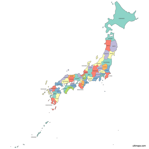 Colored Japan Map with Prefecturespng561 KB
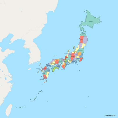 Political Map of Japan with Prefecturespng718 KB
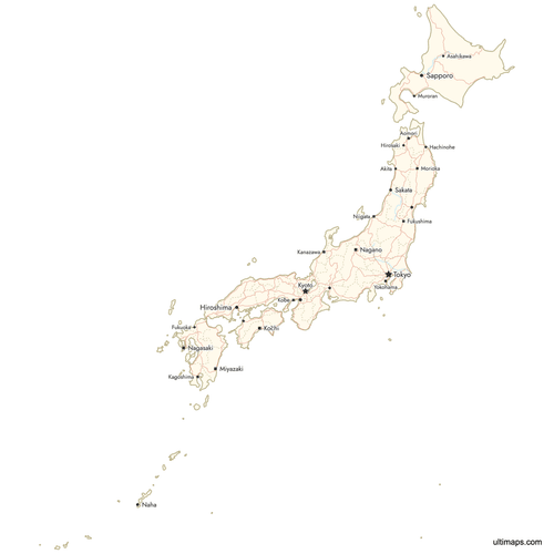 Map of Japan with Cities and Roadspng677 KB
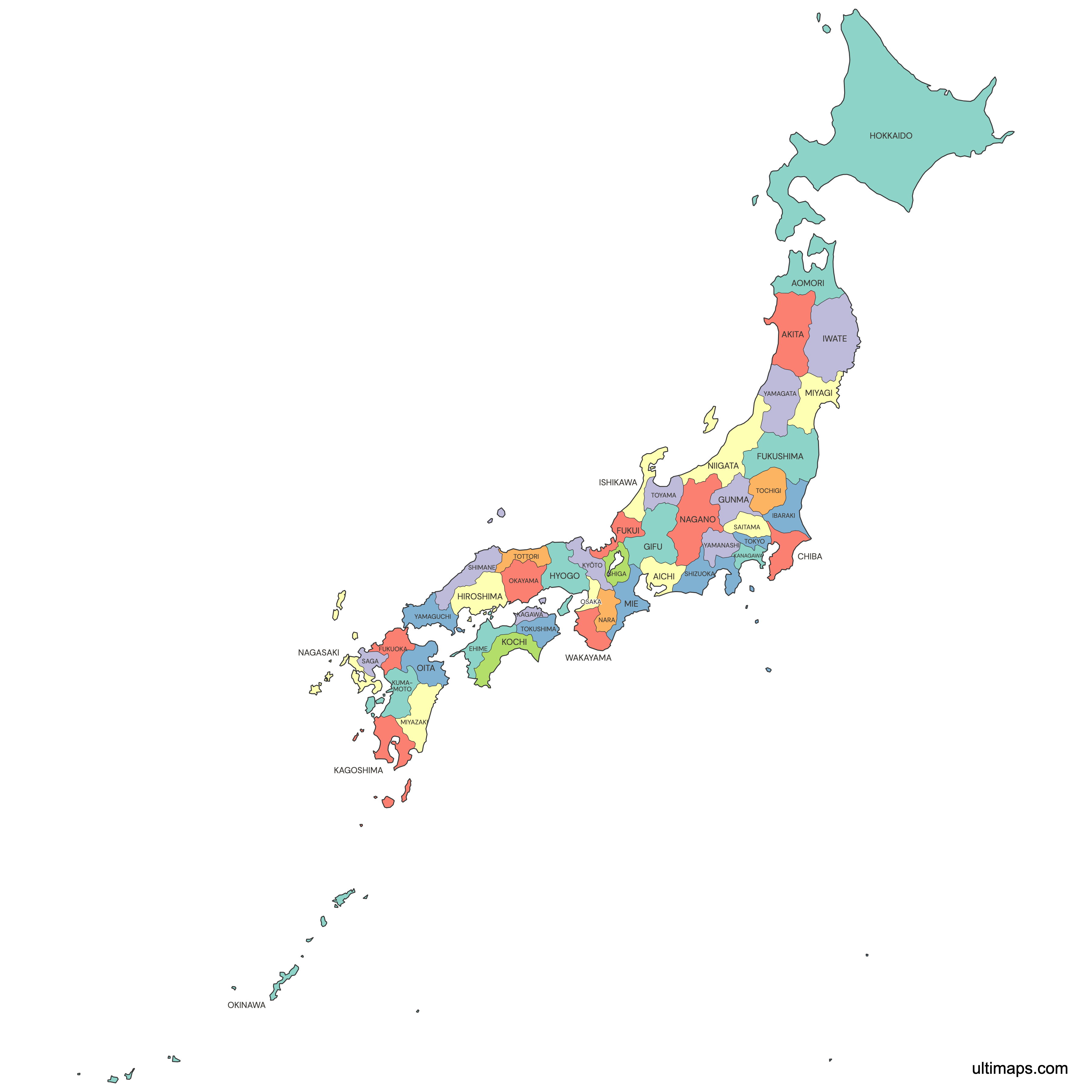
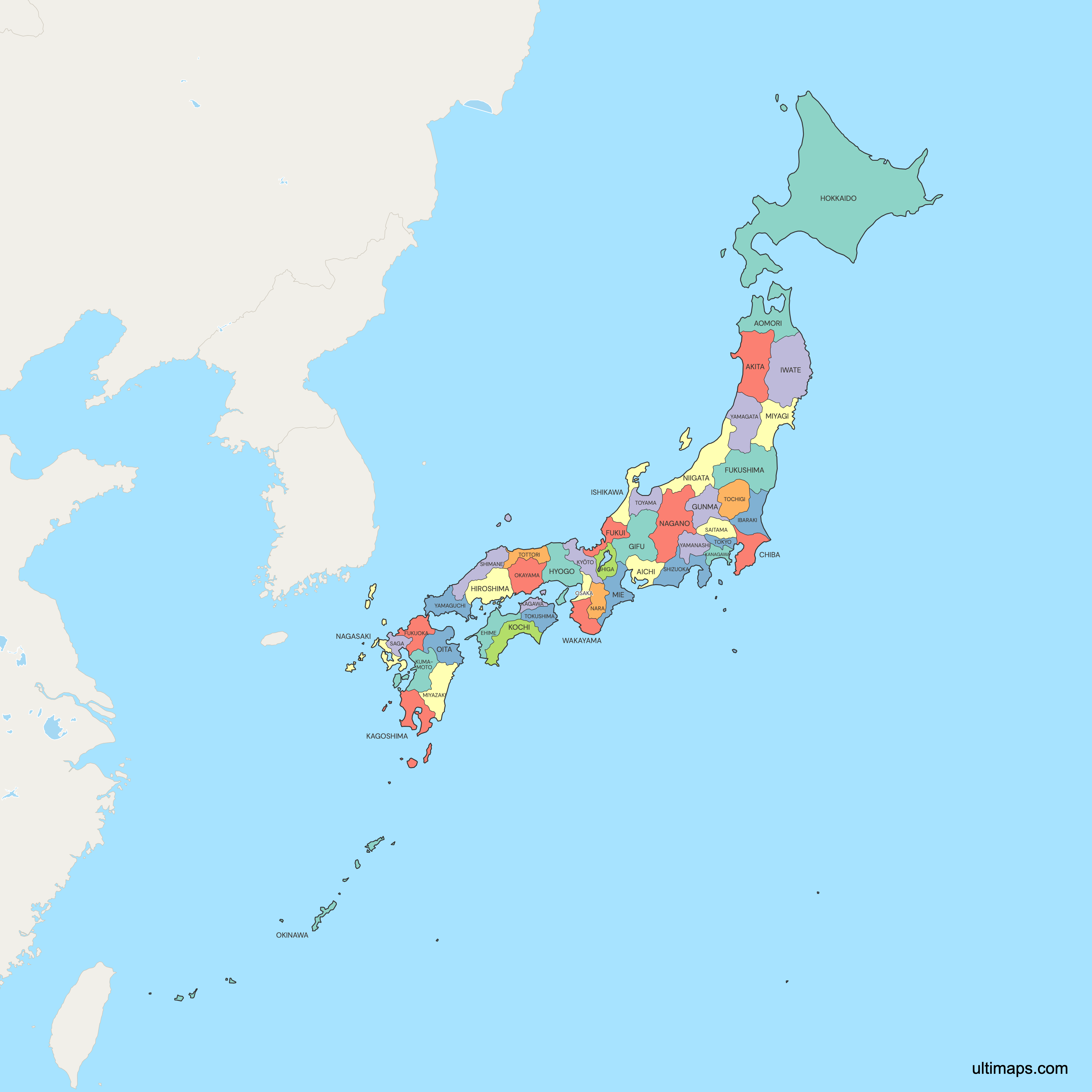
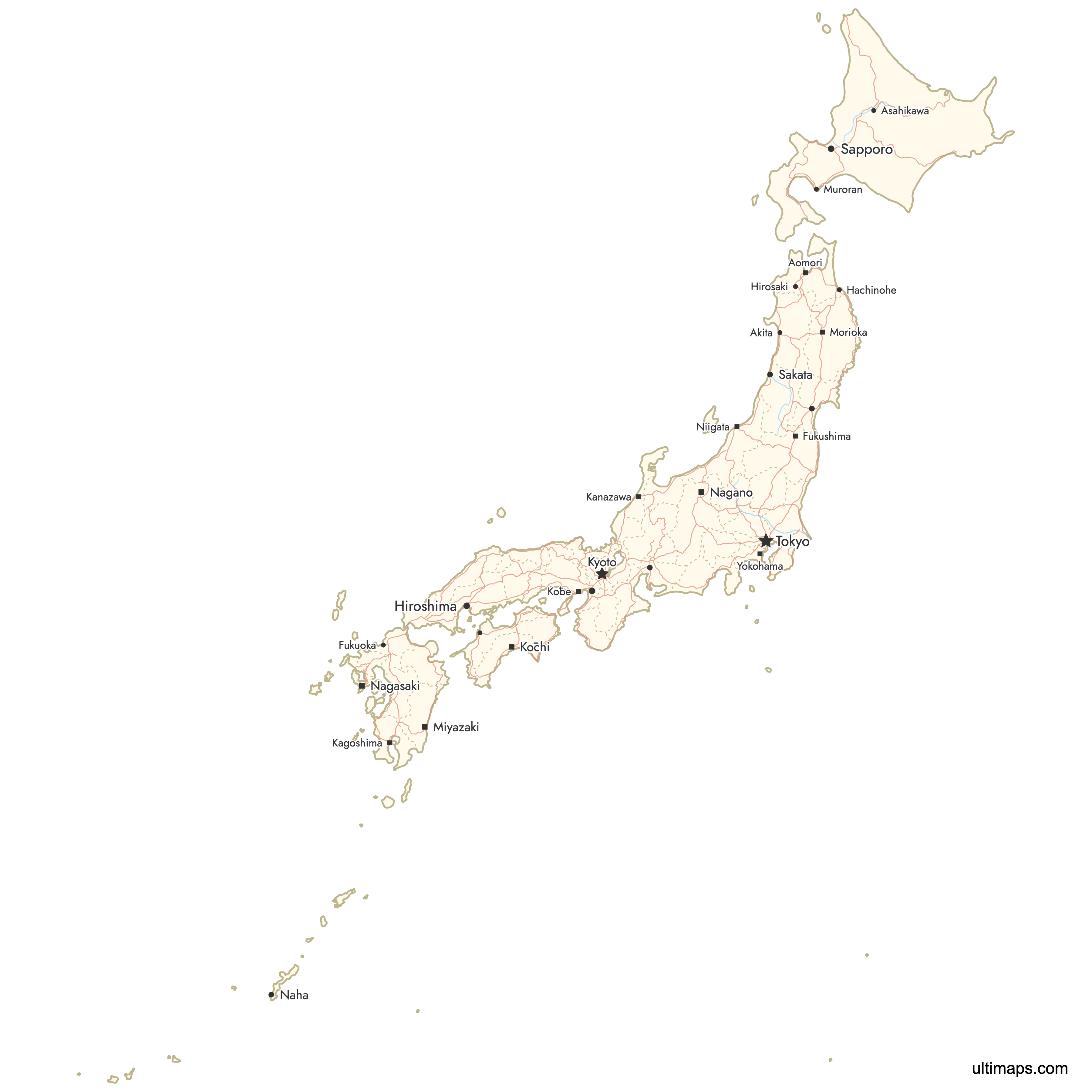
Need it without colors? The blank version of this map comes as a print-ready PDF (A4 and US Letter), a PNG and an editable SVG.
Custom Map Features
This map supports labels.
This map supports surrounding areas, roads, rivers and cities. New
This map is divided into 47 prefectures.
Updates
Apr 23, 2026:
- Added map of Japan prefectures with surrounding countries, cities and roads
Frequently Asked Questions
Japan has 47 prefectures, and the Ultimaps map draws all 47. The count has not changed since 15 May 1972, when Okinawa returned to Japanese administration from the United States and became a prefecture again. The 47 come in four legal types. Tokyo is a metropolis (to), Hokkaido is a circuit (dō), Osaka and Kyoto are urban prefectures (fu), and the other 43 are prefectures (ken). Below the prefectures are cities, towns and villages. In the ISO 3166-2 standard the prefectures carry the codes JP-01 (Hokkaido) through JP-47 (Okinawa), which follow the national numbering used in Japanese government statistics.
Hokkaido is Japan's largest prefecture by area, at 83,422 km² (32,210 sq mi) according to the Geospatial Information Authority of Japan (GSI). It includes the island of Hokkaido, the second-largest of Japan's main islands, and smaller islands around it. The GSI total also includes the islands Japan calls the Northern Territories, which Russia administers. Its capital is Sapporo. The largest prefecture on Honshu is Iwate, at 15,275 km² (5,898 sq mi) per GSI, which makes Hokkaido more than five times the size of Iwate. The smallest prefecture is Kagawa on Shikoku, at 1,877 km² (725 sq mi). Hokkaido's area is about 44 times Kagawa's.
Tokyo is Japan's most populated prefecture, with 14,246,219 residents in the 2025 census preliminary counts published by the Statistics Bureau of Japan. Tokyo Prefecture covers the 23 special wards that form the urban core, the cities and towns of the Tama area to the west, and the Izu and Ogasawara island groups in the Pacific. Shinjuku is home to the Tokyo Metropolitan Government. The neighboring prefectures of Kanagawa, Saitama and Chiba make up the rest of the Greater Tokyo area. At the other end of the ranking is Tottori, on the Sea of Japan coast, with 523,732 residents in the 2025 census preliminary counts.
Start from the map at the top of this page, which opens in a free editor with no sign-up. Coloring prefectures one by one suits groupings, such as the eight traditional regions or a set of sales territories. Pasting one value per prefecture, keyed by names like Hyogo or Miyagi, turns the map into a choropleth with a legend. Pins can mark Sapporo, Nagoya or a customer address, and the style settings cover label text, line thickness, fonts and background. The free plan exports a standard PNG with a small Ultimaps credit, while high-resolution PNG, SVG and PDF need Pro.
Tokyo is a prefecture, officially Tokyo-to, the Tokyo Metropolis. It is also the national capital of Japan. A separate Tokyo City existed until 1 July 1943, when the wartime government merged it with Tokyo Prefecture. Tokyo has had no single city government since then. The former city area is now the 23 special wards, including Shinjuku, Shibuya and Chiyoda. Each ward has its own elected mayor and assembly. The rest of Tokyo Prefecture includes 26 cities in the Tama area, such as Hachioji and Machida, along with towns, villages and the Izu and Ogasawara islands. In the 2025 census preliminary counts, Tokyo Prefecture had 14,246,219 residents.
Japan's 47 prefectures use four suffixes: to, dō, fu and ken. These names come from history. They do not mark large differences in power. The Meiji government first created fu and ken in 1868 and extended them nationwide in 1871, when it abolished the feudal domains. It used fu for the major urban centers, and today Osaka-fu and Kyoto-fu keep that label. Tokyo was also a fu until 1943, when it became Tokyo-to, the only metropolis. Hokkaido takes dō, meaning circuit, from the ancient system of regional roads and provinces, and it is the only dō. The other 43 prefectures are ken, such as Aichi-ken and Fukuoka-ken. All 47 have an elected governor and assembly.
Japan's eight traditional regions group the 47 prefectures by geography. They have no government of their own. Hokkaido is one prefecture. Tohoku has 6 prefectures, including Miyagi and Aomori. Kanto has 7, including Tokyo, Kanagawa, Saitama and Chiba. Chubu has 9, including Aichi, Niigata and Nagano. Kinki, also called Kansai, has 7, including Osaka, Kyoto and Hyogo. Chugoku has 5, including Hiroshima and Tottori. Shikoku has 4: Kagawa, Tokushima, Ehime and Kochi. Kyushu has 8, including Fukuoka and Okinawa. Weather reports, textbooks and statistics use these groups. On a prefecture map you can show them by giving every prefecture in a region the same color.
Japan does not have states or provinces. Its first-level divisions are 47 prefectures, and the country has a unitary government, not a federal one. Prefectures have no constitutions of their own, and their ordinances must stay within national law. They run most public high schools, pay municipal schoolteachers, and run the police, public health centers, regional planning and prefectural roads, and each one elects a governor and an assembly. The older provinces (kuni), such as Musashi, Settsu and Satsuma, had no administrative role after the 1871 reform. They still appear in place names and rail line names. Below the prefectures, Japan has municipalities: cities (shi), towns (machi or chō) and villages (mura or son), plus Tokyo's 23 special wards.